Introduction
Information on archaeological materials in this locale first came to the attention of Dr. Nicholson through Doug Jackson, a local artifact collector from Souris. Doug had observed archaeological materials that included bone, ceramics and lithic material that had been exposed by municipal road building activity, northwest of Lauder Manitoba
Environment
The Makotchi-Ded Dontipi locale is located among stabilized sand dunes in the Lauder Sandhills in Southwestern Manitoba, northwest of the village of Lauder. The area is a mosaic of medium grass prairie and copses of aspen poplar and aspen-oak, together with intermittent sedge grass marshes and small ponds. These wetlands are bordered with balsam poplar, water birch, willows and red osier dogwood.
The well-drained upland forest also contains saskatoon, chokecherry, wild current, hazelnut bushes and occasional wild plums. Lowland areas have nannyberries and high-bush cranberry. Wild strawberries grow in lightly shaded areas along trail margins and in open patches in aspen forest.
History of Excavations
The Makotchi-Ded Dontipi locale is a virtual "island" of forest and marshlands in a vast expanse of mixed grass prairie. This archaeologically and environmentally rich area was given the Dakota name Makotchi-Ded Dontipi, meaning "the place where we live".
Summation
Prior to European settlement, the area was a rich environment for hunter-gatherer people. Archaeological investigations from 1992 to 2002 have revealed numerous sites within the locale. Some of these sites have been extensively excavated while others have been identified or tested.
Seven sites that have been identified in this locale range in age from the historic through protohistoric periods and extend into the middle precontact period. The major sites are the initial Middle Missouri Duthie site, the late precontact Jackson, Bradshaw sites and the protohistoric Twin Fawns, Schuddemat and Hollow B sites. The multi-component Vera site includes historic Métis, late precontact Vickers Focus, and middle precontact Besant, Pelican Lake, McKean Complex and Oxbow occupations. Over 230 units were excavated as well as numerous test pits and several extensive surveys.
Scope and Content
Scope and Content
The Series has been divided into seven sub-series, including (1) Duthie site (2) Jackson site (3) Twin Fawns site (4) Vera site (5) Schuddemat site (6) Bradshaw site (7) Hollow B site.
ARCH 2: North Lauder Locale
The North Lauder locale has a long archaeological and geological history that is important for understanding the forces that shaped the region. Archaeological research in the locale shows that the area has been occupied by humans for at least the past 6,500 years. Environmental forces provided an area of diverse resources that attracted early peoples.
Environment of the Lauder Sandhills
The North Lauder locale is part of the greater Lauder Sandhills area. The glaciers that covered this region began to recede approximately 11,000 years ago leaving a large lake known as glacial Lake Hind. The Souris River, the Lauder Sandhills and the Oak Lake Aquifer are remnants of the environmental and geological forces that shaped the region.
The Lauder Sandhills region is characterized by a landscape of sand sheets and stabilized sand dunes interspersed with a variety of wetlands. This complex topographic and hydrological situation favoured the development of an island mosaic of mixed forest, wetland and meadow, surrounded by mixed grass prairie. The result was a large, isolated ecotone which provided a rich variety of subsistence resources for hunter-gatherers.
Research in the Lauder Sandhills
Archaeologists from Brandon University have been conducting research in the Lauder Sandhills since 1991. Research in the North Lauder locale has focused on the Atkinson site, a 6,500 year old hunter-gatherer site and Flintstone Hill.
The Atkinson site
The Atkinson site is one of the oldest excavated sites in Manitoba and has been Radiocarbon dated to 6,500 years before present. The Atkinson site is located on the bank of the Souris River and was discovered when a hearth (fire pit) was seen eroding out of the bank. Based on the date of the site and the kind of lithics (stone tools) present it is considered a Gowen occupation. The Atkinson site is evidence that bison hunters were active on the northern plains at a very early date. Similar sites have also been found on the High Plains in the U.S. and are referred to as the Mummy Cave Complex.
The Atkinson Site is of great importance as it is the first undisturbed site of this type to be excavated in Manitoba and extends the range of these sites south and east from the type-sites in central Saskatchewan.
Flintstone Hill
The geomorphology of the glacial Lake Hind Basin over the past 11,000 years is known primarily through the study of a cut bank along the Souris River. Flint Stone Hill contains the most complete stratigraphic record for the post-glacial period on the northern plains. The site has been extensively studied by geoarchaeologists, geologists and paleoenvironmentalists over many years and their findings have contributed to our understanding of the region.
The North Lauder locale Borden designations of Atkinson site DiMe-27 and Flintstone Hill site DiMe-26.
Borden System
Archaeological sites in Canada are identified by the Borden system, which is a uniform site designation system. The country is divided into grids based on latitude and longitude in blocks of 10 x 20 minutes. The first 4 letters indicate the block and the following numbers indicate the actual site. For example the area of the Lauder Sandhills in southwestern Manitoba is identified by the letters DM and the North Lauder locale within that area is DiMe. The Atkinson site is DiMe-27 and the Flintstone Hill site DiMe-26. As new sites are discovered they will be numbered sequentially.
Scope and Content
The Series has been divided into two sub-series, including (1) Atkinson site DiMe-27 and Flintstone Hill site DiMe-26.
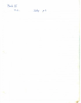
Jane Gibson was crew chief for the Lovstrom locale in 1987. Her field journals contain information about all Block/sites excavated. Pages 9-27 relate to Block E.
Scope and Content
Record of excavation methods, items recovered, features, local environment and weather noted by teaching assistant.
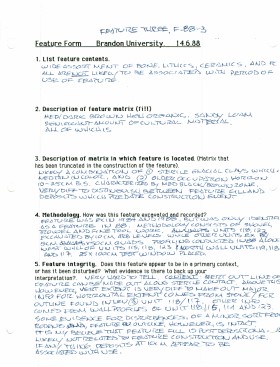
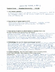
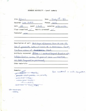
Record of excavation unit 115 feature 3 at Lovstrom Block E.
Scope and Content
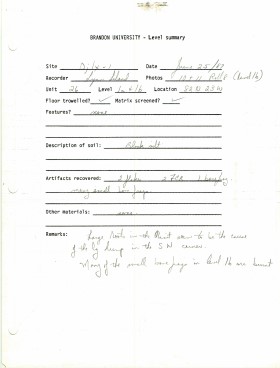
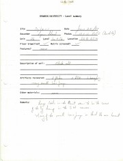
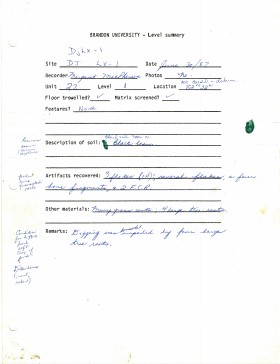
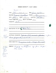
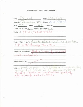
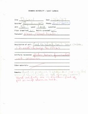
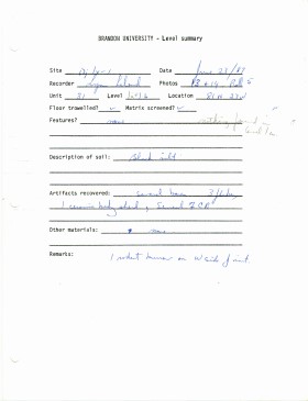
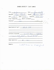
Site records of excavation units may include: level summaries, floor plans, feature sheets, wall profiles, unit summaries and any other additional information relating to the unit.
Radiocarbon date reports have been scanned in multi-page PDF files.
History / Biographical
The Crepeele locale is located within the larger Lauder Sandhills area, located in southwestern Manitoba. The area is a complex region of high biodiversity made up of stabilized sand dunes and wetlands that encourage the development of mixed forest and grass prairie. This area provided a variety of subsistence resources for pre-European hunter-gatherers. At the present time the grass prairie is now farm land but the areas of vegetated sand dunes have not been cultivated and have revealed numerous pre-contact archaeological sites.
Archaeological surveying was conducted in 2003. The results of the 2003 Casselman survey showed over 300 test uints contained cultural material and indicated several areas for further examination including the Crepeele site DiMe-29, Sarah site DiMe-28 and Graham sites DiMe-30.
From 2003 to 2008 field work took place at the locale with 75 - 1m x1m units excavated. The Crepeele locale is a complex region of high biodiversity made up of stabilized sand dunes and wetlands that encourage the development of mixed forest and grass prairie. This area provided a variety of subsistence resources for pre-European hunter-gatherers. At the present time the grass prairie is now farm land but the areas of vegetated sand dunes have not been cultivated and have revealed numerous pre-contact archaeological sites.
To help establish the cultural sequence at the locale Radiocarbon dates were obtained from the three sites in the Crepeele locale.
Radiocarbon dating
The technique of radiocarbon dating was developed by Willard Libby and his colleagues at the University of Chicago in 1949.
Radiocarbon dating is used to estimate the age of organic remains from archaeological sites. Organic matter has a radioactive form of carbon (C14) that begins to decay upon death. C14 decays at a steady, known rate of a half life of 5,730 years. The technique is useful for material up to 50,000 years. Fluctuations of C14 in the atmosphere can affect results so dates are calibrated against dendrochronology. Radiocarbon dates are calibrated to calendar years.
Dates are reported in radiocarbon years or Before Present. Before Present refers to dates before 1950. The introduction of massive amounts of C14, due to atomic bomb and surface testing of atomic weapons, has widely increased the standard deviation on all dates after A.D. 1700 causing these dates to be unreliable.
Accelerated mass spectrometry can more accurately measure C14 with smaller samples and can date materials to 80,000 years.
Scope and Content
Sub sub series contains radiocarbon dates from: Crepeele, Sarah and Graham sites.
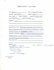
Record of site excavation test unit 3 at the Lovstrom survey 1985.
Scope and Content
Site records of excavation units may include: level summaries, floor plans, feature sheets, wall profiles, unit summaries and any other additional information relating to the unit.
Radiocarbon date reports have been scanned in multi-page PDF files.
History / Biographical
The North Lauder locale has a long archaeological and geological history that is important for understanding the forces that shaped the region. Archaeological research in the locale shows that the area has been occupied by humans for at least the past 6,500 years. Environmental forces provided an area of diverse resources that attracted early peoples.
Archaeologists from Brandon University have been conducting research in the North Lauder locale that has focused on the Atkinson site, a 6,500 year old hunter-gatherer site and Flintstone Hill.
The geomorphology of the glacial Lake Hind Basin over the past 11,000 years is known primarily through the study of a cut bank along the Souris River. Flintstone Hill contains the most complete stratigraphic record for the post-glacial period on the northern plains. The site has been extensively studied by geoarchaeologists, geologists and paleoenvironmentalists over many years and their findings have contributed to our understanding of the region.
Radiocarbon dates were obtained from the Atkinson site and Flintstone Hill.
Radiocarbon dating
The technique of radiocarbon dating was developed by Willard Libby and his colleagues at the University of Chicago in 1949.
Radiocarbon dating is used to estimate the age of organic remains from archaeological sites. Organic matter has a radioactive form of carbon (C14) that begins to decay upon death. C14 decays at a steady, known rate of a half life of 5,730 years. The technique is useful for material up to 50,000 years. Fluctuations of C14 in the atmosphere can affect results so dates are calibrated against dendrochronology. Radiocarbon dates are calibrated to calendar years.
Dates are reported in radiocarbon years or Before Present. Before Present refers to dates before 1950. The introduction of massive amounts of C14, due to atomic bomb and surface testing of atomic weapons, has widely increased the standard deviation on all dates after A.D. 1700 causing these dates to be unreliable.
Accelerated mass spectrometry can more accurately measure C14 with smaller samples and can date materials to 80,000 years.
Scope and Content
Sub sub series contains radiocarbon dates from: the Atkinson site and Flintstone Hill.
The Lovstrom surface collection came from small fields cleared within, and adjacent to, the major portions of the site which were excavated. The Lovstroms initial collection has since been added to by field personnel from Brandon University. The initial collections consisted of lithics and ceramics. A collection of faunal remains from the cultivated area was made by a Brandon University zooarchaeology class in 1986 which yielded specimens of elk, canid, mussels, and sucker, in addition to an expected abundance of bison. Since these materials were in a surface context, it may be that some of the faunal remains were historic.
The high biodiversity and evidence of pre-Europeon contact prompted the decision to test the Lovstrom locale. Nine 1m2 units were excavated in 1985 and, in 1986, an additional 15 1m2 units were excavated for a total of 24 test units. This testing indicated the presence of a large precontact locale with lithics, woodland ceramics and large amounts of reasonably well-preserved faunal materials.
The lithics indicated a late Prehistoric occupation (Nicholson 1986:35). However, the ceramics were more useful in that they identified the presence of Late Woodland cultures (Blackduck and Duckbay) and a single Middle Missouri vessel. It is believed that the Middle Missouri vessel was imported since the paste and construction/decorative technology differ distinctively from that of all other vessels recovered from the site. It was on the basis of an examination of these surface finds that the decision to test the Lovstrom site was made. These test excavations were conducted during the summers of 1985 and 1986.
Field investigations through shovel tests, excavation units, and examination of rodent mounds, indicated that the cultural deposits at the Lovstrom locale extend approximately 500m north from the edge of the Souris channel and eastward for over two hundred meters from the escarpment along Jock’s Creek. The presence of dense forest vegetation covering much of the locale, and the subsurface nature of the archaeological deposits obscured surface indications.
Radiocarbon dates: Test Unit 4: 1215/320 BP and Test Unit 8 1280/190 BP
Scope and Content
Sub-series has been divided into sub sub series including: Lovstrom survey 1985 and Lovstrom survey 1986
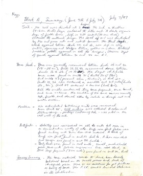
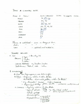
Block A was the most southern site in the locale. The excavation block consisted of 12 contiguous 1m2 units dug in a 3m x 4m rectangle. The block was the least productive of cultural materials, and bone preservation was the poorest. Under the sod, the black loam layer appeared at 5 cm below surface, and the glacial clay at 25 cm below surface. Excavators described the soil matrix as gritty and silty, and it became concrete hard when dried.
The occupation or bone layer extended from 10 to 25 cm below surface and consisted of a contiguous scatter of FCR and unidentifiable large ungulate bone which was heavily processed and intensively scavenged by carnivores. Most cultural materials were recovered within this layer. Fire cracked rock (FCR) and small burnt bone fragments were present but no intact hearths or processing features were evident.
Non-cultural materials included limestone and other natural pebbles derived from the parent till. (These small limestone pebbles were apparent in the occupation layers in other blocks as well). Root and rodent disturbance was extensive throughout Block A. Most units were excavated to gravelly clay till. Nine of the twelve units were dug to level 4b, which ended at 40 cm b.s.
No further excavations were done at this site. No C14 dates were taken.
Scope and Content
Sub-sub-sub series contains: Summary information of field methology, number and co-ordinates of excavations, personnel and their staff position; Field journals are daily records of recoveries, features and activities at the site; Site records include excavation level and unit summaries, feature sheets, profiles; sample records and maps; Artifact catalogues are lists and identifications of all artifacts recovered; Photographs are of excavation units, features, the landscape and personnel.
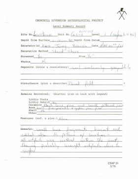
Record of site excavation unit 25 at Lovstrom Block A.
Scope and Content
Site records of excavation units may include: level summaries, floor plans, feature sheets, wall profiles, unit summaries and any other additional information relating to the unit.
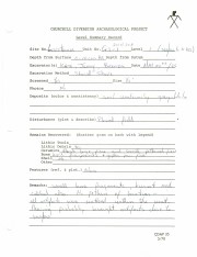
Record of site excavation unit 26 at Lovstrom Block A.
Scope and Content
Site records of excavation units may include: level summaries, floor plans, feature sheets, wall profiles, unit summaries and any other additional information relating to the unit.
Record of site excavation unit 27 at Lovstrom Block A.
Scope and Content
Site records of excavation units may include: level summaries, floor plans, feature sheets, wall profiles, unit summaries and any other additional information relating to the unit.
Record of site excavation unit 32 at Lovstrom Block A.
Scope and Content
Site records of excavation units may include: level summaries, floor plans, feature sheets, wall profiles, unit summaries and any other additional information relating to the unit.
Record of site excavation unit 31 at Lovstrom Block A.
Scope and Content
Site records of excavation units may include: level summaries, floor plans, feature sheets, wall profiles, unit summaries and any other additional information relating to the unit.