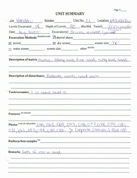
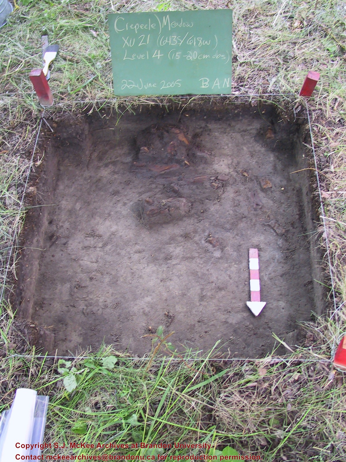
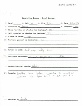
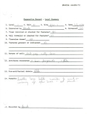
Record of site excavation unit 21 at the Crepeele site 2005.
Scope and Content
Site records of excavation units may include: level summaries, floor plans, feature sheets, wall profiles, unit summaries and any other additional information relating to the unit.
Record of site excavation unit 21 during the 1986 Lovstrom survey.
Scope and Content
Site records of excavation units may include: level summaries, floor plans, feature sheets, wall profiles, unit summaries and any other additional information relating to the unit.
Carey Co-operative Elevator Association Limited Organizational papers: 1961 Directors' Resolution, 18 October 1961 Minutes of Executive Board meetings, volume 1, 7 March 1947 - volume 5, 10 December 1984 Financial records and statistics Statement of surplus, 1951 - 1955 (5 reports) Final statements, 1948 - 1952 (2 reports) Analysis of Operating Results, 1952 - 1958 (5 reports) Allocation of surplus, 15 January 1949 Physical capacities of elevator, 29 October 1959 Comparison of Pool and Pioneer, no date Corporate Name: Rural Municipality of De Salaberry
For custodial history see the collection level description of the Lawrence Stuckey collection.
Scope and Content
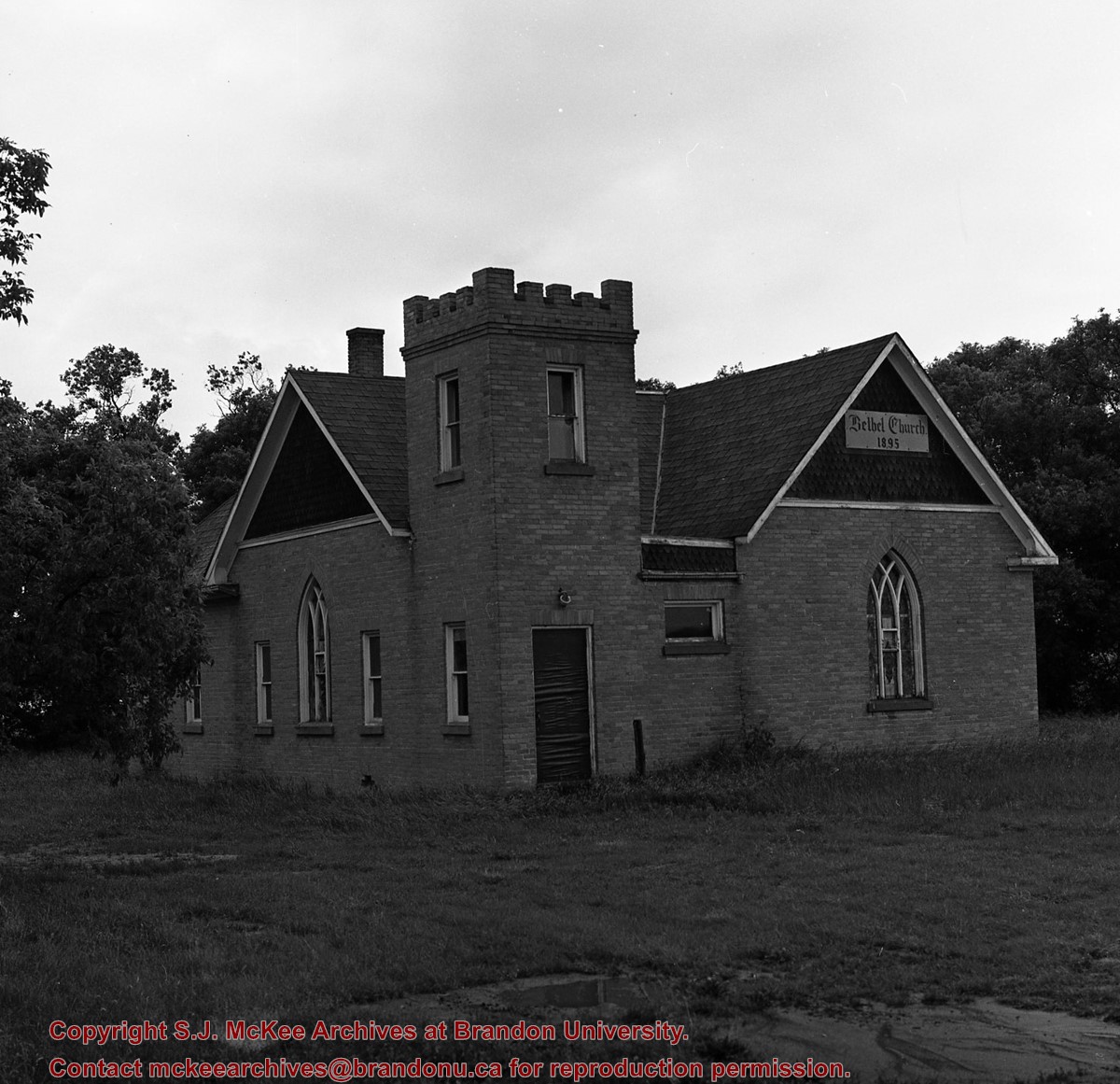
Image of Bethel Church (1895) on Highways 2 & 21 west of Deleau, Manitoba.
Notes
[Brandon SW includes communities south of Trans-Canada #1 highway and west of PTH #10.] [Images 349a and 349b are images of the exterior of the church, and images 349c-349-e are images of the stained glass windows.]
For custodial history see the collection level description of the Lawrence Stuckey collection.
Scope and Content
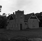
Image of Bethel Church (1895) on Highways 2 & 21 west of Deleau, Manitoba.
Notes
[Brandon SW includes communities south of Trans-Canada #1 highway and west of PTH #10.] [Images 349a and 349b are images of the exterior of the church, and images 349c-349-e are images of the stained glass windows.]
For custodial history see the collection level description of the Lawrence Stuckey collection.
Scope and Content
Image of Bethel Church (1895) on Highways 2 & 21 west of Deleau, Manitoba.
Notes
[Brandon SW includes communities south of Trans-Canada #1 highway and west of PTH #10.] [Images 349a and 349b are images of the exterior of the church, and images 349c-349-e are images of the stained glass windows.]


+on+Highways++2+%26+21+west+of+Deleau%2c+Manitoba.)
+on+Highways++2+%26+21+west+of+Deleau%2c+Manitoba.)
+on+Highways++2+%26+21+west+of+Deleau%2c+Manitoba.)
+on+Highways++2+%26+21+west+of+Deleau%2c+Manitoba.)
+on+Highways++2+%26+21+west+of+Deleau%2c+Manitoba.)
+on+Highway+2-21+near+Hartney+Junction)