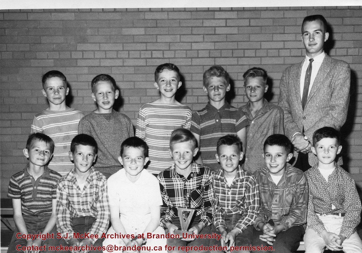
Photograph shows a dozen boys belonging to a junior softball team. One boy is holding a trophy.
Notes
Writing on the back of the photograph reads: Webster Hiblock Junior Soft Ball Team Winners of Medicine Hat City Championship. Left to right are: Top row, Bruce Rae, Brian Heller Allen Browne, Gary Smith, Byron Kohls, Mr. J. Crane?. Bottom row: Douglas Gerber, Clayton Hirsch, Gallagher McGuinness, Billy Holden, Brian Crandell, Milton Klaudt, Kenneth Bix
The Medicine Hat Exhibition and Stampede Parade Day was held on Thursday, July 19, 1962, at 9:30 a.m. The local newspaper reported that approximately 24,000 people were in attendance to see parade marshall Rod Ashburner leading 175 entries consisting of 90 floats, 75 horses, and 10 bands. There were 19 parade categories eligible for $12,000 in prize money and included: junior and senior cowboys and cowgirls; fancy and Shetland ponies; sulky class open; comic, commercial, industrial and organizational floats; decorated cars; special ranch class; 4-H Clubs; and a non-competitive class.
The parade route started at Second St. and Allowance Ave., from Second St. to Ash Ave., north on Ash to First St. SE., from First St. S.E. to Fourth Ave., south to Second St. to South Railway St., south on South Railway St. to Third St., with a finish at McLeod Trail. A route map was published in the Medicine Hat News the day before the parade.
Aerial photographs of the parade were taken by Medicine Hat News photographer Howard Heid (1930-2005) from the private helicopter of John Bourn. Bourn was a pilot from Woodville, Wisconsin, who chartered his four-seater helicopter for sight-seers at exhibitions and stampedes across the county.
(Sources: Pat Currie, "Let 'Er Go!," Medicine Hat News, 19 July 1962,1; Harald Gunderson, "'Eye in the Sky' Best Parade View," Medicine Hat News, 19 July 1962,1; "Parade Starts at 9:30 Sharp," 18 July 1962)
Scope and Content
Photograph shows an aerial view of the Medicine Hat Exhibition and Stampede Parade route with a focus on the First Street SE. A number of gas stations and garages are visible along this route and include Texaco, Shell, Ford, and B/A. The Fraternal Order of Eagles lodge is also visible.
Notes
This photograph appeared on the front page of The Medicine Hat News (19 July 1962).
The Medicine Hat Exhibition and Stampede Parade Day was held on Thursday, July 19, 1962, at 9:30 a.m. The local newspaper reported that approximately 24,000 people were in attendance to see parade marshall Rod Ashburner leading 175 entries consisting of 90 floats, 75 horses, and 10 bands. There were 19 parade categories eligible for $12,000 in prize money and included: junior and senior cowboys and cowgirls; fancy and Shetland ponies; sulky class open; comic, commercial, industrial and organizational floats; decorated cars; special ranch class; 4-H Clubs; and a non-competitive class.
The parade route started at Second St. and Allowance Ave., from Second St. to Ash Ave., north on Ash to First St. SE., from First St. S.E. to Fourth Ave., south to Second St. to South Railway St., south on South Railway St. to Third St., with a finish at McLeod Trail. A route map was published in the Medicine Hat News the day before the parade.
Aerial photographs of the parade were taken by Medicine Hat News photographer Howard Heid (1930-2005) from the private helicopter of John Bourn. Bourn was a pilot from Woodville, Wisconsin, who chartered his four-seater helicopter for sight-seers at exhibitions and stampedes across the county.
(Sources: Pat Currie, "Let 'Er Go!," Medicine Hat News, 19 July 1962,1; Harald Gunderson, "'Eye in the Sky' Best Parade View," Medicine Hat News, 19 July 1962,1; "Parade Starts at 9:30 Sharp," 18 July 1962)
Scope and Content
Photograph shows an aerial view of the Medicine Hat Exhibition and Stampede Parade route with a focus on the First Street SE and and the South Railway Street merge. A number of gas stations and garages are visible along this route and include Texaco, Shell, Ford, and B/A. The Fraternal Order of Eagles lodge is also visible.
Notes
This photograph shows the neighbourhood before rezoning and commercial development.
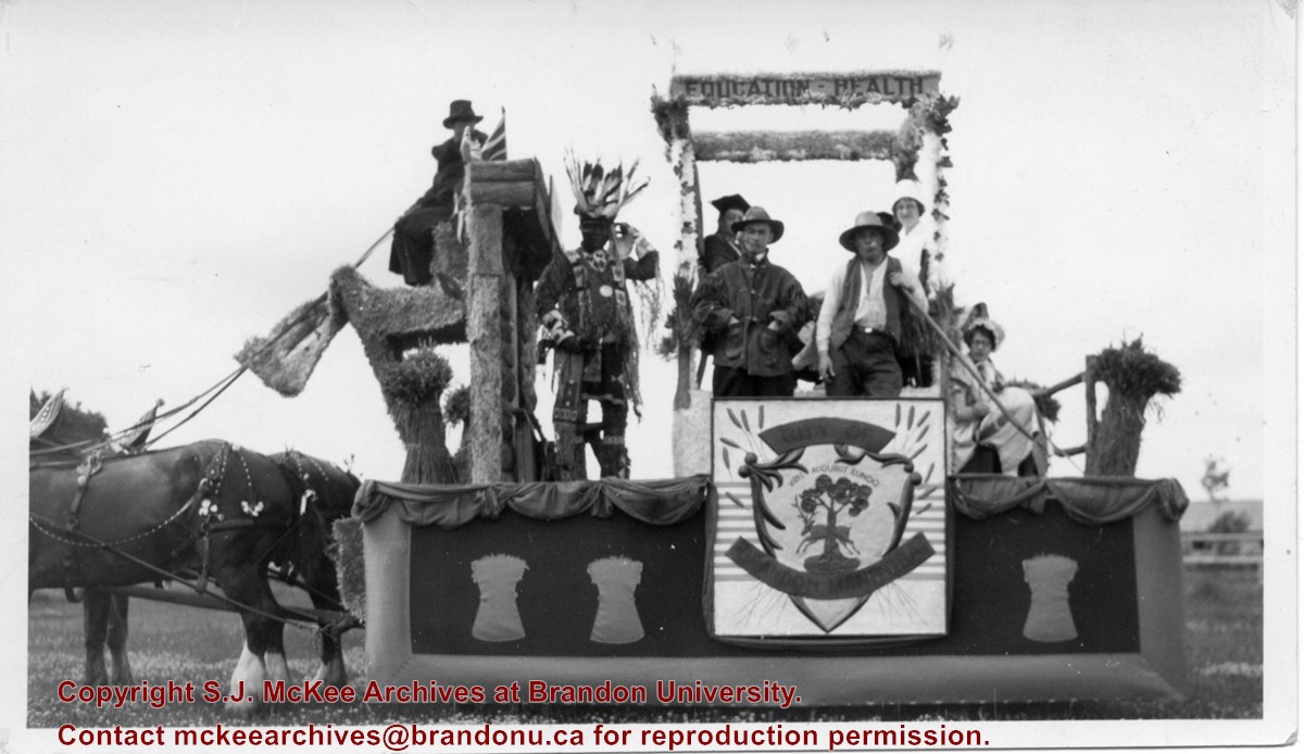
Photograph shows the City of Brandon parade float pulled by two clydesdale horses. The parade is in honour of the diamond anniversary of Canada's Confederation. The float is decorated with wheat sheaves, the city's coat of arms, and the words "education" and "health" adorn a pergola or arbour in the centre of the float. Seven people are on the float and appear to be in costume. An Aboriginal man is dressed in full regalia, one man appears to be in academic robes, another dressed as a farmer. One woman appears to be dressed like a nurse while another may be wearing a pioneer costume.
Notes
Writing on the back of the photograph reads: Brandon City's foat in 1927, Celebrating 60 years of Confederation, The lady in white is Miss Ann Carnahan who was on the city staff for a number of years and now resides in Victoria. She is my husbands [sic.] sister.
Photograph shows the Brandon Wheat Market along Pacific Avenue on November 30, 1885. Farmers can be seen driving wagon teams loaded with bags of grain in line on Pacific Avenue from 10 Street to at least 7th Street. On the north side of Pacific Avenue the CPR Land Office and grain elevators are pictured. On the south side of Pacific Avenue, the general merchant/hardware store Bower, Blackburn, Mundell & Porter is situated on the corner of Pacific Avenue and 10th Street. A 10th Street sign is affixed to the merchants' store. On the east side of the general store, Edie House, the Grand View Hotel, and a Farmers' boarding and lodging house can be seen. Most of the buildings appear to be woodframed except for the Grand View, which is constructed of brick. Sidewalks appear to be in place on the south side of Pacific and snow dusts the streets. A baby swathed in winter clothing sits in a pram/baby carriage in front of the general store.
Notes
Writing on the front of the photograph reads: Novemeber 30th, 1885, Brandon Wheat Market
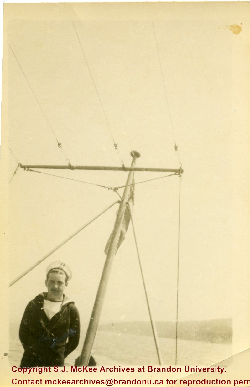
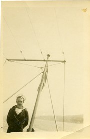
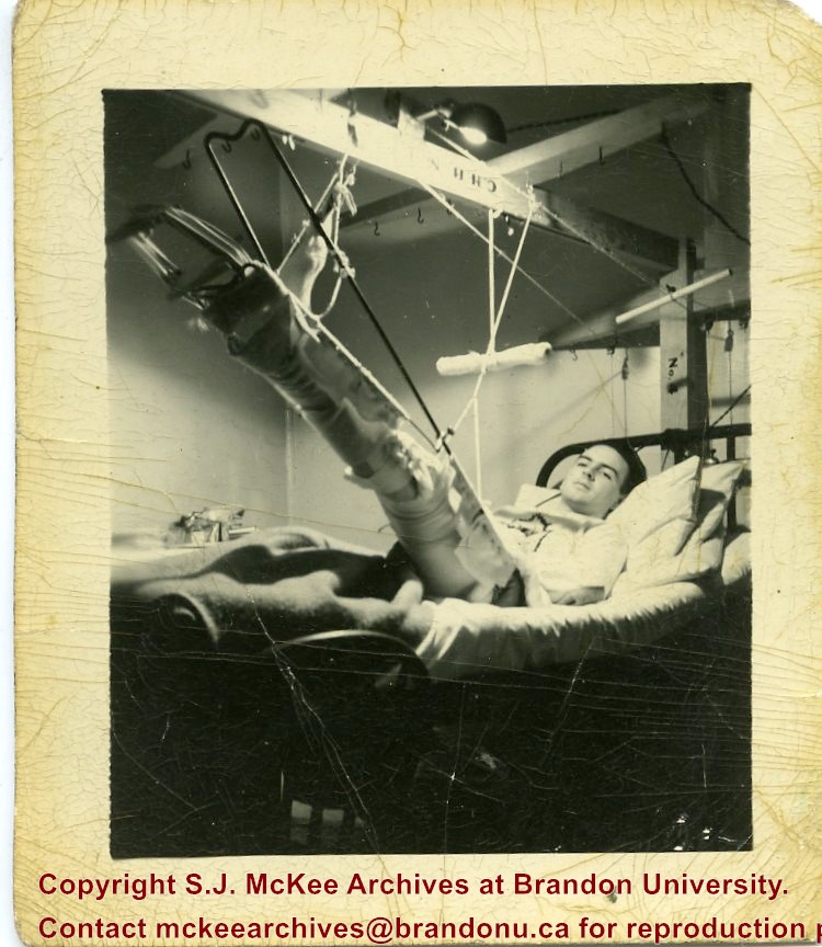
On 23 September 1940, McGuinness was seriously injured in a naval accident when his ship ran aground; McGuinness’ leg was broken when the ship’s tow cable snapped and he spent the next 11 months convalescing at Camp Hill Hospital in Halifax, Nova Scotia. While in hospital McGuinness contracted scarlet fever and diphtheria and developed osteomyelitis as a complication of his femur facture. McGuinness returned to Winnipeg to continue his convalescence at Deer Lodge Hospital and was ultimately discharged from the navy in 1941.
Scope and Content
Photograph shows Fred McGuinness in traction in a hospital bed, possibly at Camp Hill Hospital.
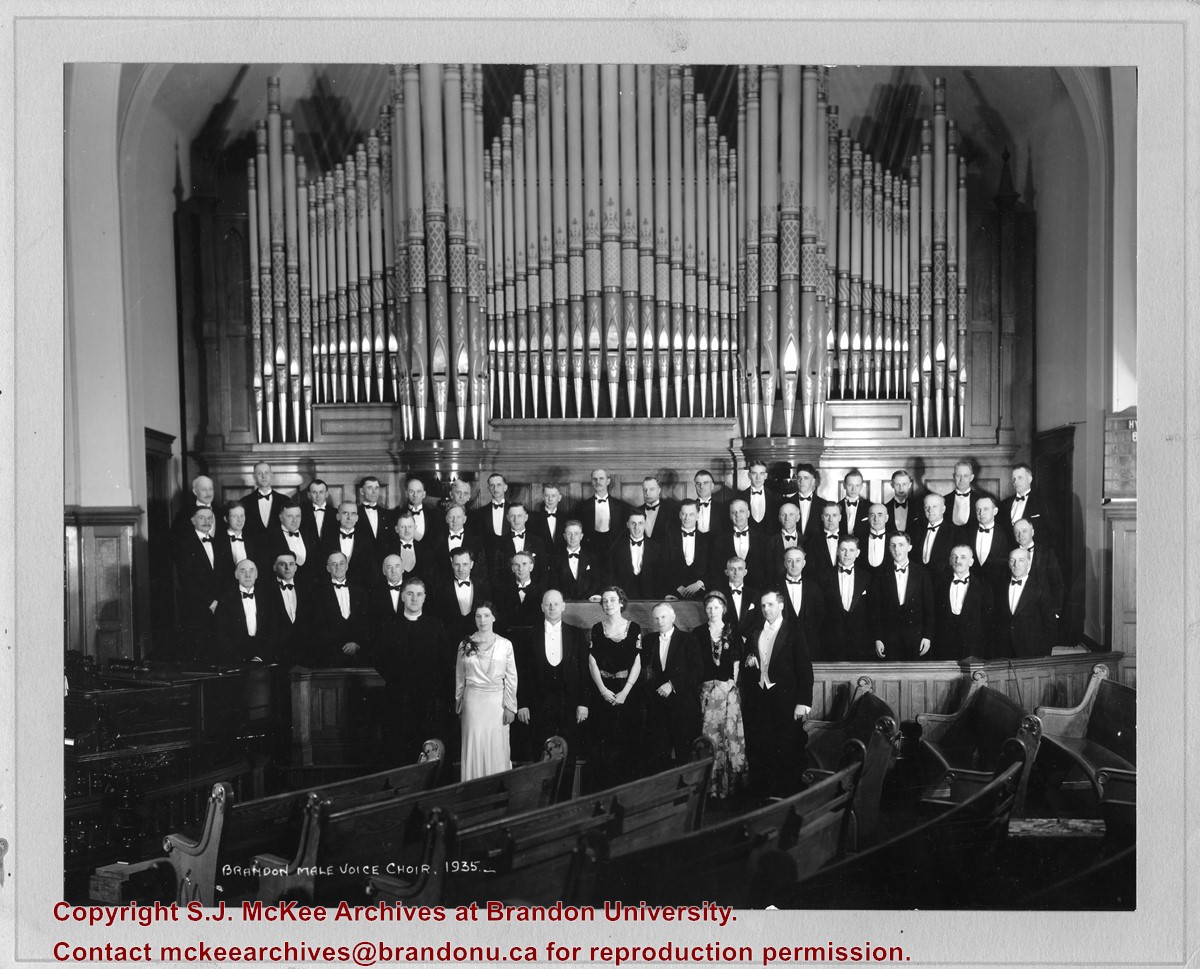
According to Henderson's 1935 Brandon City Directory, the First United Church was located on the corner of 8th Street and Lorne Avenue. The minister at the time was Reverend John H. Garden.
Scope and Content
Photograph shows the Brandon Male Voice Choir dressed in tuxedos and posing before the First United Church's pipe organ. A minister (possibly Rev. John H. Garden) and three women in formal attire are standing in the front row.
Notes
Writing on the back of the photograph reads: return to Bob Hoffman, Box #1, Brandon, R7A 5Y6
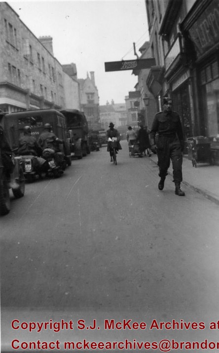
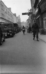
Photograph shows the train station at the port of Mulgrave, Nova Scotia. Possibly the site where the HMCS Alachasse was docked when Fred McGuinness was a telegraphers in the Canadian Navy.
Notes
Writing on the back of the postcard reads: AZO post card
Brient was a point along the Algoma Central Railway line that connected the Helen Mine to the Michipicoten Harbour. It is located southwest of Wawa, Ontario.
Scope and Content
Photograph shows ore box cars in a railway yard.
Notes
Writing beneath the photograph in the album reads: yard at Brient
Trembley was a point along the Algoma Central Railway line that connected the Helen Mine to the Michipicoten Harbour. It is located southwest of Wawa, Ontario.
Scope and Content
Photograph shows railroad tracks. A line of ore cars stretch along one track. Writing on the side of one of the cars (#3017) reads: Algoma Central Railway Co.
Notes
Writing beneath the photograph in the album reads: Trembley - Ore Cars
Brient was a point along the Algoma Central Railway line that connected the Helen Mine to the Michipicoten Harbour. It is located southwest of Wawa, Ontario.
Scope and Content
Photograph shows several men standing on railway tracks before a wood-framed train station in the winter. A sign attached to the station reads: British American Express Co. The man in the foreground appears to have a mailbag over on his back and several newspapers tucked beneath his arm.
Notes
Writing beneath the photograph in the album reads: station at Brient
In 1901, American entrepreneur Francis Hector Clergue (1856-1939) obtained the charter for the Ontario, Hudson Bay and Western Railway. Following his purchase, he reincoporated the Algoma Central Railway to the Algoma Central and Hudson's Bay Railway. (Source: Sault St. Mairie Public Library, "Transportation - Algoma Central Railway," Sault History Online, 2008)
Scope and Content
Photograph shows railroad tracks cutting through the Canadian Shield.
Notes
Writing beneath the photograph in the album reads: Algoma Central & Hundson Bay Ry.
The Lake Talbot tresle was a point along the Algoma Central Railway line that connected the Helen Mine to the Michipicoten Harbour. It is located north of Wawa and southwest of the Helen Mine.
Scope and Content
Photograph shows several men walking a railway line. Before them is a tresle bridge.
Notes
Writing beneath the photograph in the album reads: Lake Talbott Tresle [sic.]
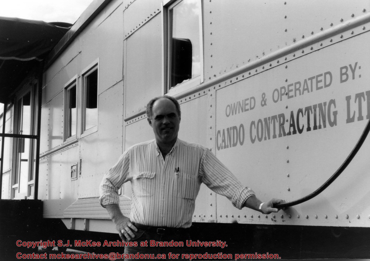
Cando Contracting Ltd. was found in 1978 by Gord Peters and Rick Hammond. The company began as a small rail line dismantling and salvage company operating out of Brandon, Manitoba. The company changed its name in 2013 to Cando Rail Services Ltd., which supplies railway support services (e.g., engineering and track services, industrial rail services, mechanical services, rail car storage, railway material sales, short line operations, transload services) to industry and the rail sector. The company maintains its headquarters in Brandon, Manitoba, and has regional offices located in Calgary, Edmonton, Winnipeg, Whitby, and Adel (Iowa). (Source: www.candoltd.com, accessed 05 Dec 2015)
Scope and Content
Photograph shows Gord Peters standing in front of the rail car that forms the entrance of Cando Contracting Ltd. in Brandon, Manitoba
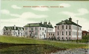
Photograph shows the buildings of the Brandon General Hospital
Notes
Part of "Christie's Brandon Series of Six Colored Picture Postcards of Brandon, Manitoba, The Crown Series, Published by Christie's Bookstore, Brandon, Man." [note: missing sixth postcard]. Writing on the front of the photograph reads: Brandon General Hospital, Brandon, Man.


