Brient was a point along the Algoma Central Railway line that connected the Helen Mine to the Michipicoten Harbour. It is located southwest of Wawa, Ontario.
Scope and Content
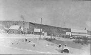
Photograph shows several men standing on railway tracks before a wood-framed train station in the winter. A sign attached to the station reads: British American Express Co. The man in the foreground appears to have a mailbag over on his back and several newspapers tucked beneath his arm.
Notes
Writing beneath the photograph in the album reads: station at Brient
In 1901, American entrepreneur Francis Hector Clergue (1856-1939) obtained the charter for the Ontario, Hudson Bay and Western Railway. Following his purchase, he reincoporated the Algoma Central Railway to the Algoma Central and Hudson's Bay Railway. (Source: Sault St. Mairie Public Library, "Transportation - Algoma Central Railway," Sault History Online, 2008)
Scope and Content
Photograph shows railroad tracks cutting through the Canadian Shield.
Notes
Writing beneath the photograph in the album reads: Algoma Central & Hundson Bay Ry.
The Lake Talbot tresle was a point along the Algoma Central Railway line that connected the Helen Mine to the Michipicoten Harbour. It is located north of Wawa and southwest of the Helen Mine.
Scope and Content
Photograph shows several men walking a railway line. Before them is a tresle bridge.
Notes
Writing beneath the photograph in the album reads: Lake Talbott Tresle [sic.]
For custodial history see the collection level description of the Lawrence Stuckey collection.
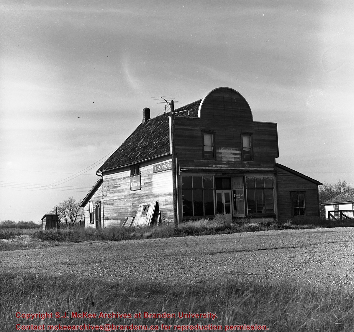
Scope and Content
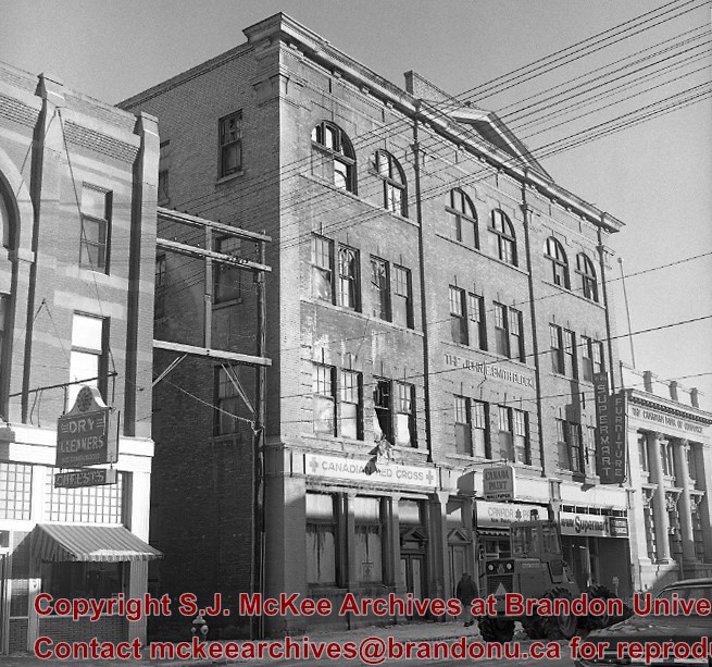
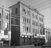
John E. Smith Block Fire - The Morning After
Notes
The John E. Smith Block was built in 1907.
Because of the fire, the building was badly gutted and the front wall bulged outward. As a result, the structure was condemned.
The Canadian Bank of Commerce had moved to the Canadian Imperial Bank of Commerce building at the corner of 8th Street & Rosser Avenue in mid-1960's, and their old building adjacent to Smith Block had since sat vacant. As a result, the stage was now set to clear the area where both buildings had stood for the construction of Scotia Tower. LAS.
[Mr. Stuckey put two negatives in same envelope, numbering them FA7 and FA7a. We have separated them.]
Photograph shows the intersection of 10th Street and Princess Avenue, Brandon, Manitoba. View is facing northwest along west side of the 100-block of 10th Street. A stationary policeman/divider is at the centre of the intersection. Visible businesses include: Doig's, Plaza Shoe Shop, and Cambridge Clothes Shop. A horse-drawn sled is parked in front of Doig's store. The Olympia Block, Cecil Hotel, and CPR Station are visible in the background.
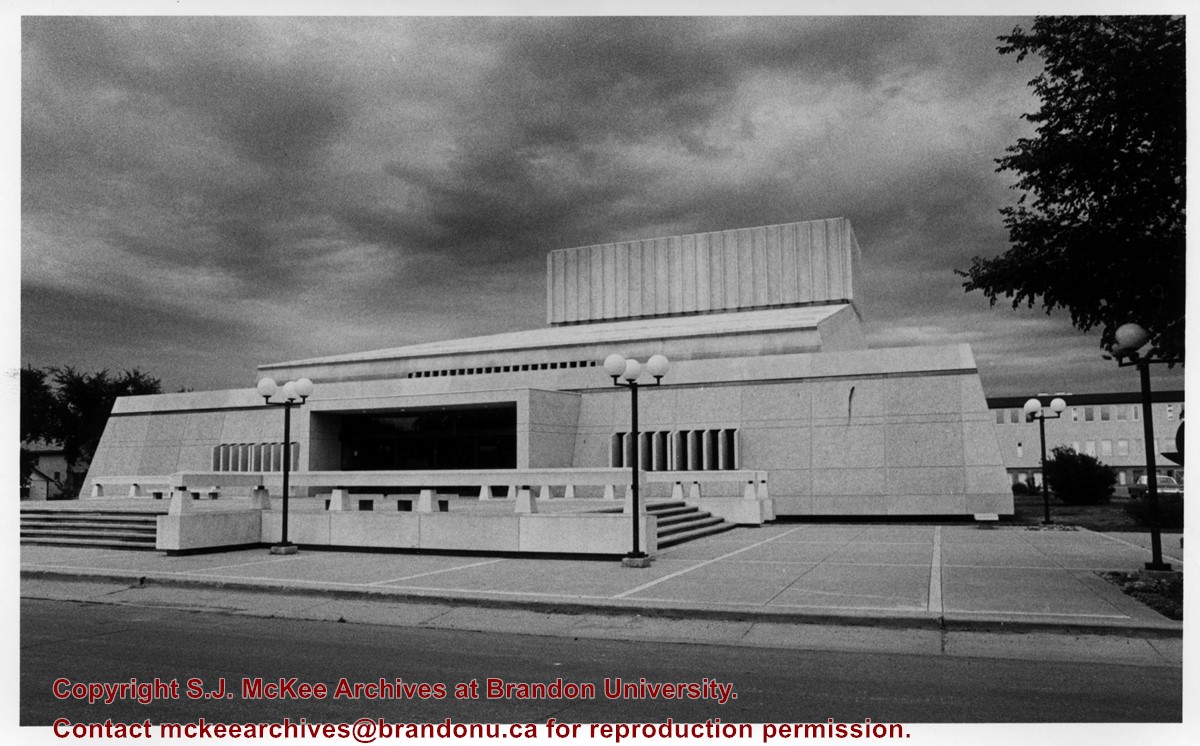
View is looking east northeast. Photograph shows the front steps, main entrance and west side of the Western Manitoba Centennial Auditorium (WMCA). Brandon University's Education Building is in the background.
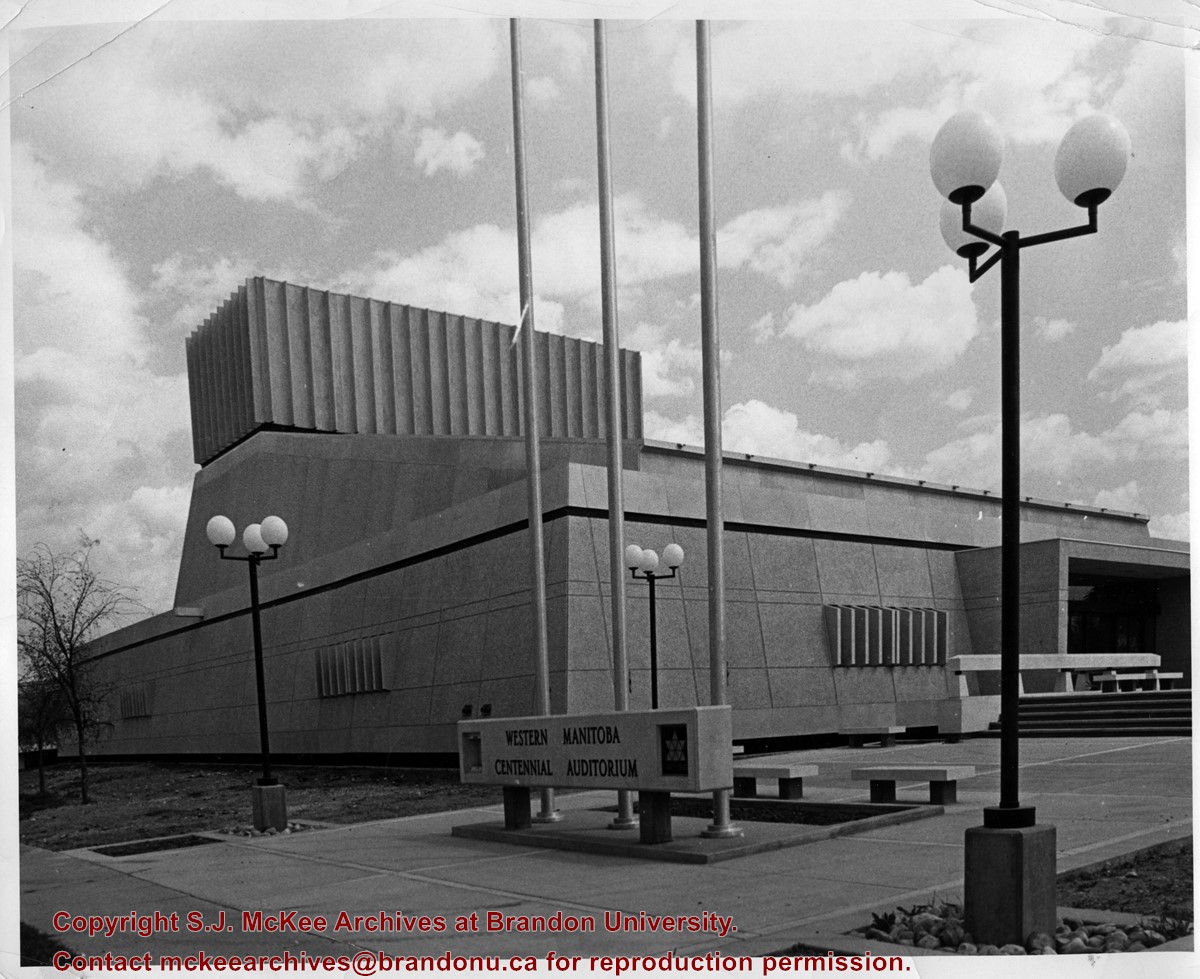
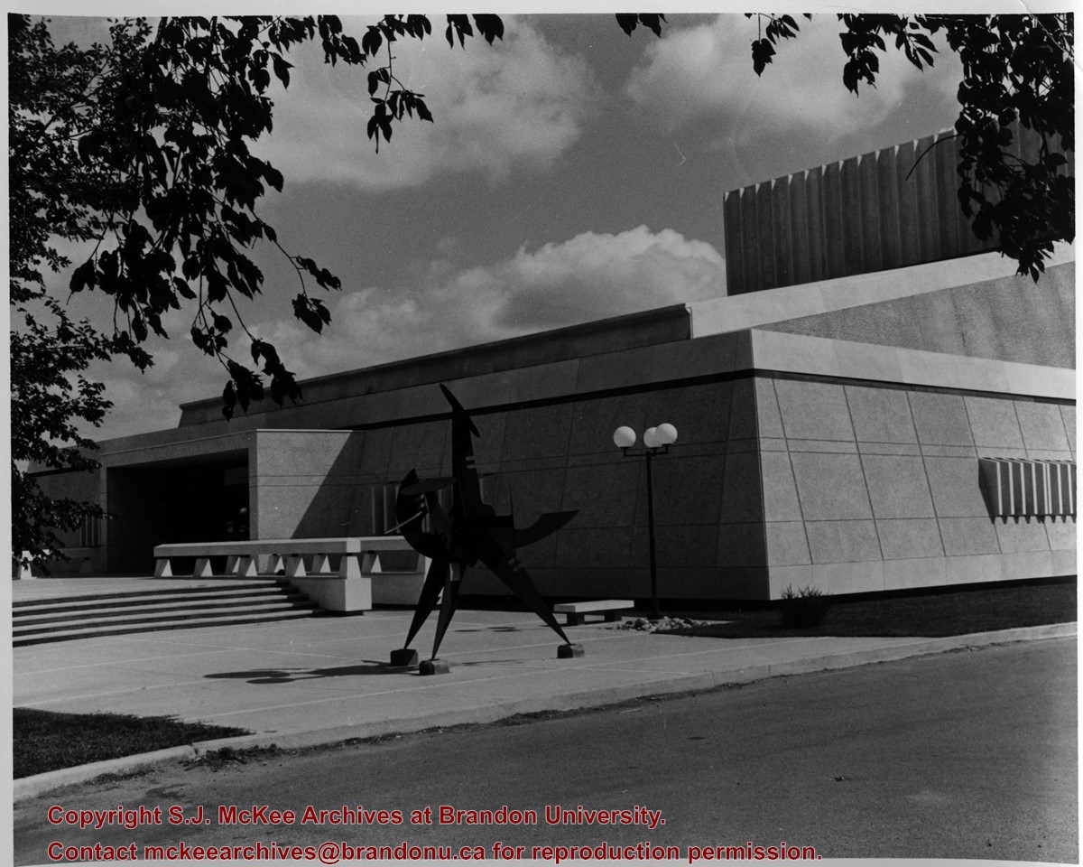
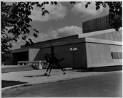
View is looking northeast. Photograph shows the southwest corner of the Western Manitoba Centennial Auditorium (WMCA). Victor Tolgesy's sculpture Explorer is in the foreground.


.jpg?width=1200&404=no-img.jpg&watermark=wmk)
.jpg?width=180&404=no-img.jpg)
.jpg?width=1200&404=no-img.jpg&watermark=wmk)
.jpg?width=180&404=no-img.jpg)


.jpg%3fmaxheight%3d1000%26maxwidth%3d1000%26watermark%3dwmk&description=Central+United+Church+-+After+Fire)
.jpg%3fmaxheight%3d1000%26maxwidth%3d1000%26watermark%3dwmk&description=Central+United+Church+-+After+Fire)