Photograph shows the intersection of 10th Street and Princess Avenue, Brandon, Manitoba. View is facing northwest along west side of the 100-block of 10th Street. A stationary policeman/divider is at the centre of the intersection. Visible businesses include: Doig's, Plaza Shoe Shop, and Cambridge Clothes Shop. A horse-drawn sled is parked in front of Doig's store. The Olympia Block, Cecil Hotel, and CPR Station are visible in the background.
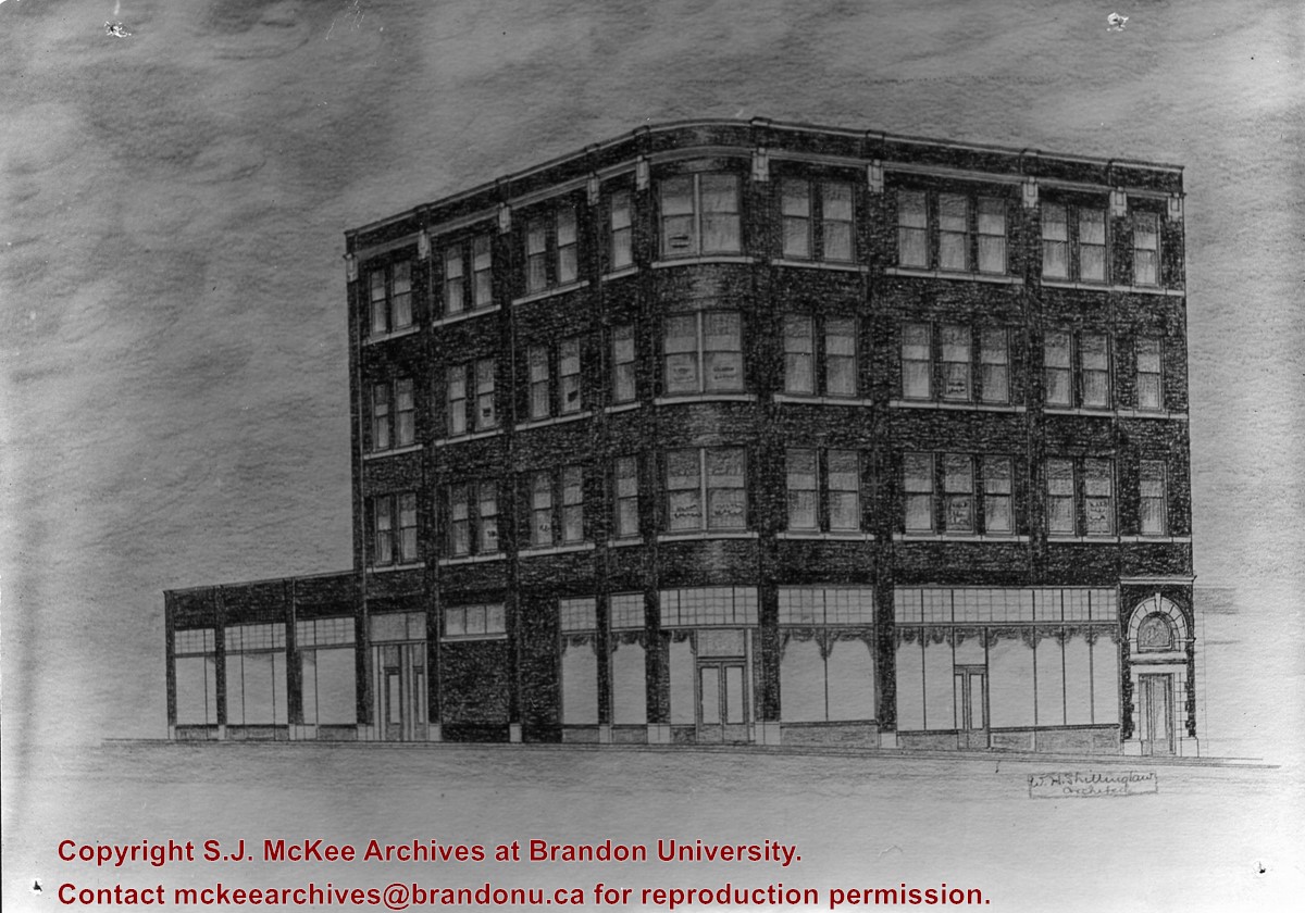
Photograph shows a sketch of the Hughes Building by architect W.H. Shillinglaw. The building, which was erected on the northwest corner of 10th Street and Princess Avenue, had the potential to be four storeys high.
Postcard shows an aerial view of 9th Street facing south in Brandon, Manitoba. Visible businesses and landmarks include: Beaubier Hotel, YMCA/police station, the original CKX Radio station towers on 8th Street (est. 1928 - moved 1940), the old City Hall, Prince Edward Hotel, and the original Manitoba Power commission smokestack on 10th Street.
Notes
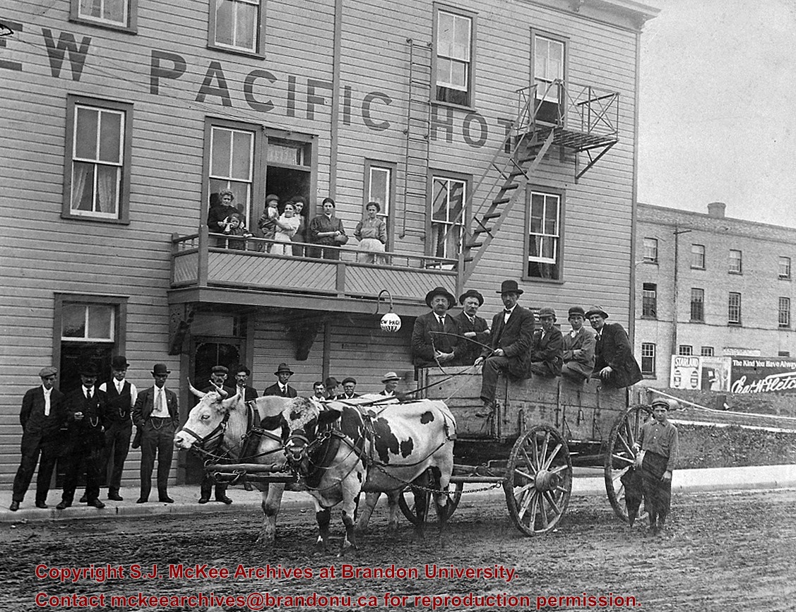
Writing on the front of the photograph reads: Brandon, Man., Jerrett Photo. This photograph shows a rare view of the 800-block between Rosser and Princess Avenues.
Red ink stain is on the front right corner of postcard
Scope and Content
Photograph shows 10th Street facing south from Princess Avenue. Visible landmarks and businesses include: Manitoba Power Commission (MPC)'s power sub-station, First Baptist Church, Wheat City Arena, and the grand stand at the Exhibition Grounds.
The partial sign visible at the bottom of the photograph on the east side of 10th Street reads Yates and Neale, which refers to a plumbing and heating company that dissolved in 1943 to be replaced by Neale, Stothard and Chapman.
Businesses on the west side of 10th Street include: Dominion Tire & Radio Co., Bolts Barber Shop, Elviss T.E. Co. Stables.
Notes
Information concerning Yates and Neale courtesy Jack Stothard. Writing on the front of the postcard reads: Brandon, Looking S.W., Jerrett Photo. This photograph shows a rare view of the 200-block of 10th Street.
For custodial history see the collection level description of the Lawrence Stuckey collection.
Scope and Content
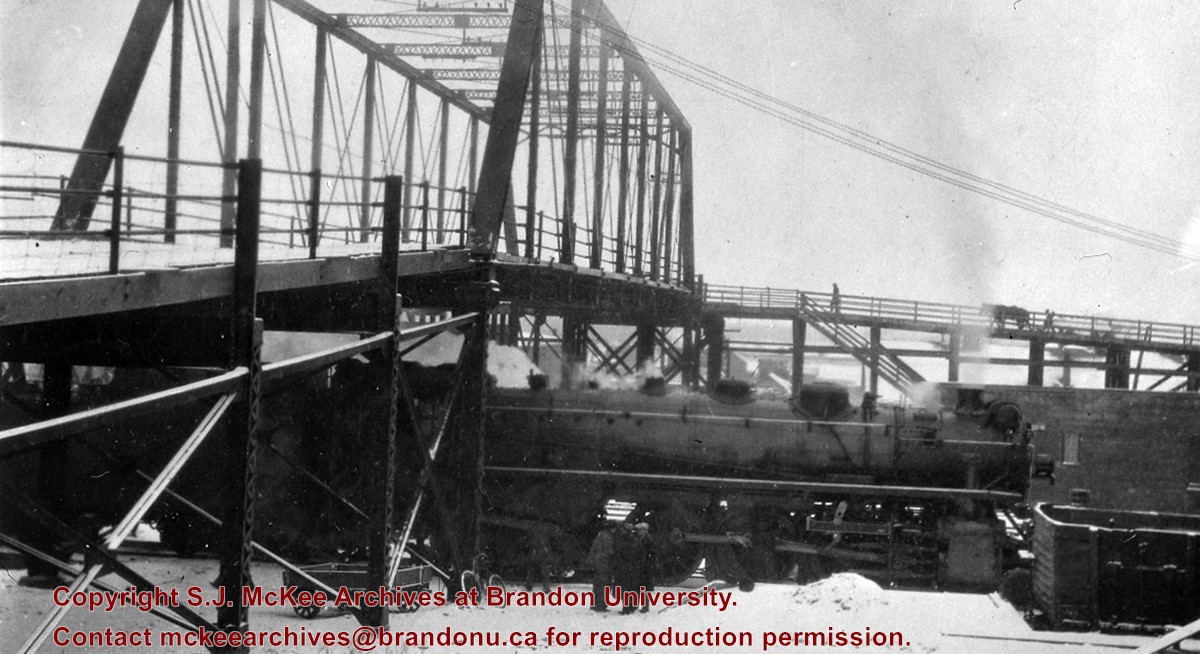
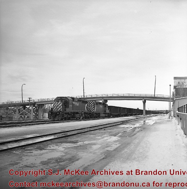
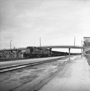
CPR No. 3, the westbound "Dominion", with engine 2829 under 1st Street Bridge
Notes
View includes former Empire Brewery, [then] in use by Bell Bottling Co.; Safe crossing over the CPR eliminated the need for a flagman. "Telltails" warn switchmen riding on top of railcars of low overhead clearance. Old Empire Brewery was (late 1950's) a feed mill, making grain feeds for livestock.
Contract for concrete approach from north end to replace east and west timber approaches along Assiniboine Ave. awarded to A.E. Jones and E. Fulcher for $30,590. Oct. 11, 1934. (Brandon Sun). As part of this project a Z-shaped ramp on the west side to Assiniboine Ave for pedestrians replaced wooden stairs to north end.
Custodial History
For custodial history see the collection level description of the Lawrence Stuckey collection.
Scope and Content
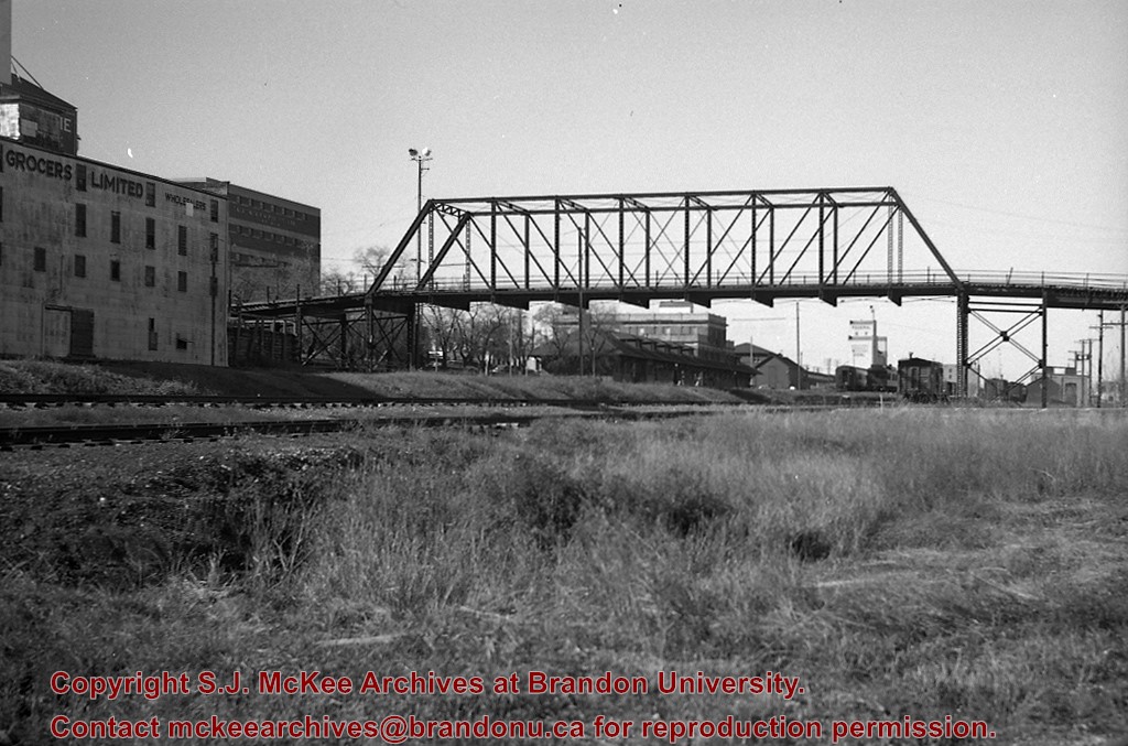
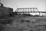
View of East side of original Eighth St. bridge from Pacific Avenue; Shows pedestrian stairway to North end and CPR early 2800 [locomotive] being serviced on Train No.4
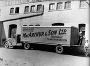
After demise of the streetcars, a transit system was started by MacArthur Transportation Co. with three routes, an east end loop, a south end loop, and a west end loop, with terminal at 8th St. & Rosser Ave. The E & W was operated as a continuous route with two locally built coach bodies on new Maple Leaf trucks. A secondhand, larger, Leland coach was acquired for the S. end, which was replaced by a large GMC about 1938.
Custodial History
For custodial history see the collection level description of the Lawrence Stuckey collection.


.jpg?width=1200&404=no-img.jpg&watermark=wmk)
.jpg?width=180&404=no-img.jpg)
.jpg?width=1200&404=no-img.jpg&watermark=wmk)
.jpg?width=180&404=no-img.jpg)


.jpg%3fmaxheight%3d1000%26maxwidth%3d1000%26watermark%3dwmk&description=Greyhound+Bus+Depot)
.jpg%3fmaxheight%3d1000%26maxwidth%3d1000%26watermark%3dwmk&description=Greyhound+Bus+Depot)