Radiocarbon date reports have been scanned in multi-page PDF files.
History / Biographical
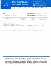
North Lauder Radiocarbon Date report by Beta Analytic Inc. for Flintstone Hill #109900.
Radiocarbon dating
The technique of radiocarbon dating was developed by Willard Libby and his colleagues at the University of Chicago in 1949.
Radiocarbon dating is used to estimate the age of organic remains from archaeological sites. Organic matter has a radioactive form of carbon (C14) that begins to decay upon death. C14 decays at a steady, known rate of a half life of 5,730 years. The technique is useful for material up to 50,000 years. Fluctuations of C14 in the atmosphere can affect results so dates are calibrated against dendrochronology. Radiocarbon dates are calibrated to calendar years.
Dates are reported in radiocarbon years or Before Present. Before Present refers to dates before 1950. The introduction of massive amounts of C14, due to atomic bomb and surface testing of atomic weapons, has widely increased the standard deviation on all dates after A.D. 1700 causing these dates to be unreliable.
Accelerated mass spectrometry can more accurately measure C14 with smaller samples and can date materials to 80,000 years.
Scope and Content
Sub sub series contains radiocarbon dates from: Atkinson site and Flintstone Hill.
Field journals have been scanned in multi-page PDF files. Artifact catalogues are PDF files in spreadsheet format. Photographs are in jpeg format.
History / Biographical
During the mid 1990’s to the early 2000’s archaeological surveying and testing took place on Flintstone Hill. In 1997 testing at the site revealed a bison skull eroding from the cutbank. A field crew dug a series of overlapping trenches down the slope of the profile and produced a schematic drawing. A radiocarbon date from the lower edge of the profile gave a date of 10,400 RCY.
Test units along the cutbank recovered lithics, soil samples, fire-cracked rock, charcoal, bison remains including a very large bison skull measuring 430-440 cm and thought to be an ancient species.
Radiocarbon dates at Flintstone hill gave dates of: a hearth dating to 3250+/-70 R.C.Y. (BETA 109529); a butchered atlas bone 4090+/-70 R.C.Y. (BETA 109990); and bone fragments accompanied by Swan River Chert and Knife River Flint lithic flakes 5350+/-50 (BETA 109530). While no diagnostic tools were recovered, these dates suggest that this occupation, which is contemporary with the Atkinson site, may be a Gowen occupation.
Scope and Content
Sub-sub-sub series contains: Summary information of field methology, number and co-ordinates of excavations, personnel and their staff position; Field journals are daily records of recoveries, features and activities at the site; Site records include excavation level and unit summaries, feature sheets, profiles; sample records and maps; Artifact catalogues are lists and identifications of all artifacts recovered; Photographs are of excavation units, features, the landscape and personnel.
Field journals have been scanned in multi-page PDF files. Artifact catalogues are PDF files in spreadsheet format. Photographs are in jpeg format.
History / Biographical
In 1998, 1999 and 2000 further testing took place on Flintstone Hill. Five test units were excavated and a series of small exploratory tests took place. Recoveries included: lithics, soil samples, fire-cracked rock, charcoal, and bison bones.
Unfortunately, despite the encouraging radiocarbon dates and scattered recoveries there was no area where extensive excavations were feasible. The unstable nature of the river bank with frequent spring flooding and erosion of the dunes has impacted potential sites.
Scope and Content
Sub-sub-sub series contains: Summary information of field methology, number and co-ordinates of excavations, personnel and their staff position; Field journals are daily records of recoveries, features and activities at the site; Site records include excavation level and unit summaries, feature sheets, profiles; sample records and maps; Artifact catalogues are lists and identifications of all artifacts recovered; Photographs are of excavation units, features, the landscape and personnel.
Radiocarbon date reports have been scanned in multi-page PDF files.
History / Biographical
Crepeele locale Radiocarbon Dates. C14 report by IsoTrace Laboratory for Crepeele site 2005 XU 8.
From 2003 to 2008 field work took place at the Crepeele locale with 75 - 1m x1m units excavated.
To help establish the cultural sequence at the locale Radiocarbon dates were obtained from the three sites in the Crepeele locale.
Radiocarbon dating
The technique of radiocarbon dating was developed by Willard Libby and his colleagues at the University of Chicago in 1949.
Radiocarbon dating is used to estimate the age of organic remains from archaeological sites. Organic matter has a radioactive form of carbon (C14) that begins to decay upon death. C14 decays at a steady, known rate of a half life of 5,730 years. The technique is useful for material up to 50,000 years. Fluctuations of C14 in the atmosphere can affect results so dates are calibrated against dendrochronology. Radiocarbon dates are calibrated to calendar years.
Dates are reported in radiocarbon years or Before Present. Before Present refers to dates before 1950. The introduction of massive amounts of C14, due to atomic bomb and surface testing of atomic weapons, has widely increased the standard deviation on all dates after A.D. 1700 causing these dates to be unreliable.
Accelerated mass spectrometry can more accurately measure C14 with smaller samples and can date materials to 80,000 years.
Scope and Content
Sub sub series contains radiocarbon dates from: Crepeele, Sarah and Graham sites.
Radiocarbon date reports have been scanned in multi-page PDF files.
History / Biographical
Crepeele locale Radiocarbon Dates. C14 report by Beta Analytic Inc. for Crepeele site XU 48 and Graham site XU 54.
From 2003 to 2008 field work took place at the Crepeele locale with 75 - 1m x1m units excavated.
To help establish the cultural sequence at the locale Radiocarbon dates were obtained from the three sites in the Crepeele locale.
Radiocarbon dating
The technique of radiocarbon dating was developed by Willard Libby and his colleagues at the University of Chicago in 1949.
Radiocarbon dating is used to estimate the age of organic remains from archaeological sites. Organic matter has a radioactive form of carbon (C14) that begins to decay upon death. C14 decays at a steady, known rate of a half life of 5,730 years. The technique is useful for material up to 50,000 years. Fluctuations of C14 in the atmosphere can affect results so dates are calibrated against dendrochronology. Radiocarbon dates are calibrated to calendar years.
Dates are reported in radiocarbon years or Before Present. Before Present refers to dates before 1950. The introduction of massive amounts of C14, due to atomic bomb and surface testing of atomic weapons, has widely increased the standard deviation on all dates after A.D. 1700 causing these dates to be unreliable.
Accelerated mass spectrometry can more accurately measure C14 with smaller samples and can date materials to 80,000 years.
Scope and Content
Sub sub series contains radiocarbon dates from: Crepeele, Sarah and Graham sites.
Radiocarbon date reports have been scanned in multi-page PDF files.
History / Biographical
Crepeele locale Radiocarbon Dates. C14 report by Beta Analytic Inc. for Crepeele site XUs 8, 30, 50.
From 2003 to 2008 field work took place at the Crepeele locale with 75 - 1m x1m units excavated.
To help establish the cultural sequence at the locale Radiocarbon dates were obtained from the three sites in the Crepeele locale.
Radiocarbon dating
The technique of radiocarbon dating was developed by Willard Libby and his colleagues at the University of Chicago in 1949.
Radiocarbon dating is used to estimate the age of organic remains from archaeological sites. Organic matter has a radioactive form of carbon (C14) that begins to decay upon death. C14 decays at a steady, known rate of a half life of 5,730 years. The technique is useful for material up to 50,000 years. Fluctuations of C14 in the atmosphere can affect results so dates are calibrated against dendrochronology. Radiocarbon dates are calibrated to calendar years.
Dates are reported in radiocarbon years or Before Present. Before Present refers to dates before 1950. The introduction of massive amounts of C14, due to atomic bomb and surface testing of atomic weapons, has widely increased the standard deviation on all dates after A.D. 1700 causing these dates to be unreliable.
Accelerated mass spectrometry can more accurately measure C14 with smaller samples and can date materials to 80,000 years.
Scope and Content
Sub sub series contains radiocarbon dates from: Crepeele, Sarah and Graham sites.
Radiocarbon date reports have been scanned in multi-page PDF files.
History / Biographical
Crepeele locale Radiocarbon Dates. C14 report by IsoTrace Analytic Laboratory for Sarah site XU17.
From 2003 to 2008 field work took place at the Crepeele locale. The Crepeele, Graham and Sarah sites were excavated with 75 - 1m x1m units excavated
To help establish the cultural sequence at the locale Radiocarbon dates were obtained from the three sites in the Crepeele locale.
Radiocarbon dating
The technique of radiocarbon dating was developed by Willard Libby and his colleagues at the University of Chicago in 1949.
Radiocarbon dating is used to estimate the age of organic remains from archaeological sites. Organic matter has a radioactive form of carbon (C14) that begins to decay upon death. C14 decays at a steady, known rate of a half life of 5,730 years. The technique is useful for material up to 50,000 years. Fluctuations of C14 in the atmosphere can affect results so dates are calibrated against dendrochronology. Radiocarbon dates are calibrated to calendar years.
Dates are reported in radiocarbon years or Before Present. Before Present refers to dates before 1950. The introduction of massive amounts of C14, due to atomic bomb and surface testing of atomic weapons, has widely increased the standard deviation on all dates after A.D. 1700 causing these dates to be unreliable.
Accelerated mass spectrometry can more accurately measure C14 with smaller samples and can date materials to 80,000 years.
Scope and Content
Sub sub series contains radiocarbon dates from: Crepeele, Sarah and Graham sites.
Radiocarbon date reports have been scanned in multi-page PDF files.
History / Biographical
Crepeele locale Radiocarbon Dates. C14 report by IsoTrace Analytic Laboratory for Graham site XUs 5 and 8.
From 2003 to 2008 field work took place at the Crepeele locale. The Crepeele, Graham and Sarah sites were excavated with 75 - 1m x1m units excavated
To help establish the cultural sequence at the locale Radiocarbon dates were obtained from the three sites in the Crepeele locale.
Radiocarbon dating
The technique of radiocarbon dating was developed by Willard Libby and his colleagues at the University of Chicago in 1949.
Radiocarbon dating is used to estimate the age of organic remains from archaeological sites. Organic matter has a radioactive form of carbon (C14) that begins to decay upon death. C14 decays at a steady, known rate of a half life of 5,730 years. The technique is useful for material up to 50,000 years. Fluctuations of C14 in the atmosphere can affect results so dates are calibrated against dendrochronology. Radiocarbon dates are calibrated to calendar years.
Dates are reported in radiocarbon years or Before Present. Before Present refers to dates before 1950. The introduction of massive amounts of C14, due to atomic bomb and surface testing of atomic weapons, has widely increased the standard deviation on all dates after A.D. 1700 causing these dates to be unreliable.
Accelerated mass spectrometry can more accurately measure C14 with smaller samples and can date materials to 80,000 years.
Scope and Content
Sub sub series contains radiocarbon dates from: Crepeele, Sarah and Graham sites.
Field journals have been scanned in multi-page PDF files. Artifact catalogues are PDF files in spreadsheet format. Photographs are in jpeg format.
History / Biographical
Block D is a wooded with oak and an understory of saskatoon and hazelnut with a thick ground cover of poison ivy and sarsaparilla. Root and rodent disturbance was extensive.
Directed by Dr. Nicholson and with Jane Gibson as crew chief, two units were opened in Block D in 1987. A hearth was identified with a ring of stones containing charcoal and burnt bone. Recoveries included two rim sherds with tool-impressed decorations along the outer edge and two prairie side-notched points. Associated bone was primarily appendicular, indicating secondary butchering.
A radiocarbon date of 230+/-90 B.P. recovered in 1987 from 17 cm below surface is consistent with a Protohistoric occupation.
Scope and Content
Sub-sub-sub series contains: Summary information of field methology, number and co-ordinates of excavations, personnel and their staff position; Field journals are daily records of recoveries, features and activities at the site; Site records include excavation level and unit summaries, feature sheets, profiles; sample records and maps; Artifact catalogues are lists and identifications of all artifacts recovered; Photographs are of excavation units, features, the landscape and personnel.
Field journals have been scanned in multi-page PDF files. Artifact catalogues are PDF files in spreadsheet format. Photographs are in jpeg format.
History / Biographical
Block D is a wooded with oak and an understory of saskatoon and hazelnut with a thick ground cover of poison ivy and sarsaparilla. Root and rodent disturbance was extensive.
Directed by Dr. Nicholson with Ian Kuijit as crew chief, five units were opened in Block D in 1988. Four units were excavated: 88, 91, 92 and 94. A feature in units 91 and 92 contained extensive deposits of large bison bone and fire-cracked rock. Several of the lower limb elements were articulated. Bone deposits were associated with numerous large fire-cracked rocks and were clustered in an area of one meter. Also recovered were a side-notched projectile point and two historic gun flints.
Judging from the association of the gun flints, projectile points, and bison bone, as well as the radiocarbon date of 230+/-90 B.P. recovered in 1987, it appears that this feature is from the Protohistoric period and related to refuse disposal.
Scope and Content
Sub-sub-sub series contains: Summary information of field methology, number and co-ordinates of excavations, personnel and their staff position; Field journals are daily records of recoveries, features and activities at the site; Site records include excavation level and unit summaries, feature sheets, profiles; sample records and maps; Artifact catalogues are lists and identifications of all artifacts recovered; Photographs are of excavation units, features, the landscape and personnel.
Field journals have been scanned in multi-page PDF files. Artifact catalogues are PDF files in spreadsheet format. Photographs are in jpeg format.
History / Biographical
Directed by Dr. Nicholson and with Jane Gibson as crew chief, two test units TU 107 and TU 108 were excavated six meters apart in 1987 and produced cultural materials which warranted a block excavation. Seven contiguous 1m2 units were opened in 1987 (XU 118, 119, 122, 123, 125, 126 (TU108) and 127). This block proved to be very productive of cultural remains. Large bison bone and fire-cracked rock indicated butchering/processing areas. Two bone tools, fabricated from scapulae were recovered. One is a bone knife – possibly a squash knife – and the other is a bifurcated scapula, which may have been a hoe.
Scope and Content
Sub-sub-sub series contains: Summary information of field methology, number and co-ordinates of excavations, personnel and their staff position; Field journals are daily records of recoveries, features and activities at the site; Site records include excavation level and unit summaries, feature sheets, profiles; sample records and maps; Artifact catalogues are lists and identifications of all artifacts recovered; Photographs are of excavation units, features, the landscape and personnel.
Field journals have been scanned in multi-page PDF files. Artifact catalogues are PDF files in spreadsheet format. Photographs are in jpeg format.
History / Biographical
Directed by Dr. Nicholson and with Ian Kuijt as crew chief, fourteen additional units were excavated in Block E in 1988. Stratigraphic evidence of distinct activity areas at successive depths and radiocarbon dates indicate at least three occupations (380 BP, 700 BP and 860 B P).
Three identified activity clusters occur stratigraphically, supporting these dated occupations. A clear distinction between Blackduck and Vickers Focus ceramics is evident in this Block. Sixteen small side-notched and un-notched points were recovered in this excavation series as well as numerous unifacial scrapers. Fragments from a grey soapstone tube were also recovered.
Scope and Content
Sub-sub-sub series contains: Summary information of field methology, number and co-ordinates of excavations, personnel and their staff position; Field journals are daily records of recoveries, features and activities at the site; Site records include excavation level and unit summaries, feature sheets, profiles; sample records and maps; Artifact catalogues are lists and identifications of all artifacts recovered; Photographs are of excavation units, features, the landscape and personnel.
Field journals have been scanned in multi-page PDF files. Artifact catalogues are PDF files in spreadsheet format. Photographs are in jpeg format.
History / Biographical
Directed by Dr. Nicholson and with Ian Kuijt as crew chief, eight units were excavated in Block H in 1988. The vegetation is similar to other areas in the locale with an open oak forest with a light understory of saskatoon, hazelnut, poison ivy and sarsaparilla.
Radiocarbon dates from this block indicate two occupations separated in time by some 300 years. The excavation of the eight 1m2 units resulted in the recovery of over 650 ceramic fragments including 20 rim sherds from at least four vessels, a grooved maul, fire-cracked rock, lithic debitage and a reworked Avonlea projectile point. A large amount of bison bone, including a number of axial elements and a fragmented skull were also recovered.
The 650 ceramics recovered are of two kinds, representing at least four vessels. Stylistically, two of these vessels appear to be from the Vickers Focus and the third vessel may be Mortlach ware. The fourth vessel appears to be Blackduck and probably comes from the lower occupation. Also encountered were what is possibly a thin ash deposit in unit 180. The presence of a large number of bison axial elements is suggestive of primary butchering activities. Several canid bones were recovered scattered among the bison bone. Although there is no visible stratigraphic evidence, the 14C dates and the different ceramic types indicate more than one occupation in this area and it is likely that several types of behavior and use of space are represented.
High numbers of ceramic fragments are often assumed to be associated with activities characteristic of habitation areas, rather than hunting or butchering behavior. The lithic material assemblage is intermediate between Blocks G and E with KRF being the most frequent material category followed by local cherts.
Scope and Content
Sub-sub-sub series contains: Summary information of field methology, number and co-ordinates of excavations, personnel and their staff position; Field journals are daily records of recoveries, features and activities at the site; Site records include excavation level and unit summaries, feature sheets, profiles; sample records and maps; Artifact catalogues are lists and identifications of all artifacts recovered; Photographs are of excavation units, features, the landscape and personnel.
Field journals have been scanned in multi-page PDF files. Artifact catalogues are PDF files in spreadsheet format. Photographs are in jpeg format.
History / Biographical
Excavations took place in block E in 1987 and 1988 with 21 units opened. Ten further units were excavated in 1991 as part of the Brandon University Archaeological Field School, directed by Dr. Nicholson with Brett Waddell as crew chief and Theresa Hill as field assistant.
In 1991 a hearth was identified in Block E as well as a cluster of spoil dirt piles believed to represent material from a pit feature identified in the 1988 excavations. The pit feature is believed to be related to the recovery of clay that may have been used to build ceramic vessels.
Stratigraphic evidence of distinct activity areas at successive depths and radiocarbon dates indicate at least three occupations (380 BP, 700 BP and 860 B P). Three identified activity clusters occur stratigraphically, supporting these dated occupations.
Large numbers of lithics were recovered, forming an assemblage dominated by SRC and KRF with lesser amounts of porcellanite and quartzite. The upper occupation contained some Tongue River Silicified Sediment (TRSS). Eight Prairie Side-Notched points were recovered as well as a lunate biface and an end scraper. Fragments from a grey soapstone tube were also recovered.
Scope and Content
Sub-sub-sub series contains: Summary information of field methology, number and co-ordinates of excavations, personnel and their staff position; Field journals are daily records of recoveries, features and activities at the site; Site records include excavation level and unit summaries, feature sheets, profiles; sample records and maps; Artifact catalogues are lists and identifications of all artifacts recovered; Photographs are of excavation units, features, the landscape and personnel.
Field journals have been scanned in multi-page PDF files. Artifact catalogues are PDF files in spreadsheet format. Photographs are in jpeg format.
History / Biographical
Based on the recoveries at the Block H in 1988, further excavations took place in 1991. Nine excavation units were opened next to the previous excavations. Another 250 ceramic sherds were recovered in 1991. Nine vessels have been identified based on rim sherds. Vickers Focus and Woodland vessels have been identified and two vessels similar to Scattered Village Complex were recovered.
The lithic material assemblage is intermediate primarily KRF followed by local cherts. Two features, a hearth and a curvilinear arrangement of rock were recovered during the 1991 excavations.
The high numbers of ceramic fragments suggests a habitation area, rather than hunting or butchering behavior. However, the separation of occupations at the site is difficult to establish and there may be different uses of the site by successive occupations.
Scope and Content
Sub-sub-sub series contains: Summary information of field methology, number and co-ordinates of excavations, personnel and their staff position; Field journals are daily records of recoveries, features and activities at the site; Site records include excavation level and unit summaries, feature sheets, profiles; sample records and maps; Artifact catalogues are lists and identifications of all artifacts recovered; Photographs are of excavation units, features, the landscape and personnel.
Field journals have been scanned in multi-page PDF files. Artifact catalogues are PDF files in spreadsheet format. Photographs are in jpeg format.
History / Biographical
Directed by Dr. Nicholson, a crew of five students from Brandon University under the supervision of Dr. Scott Hamilton excavated a total of 9 units in 1985. This testing indicated the presence of artifacts manufactured by Blackduck and Duckbay peoples from the boreal forest and northern parkland areas. Other ceramics diagnostic of groups from the Saskatchewan Basin and the Middle Missouri area were also recovered in surface collection from the cultivated area of the locale.
Scope and Content
Sub-sub-sub series contains: Summary information of field methology, number and co-ordinates of excavations, personnel and their staff position; Field journals are daily records of recoveries, features and activities at the site; Site records include excavation level and unit summaries, feature sheets, profiles; sample records and maps; Artifact catalogues are lists and identifications of all artifacts recovered; Photographs are of excavation units, features, the landscape and personnel.
Field journals have been scanned in multi-page PDF files. Artifact catalogues are PDF files in spreadsheet format. Photographs are in jpeg format.
History / Biographical
Directed by Dr. Nicholson with Brenda Kramarchuck as crew chief, two students from Brandon University were hired to excavate an additional sample of 15 1m2 units in 1986. This work confirmed the results of the first season, and resulted in an increased sample of faunal material, lithics, ceramics, and in the identification of distinctive ceramic clusters from different locations within the locale. These two seasons of testing satisfactorily demonstrated the presence of a large Prehistoric locale containing the remains of Late Woodland occupation which included lithics, ceramics and reasonably well preserved faunal remains.
Scope and Content
Sub-sub-sub series contains: Summary information of field methology, number and co-ordinates of excavations, personnel and their staff position; Field journals are daily records of recoveries, features and activities at the site; Site records include excavation level and unit summaries, feature sheets, profiles; sample records and maps; Artifact catalogues are lists and identifications of all artifacts recovered; Photographs are of excavation units, features, the landscape and personnel.
Field journals have been scanned in multi-page PDF files. Artifact catalogues are PDF files in spreadsheet format. Photographs are in jpeg format.
History / Biographical
Archaeological testing began in the Crepeele locale in May 2003 with a field crew of four members. James Graham supervised the crew and was assisted by Sarah Graham, Jollana Bishop, and Lisa Sonnenburg. Later additions to the testing team were Todd Kristensen, Michael Evans, and Emily Ansell.
The methodology for this survey used an arbitrary datum and a transit to establish a grid of 30 m intervals and a shovel test every 20 m. Materials were removed and screened to a minimum depth of 50 cm below surface. All recovered materials were bagged and removed to the lab for further analysis. All information including: test pit grid co-ordinates; UTM co-ordinates for each test pit; artifact presence; excavator; vegetation; aspect; paleosol; paleosol depth; and notes, were entered into a GIS database.
Approximately 600 shovel test pits were excavated and recorded in this fashion. Of the 600 shovel test pits, over 300 contained cultural materials. Based on the results of the Casselman survey several areas were designed for further testing and excavation. Crepeele West and Crepeele East were renamed the Sarah site DiMe-28) and Crepeele 3 which became the Crepeele site DiMe- 29.
Scope and Content
Sub-sub-sub series contains: Summary information of field methology, number and co-ordinates of excavations, personnel and their staff position; Field journalsare daily records of recoveries, features and activities at the site; Site records include excavation level and unit summaries, feature sheets, profiles; sample records and maps; Artifact catalogues are lists and identifications of all artifacts recovered; Photographs are of excavation units, features, the landscape and personnel.
Box contains minutes geenrated by local MPE associations, collected and microfilmed by the central office. Rolls in this box include the following:
Roll 13: Oakbank 1940-51; Oakburn 1940-51; Oak Lake 1928-51; Oakland 1928-51; Oakville 1928-51; Osbourne 1927-51; Rapid City 1926-51; Pierson 1928-51; Pilot Mound 1928-51; Pipestone 1929-51; Poplar Point 1947-51; Portage 1927-51; Purves 1928-51
Roll 14: Rapid City 1926-27; Rathwell 1928-51; Regent 1927-51; Reston 1927-51; Rhodes 1928-48; Riverton 1948-51; Sandy Lake 1943-51; Selkirk 1947-51; Roblin 1926-51; Rossburn 1929-51; Roundthwaite 1928-51; Russell 1940-51; Ste Agathe 1946-51; St Jean 1949-51; Sanford 1927-51; Scrick 1944-51
Roll 15: missing
Roll 16: Starbuck 1927-40; Stonewall 1939-51; Strathclair 1947-51; Swan Lake 1928-51; Teulon 1940-51; Thorn Hill 1926-51; Tilston 1928-51; Treherne 1928-51; Vista 1940-51; Warren 1947-51; Waskada 1925-51; Wawanesa 1927-51; Wood Bay 1937-51; Wood Bay 1926-37; Wood North 1928-51
Roll 17: Side 1 Alexander to Birdtail Oct 1951 – June 1957; Side 2 Birnie to Cartwright Oct 1951 – June 1957
Roll 18: Side 1 Chillon to Ebor Oct 1951 – June 1957; Side 2 Eden to Fork River Oct 1951 – June 1957
Roll 19: Side 1 Forrest to Hamiota Oct 1951 – June 1957; Side 2 Harding to Kronsgart Oct 1951 – June 1957
Roll 20: Side 1 Landseer to Maples Oct 1951 – June 1957; Side 2 Margaret to Napinka Oct 1951 – June 1957
Roll 21: Side 1 Neelin to Purvis Oct 1951 – June 1957; Side 2 Rapid City to Silverton Oct 1951 – June 1957
Roll 22: Side 1 Sinclair to Warren Oct 1951 – June 1957; Side 2 Waskada to Woodnorth Oct 1951 – June 1957