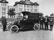
Contract for concrete approach from north end to replace east and west timber approaches along Assiniboine Ave. awarded to A.E. Jones and E. Fulcher for $30,590. Oct. 11, 1934. (Brandon Sun). As part of this project a Z-shaped ramp on the west side to Assiniboine Ave for pedestrians replaced wooden stairs to north end.
Custodial History
For custodial history see the collection level description of the Lawrence Stuckey collection.
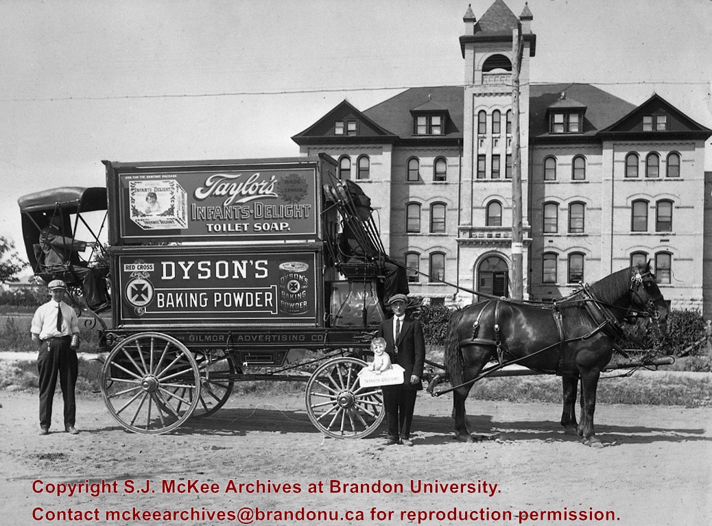
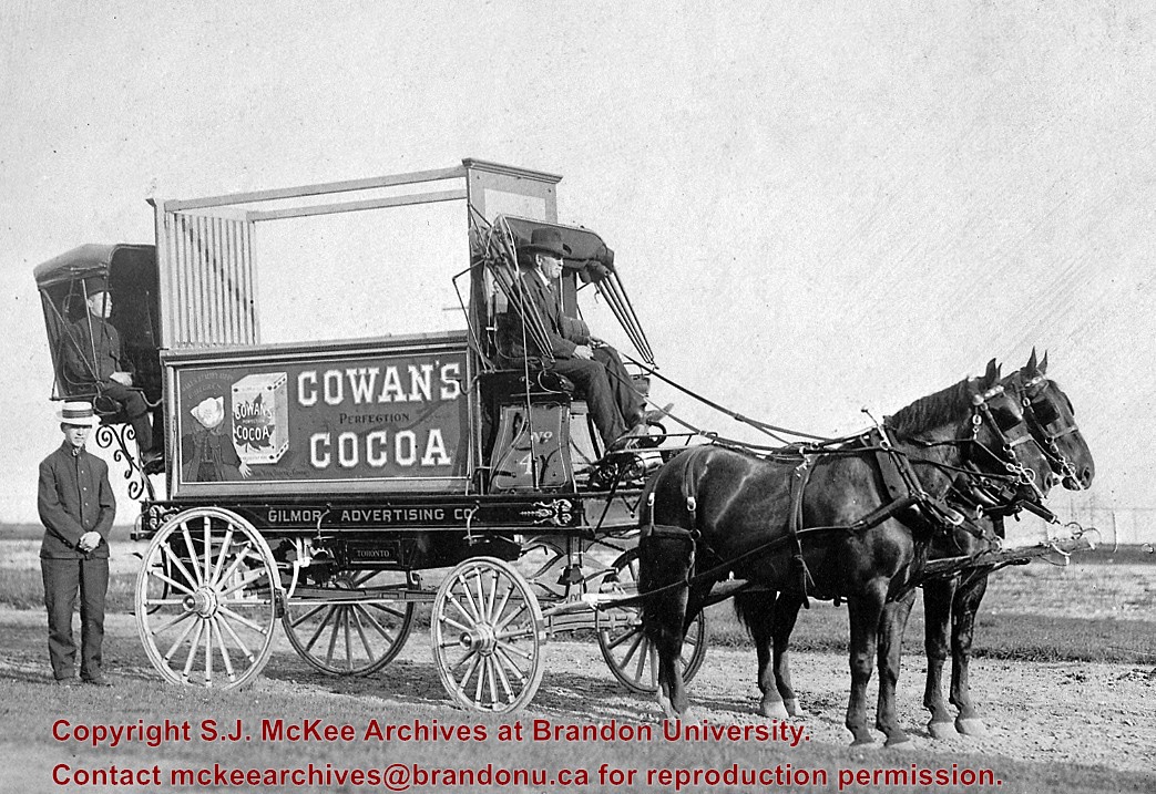
Scope and Content
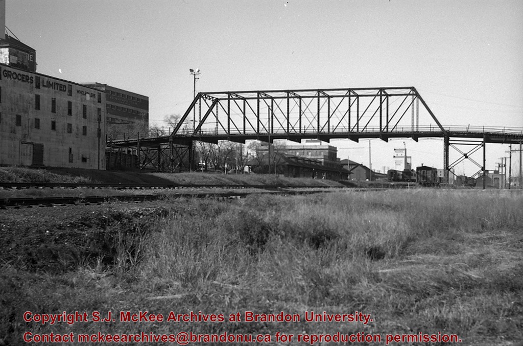
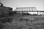
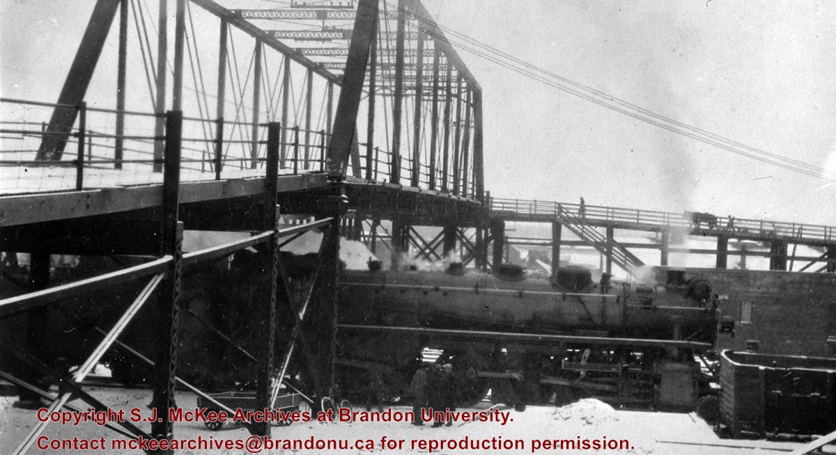
View of East side of original Eighth St. bridge from Pacific Avenue; Shows pedestrian stairway to North end and CPR early 2800 [locomotive] being serviced on Train No.4
For custodial history see the collection level description of the Lawrence Stuckey collection.
Scope and Content
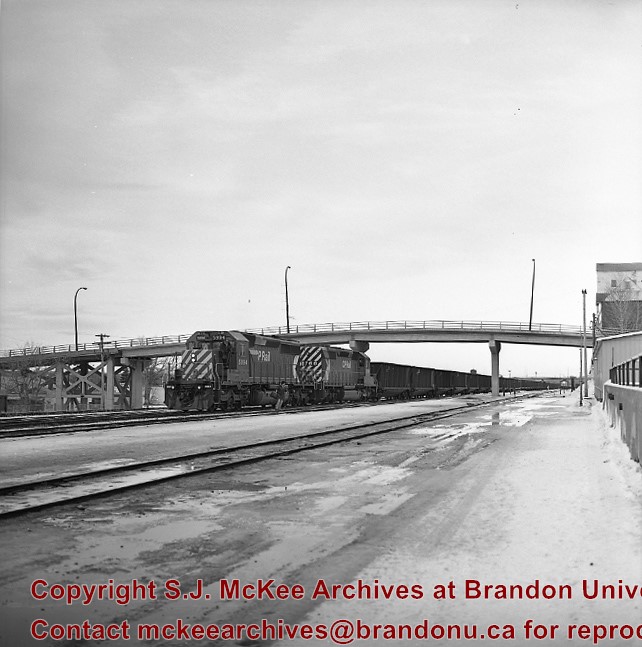
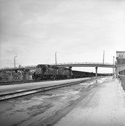
CPR No. 3, the westbound "Dominion", with engine 2829 under 1st Street Bridge
Notes
View includes former Empire Brewery, [then] in use by Bell Bottling Co.; Safe crossing over the CPR eliminated the need for a flagman. "Telltails" warn switchmen riding on top of railcars of low overhead clearance. Old Empire Brewery was (late 1950's) a feed mill, making grain feeds for livestock.
This photo was taken by C.J. Smith for Bryant Studio. Bryant Studio (I believe) was opened in 1907 by Smith for Bryant. Smith later bought the studio when Bryant planned to close it. The same studio was subsequently purchased by L.A. Stuckey on January 1, 1958. LAS.
Custodial History
For custodial history see the collection level description of the Lawrence Stuckey collection.
Scope and Content
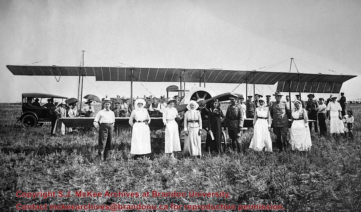
Photo of Katherine Stinson and her aircraft at Camp Hughes, including Army officers and nurses.
Notes
See Lawrence Stuckey file (Finding Aids) for biography of Katherine Stinson.
Brient was a point along the Algoma Central Railway line that connected the Helen Mine to the Michipicoten Harbour. It is located southwest of Wawa, Ontario.
Scope and Content
Photograph shows ore box cars in a railway yard.
Notes
Writing beneath the photograph in the album reads: yard at Brient
Brient was a point along the Algoma Central Railway line that connected the Helen Mine to the Michipicoten Harbour. It is located southwest of Wawa, Ontario.
Scope and Content
Photograph shows several men standing on railway tracks before a wood-framed train station in the winter. A sign attached to the station reads: British American Express Co. The man in the foreground appears to have a mailbag over on his back and several newspapers tucked beneath his arm.
Notes
Writing beneath the photograph in the album reads: station at Brient
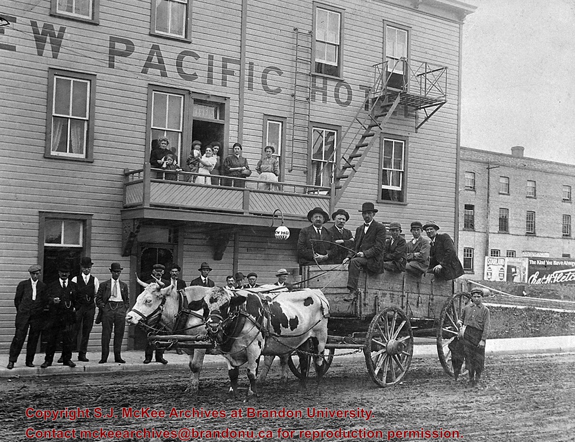
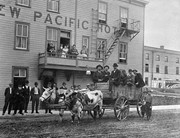
Photograph shows the intersection of 10th Street and Princess Avenue, Brandon, Manitoba. View is facing northwest along west side of the 100-block of 10th Street. A stationary policeman/divider is at the centre of the intersection. Visible businesses include: Doig's, Plaza Shoe Shop, and Cambridge Clothes Shop. A horse-drawn sled is parked in front of Doig's store. The Olympia Block, Cecil Hotel, and CPR Station are visible in the background.
Photograph shows the Brandon Wheat Market along Pacific Avenue on November 30, 1885. Farmers can be seen driving wagon teams loaded with bags of grain in line on Pacific Avenue from 10 Street to at least 7th Street. On the north side of Pacific Avenue the CPR Land Office and grain elevators are pictured. On the south side of Pacific Avenue, the general merchant/hardware store Bower, Blackburn, Mundell & Porter is situated on the corner of Pacific Avenue and 10th Street. A 10th Street sign is affixed to the merchants' store. On the east side of the general store, Edie House, the Grand View Hotel, and a Farmers' boarding and lodging house can be seen. Most of the buildings appear to be woodframed except for the Grand View, which is constructed of brick. Sidewalks appear to be in place on the south side of Pacific and snow dusts the streets. A baby swathed in winter clothing sits in a pram/baby carriage in front of the general store.
Notes
Writing on the front of the photograph reads: Novemeber 30th, 1885, Brandon Wheat Market


