Show All Information
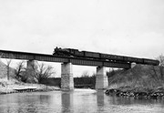
Assiniboine River; Treesbank Ferry - Stockton Ferry
Show All Information
Assiniboine River; Treesbank Ferry - Stockton Ferry
Show All Information
Assiniboine River; Treesbank Ferry - Stockton Ferry
Show All Information
Assiniboine River; Treesbank Ferry - Stockton Ferry
Show All Information
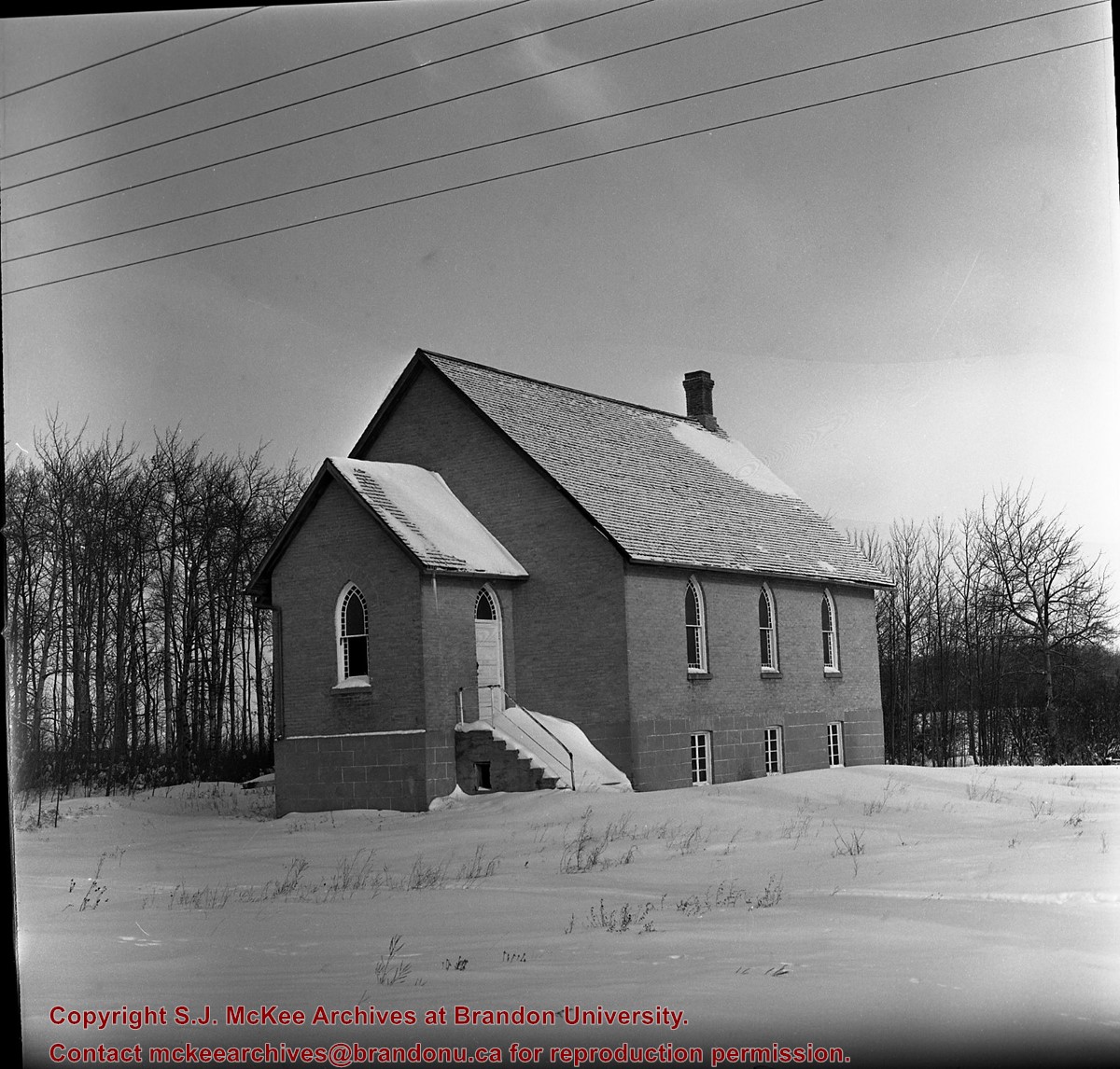
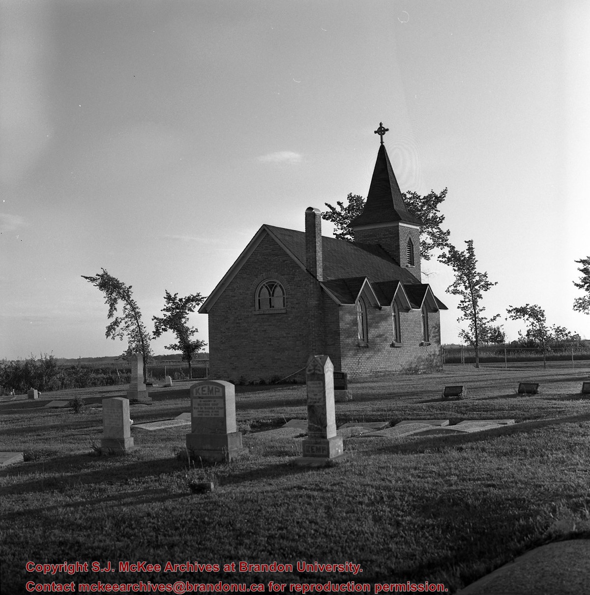
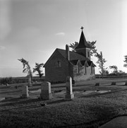
Cameron church, north of Minnedosa, Manitoba, Highway 10
Part Of
RG 11 Lawrence Stuckey fonds
Creator
L.A. Stuckey
Description Level
Item
Series Number
3.3
Item Number
1-2002.3.3.BNW[270]
Accession Number
1-2002
GMD
graphic
Date Range
January 29, 1979
Physical Description
2.25" x 2.25" (b/w)
Material Details
Negative
Custodial History
For custodial history see the collection level description of the Lawrence Stuckey collection.
Scope and Content
Image of Cameron church, north of Minnedosa, Manitoba, Highway 10
Notes
[Brandon NW includes communities north of Trans-Canada #1 highway and west of PTH #10.]
Name Access
Minnedosa, Manitoba
Subject Access
Church buildings/Churches
Repro Restriction
The McKee Archives is the copyright holder of the Stuckey materials.
Storage Location
Lawrence Stuckey collection
Show Less
Show All Information
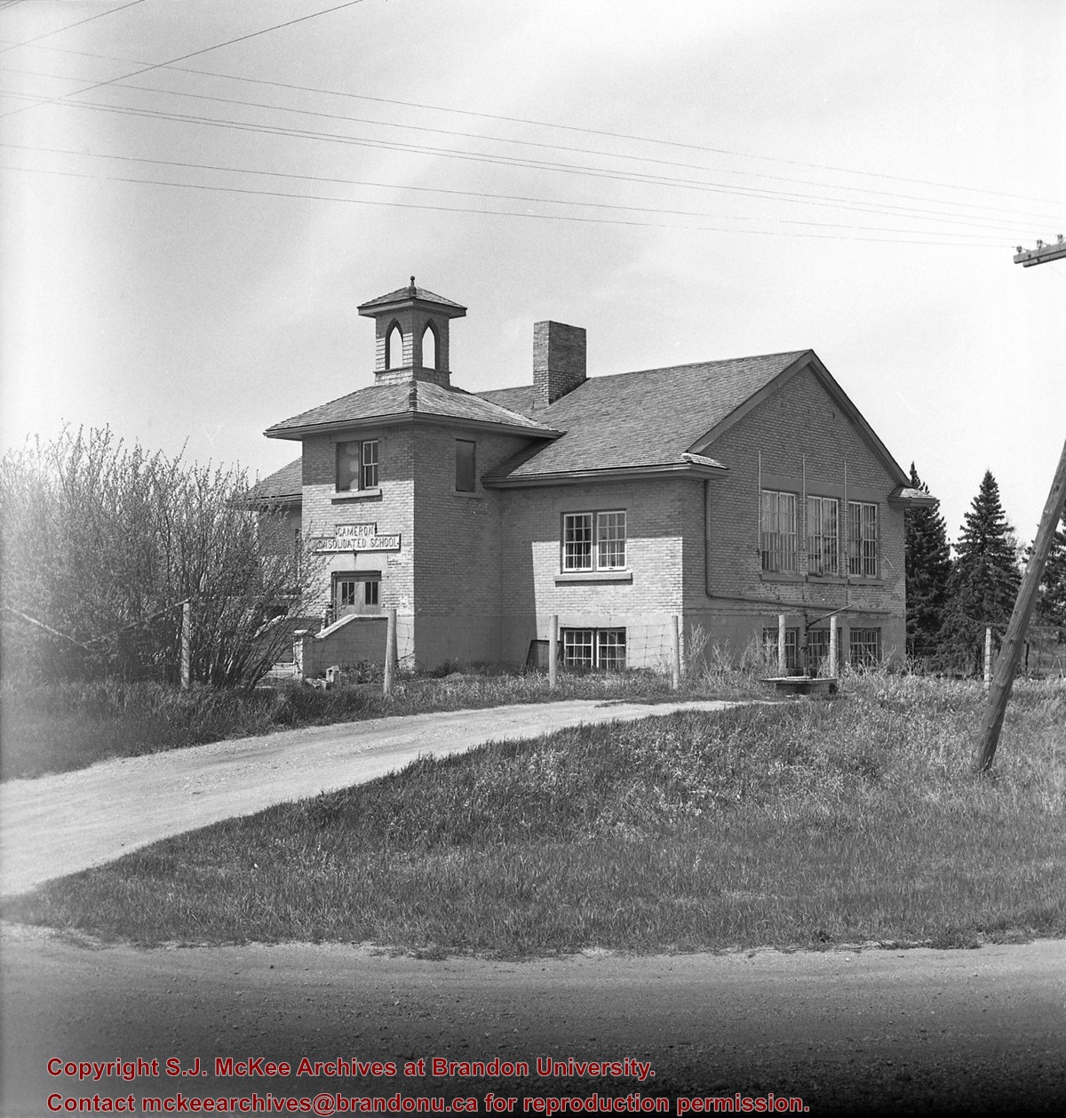
Cameron School, Highway 10, north of Minnedosa, Manitoba
Part Of
RG 11 Lawrence Stuckey fonds
Creator
L.A. Stuckey
Description Level
Item
Series Number
3.3
Item Number
1-2002.3.3.BNW[269]
Accession Number
1-2002
GMD
graphic
Date Range
June 5, 1979
Physical Description
2.25" x 2.25" (b/w)
Material Details
Negative
Custodial History
For custodial history see the collection level description of the Lawrence Stuckey collection.
Scope and Content
Image of Cameron school, highway 10, north of Minnedosa.
Notes
[Brandon NW includes communities north of Trans-Canada #1 highway and west of PTH #10.]
Name Access
Minnedosa, Manitoba
Subject Access
school buildings
Repro Restriction
The McKee Archives is the copyright holder of the Stuckey materials.
Storage Location
Lawrence Stuckey collection
Show Less
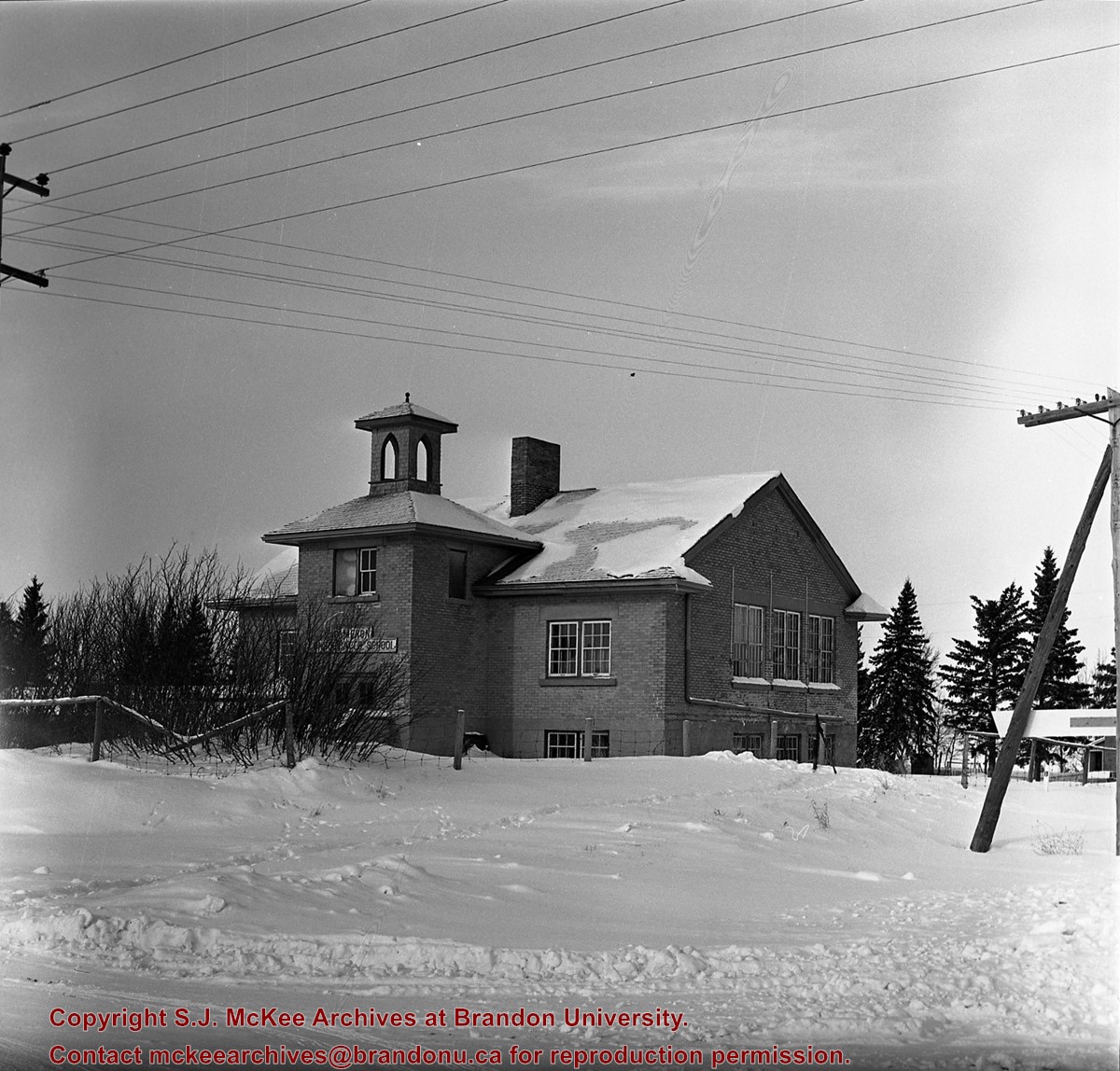
Show All Information
Cameron School, north of Minnedosa on PTH 10
Part Of
RG 11 Lawrence Stuckey fonds
Creator
L.A. Stuckey
Description Level
Item
Series Number
3.3
Item Number
1-2002.3.3.BNW[271]
Accession Number
1-2002
GMD
graphic
Date Range
January 29, 1979
Physical Description
2.25" x 2.25" (b/w)
Material Details
Negative
Custodial History
For custodial history see the collection level description of the Lawrence Stuckey collection.
Scope and Content
Image of Cameron School, north of Minnedosa on PTH 10.
Notes
[Brandon NW includes communities north of Trans-Canada #1 highway and west of PTH #10.]
Name Access
Minnedosa, Manitoba
Subject Access
school buildings
Repro Restriction
The McKee Archives is the copyright holder of the Stuckey materials.
Storage Location
Lawrence Stuckey collection
Show Less
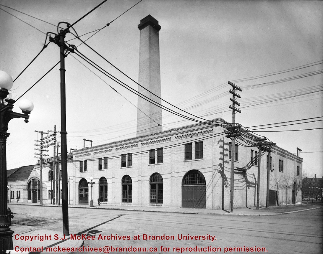
Show All Information
Canada Gas & Electric Co. Steam Plant
Part Of
RG 11 Lawrence Stuckey fonds
Creator
C.J. Smith
Description Level
Item
Series Number
3.1
Item Number
1-2002.3.1J4
Accession Number
1-2002
GMD
graphic
Date Range
[ca. 1930]
Physical Description
3 1/2" x 5"
Material Details
Negative
History / Biographical
In 1917 the Brandon Electric Light Co. and the Brandon Gas & Power Co. merged to form the Canada Gas & Electric Company; CG&EC was subsequently taken over by the Manitoba Power Commission;
Brandon's central heating system was taken over by the Brandon Steam Heat Users Co-operative;
On September 13, 1957 at 3:38 PM, an explosion in the boiler and stack destroyed the large stack causing two fatalities.
Custodial History
For custodial history see the collection level description of the Lawrence Stuckey collection.
Scope and Content
Canada Gas & Electric Co. steam plant
Notes
View (from 10th St.) of the coal-powered steam generating plant located at 10th St. & Lorne Ave.
Copy negative from 8x10 negative by C.J. Smith (on file).
Name Access
Canada Gas & Electric Co. Steam Plant
Subject Access
generation of electricity coal powerhouses Brandon Public Utilities
Repro Restriction
The McKee Archives is the copyright holder for the Stuckey materials.
Storage Location
Lawrence Stuckey collection
Show Less
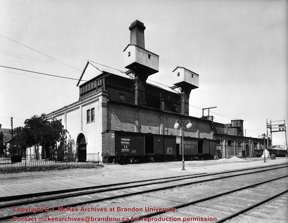
Show All Information
Canada Gas & Electric Co. Steam Plant
Part Of
RG 11 Lawrence Stuckey fonds
Creator
C.J. Smith
Description Level
Item
Series Number
3.1
Item Number
1-2002.3.1J5
Accession Number
1-2002
GMD
graphic
Date Range
[ca. 1930]
Physical Description
3 1/2" x 5"
Material Details
Negative
History / Biographical
In 1917 the Brandon Electric Light Co. and the Brandon Gas & Power Co. merged to form the Canada Gas & Electric Company; CG&EC was subsequently taken over by the Manitoba Power Commission;
Brandon's central heating system was taken over by the Brandon Steam Heat Users Co-operative;
On September 13, 1957 at 3:38 PM, an explosion in the boiler and stack destroyed the large stack causing two fatalities.
Custodial History
For custodial history see the collection level description of the Lawrence Stuckey collection.
Scope and Content
Canada Gas & Electric Co. steam plant
Notes
Rear view of the coal-powered steam generating plant located at 10th St. & Lorne Avenue
Coal was fed from boxcars up elevators to crushers in two cupolas from which it was fed by gravity to chain grate boilers; The chain grate revolved slowly but constantly with coal fed at front edge, burned, and dumped as cinders in pit at far end
The two boxcars shown were used to haul the coal; One is lettered for the Canadian National, the other is still lettered for the merged Grand Trunk Pacific; Cinders were loaded in gondola cars at far right
Copy negative from 8x10 negative by C.J. Smith (on file).
Name Access
Canada Gas & Electric Co. Steam Plant
Subject Access
generation of electricity coal powerhouses Brandon Public Utilities
Repro Restriction
The McKee Archives is the copyright holder for the Stuckey materials.
Storage Location
Lawrence Stuckey collection
Show Less
Show All Information
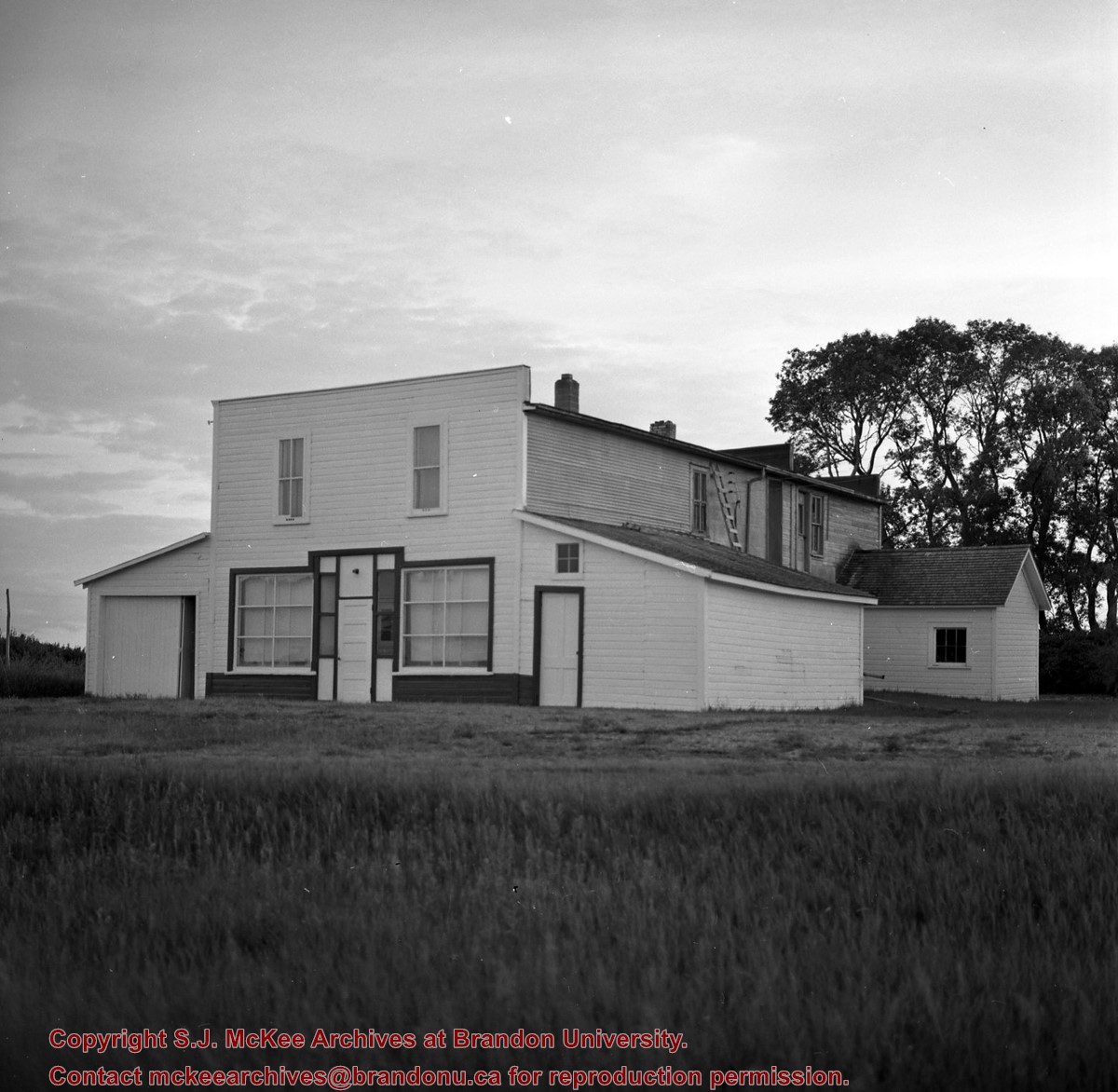
Cannings General Store, Hayfield, Manitoba
Part Of
RG 11 Lawrence Stuckey fonds
Creator
L.A. Stuckey
Description Level
Item
Series Number
3.3
Item Number
1-2002.3.3.BSW[326]
Accession Number
1-2002
GMD
graphic
Date Range
July 15, 1979
Physical Description
2.25" x 2.25" (b/w)
Material Details
Negative
Custodial History
For custodial history see the collection level description of the Lawrence Stuckey collection.
Scope and Content
Image of Cannings General Store, Hayfield, Manitoba.
Notes
[Brandon SW includes communities south of Trans-Canada #1 highway and west of PTH #10.]
Name Access
Hayfield, Manitoba Cannings General Store
Subject Access
general stores
Repro Restriction
The McKee Archives is the copyright holder of the Stuckey materials.
Storage Location
Lawrence Stuckey collection
Show Less
Show All Information
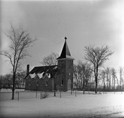
Church, Smart, Manitoba (2 miles north, 1 mile east of)
Part Of
RG 11 Lawrence Stuckey fonds
Description Level
Item
GMD
graphic
Date Range
December 19, 1978; August 4, 1979
Accession Number
1-2002
Part Of
RG 11 Lawrence Stuckey fonds
Creator
L.A. Stuckey
Description Level
Item
Series Number
3.3
Item Number
1-2002.3.3.CNR[149a]
Accession Number
1-2002
GMD
graphic
Date Range
December 19, 1978; August 4, 1979
Physical Description
2.25" x 2.25" (b/w)
Material Details
Negative
History / Biographical
Stuckey's notes: St. George's, Elton district, built 1901.
Custodial History
For custodial history see the collection level description of the Lawrence Stuckey collection.
Scope and Content
Image of a church at Smart, Manitoba (2 miles north, 1 mile east), taken along the CNR mainline, Rivers substation.
Name Access
CNR Smart, Manitoba
Subject Access
railways Church buildings/Churches
Repro Restriction
The McKee Archives is the copyright holder of the Stuckey materials.
Storage Location
Lawrence Stuckey collection
Arrangement
[Mr. Stuckey put three negatives in same envelope. We have separated them and numbered them (149a) to (149c)].
Show Less
Show All Information
Church, Smart, Manitoba (2 miles north, 1 mile east of)
Part Of
RG 11 Lawrence Stuckey fonds
Description Level
Item
GMD
graphic
Date Range
December 19, 1978; August 4, 1979
Accession Number
1-2002
Part Of
RG 11 Lawrence Stuckey fonds
Creator
L.A. Stuckey
Description Level
Item
Series Number
3.3
Item Number
1-2002.3.3.CNR[149c]
Accession Number
1-2002
GMD
graphic
Date Range
December 19, 1978; August 4, 1979
Physical Description
2.25" x 2.25" (b/w)
Material Details
Negative
History / Biographical
Stuckey's notes: St. George's, Elton district, built 1901.
Custodial History
For custodial history see the collection level description of the Lawrence Stuckey collection.
Scope and Content
Image of a church at Smart, Manitoba (2 miles north, 1 mile east), taken along the CNR mainline, Rivers substation.
Name Access
CNR Smart, Manitoba
Subject Access
railways Church buildings/Churches
Repro Restriction
The McKee Archives is the copyright holder of the Stuckey materials.
Storage Location
Lawrence Stuckey collection
Arrangement
[Mr. Stuckey put three negatives in same envelope. We have separated them and numbered them (149a) to (149c)].
Show Less
Show All Information
Church, Smart, Manitoba (2 miles north, 1 mile east of)
Part Of
RG 11 Lawrence Stuckey fonds
Description Level
Item
GMD
graphic
Date Range
December 19, 1978; August 4, 1979
Accession Number
1-2002
Part Of
RG 11 Lawrence Stuckey fonds
Creator
L.A. Stuckey
Description Level
Item
Series Number
3.3
Item Number
1-2002.3.3.CNR[149b]
Accession Number
1-2002
GMD
graphic
Date Range
December 19, 1978; August 4, 1979
Physical Description
2.25" x 2.25" (b/w)
Material Details
Negative
History / Biographical
Stuckey's notes: St. George's, Elton district, built 1901.
Custodial History
For custodial history see the collection level description of the Lawrence Stuckey collection.
Scope and Content
Image of a church at Smart, Manitoba (2 miles north, 1 mile east), taken along the CNR mainline, Rivers substation.
Name Access
CNR Smart, Manitoba
Subject Access
railways Church buildings/Churches
Repro Restriction
The McKee Archives is the copyright holder of the Stuckey materials.
Storage Location
Lawrence Stuckey collection
Arrangement
[Mr. Stuckey put three negatives in same envelope. We have separated them and numbered them (149a) to (149c)].
Show Less
Show All Information
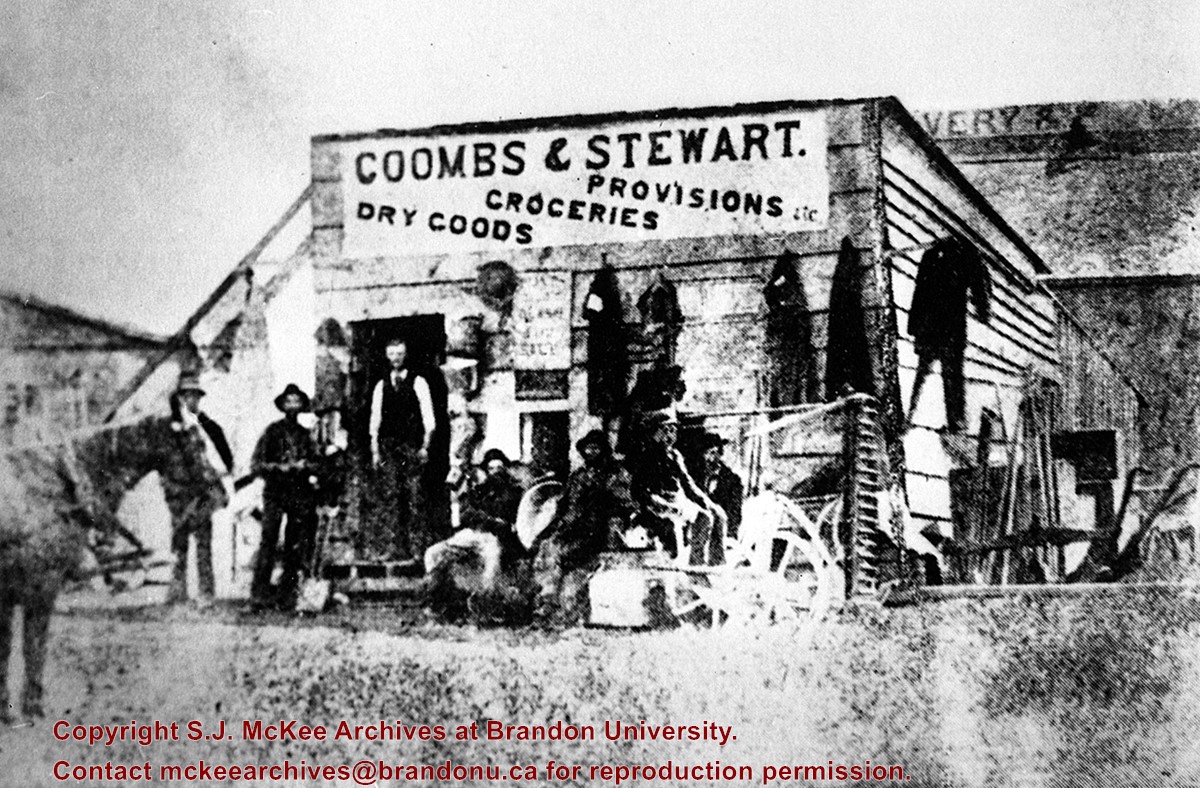
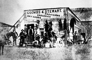
Coombs & Stewart Store
Part Of
RG 11 Lawrence Stuckey fonds
Description Level
Item
Series Number
3.1
Item Number
1-2002.3.1E13
Accession Number
1-2002
GMD
graphic
Date Range
1881
Physical Description
3 1/2" x 5"
Material Details
Negative
History / Biographical
This store, the first established in Brandon (June 12, 1881), was erected on the southeast corner of 6th St. & Pacific Avenue, facing Pacific.
Coombs and Steward later opened a store on the northeast corner of 9th St. & Rosser Ave.
Billy Muir was Coombs & Stewart's first clerk. He later opened a store of his own on the west side of the 100 block of 6th St., which he operated for nearly 50 years. (I was often a customer as a kid - LAS). Billy Muir closed his 6th Street store June 1945 (Brandon Sun). [See E18]
Custodial History
For custodial history see the collection level description of the Lawrence Stuckey collection.
Scope and Content
Coombs & Stewart Store
Name Access
Coombs & Stewart
Subject Access
businesses dry goods general stores Brandon business buildings & facilities before 1940
Repro Restriction
The McKee Archives is the copyright holder for the Stuckey materials.
Storage Location
Lawrence Stuckey collection
Show Less
Show All Information
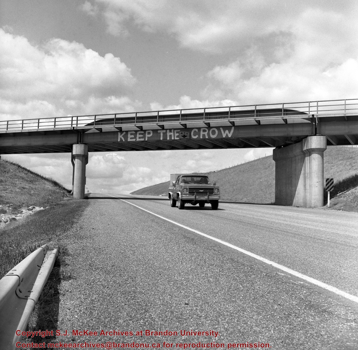
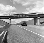
CP bridge over Highway 10 "KEEP THE CROW", Minnedosa, Manitoba.
Part Of
RG 11 Lawrence Stuckey fonds
Creator
L.A. Stuckey
Description Level
Item
Series Number
3.3
Item Number
1-2002.3.3.CPR[112.2]
Accession Number
1-2002
GMD
graphic
Date Range
May 22, 1983
Physical Description
2.5" x 2.5" (b/w)
Material Details
Negative
History / Biographical
Mr. Stuckey's notes: Similar painting on other side "Refuse the Cruise." Bridge newly painted July or Aug. 83.
Custodial History
For custodial history see the collection level description of the Lawrence Stuckey collection.
Scope and Content
Image of CP Bridge over Hwy. 10 "KEEP THE CROW", Minnedosa, Manitoba. Image was taken along the CPR Minnedosa & Bredenbury subdivision (ex. Manitoba & N.W. Railway).
Notes
["KEEP THE CROW" appears to have been spray painted on the side of the bridge].
Name Access
Minnedosa, Manitoba CPR
Subject Access
bridges Trucks
Repro Restriction
The McKee Archives is the copyright holder of the Stuckey materials.
Storage Location
Lawrence Stuckey collection
Show Less
Show All Information
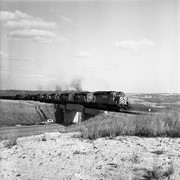
CPR Highway 10 bridge (town in background) and XW 5693-5703-5918-5960-5947-3036, Minnedosa, Manitoba.
Part Of
RG 11 Lawrence Stuckey fonds
Creator
L.A. Stuckey
Description Level
Item
Series Number
3.3
Item Number
1-2002.3.3.CPR[111]
Accession Number
1-2002
GMD
graphic
Date Range
March 31, 1984
Physical Description
2.5" x 2.5" (b/w)
Material Details
Negative
Custodial History
For custodial history see the collection level description of the Lawrence Stuckey collection.
Scope and Content
Image of CPR Highway 10 bridge (town in background) and XW 5693-5703-5918-5960-5947-3036, Minnedosa, Manitoba. Image was taken along the CPR Minnedosa & Bredenbury subdivision (ex. Manitoba & N.W. Railway).
Name Access
Minnedosa, Manitoba CPR
Subject Access
trains engines bridges
Repro Restriction
The McKee Archives is the copyright holder of the Stuckey materials.
Storage Location
Lawrence Stuckey collection
Show Less
Show All Information
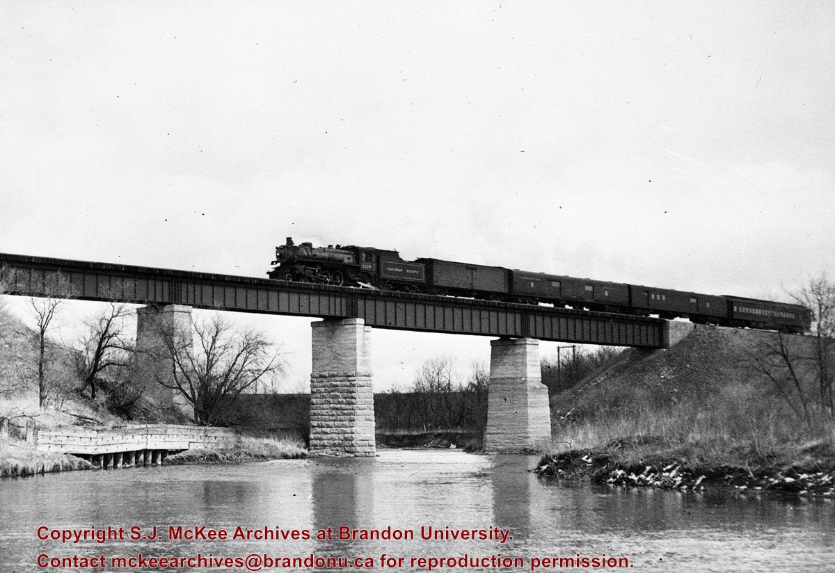
CPR no. 55 Engine 1210 on Souris River bridge, Treesbank, Manitoba
Part Of
RG 11 Lawrence Stuckey fonds
Creator
L.A. Stuckey
Description Level
Item
Series Number
3.3
Item Number
1-2002.3.3.CPR[58]
Accession Number
1-2002
GMD
graphic
Date Range
April 22, 1954
Physical Description
5" x 3.5" (b/w)
Material Details
Copy negative
History / Biographical
Stuckey's notes: 1210, 4-6-2- class G-5B. Built at Montreal Locomotive Works 1945.
Custodial History
For custodial history see the collection level description of the Lawrence Stuckey collection.
Scope and Content
Image of CPR no. 55 engine 1210 on Souris River bridge, Treesbank, Manitoba, taken along the CPR lines south of mainline.
Name Access
CPR Treesbank, Manitoba Souris River
Subject Access
railways trains locomotives bridges Rivers geographic features
Repro Restriction
The McKee Archives is the copyright holder of the Stuckey materials.
Storage Location
Lawrence Stuckey collection
Show Less
Show All Information
Curries Landing (Assiniboine River)
Part Of
RG 11 Lawrence Stuckey fonds
Creator
L.A. Stuckey
Description Level
Item
Series Number
3.3
Item Number
1-2002.3.3.BSE[366a]
GMD
graphic
Date Range
Apr. 12, 1977
Physical Description
2.5" x 2.5"
Material Details
Negative
Custodial History
For custodial history see the collection level description of the Lawrence Stuckey collection.
Scope and Content
Image of Curries Landing (Assiniboine River).
Notes
[Brandon SE includes communities south of Trans-Canada #1 highway and east of PTH #10.]
Name Access
Curries Landing Assiniboine River
Subject Access
Rivers
Storage Location
Lawrence Stuckey collection
Arrangement
[Mr. Stuckey put three negatives in the same envelope. We have separated them and numbered the negatives (366a) to(366c)].
Show Less
Show All Information
Curries Landing (Assiniboine River)
Part Of
RG 11 Lawrence Stuckey fonds
Creator
L.A. Stuckey
Description Level
Item
Series Number
3.3
Item Number
1-2002.3.3.BSE[366b]
GMD
graphic
Date Range
Apr. 12, 1977
Physical Description
2.5" x 2.5"
Material Details
Negative
Custodial History
For custodial history see the collection level description of the Lawrence Stuckey collection.
Scope and Content
Image of Curries Landing (Assiniboine River).
Notes
[Brandon SE includes communities south of Trans-Canada #1 highway and east of PTH #10.]
Name Access
Curries Landing Assiniboine River
Subject Access
Rivers
Storage Location
Lawrence Stuckey collection
Arrangement
[Mr. Stuckey put three negatives in the same envelope. We have separated them and numbered the negatives (366a) to(366c)].
Show Less
Show All Information
Curries Landing (Assiniboine River)
Part Of
RG 11 Lawrence Stuckey fonds
Creator
L.A. Stuckey
Description Level
Item
Series Number
3.3
Item Number
1-2002.3.3.BSE[366c]
GMD
graphic
Date Range
Apr. 12, 1977
Physical Description
2.5" x 2.5"
Material Details
Negative
Custodial History
For custodial history see the collection level description of the Lawrence Stuckey collection.
Scope and Content
Image of Curries Landing (Assiniboine River).
Notes
[Brandon SE includes communities south of Trans-Canada #1 highway and east of PTH #10.]
Name Access
Curries Landing Assiniboine River
Subject Access
Rivers
Storage Location
Lawrence Stuckey collection
Arrangement
[Mr. Stuckey put three negatives in the same envelope. We have separated them and numbered the negatives (366a) to(366c)].
Show Less


%0a)
%0a)
%0a)
+and+XW+5693-5703-5918-5960-5947-3036%2c+Minnedosa%2c+Manitoba.)
)
)
)