Show All Information
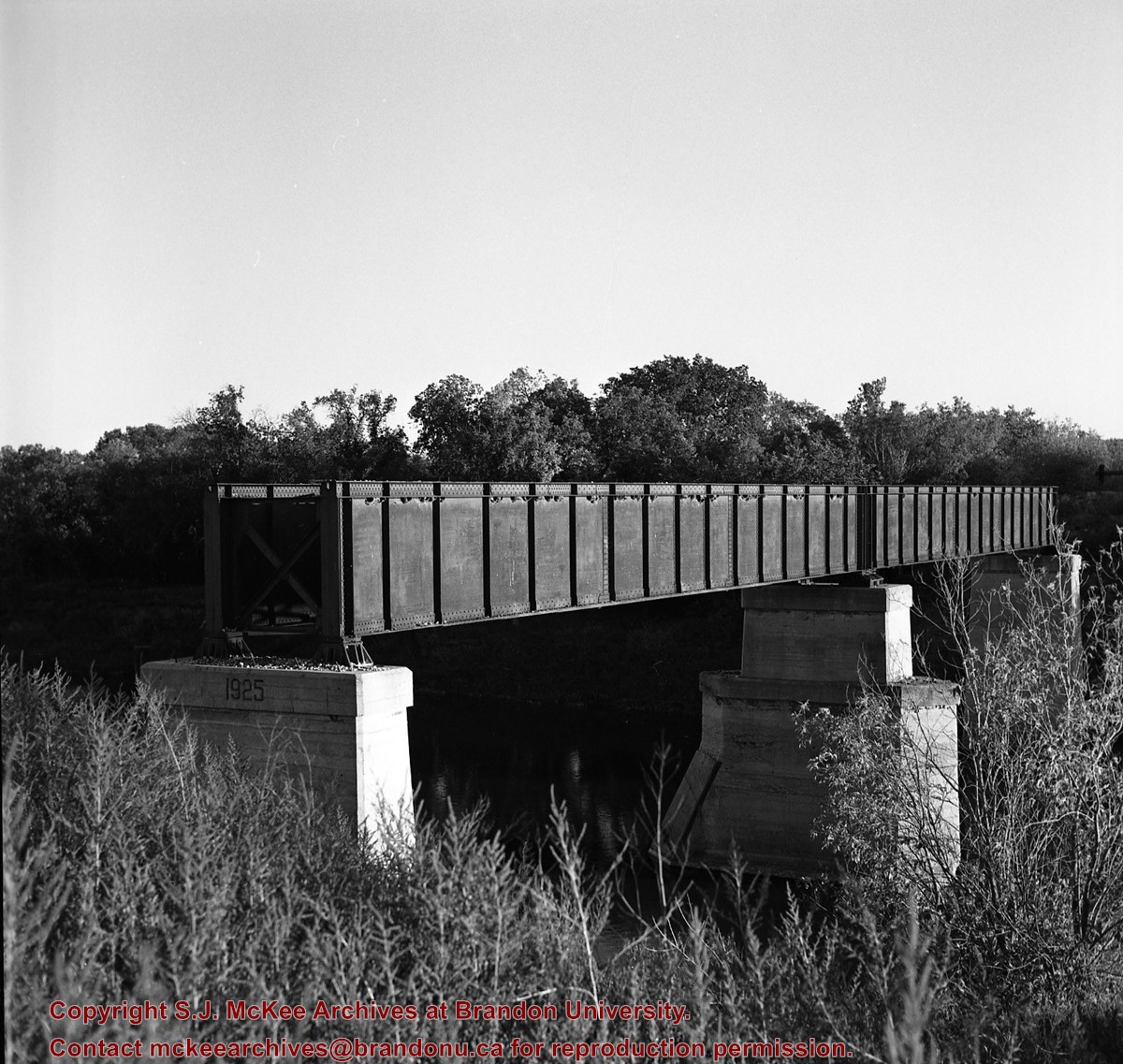
Abandoned bridge over Souris River at Wawanesa, Manitoba
Part Of
RG 11 Lawrence Stuckey fonds
Creator
L.A. Stuckey
Description Level
Item
Series Number
3.3
Item Number
1-2002.3.3.CNR[181]
Accession Number
1-2002
GMD
graphic
Date Range
September 4, 1988
Physical Description
2.25" x 2.25" (b/w)
Material Details
Negative
History / Biographical
Stuckey's notes: Last train over this line December 29, 1983.
Custodial History
For custodial history see the collection level description of the Lawrence Stuckey collection.
Scope and Content
Image of an abandoned bridge over the Souris River at Wawanesa, Manitoba, taken along the CNR line, Wawanesa substation.
Name Access
CNR Wawanesa, Manitoba Souris River
Subject Access
railways bridges
Repro Restriction
The McKee Archives is the copyright holder of the Stuckey materials.
Storage Location
Lawrence Stuckey collection
Show Less
Show All Information
Aerial view of bottom sand patterns; William River, Athabasca Sand Dunes Park Land Reserve, Saskatchewan
Title Variation
Saskatchewan
Artist
Milne, Courtney
Collection
The Sacred Earth
Date
1991
Form
photograph
Series
4/10
Dimensions
47 X 74 cm
Size Overall
61.5 X 89.5 cm
Medium
color photograph
Condition
good
Primary Support
paper
Secondary Support
mat, plexiglass, backing board; frame - metal
Accession Number
241
Show Less
Show All Information
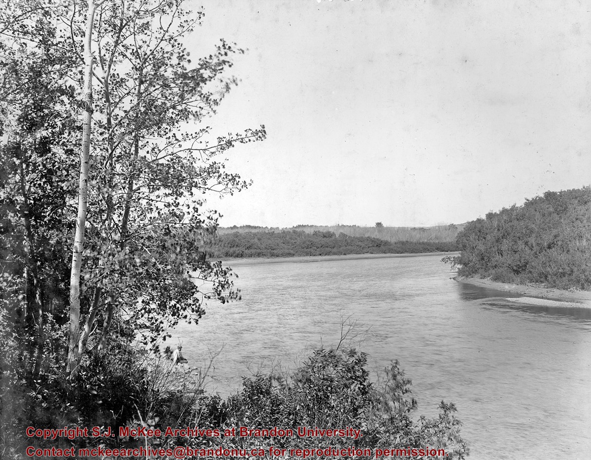
Assiniboine River
Part Of
Alf Fowler collection
Description Level
Item
GMD
graphic
Date Range
ca. 1911
Accession Number
6-1999
Part Of
Alf Fowler collection
Creator
Davidson & Gowen
Description Level
Item
Item Number
6-1999.93
Accession Number
6-1999
GMD
graphic
Date Range
ca. 1911
Physical Description
9.25" x 7.25" (b/w)
Physical Condition
There is a small tear at the top of the photograph.
Custodial History
See fonds level description of the Alf Fowler collection for custodial history.
Scope and Content
Photo shows a portion of the Assiniboine River north of the city.
Storage Range
RG 5 Western Manitoba Manuscript collection - photograph storage drawer
Show Less
Show All Information
Assiniboine River Bridge North of Kemnay
Part Of
RG 11 Lawrence Stuckey fonds
Creator
George H. Harris
Description Level
Item
Series Number
3.1
Item Number
1-2002.3.1OB5(1)
Accession Number
1-2002
GMD
graphic
Date Range
[ca. 1938]
Physical Description
2 1/2" x 2 1/2"
Material Details
Negative
History / Biographical
This bridge was condemned in the late 1930s but cyclists continued to use it until it was torn down (approximately 1940)
Until the early 1920s the Canadian Pacific Railway maintained a well and pumping station near the southeast corner of this bridge, which pumped water through a pipeline to a locomotive watering tank at Kemnay.
Custodial History
For custodial history see the collection level description of the Lawrence Stuckey collection.
Scope and Content
Assiniboine River Bridge North of Kemnay
Notes
[Mr. Stuckey put a negative and print in the same envelope. We have separated them, numbering the negative OB5(1) and the print OB5(1a).]
Name Access
Assiniboine River Bridge North of Kemnay
Subject Access
manmade geographic features bridges Brandon Area Bridges
Repro Restriction
The McKee Archives is the copyright holder for the Stuckey materials.
Storage Location
Lawrence Stuckey collection
Show Less
Show All Information
Assiniboine River Bridge North of Kemnay
Part Of
RG 11 Lawrence Stuckey fonds
Creator
George H. Harris
Description Level
Item
Series Number
3.1
Item Number
1-2002.3.1OB5(1a)
Accession Number
1-2002
GMD
graphic
Date Range
[ca. 1938]
Physical Description
2 1/2" x 2 1/2"
Material Details
Photograph
History / Biographical
This bridge was condemned in the late 1930s but cyclists continued to use it until it was torn down (approximately 1940)
Until the early 1920s the Canadian Pacific Railway maintained a well and pumping station near the southeast corner of this bridge, which pumped water through a pipeline to a locomotive watering tank at Kemnay.
Custodial History
For custodial history see the collection level description of the Lawrence Stuckey collection.
Scope and Content
Assiniboine River Bridge North of Kemnay
Notes
[Mr. Stuckey put a negative and print in the same envelope. We have separated them, numbering the negative OB5(1) and the print OB5(1a).]
Name Access
Assiniboine River Bridge North of Kemnay
Subject Access
manmade geographic features bridges Brandon Area Bridges
Repro Restriction
The McKee Archives is the copyright holder for the Stuckey materials.
Storage Location
Lawrence Stuckey collection
Show Less
Show All Information
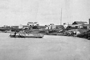
Assiniboine River Ferry
Part Of
RG 11 Lawrence Stuckey fonds
Description Level
Item
Series Number
3.1
Item Number
1-2002.3.1L2
Accession Number
1-2002
GMD
graphic
Date Range
1882
Physical Description
3 1/2" x 5"
Material Details
Negative
History / Biographical
Ferry service was used until the First Street bridge was built.
Custodial History
For custodial history see the collection level description of the Lawrence Stuckey collection.
Scope and Content
Ferry on the Assiniboine River near Second Street
Notes
Courtesy of Brandon Sun
Name Access
Assiniboine River Ferry
Subject Access
Transportation boats ferries Brandon Transportation (other than rail)
Repro Restriction
The McKee Archives is the copyright holder for the Stuckey materials.
Storage Location
Lawrence Stuckey collection
Show Less
Show All Information
Assiniboine River; Treesbank Ferry - Stockton Ferry
Show All Information
Assiniboine River; Treesbank Ferry - Stockton Ferry
Show All Information
Assiniboine River; Treesbank Ferry - Stockton Ferry
Show All Information
Assiniboine River; Treesbank Ferry - Stockton Ferry
Show All Information
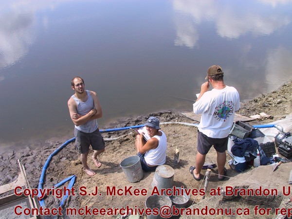
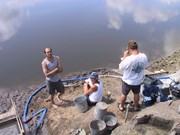
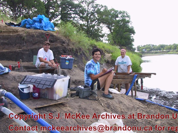
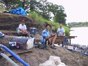
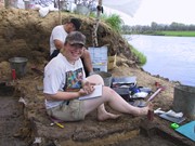
Atkinson site 2003 - Crew on river bank
Show All Information
Atkinson site 2003 - crew on river bank
Show All Information
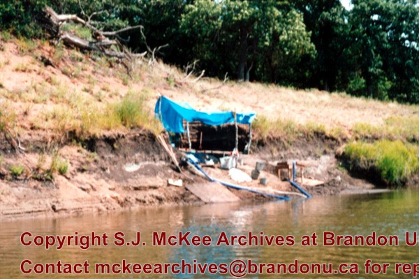
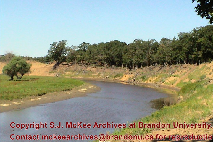
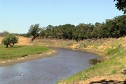
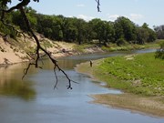
Atkinson site 2003 - site on the Souris River
Show All Information
Atkinson site 2003 - Souris River
Show All Information
Atkinson site 2004 - crew on river bank
Show All Information
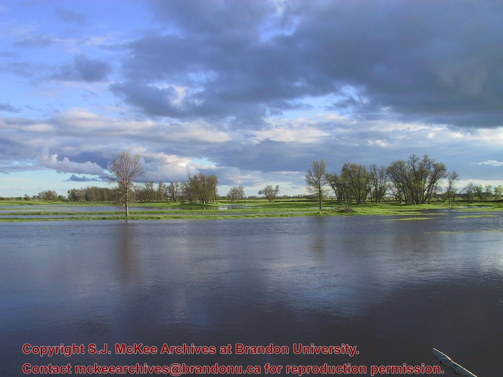
Atkinson site 2004 - Souris River flood
Show All Information
Atkinson site 2006 - site on the Souris river
Show All Information
Bow River West of Calgary
Title Variation
Calgary
Artist
Burdeny, Barry
Date
1964
Form
painting
Dimensions
61 X 76 cm
Size Overall
unknown
Medium
oil
Condition
unknown
Primary Support
board
Secondary Support
unknown
Accession Number
L-44
Show Less
Show All Information
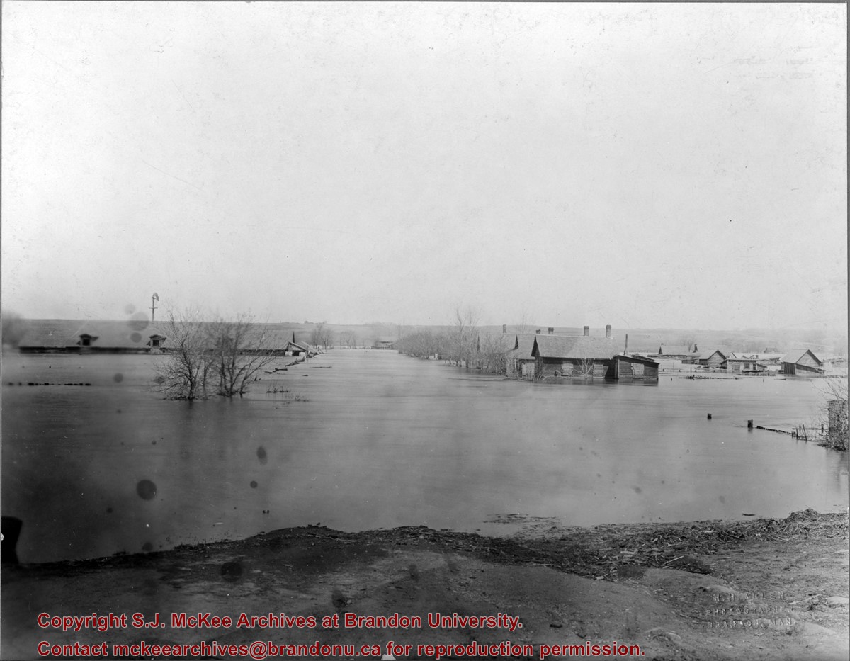
Brandon flood
Part Of
RG 12 Brandon and Area Photograph Collection
Creator
Photographer: H.H. Allen
Description Level
Item
Series Number
2
Item Number
BAPC 2.24
GMD
graphic
Date Range
1922
Physical Description
9.5" x 7.5" (b/w)
Material Details
On matting
Physical Condition
Some spotting on the image
History / Biographical
The "flats" refers to the Assiniboine River floodplane from 18th Street to First Street on either side of the river. See p. 223 of G.F. Barker's Brandon: A City for a description of the 1922 flood.
Custodial History
The photo was owned by Mrs. Wes Railton prior to its donation to the Archives.
Scope and Content
Photograph contains an image of houses on the Assiboine floodplane (Brandon's "flats") submerged in flood-waters.
Name Access
Brandon Assiniboine River
Subject Access
northend floods natural phenomena
Storage Location
BAPC oversize storage drawer
Show Less
Show All Information
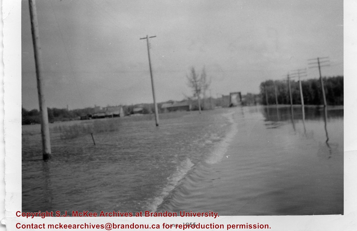
Brandon flood
Part Of
Fred McGuinness collection
Description Level
Item
Series Number
McG 9
Item Number
1-2015.232
Accession Number
1-2015
GMD
graphic
Date Range
1955
Physical Description
5" x 3.5" (b/w)
Custodial History
Photograph given to Fred McGuinness by J. Bilinski of Brandon
Scope and Content
Photograph shows flood waters covering a road. Telephone poles show water marks designated flood levels.
Notes
Writing on the back of the photograph reads: Flood 55, Over 18th St., J. Bilinski RR#1 Bdn MB
Name Access
Brandon City of Brandon 18th Street
Subject Access
floods disasters
Storage Location
RG 5 photograph storage drawer 2 (hanging photos)
Arrangement
Cigar box photographs
Show Less
.jpg?width=1200&404=no-img.jpg&watermark=wmk)
.jpg?width=180&404=no-img.jpg)
.jpg?width=1200&404=no-img.jpg&watermark=wmk)
.jpg?width=180&404=no-img.jpg)


.jpg%3fmaxheight%3d1000%26maxwidth%3d1000%26watermark%3dwmk&description=Assiniboine+River+Bridge+North+of+Kemnay)
.jpg%3fmaxheight%3d1000%26maxwidth%3d1000%26watermark%3dwmk&description=Assiniboine+River+Bridge+North+of+Kemnay)