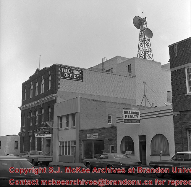
Photograph is looking northeast and shows Brandon Realty, ARM Industries Inc. (silk screen printers), Col. Ray Robinson's Auction Services, and the MTS building.
Repro Restriction
The McKee Archives is the copyright holder for the Stuckey materials.
See fonds level description of the Alf Fowler collection for custodial history.
Scope and Content
Photo was taken of 10th Street from Pacific Avenue looking sourth. Visible businesses include: the Cecil Hotel; the Canadian Bank of Commerce; Campbell and Campbell; and the Bank of British North America
Storage Range
RG 5 Western Manitoba Manuscript collection - photograph storage drawer
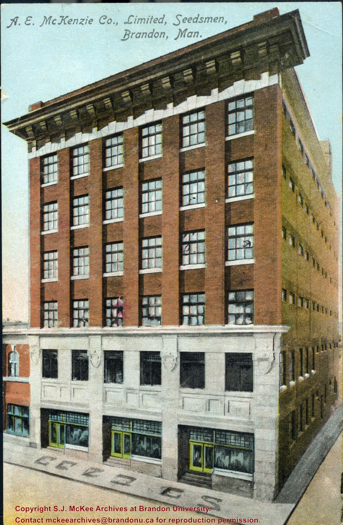
Postcard was sent to Chuck Wilson's aunt, Mrs. W.M. Wilson in Creelman, SK by the McKenzie Seed Company in 1912. Chuck Wilson found the postcard in some of his aunt's papers in 2009 and mailed it to the McKee Archives.
Scope and Content
Item consists of a colour postcard of the McKenzie Seed Company building located on the west side of the 100 block of 9th Street. The card was sent to Mrs. W.M. Wilson of Creelman, SK to acknowledge her order.
Writing on the front of the card reads: A.E. McKenzie Co., Limited, Seedsmen, Brandon, Man
Image is looking east northeast from approximately the 300 block of 23rd Street between Lorne and Louise Avenues. Photograph shows the Brandon College campus after the opening of the original Music Building in 1963, but before the construction of the Education Building in 1966. A number of house on the 300 blocks of 22nd and 21st Streets are visible in the foreground, with the A.E. McKenzie Seed Co., the Prince Edward Hotel and various grain elevators on the horizon.
In 1901, American entrepreneur Francis Hector Clergue (1856-1939) obtained the charter for the Ontario, Hudson Bay and Western Railway. Following his purchase, he reincoporated the Algoma Central Railway to the Algoma Central and Hudson's Bay Railway. (Source: Sault St. Mairie Public Library, "Transportation - Algoma Central Railway," Sault History Online, 2008)
Scope and Content
Photograph shows railroad tracks cutting through the Canadian Shield.
Notes
Writing beneath the photograph in the album reads: Algoma Central & Hundson Bay Ry.
The Lake Talbot tresle was a point along the Algoma Central Railway line that connected the Helen Mine to the Michipicoten Harbour. It is located north of Wawa and southwest of the Helen Mine.
Scope and Content
Photograph shows several men walking a railway line. Before them is a tresle bridge.
Notes
Writing beneath the photograph in the album reads: Lake Talbott Tresle [sic.]
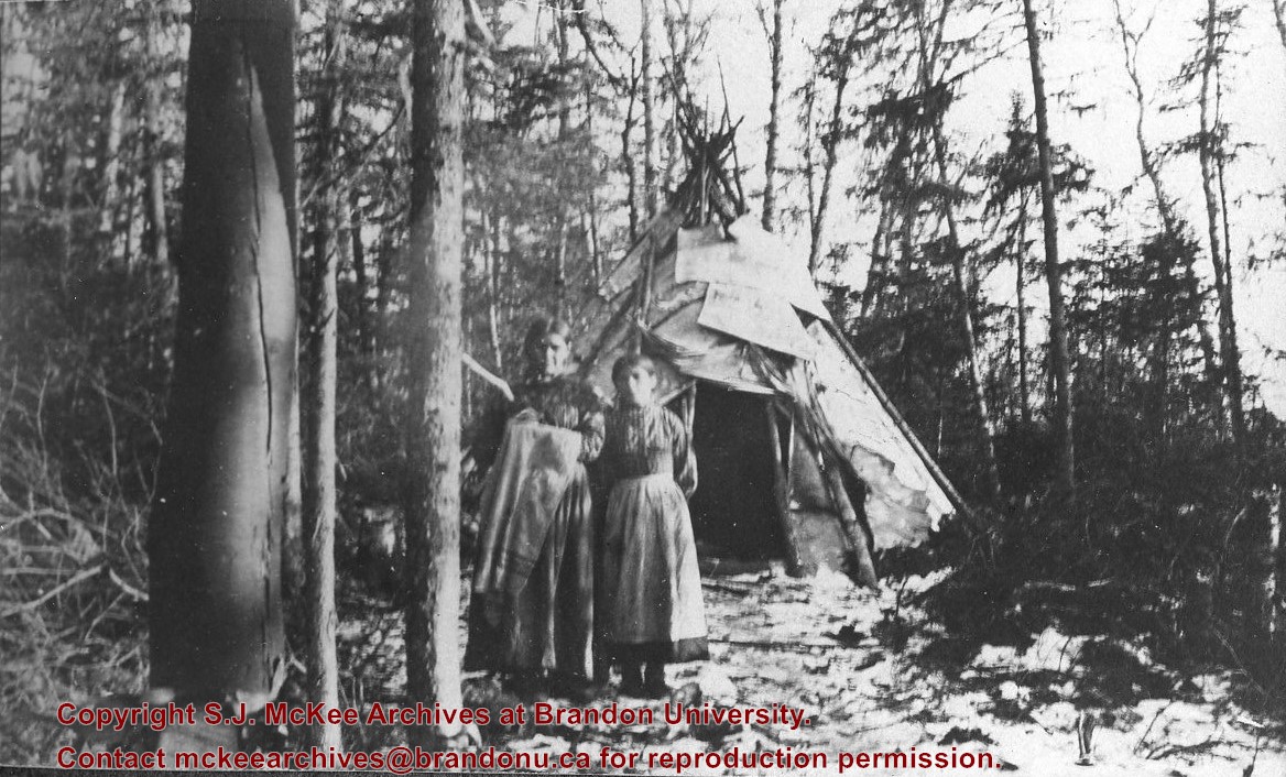
Photograph shows two aboriginal women standing before a tipi in the brush.
Notes
Writing beneath the photograph in the album reads: At the Indian Settlement. Based on provenience of images in the album, the aboringals in question may be from the Michipicoten band.
Trembley was a point along the Algoma Central Railway line that connected the Helen Mine to the Michipicoten Harbour. It is located southwest of Wawa, Ontario.
Scope and Content
Photograph shows railroad tracks. A line of ore cars stretch along one track. Writing on the side of one of the cars (#3017) reads: Algoma Central Railway Co.
Notes
Writing beneath the photograph in the album reads: Trembley - Ore Cars


