The idea of the Keystone Centre was first mentioned in 1958, at a meeting of the board of directors of the Manitoba Winter Fair. The Manitoba Winter Fair wanted a new facility because the old Wheat City Arena had a leaking roof and a deteriorating west wall. The old facility also had limited space and the Winter Fair felt it needed more space for expansion. The Provincial Exhibition of Manitoba also had problems with their facilities, such as old barns and poor display areas. The idea of the Keystone Centre was put on hold until 1969, when the boards of the Provincial Exhibition and the Manitoba Winter Fair joined together as the Provincial Exhibition Association of Manitoba and the Wheat City Arena was sold and demolished. The original estimate for the cost of the Keystone Centre facilities was $4.5 million and funding would be proportioned so that the federal and provincial governments would each put in one-third of the money, with the rest coming from local donations. The financial campaign for the Keystone Centre began in 1970, and construction began in November 1970. The grand opening of the Centre was in March 1973, and coincided with the Royal Manitoba Winter Fair of that year.
Custodial History
This fonds was accessioned by the McKee Archives in 1998. Prior custodial history is unknown.
Scope and Content
Fonds contains many folders full of correspondence, financial statements, meeting minutes and other documents relating to the development and construction of the Keystone Centre from 1970-1974, including those from the Keystone Executive Committee, as well as the Building Committee. Fonds also contains one folder that pertains to the Brandon Area Agricultural Development Survey from 1959. This folder contains the names and locations of all farmers in the Brandon area in 1959. The Brandon Area Agricultural Development Survey was created in 1959, in order to make farming in the Brandon area more profitable. The survey was aided by Doane Agricultural Service from St. Louis, Missouri, who had success creating agricultural development programs in the United States. Fonds also contains folders from the Provincial Exhibition with correspondence, pamphlets, estimates, and studies from the 1960's. There is also one folder belonging to the Manitoba Winter Fair, which contains correspondence and financial statements relating to the Wheat City Arena. Fonds also contains information pertaining to the proposals made in the 1960's, for the building of the Keystone Centre, as well as one folder about the Keystone campaign from 1970-73. There is also one folder about the opening of the Keystone Centre, which contains newspaper clippings and guest lists. Finally, the fonds contains information about a court case involving Albert Bobyk and Robert Stewart. Stewart was the project manager for the Building Committee and Bobyk worked on the Keystone Center. The fonds includes a report about the trial of the two men who were charged with fraud involving their work on the Keystone Centre.
Photograph shows Western Motors Ltd. on the southwest corner of 10th Street and Princess Avenue. Anglo gas station is part of the car shop, which sells GM, Chevrolet, and Oldsmobiles.
Hutchings' Drugs is on the ground floor of the Hughes Building on the northwest corner of 10th Street and Princess. Manufacturers Life occupies the second storey.
Photograph shows the north face of the Prince Edward Hotel on Princess Avenue. To the east of the hotel is Old City Hall with the military monument (which has since been relocated to the Brandon Armoury). On the west side of the hotel is Wheelers Esso Service Station.
Notes
The photograph appears to be taken from the Hughes Building on 10th Street.
Photograph shows Princess Avenue facing east from 10th Street. On the north side of Princess Avenue, a B/A Service Station, Princess Cafe, Lindenberg Seeds, and the Central Fire Station are visible. Old City Hall with the war memorial and the Prince Edward Hotel are visible on the south side of Princess Avenue. Traffic is travelling one-way on Princess Avenue.
Photograph shows the Greyhound Bus Depot at 11th Street and Princess Avenue. Western Motors, Wheelers Esso Station, and the Prince Edward Hotel are visible along the south side of Princess Avenue. Traffic is travelling one-way on Princess Avenue.
Photograph shows Western Motors Ltd. on the southwest corner of 10th Street and Princess Avenue. To the west of the car dealership/garage is the Greyhound Bus Station and its Maxwell House Cafe as well as the court house.
Photograph shows the west side of the 200-block on 10th Street. Visible businesses include: Chamber of Commerce Tourist Information, Dominion Tire & Radio Co., Bonnie's Bonnet Shop, Steve's Grill, Wally's Taxi, and Western Motors Ltd. The painted advertisement for Doig, Rankin and Robertson is visible on the Alexandra Block. Christmas ornaments are displayed from light standards and include Santa Claus and a Christmas elf.
Photograph shows the west side of the 200-block on 10th Street. Visible businesses include: Chamber of Commerce Tourist Information, Dominion Tire & Radio Co., Steve's Grill, Wally's Taxi, and the garage entrances to Western Motors Ltd. A Santa Claus Christmas ornament is displayed from a light standard.
Photograph shows the Red Indian (Gasoline) Station on the north side Princess Avenue between 9th and 10th Streets, Brandon. Attached to the west side of the gas station is another shop which contains Hutchings' Drug Store. The Alexandra Block on 10th Street is visible in the background.
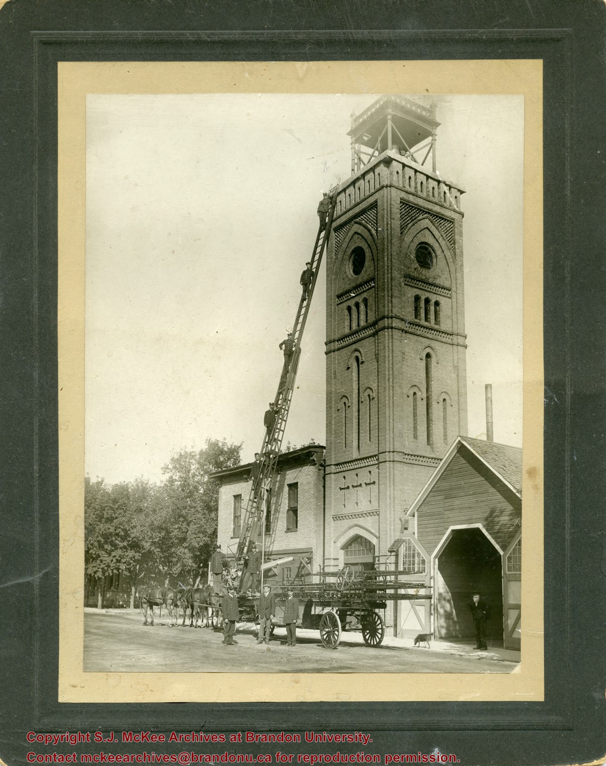
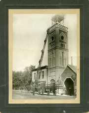
The Original Brandon Fire Hall was located on the east half of the north side of the 600-block of Princess Avenue. The hall was in operation from 1884 to 1911.
Scope and Content
Photograph shows Brandon's first fire hall on Princess Avenue. The hose tower and stable are visible. The horse-drawn ladder wagon is parked on the street in front of the hall and the rescue ladder is extended against the tower. Five firefighters are standing on the ladder and two are standing at its base.
Notes
Writing on the back of the photograph reads: Mrs. E. Harden, 6th Street
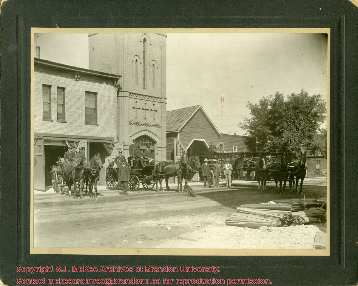
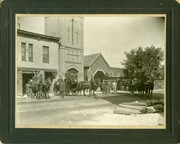
The Original Brandon Fire Hall was located on the east half of the north side of the 600-block of Princess Avenue. The hall was in operation from 1884 to 1911.
Scope and Content
Photograph shows Brandon's first fire hall on Princess Avenue facing east. The hose tower and stables are visible. The three horse-drawn ladder wagon is parked is on the right. Pairs of horses are harnessed to two hose wagons. A dog sits on the street before the parked wagons.
Notes
Writing on the back of the photograph reads: 1903 or 1905, "First Fire Hall," Princess Avenue, Brandon, Man.
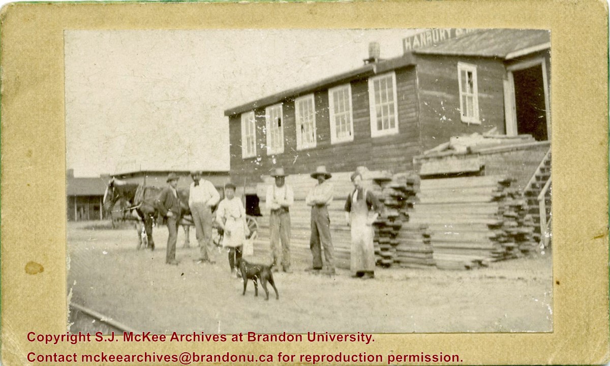
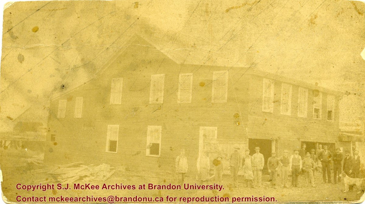
The Hanbury Manufacturing Company was located at 600-698 Assiniboine Avenue.
Scope and Content
Photograph shows a group of men standing in front of a pile of lumber in the yard of Hanbury Manufacturing. A horse is hitched to a buggy in the background and a dog stands in the foreground.
Photograph was given to Fred McGuinness by Linda Bilkoski (nee Lepard) of Lac du Bonnet, MB.
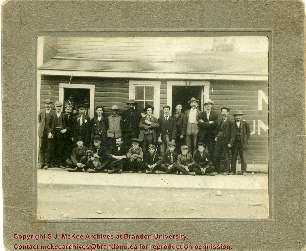
Scope and Content
Photograph shows a group of 24 males alongside a wood-framed building. The individuals are likely employees of McDiarmid Lumber. The ages of employees range from children to middle-age.The men appear to be wearing their "Sunday-best." Some men have smoking pipes, another man is holding a dog.
Notes
Date range based on establishment of McDiarmid & Clark and employment periods for members of the Chalmers family based on Henderson's Brandon City Directory.
Photograph was given to Fred McGuinness by Linda Bilkoski (nee Lepard) of Lac du Bonnet, MB.
Scope and Content
Photograph shows a group of 17 men stading in a lumber yard.
Notes
This picture is the same as the negative in the Lawrence Stuckey collection. Stuckey obtained a copy of the photo from George Lepard, father of Linda Bilkoski (nee Lepard). Date range based on employment dates of Edward Chalmers. Ed Chalmers was the brother of Catherine Harden (nee Chalmers), mother to Edith Harden, who in turn, is the wife of George Lepard.
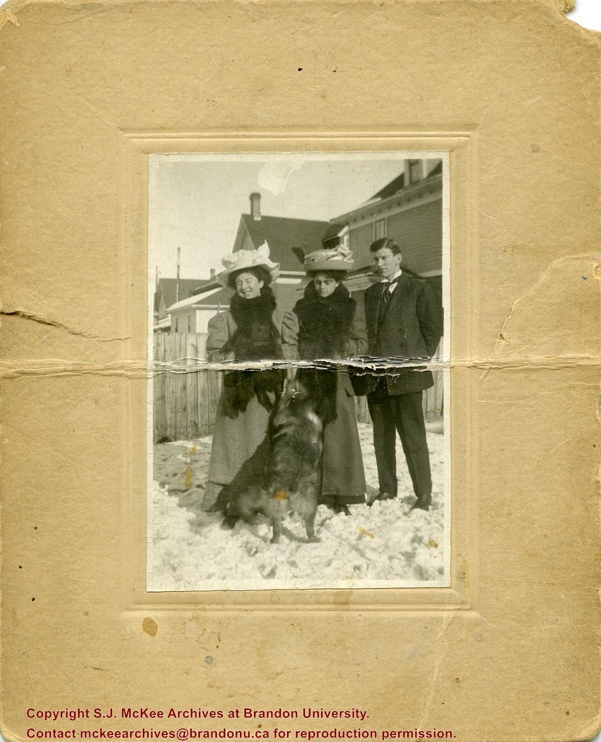
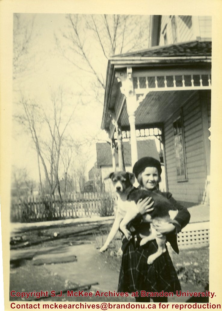
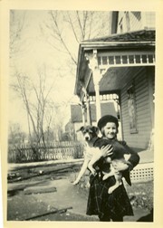
Photograph shows two women, a man, and dog, standing in a residential backyard during the winter. The women are wearing large hats and fur stoles. The woman standing in the middle is likely Isabella Louisa McGuinness (nee Pope), mother to Brandon Sun editor Fred McGuinness.
The Medicine Hat Exhibition and Stampede Parade Day was held on Thursday, July 19, 1962, at 9:30 a.m. The local newspaper reported that approximately 24,000 people were in attendance to see parade marshall Rod Ashburner leading 175 entries consisting of 90 floats, 75 horses, and 10 bands. There were 19 parade categories eligible for $12,000 in prize money and included: junior and senior cowboys and cowgirls; fancy and Shetland ponies; sulky class open; comic, commercial, industrial and organizational floats; decorated cars; special ranch class; 4-H Clubs; and a non-competitive class.
The parade route started at Second St. and Allowance Ave., from Second St. to Ash Ave., north on Ash to First St. SE., from First St. S.E. to Fourth Ave., south to Second St. to South Railway St., south on South Railway St. to Third St., with a finish at McLeod Trail. A route map was published in the Medicine Hat News the day before the parade.
Aerial photographs of the parade were taken by Medicine Hat News photographer Howard Heid (1930-2005) from the private helicopter of John Bourn. Bourn was a pilot from Woodville, Wisconsin, who chartered his four-seater helicopter for sight-seers at exhibitions and stampedes across the county.
(Sources: Pat Currie, "Let 'Er Go!," Medicine Hat News, 19 July 1962,1; Harald Gunderson, "'Eye in the Sky' Best Parade View," Medicine Hat News, 19 July 1962,1; "Parade Starts at 9:30 Sharp," 18 July 1962)
Scope and Content
Photograph shows an aerial view of the Medicine Hat Exhibition and Stampede Parade route with a focus on the First Street SE. A number of gas stations and garages are visible along this route and include Texaco, Shell, Ford, and B/A. The Fraternal Order of Eagles lodge is also visible.
Notes
This photograph appeared on the front page of The Medicine Hat News (19 July 1962).
The Medicine Hat Exhibition and Stampede Parade Day was held on Thursday, July 19, 1962, at 9:30 a.m. The local newspaper reported that approximately 24,000 people were in attendance to see parade marshall Rod Ashburner leading 175 entries consisting of 90 floats, 75 horses, and 10 bands. There were 19 parade categories eligible for $12,000 in prize money and included: junior and senior cowboys and cowgirls; fancy and Shetland ponies; sulky class open; comic, commercial, industrial and organizational floats; decorated cars; special ranch class; 4-H Clubs; and a non-competitive class.
The parade route started at Second St. and Allowance Ave., from Second St. to Ash Ave., north on Ash to First St. SE., from First St. S.E. to Fourth Ave., south to Second St. to South Railway St., south on South Railway St. to Third St., with a finish at McLeod Trail. A route map was published in the Medicine Hat News the day before the parade.
Aerial photographs of the parade were taken by Medicine Hat News photographer Howard Heid (1930-2005) from the private helicopter of John Bourn. Bourn was a pilot from Woodville, Wisconsin, who chartered his four-seater helicopter for sight-seers at exhibitions and stampedes across the county.
(Sources: Pat Currie, "Let 'Er Go!," Medicine Hat News, 19 July 1962,1; Harald Gunderson, "'Eye in the Sky' Best Parade View," Medicine Hat News, 19 July 1962,1; "Parade Starts at 9:30 Sharp," 18 July 1962)
Scope and Content
Photograph shows an aerial view of the Medicine Hat Exhibition and Stampede Parade route with a focus on the First Street SE and and the South Railway Street merge. A number of gas stations and garages are visible along this route and include Texaco, Shell, Ford, and B/A. The Fraternal Order of Eagles lodge is also visible.
Notes
This photograph shows the neighbourhood before rezoning and commercial development.
The Medicine Hat Exhibition and Stampede Parade Day was held on Thursday, July 19, 1962, at 9:30 a.m. The local newspaper reported that approximately 24,000 people were in attendance to see parade marshall Rod Ashburner leading 175 entries consisting of 90 floats, 75 horses, and 10 bands. There were 19 parade categories eligible for $12,000 in prize money and included: junior and senior cowboys and cowgirls; fancy and Shetland ponies; sulky class open; comic, commercial, industrial and organizational floats; decorated cars; special ranch class; 4-H Clubs; and a non-competitive class.
The parade route started at Second St. and Allowance Ave., from Second St. to Ash Ave., north on Ash to First St. SE., from First St. S.E. to Fourth Ave., south to Second St. to South Railway St., south on South Railway St. to Third St., with a finish at McLeod Trail. A route map was published in the Medicine Hat News the day before the parade.
Aerial photographs of the parade were taken by Medicine Hat News photographer Howard Heid (1930-2005) from the private helicopter of John Bourn. Bourn was a pilot from Woodville, Wisconsin, who chartered his four-seater helicopter for sight-seers at exhibitions and stampedes across the county.
(Sources: Pat Currie, "Let 'Er Go!," Medicine Hat News, 19 July 1962,1; Harald Gunderson, "'Eye in the Sky' Best Parade View," Medicine Hat News, 19 July 1962,1; "Parade Starts at 9:30 Sharp," 18 July 1962)
Scope and Content
Photograph shows an aerial view of the Medicine Hat Exhibition and Stampede Parade route with a focus on the First Street SE and Sixth Avenue intersection. A number of gas stations and garages are visible along this route and include Texaco, Shell, Ford, and B/A. A number of observers can be seen sitting on rooftops.
Notes
This photograph shows the neighbourhood before rezoning and commercial development.
The Medicine Hat Exhibition and Stampede Parade Day was held on Thursday, July 19, 1962, at 9:30 a.m. The local newspaper reported that approximately 24,000 people were in attendance to see parade marshall Rod Ashburner leading 175 entries consisting of 90 floats, 75 horses, and 10 bands. There were 19 parade categories eligible for $12,000 in prize money and included: junior and senior cowboys and cowgirls; fancy and Shetland ponies; sulky class open; comic, commercial, industrial and organizational floats; decorated cars; special ranch class; 4-H Clubs; and a non-competitive class.
The parade route started at Second St. and Allowance Ave., from Second St. to Ash Ave., north on Ash to First St. SE., from First St. S.E. to Fourth Ave., south to Second St. to South Railway St., south on South Railway St. to Third St., with a finish at McLeod Trail. A route map was published in the Medicine Hat News the day before the parade.
Aerial photographs of the parade were taken by Medicine Hat News photographer Howard Heid (1930-2005) from the private helicopter of John Bourn. Bourn was a pilot from Woodville, Wisconsin, who chartered his four-seater helicopter for sight-seers at exhibitions and stampedes across the county.
(Sources: Pat Currie, "Let 'Er Go!," Medicine Hat News, 19 July 1962,1; Harald Gunderson, "'Eye in the Sky' Best Parade View," Medicine Hat News, 19 July 1962,1; "Parade Starts at 9:30 Sharp," 18 July 1962)
Scope and Content
Photograph shows an aerial view of the Medicine Hat Exhibition and Stampede Parade route, with a focus on Second Street SE. Visible store signs include: Gardener's Used Cars, Provincial Treasury Branch, Furvey's Furniture and Appliances, J.J. Moore & Son Furniture, Alberta Credit Jewellers, James Richardson & Sons, Medicine Hat Gas Power Water City Owned Utilities.
Notes
This photograph shows the neighbourhood before rezoning and commercial development.


+north+side+Princess+Avenue+between+9th+Street+and+10th+Street%2c+Brandon%2c+Manitoba)
)