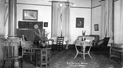
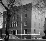
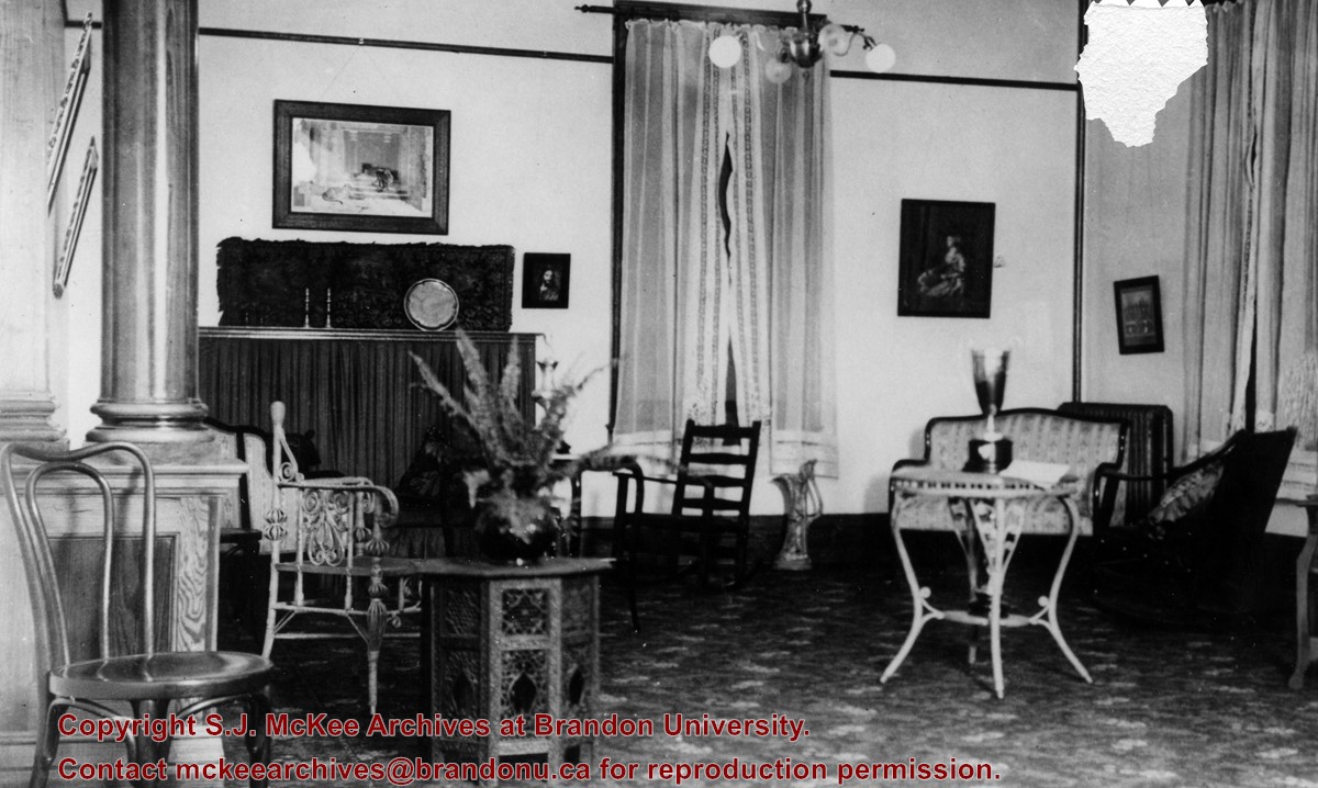
The building pictured was built in 1906-1907. Prior to its use as the Public Library, the building housed the Merchants Bank of Canada. The Library left this location in 1984 when it moved to the former Co-op store on 7th Street & Princess Avenue. This building subsequently became the Brandon Chamber of Commerce building in September of 1985. According to Stuckey, the façade of the building is to remain as heritage building, with interior renovations undertaken with government financing.
Custodial History
For custodial history see the collection level description of the Lawrence Stuckey collection.
Scope and Content
Brandon Public Library [branch of Western Manitoba Regional Library].
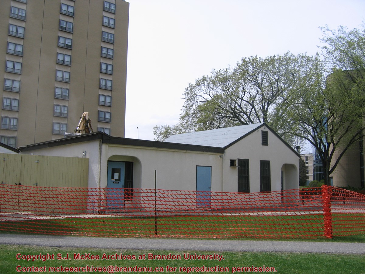
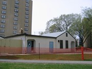
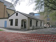
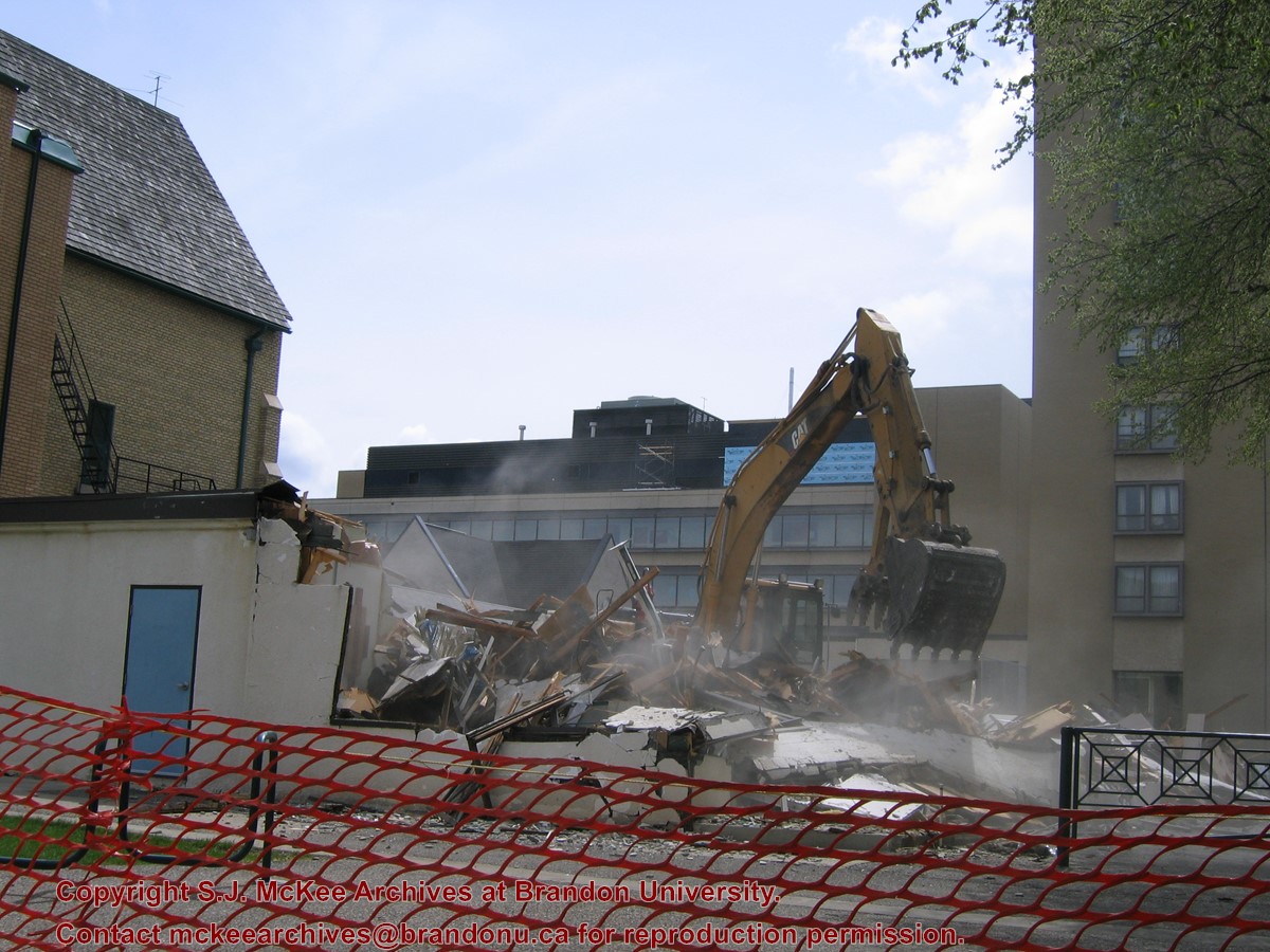
Located at the centre of the Brandon University campus, the Physical Plant H-Hut was destroyed following the opening of the new $3.9M, 13,600 square-foot physical plant on 07 April 2010.
Custodial History
Photograph was taken by McKee Archives project archivist Jill Sutherland.
Scope and Content
Photograph shows the demolition of the Physical Plant H-Hut.
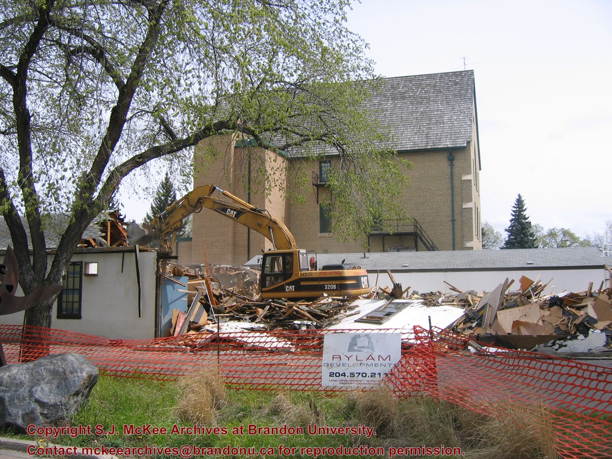
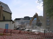
Located at the centre of the Brandon University campus, the Physical Plant H-Hut was destroyed following the opening of the new $3.9M, 13,600 square-foot physical plant on 07 April 2010.
Custodial History
Photograph was taken by McKee Archives project archivist Jill Sutherland.
Scope and Content
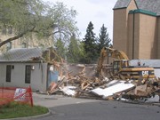
Photograph shows the demolition of the Physical Plant H-Hut. A sign for Rylam Development is visible on the snow fence fencing off the demolition site.
Located at the centre of the Brandon University campus, the Physical Plant H-Hut was destroyed following the opening of the new $3.9M, 13,600 square-foot physical plant on 07 April 2010.
Custodial History
Photograph was taken by McKee Archives project archivist Jill Sutherland.
Scope and Content
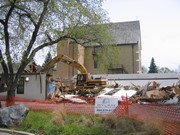
Photograph shows the demolition of the Physical Plant H-Hut. The photograph is looking northeast from the steps of Harvest Hall. The Citizens' Science Centre (BUSU Building) is visible in the background.
Located at the centre of the Brandon University campus, the Physical Plant H-Hut was destroyed following the opening of the new $3.9M, 13,600 square-foot physical plant on 07 April 2010.
Custodial History
Photograph was taken by McKee Archives project archivist Jill Sutherland.
Scope and Content
Photograph shows the demolition of the Physical Plant H-Hut. The photograph is looking northeast.
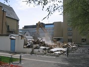
Located at the centre of the Brandon University campus, the Physical Plant H-Hut was destroyed following the opening of the new $3.9M, 13,600 square-foot physical plant on 07 April 2010.
Custodial History
Photograph was taken by McKee Archives project archivist Jill Sutherland.
Scope and Content
Photograph shows the demolition of the Physical Plant H-Hut. The photograph is looking south/southeast.
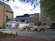
Located at the centre of the Brandon University campus, the Physical Plant H-Hut was destroyed following the opening of the new $3.9M, 13,600 square-foot physical plant on 07 April 2010.
Custodial History
Photograph was taken by McKee Archives project archivist Jill Sutherland.
Scope and Content
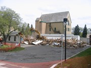
Photograph shows the demolition of the Physical Plant H-Hut. The photograph is looking southeast. The John R. Brodie Science Centre, the Geology H-Hut, and portions of the Citizens' Science Building (BUSU Building), Knowles-Douglas expansion (KDC) and McMaster Hall are visible in the background.
Built 1906-07; Former Merchants Bank of Canada; Library moved to former Co-op store on 7th Street & Princess Ave in 1984; This building became the Brandon Chamber of Commerce in September of 1985; Façade to remain as heritage building, interior renovations to be conducted with government financing.
Custodial History
For custodial history see the collection level description of the Lawrence Stuckey collection.
Scope and Content
The Merchants Bank of Canada (Western Manitoba Regional Library)
Notes
[Mr. Stuckey wrote on envelope "3 negs." but there is only one in the envelope.]
For custodial history see the collection level description of the Lawrence Stuckey collection.
Scope and Content
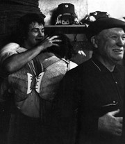
H. Rungay, President of Provincial Exhibition 1962 - 1964.
Notes
Mr. Stuckey originally placed 32 negatives in one envelope labeled “M – Presidents of Fair Boards 1882 – 1972”; We have separated and renumbered these negatives as M30(1) to M30(32) inclusively; Records of the Provincial Exhibition Association are held in the S.J. McKee Archives (RG2) including photos of board members.
The Police Station and Court House were located on the east side of 8th Street in the 200 block between the new YMCA building and First Church United. The building that house the Police Station and Court House was the old YMCA building (they removed the front columns during renovations).
Scope and Content
Photograph is looking east north east and shows the Police Station and Court House main entrance. The building also housed City Welfare. A private parking sign for First Church United is visible in the bottom left corner.
Repro Restriction
The McKee Archives is the copyright holder for the Stuckey materials.
.jpg?width=1200&404=no-img.jpg&watermark=wmk)
.jpg?width=180&404=no-img.jpg)
.jpg?width=1200&404=no-img.jpg&watermark=wmk)
.jpg?width=180&404=no-img.jpg)


.jpg?width=1200&404=no-img.jpg&watermark=wmk)
.jpg?width=180&404=no-img.jpg)
.jpg?width=1200&404=no-img.jpg&watermark=wmk)
.jpg?width=180&404=no-img.jpg)


.jpg?width=1200&404=no-img.jpg&watermark=wmk)
.jpg?width=180&404=no-img.jpg)


.jpg%3fmaxheight%3d1000%26maxwidth%3d1000%26watermark%3dwmk&description=Brandon+Public+Library)
.jpg%3fmaxheight%3d1000%26maxwidth%3d1000%26watermark%3dwmk&description=Brandon+Public+Library)
.jpg%3fmaxheight%3d1000%26maxwidth%3d1000%26watermark%3dwmk&description=Merchants+Bank+(Public+Library)+Building)
.jpg%3fmaxheight%3d1000%26maxwidth%3d1000%26watermark%3dwmk&description=Merchants+Bank+(Public+Library)+Building)
.jpg%3fmaxheight%3d1000%26maxwidth%3d1000%26watermark%3dwmk&description=H.+Rungay)