Skip header and navigation

Revise Search

20 records – page 1 of 1.

Aerial view: Brandon University campus

http://archives.brandonu.ca/en/permalink/descriptions605
Part Of
Aerial views and campus photographs
Description Level
Item
GMD
graphic
Date Range
c. 1969
Part Of
Aerial views and campus photographs
Description Level
Item
Series Number
2.1
Item Number
2.1.12
GMD
graphic
Date Range
c. 1969
Physical Description
3.5" x 3.5" (b/w)
Scope and Content
View is northeast. Brandon University campus and some of the surrounding residential areas.
Images
Show Less

Aerial view: Brandon University campus

http://archives.brandonu.ca/en/permalink/descriptions607
Part Of
Aerial views and campus photographs
Description Level
Item
GMD
graphic
Date Range
c. 1970
Part Of
Aerial views and campus photographs
Description Level
Item
Series Number
2.1
Item Number
2.1.14
GMD
graphic
Date Range
c. 1970
Physical Description
5" x 3" (b/w)
Scope and Content
View is north northwest from the roof of Flora Cowan Hall (?). Photograph shows: the J.R.C. Evans Lecture Theatre, the A.E. McKenzie Building and the Western Manitoba Centennial Auditorium as well as a number of houses on 20th Street.
Images
Show Less

Aerial view: Brandon University campus covered in snow

http://archives.brandonu.ca/en/permalink/descriptions613
Part Of
Aerial views and campus photographs
Description Level
Item
GMD
graphic
Date Range
c. 1970s
Part Of
Aerial views and campus photographs
Description Level
Item
Series Number
2.1
Item Number
2.1.22
GMD
graphic
Date Range
c. 1970s
Physical Description
5" x 3.5" (b/w)
Physical Condition
Photograph is slightly overexposed.
Scope and Content
View is north northwest from the John R. Brodie Science Center (?). Photograph shows: Citizens' Science Building, Brandon College Building and Clark Hall, the Education Building and the driveway running in front of the buildings.
Images
Show Less

Aerial view: Brandon University campus

http://archives.brandonu.ca/en/permalink/descriptions618
Part Of
Aerial views and campus photographs
Description Level
Item
GMD
graphic
Date Range
c. 1969
Part Of
Aerial views and campus photographs
Description Level
Item
Series Number
2.1
Item Number
2.1.26
GMD
graphic
Date Range
c. 1969
Physical Description
3.5" x 3.5" (b/w)
Scope and Content
Taken from an airplane, photograph is looking northwest from approximatley 15th Street and Louise Avenue. Shown are a number of residential blocks, the Brandon University campus, the railroad tracks and the Assiniboine River to approximatley 34th Street.
Images
Show Less

Aerial view: Brandon University campus

http://archives.brandonu.ca/en/permalink/descriptions619
Part Of
Aerial views and campus photographs
Description Level
Item
GMD
graphic
Date Range
c. 1969
Part Of
Aerial views and campus photographs
Description Level
Item
Series Number
2.1
Item Number
2.1.27
GMD
graphic
Date Range
c. 1969
Physical Description
3.5" x 3.5" (b/w)
Scope and Content
Taken from an airplane, photograph is looking north northwest from almost right above the Brandon University campus.
Images
Show Less

Aerial view: Brandon University campus

http://archives.brandonu.ca/en/permalink/descriptions620
Part Of
Aerial views and campus photographs
Description Level
Item
GMD
graphic
Date Range
c. 1969
Part Of
Aerial views and campus photographs
Description Level
Item
Series Number
2.1
Item Number
2.1.28
GMD
graphic
Date Range
c. 1969
Physical Description
3.5" x 3.5" (b/w)
Scope and Content
Taken from an airplane, photograph is looking north from approximately Louise Avenue between 18th and 20th Streets.
Notes
Photograph is slightly out of focus.
Show Less

Brandon University campus front lawn

http://archives.brandonu.ca/en/permalink/descriptions769
Part Of
Aerial views and campus photographs
Description Level
Item
GMD
graphic
Date Range
May 1978
Part Of
Aerial views and campus photographs
Description Level
Item
Series Number
2.1
Item Number
2.1.143
GMD
graphic
Date Range
May 1978
Physical Description
3.5" x 5" (colour)
Scope and Content
Photograph is looking south and shows the front lawn. The John R. Brodie Science Centre is in the background.
Images
Show Less

Brandon University campus

http://archives.brandonu.ca/en/permalink/descriptions771
Part Of
Aerial views and campus photographs
Description Level
Item
GMD
graphic
Date Range
c. 1980
Part Of
Aerial views and campus photographs
Description Level
Item
Series Number
2.1
Item Number
2.1.31
GMD
graphic
Date Range
c. 1980
Physical Description
5" x 4" (b/w)
Scope and Content
View is southwest from approximately 18th Street and Lorne Avenue. Photograph shows the Brandon University campus in winter, including: the Brandon University sign, the John R. Brodie Science Centre, the Citizens' Science Building and McMaster Hall.
Images
Show Less

Brandon University campus front lawn

http://archives.brandonu.ca/en/permalink/descriptions772
Part Of
Aerial views and campus photographs
Description Level
Item
GMD
graphic
Date Range
May 1978
Part Of
Aerial views and campus photographs
Description Level
Item
Series Number
2.1
Item Number
2.1.32
GMD
graphic
Date Range
May 1978
Physical Description
5" x 3.5" (colour)
Scope and Content
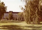
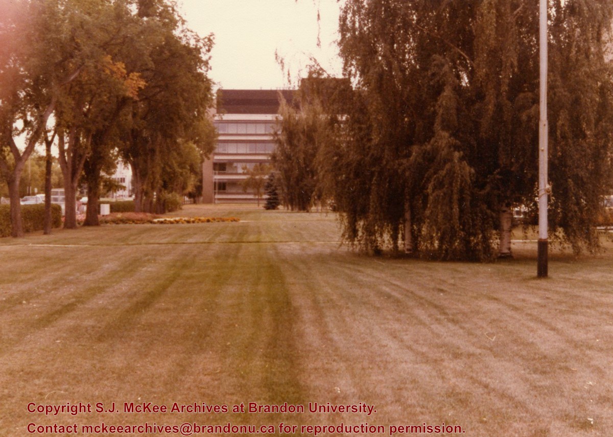
View is south southwest. Photograph shows the Brandon University campus front lawn in summer, with the John R. Brodie Science Centre, McMaster Hall, and the Citizens' Science Building in the background.
Images
Show Less

Brandon University campus front lawn

http://archives.brandonu.ca/en/permalink/descriptions774
Part Of
Aerial views and campus photographs
Description Level
Item
GMD
graphic
Date Range
May 1978
Part Of
Aerial views and campus photographs
Description Level
Item
Series Number
2.1
Item Number
2.1.33
GMD
graphic
Date Range
May 1978
Physical Description
5" x 3.5" (colour)
Scope and Content
View is south. Photograph shows the Brandon University campus front lawn in summer. The John R. Brodie Science Centre is in the background.
Images
Show Less

Brandon University campus

http://archives.brandonu.ca/en/permalink/descriptions779
Part Of
Aerial views and campus photographs
Description Level
Item
GMD
graphic
Date Range
c. late 1970s
Part Of
Aerial views and campus photographs
Description Level
Item
Series Number
2.1
Item Number
2.1.46
GMD
graphic
Date Range
c. late 1970s
Physical Description
7" x 5" (colour)
Scope and Content
View is southwest from the north side of Princess Avenue. Photograph shows the original Music Building, the north driveway entrance and parts of Clark Hall and the Brandon College building.
Images
Show Less

Brandon University campus front lawn flower gardens

http://archives.brandonu.ca/en/permalink/descriptions784
Part Of
Aerial views and campus photographs
Description Level
Item
GMD
graphic
Date Range
May 1978
Part Of
Aerial views and campus photographs
Description Level
Item
Series Number
2.1
Item Number
2.1.34
GMD
graphic
Date Range
May 1978
Physical Description
5" x 3.5" (colour)
Scope and Content
Photograph shows the flower bed on the front lawn of the Brandon Unviersity campus.
Images
Show Less

Brandon University campus

http://archives.brandonu.ca/en/permalink/descriptions788
Part Of
Aerial views and campus photographs
Description Level
Item
GMD
graphic
Date Range
c. 1975
Part Of
Aerial views and campus photographs
Description Level
Item
Series Number
2.1
Item Number
2.1.47
GMD
graphic
Date Range
c. 1975
Physical Description
5" x 5" (b/w)
Scope and Content
View is southwest from the sidewalk on the west side of 18th Street. Photograph shows the Brandon University sign, the front lawn, the Citizens' Science Building, McMaster Hall and the John R. Brodie Science Centre.
Images
Show Less

Brandon University campus

http://archives.brandonu.ca/en/permalink/descriptions804
Part Of
Aerial views and campus photographs
Description Level
Item
GMD
graphic
Date Range
1966
Part Of
Aerial views and campus photographs
Description Level
Item
Series Number
2.1
Item Number
2.1.48
GMD
graphic
Date Range
1966
Physical Description
10" x 8" (b/w)
Scope and Content
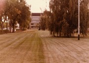
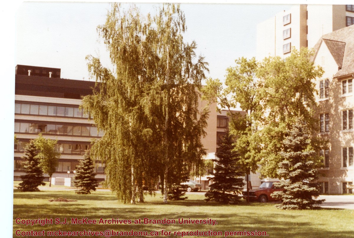
View is south from the north side of Princess Avenue. Photograph shows the walkway leading south across campus, the original Music Building, the A.E. McKenzie Building, the J.R.C. Evans Lecture Theatre, Flora Cowan Hall and Darrach Hall.
Images
Show Less

Brandon University campus

http://archives.brandonu.ca/en/permalink/descriptions805
Part Of
Aerial views and campus photographs
Description Level
Item
GMD
graphic
Date Range
1966
Part Of
Aerial views and campus photographs
Description Level
Item
Series Number
2.1
Item Number
2.1.49
GMD
graphic
Date Range
1966
Physical Description
10" x 8" (b/w)
Scope and Content
View is southwest from Princess Avenue. Photograph shows the original Music Building, the A.E. McKenzie Building, the J.R.C. Evans Lecture Theatre and Darrach Hall. Also visible are the field where the Western Manitoba Centennial Auditorium now stands, as well as a number of houses on 20th Street.
Images
Show Less

Brandon University campus

http://archives.brandonu.ca/en/permalink/descriptions836
Part Of
Aerial views and campus photographs
Description Level
Item
GMD
graphic
Date Range
1977
Part Of
Aerial views and campus photographs
Description Level
Item
Series Number
2.1
Item Number
2.1.52
GMD
graphic
Date Range
1977
Physical Description
10" x 8" (b/w)
Scope and Content
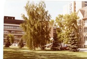
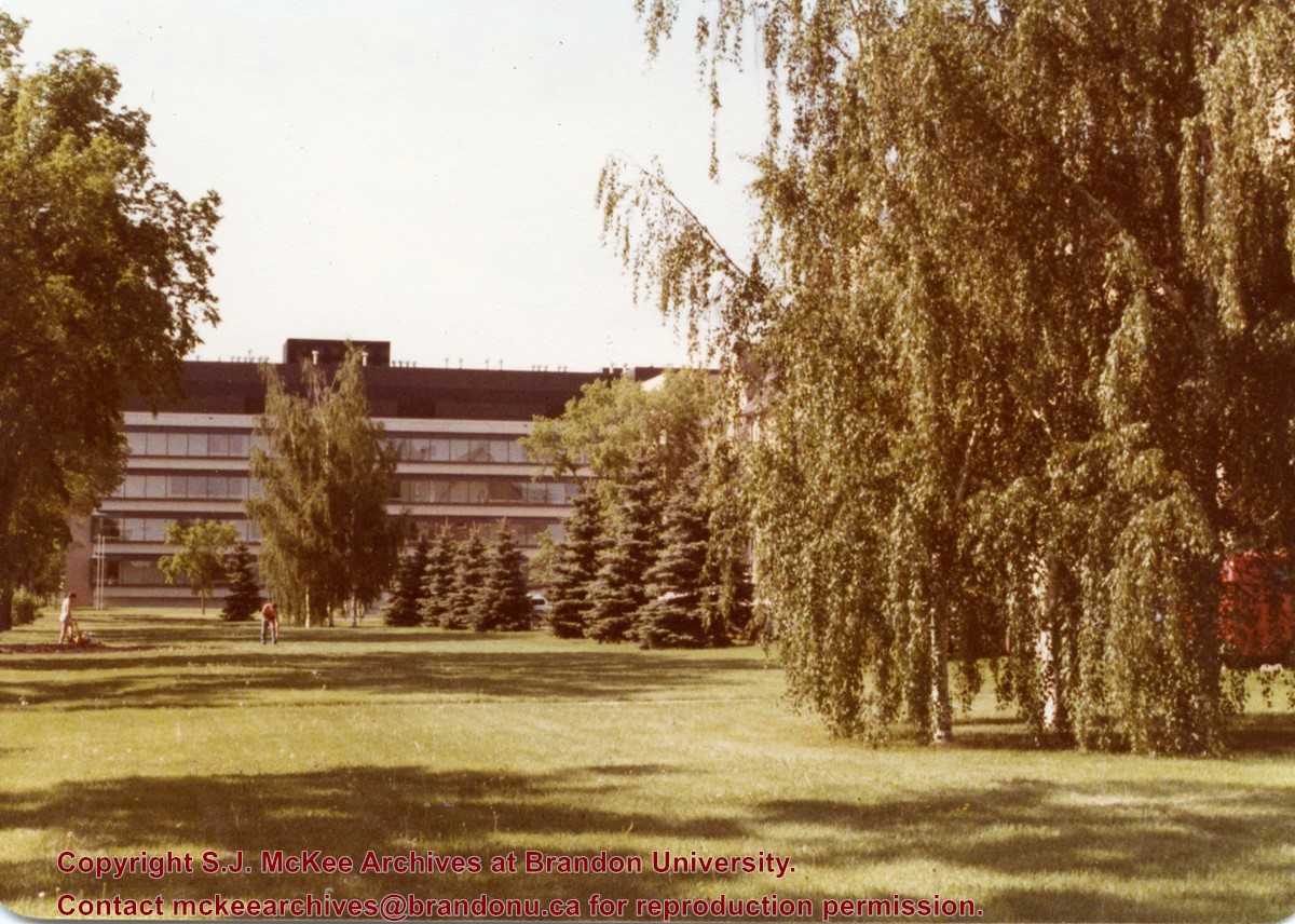
View is northeast fron the west side of the Dining Hall. Photograph shows portions of the J.R.C. Evans Lecture Theatre and the A.E. McKenzie Building, as well as an H-Hut, Clark Hall, the Brandon College Building and the quadrangle.
Images
Show Less

Brandon University driveway

http://archives.brandonu.ca/en/permalink/descriptions841
Part Of
Aerial views and campus photographs
Description Level
Item
GMD
graphic
Date Range
c. 1980s
Part Of
Aerial views and campus photographs
Description Level
Item
Series Number
2.1
Item Number
2.1.35
GMD
graphic
Date Range
c. 1980s
Physical Description
3.5" x 5" (b/w)
Scope and Content
View is north from approximately the Citizens' Science Building. Photograph shows the driveway running in front of the Brandon College Building and Clark Hall, a number of cars and students along the driveway and the Education Building in the background.
Images
Show Less

Brandon University campus

http://archives.brandonu.ca/en/permalink/descriptions850
Part Of
Aerial views and campus photographs
Description Level
Item
GMD
graphic
Date Range
May 1978
Part Of
Aerial views and campus photographs
Description Level
Item
Series Number
2.1
Item Number
2.1.36
GMD
graphic
Date Range
May 1978
Physical Description
5" x 3.5" (colour)
Scope and Content
View is northwest from the front lawn. Clark Hall and the Education Building are visible between the trees.
Images
Show Less

Brandon University campus

http://archives.brandonu.ca/en/permalink/descriptions866
Part Of
Aerial views and campus photographs
Description Level
Item
GMD
graphic
Date Range
October 1981
Part Of
Aerial views and campus photographs
Description Level
Item
Series Number
2.1
Item Number
2.1.37
GMD
graphic
Date Range
October 1981
Physical Description
3.5" x 5" (colour)
Scope and Content
View is south from the lawn in front of the Education Building and shows a student exiting the building. The driveway and John R. Brodie Science Centre are visible in the background.
Images
Show Less

Brandon University campus front lawn

http://archives.brandonu.ca/en/permalink/descriptions869
Part Of
Aerial views and campus photographs
Description Level
Item
GMD
graphic
Date Range
May 1978
Part Of
Aerial views and campus photographs
Description Level
Item
Series Number
2.1
Item Number
2.1.38
GMD
graphic
Date Range
May 1978
Physical Description
5" x 3.5" (colour)
Scope and Content
View is north encompassing the front lawn of the Brandon University campus. The Education Building can be seen in the background.
Show Less

20 records – page 1 of 1.