Postcard was donated to the McKee Archives by Allen Drysdale, archivist at Beautiful Plains Archives in October 2011. Drysdale received the postcard as part of a larger donation to his archives.
Scope and Content
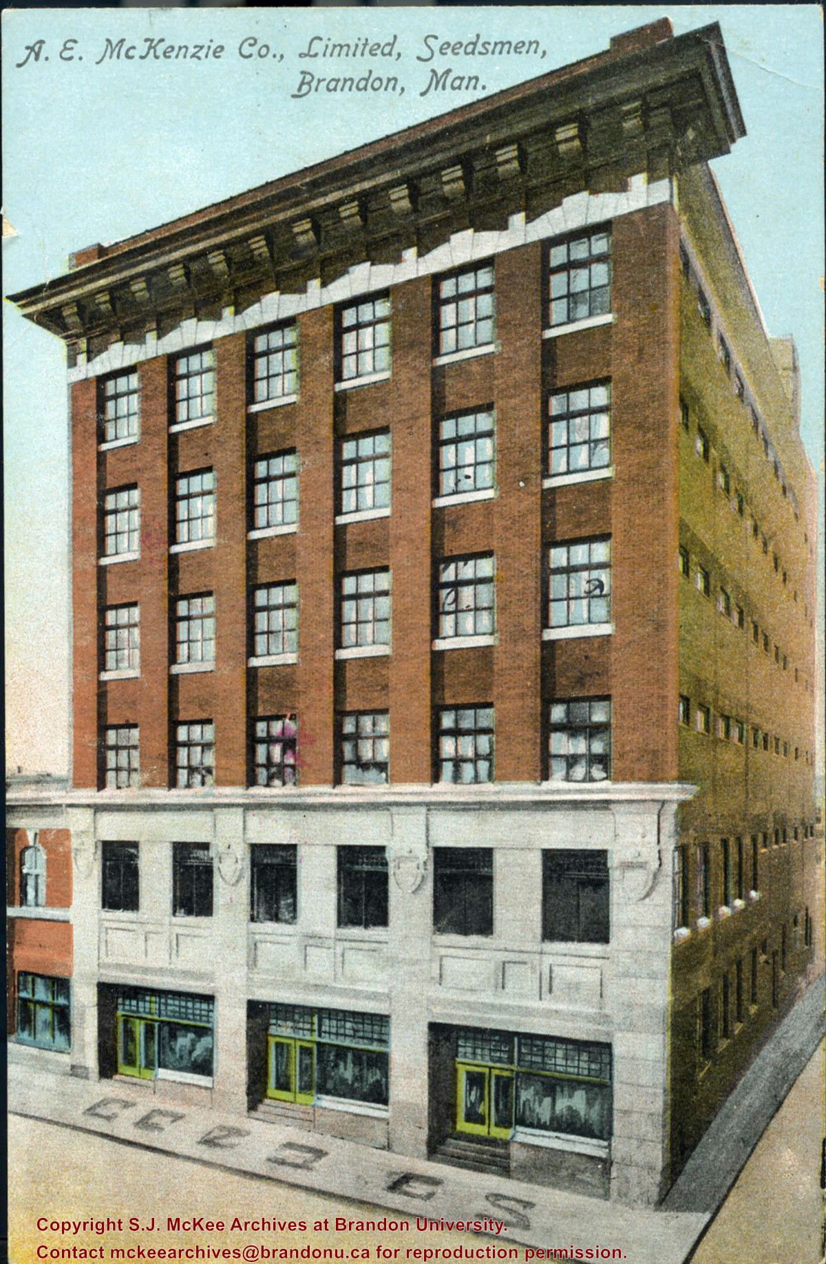
Item is a colour postcard of the A.E. McKenzie Seed Company in Brandon, MB. The postcard was sent to John Dorset, Elphinstone, MB from his brother Sid (?).
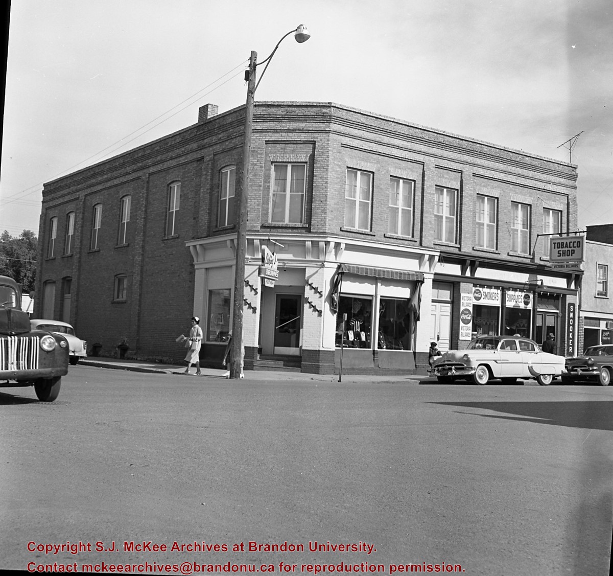
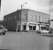
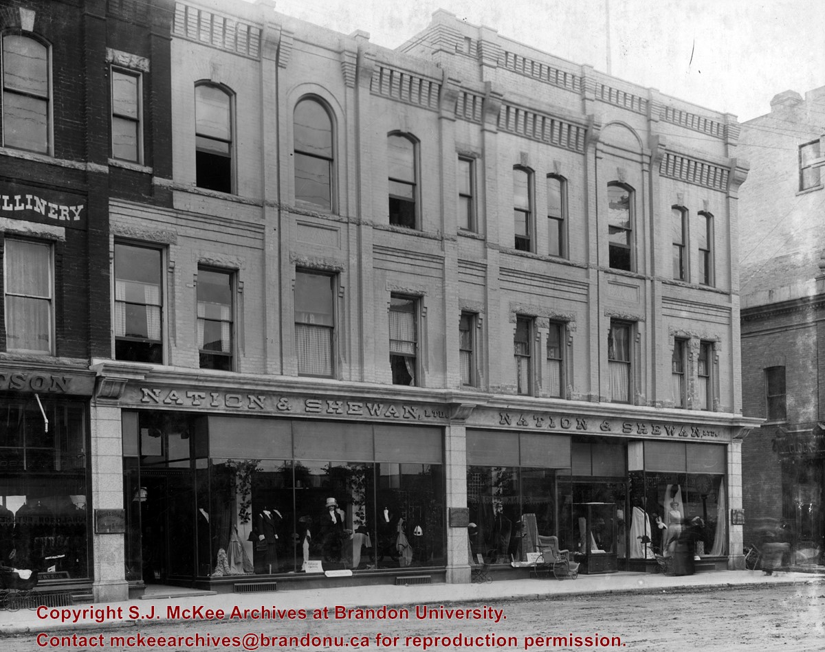
Erected in 1889, at 806 Rosser Avenue (the southeast corner of Rosser Avenue and 7th Street), the building was designed by Brandon architect W.H. Shillinglaw. At the time of its construction the structure housed the Nation Department Store, which became Nation & Shewan Department Store in 1894. One of Brandon’s largest and most successful drygoods businesses, the venture was owned and operated by Fred Nation and Alexander Shewan.
Built adjacent to an existing three storey brick building known as the A.D. Rankin Block (built sometime between 1885 and 1888), this smaller building was eventually absorbed by the Nation and Shewan Block after 1897, when Rankin Drygoods moved into the newly constructed Syndicate Block located farther east down Rosser Ave. Later, the Rankin Block became known as Nation Chambers. These two structures comprised what was known as the Nation and Shewan Block.
Major improvements were made to the store and an annex was added in 1910. Some of the renovation additions included, but were not limited to: an updated frontage with new copper sash windows and prismatic glass tops, plate glass windows, new fixtures and carpet. With the renovations the floor space of the business was almost doubled. The stock of the business also increased, with the Brandon Weekly Sun reporting that when finished, Nation & Shewan would be a “store of which the citizens of Brandon will be justly proud.”
The drygoods firm operated until Nation’s death 1926, when it became known as A. Shewan Limited. From 1933 to 1944, the business was known as Shewan and Son. Shortly thereafter, the Metropolitan Stores Ltd began operating out of the Nation & Shewan Block.
In 2000, the Town Centre prepared to knock down what was then known as the Red Apple Building, the former Nation & Shewan Block. The demolition was to make way for the new atrium and entrance for the mall, and begin a new period of redevelopment at the downtown shopping centre.
Custodial History
See fonds level description of the Alf Fowler collection for custodial history.
Scope and Content
Photo shows the front of the Nation & Shewan Block, which was located in the 800 block of Rosser Avenue on the southside.
Storage Range
RG 5 Western Manitoba Manuscript collection - photograph storage drawer
Edward Walker was a native of England. In 1895, he left his home in Stockport England and traveled to the village of Millwood, Manitoba where, with three of his five children, he began a new life on the Canadian settlement frontier.
Walker was a professional photographer and his fonds contains a variety of images of Millwood and the surrounding agricultural community, its people, and life. These images were produced from gelatin dry plate negatives, a process introduced around 1880 to replace the wet collodin process in which a photographic solution was applied to a glass plate just prior to exposure. Edward Walker’s pictorial account of life in and around Millwood Manitoba circa 1900 is an important photographic legacy of pioneer life on the upper reaches of the Assiniboine Valley.
The village of Millwood was - and is - located in the Assiniboine River valley close to the Manitoba-Saskatchewan border just a few miles northwest of Binscarth and a similar distance southwest of Russell. It came into existence in 1887 with the construction of the Manitoba and North-Western Railway, a road that ran diagonally through the new West from Prince Albert, North West Territories to Portage la Prairie Manitoba.
Custodial History
These photographic images are drawn from the Edward Walker fonds held at the S.J. McKee Archives. They were used in an exhibit entitled "Millwood on the Assiniboine circa 1900" in 2005. The exhibit was located on The Curve Gallery in the John E. Robbins Library and curated by Tom Mitchell.
Scope and Content
Consists of 22 photographic prints mounted on foam board used by the Archives for the display.
Notes
A selection of thes images are on display in the S. J. McKee Archives. The balance are in storage at RG 6 Brandon University fonds, Series 8: Library Services, 8.2 S.J. McKee Archives.
Storage Location
RG 6 Brandon University fonds
Series 8: Library Services
8.2 S.J. McKee Archives
Images of a Prairie City was a photography display of early Brandon circa 1912. The exhibition presented images of Brandon in the years immediately prior to the Great War when the city had moved beyond a pioneer stage and taken on the features of a modern North American urban centre, boasting parks, exhibitions, paved streets, and the latest trends in architecture and transportation.
Custodial History
These photographic images were drawn from the Alfred Fowler collection held at the S.J. McKee Archives. They were used in an exhibit entitled "Images of a Prairie City" in March 2004. The exhibit was located on The Curve Gallery in the John E. Robbins Library and curated by Christy Henry.
Scope and Content
Consists of 21 photographic prints (in frames) used by the Archives.
Notes
Seven photographs and the information page are on display in Student Services, McKenzie Building, Room 102. Six are on dislay in McKenzie Building, Room 117 and two are on display in McKenzie Building, Room 104. The remainder of the display is in storage at RG 6 Brandon University fonds
Series 8: Library Services 8.2, S.J. McKee Archives. The prints stored in the Archives should be handled with great care.
Storage Location
RG 6 Brandon University fonds
Series 8: Library Services
8.2 S.J. McKee Archives
View is southwest from approximatley 16th Street between Princess and Rosser Avenues. Photograph shows the Brandon University campus, as well as surrounding residential blocks, including Flemming, J.R. Reid and Vincent Massey schools.
View is west southwest from approximatley 16th Street between Princess and Lorne Avenues. Photograph shows the Brandon University campus, as well as surrounding residential blocks between 16th and 23rd Streets, Princess and Louise Avenues..
View is west from approximatley 17th Street between Lorne and Louise Avenues. Photograph shows a portion of the Brandon University campus (excluding the Education Building and anything north of it), as well as surrounding residential blocks from approximatley 17th Street to 22nd Street.
View is west northwest from approximatley 16th Street and Louise Avenue. Photograph shows the Brandon University campus, prior to the Library Extension, and a large portion of the city to the west of the campus.
View is northwest from approximatley 16th Street and Louise Avenue. Photograph shows the Brandon University campus, prior to the Library Extension, and a large portion of the city to the west of the campus.
Photograph shows the removal of one of the houses formerly located on 20th Street between Louise and Princess Avenues. The houses on those blocks were removed to create parking lots for the University. A Fed Zavislak Ltd. Well Drilling & Trucking pickup truck is visible at the curb.
Photograph shows the removal of one of the houses formerly located on 20th Street between Louise and Princess Avenues. The houses on those blocks were removed to create parking lots for the University.
View is northeast probably from the roof of McMaster Hall. Photograph shows the construction of the new roof on Clark Hall and the Brandon College Building. A portion of the east side of the 000 and 100 blocks of 18th Street, as well as the corner of 18th Street and Rosser Avenue are visible in the upper left hand corner. This includes the "Downtown Brandon" sign.
View is north northeast probably from the roof of McMaster Hall. Photograph shows the construction of the new roof on Clark Hall and the Brandon College Building, as well as the construction of the extension to Clark Hall and the skywalk. Portions of the city as far north as the Assiniboine River are also visible.
View is northeast from the Brandon College Building. Photograph shows the inside of the Brandon College Building after it had been gutted and then partially rebuilt. The exterior fascade of the west side of the building can be clearly seen in this photograph. A number of houses on the east side of 200 block of 18th Street are also visible, as is the stone fence on Princess Avenue and the flag pole on the front lawn.


)