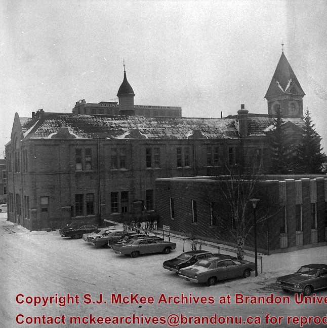
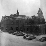
The John R. Brodie Science Centre was completed in 1971, with the official opening on May 7, 1972. It is located in the southeast corner of the campus and houses the Faculty of Science. The Brodie Building was named for John R. Brodie, a Brandon man who donated $250,000 to Brandon College in 1963 with the stipulation that the money be used for a Science Centre.
Scope and Content
Sub-series consists of photographs of the John R. Brodie Science Centre.
Notes
Additional biographical information on John R. Brodie is available in his bio file in the Reading Room.
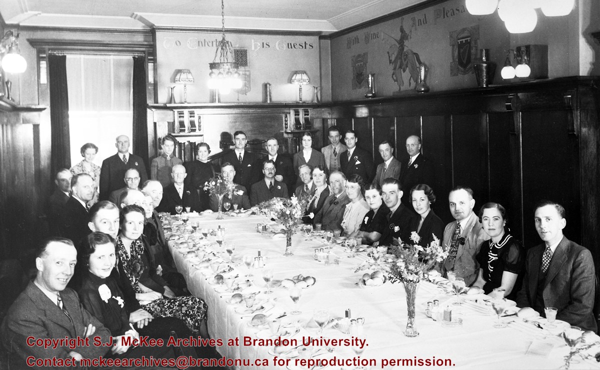
Firby, who graduated from Brandon University in 1991, worked as the Acting Director for Alumni Relations from August 1993 - August 1995. She married John Brewster in Calgary, AB on August 15, 1998.
Custodial History
Photograph was tranfered to the McKee Archives from the Public Communications Office in the winter of 2007.
Scope and Content
Photograph Marla Firby and John Brewster on their wedding day.
Notes
Information about the wedding appeared in the Fall 1998 issue of Alumni News.
Donkersloot began working at Brandon University in 1971 as the Clerk of Works. From 1973 until his retirement, he was the Director of Physical Plant.
Custodial History
Photographs were taken by Tom Donkersloot during construction and stored in albums in the Physical Plant H-Hut until they were transfered to the McKee Archives by Doug Duncalf in May 2008.
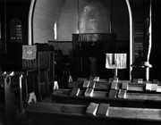
Scope and Content
Thirty four photographs of the construction of the John R. Brodie Science Centre.
Notes
Donkersloot recorded the date and time each photograph was taken on the back of the photos.
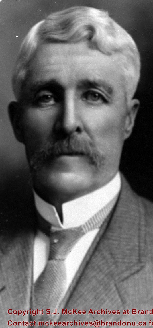
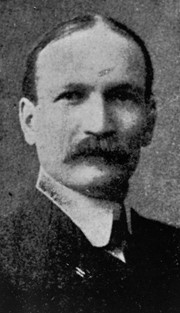
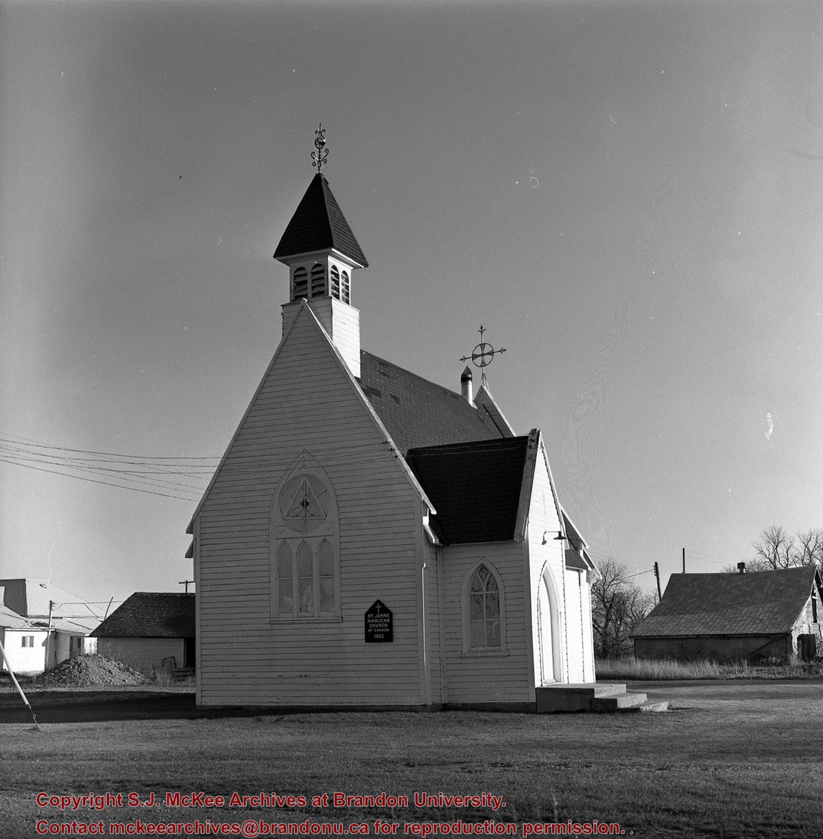
Fleming served as mayor in 1905, 1906-1911, 1912 and 1913
Custodial History
For custodial history see the collection level description of the Lawrence Stuckey collection.
Scope and Content
Item is a portrait of Brandon mayor John Fleming.
Notes
[Mr. Stuckey incorrectly noted the dates of Mayor Fleming's terms. John W. Fleming served as mayor of Brandon 1905-1906 and 1911-1913 (Barker, G.F. Brandon: a City 1881-1961. Altona: D.W. Friesen & Sons Ltd., 1977.).]
For custodial history see the collection level description of the Lawrence Stuckey collection.
Scope and Content
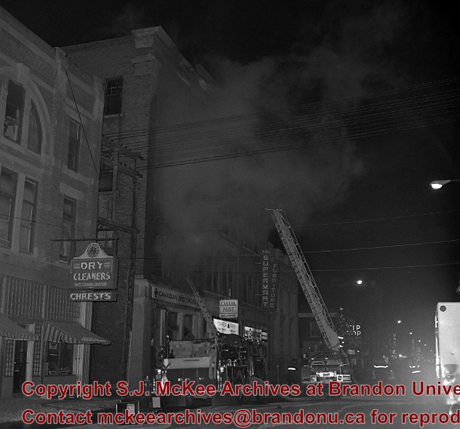
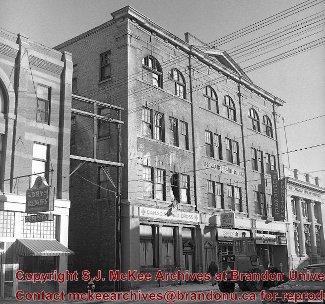
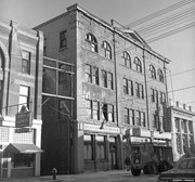
John E. Smith Block Fire
Notes
The John E. Smith Block was built in 1907.
Because of the fire, the building was badly gutted and the front wall bulged outward. As a result, the structure was condemned.
The Canadian Bank of Commerce had moved to the Canadian Imperial Bank of Commerce building at the corner of 8th Street & Rosser Avenue in mid-1960's, and their old building adjacent to Smith Block had since sat vacant. As a result, the stage was now set to clear the area where both buildings had stood for the construction of Scotia Tower. LAS.
[Mr. Stuckey put two negatives in same envelope, numbering them FA7 and FA7a. We have separated them.]
For custodial history see the collection level description of the Lawrence Stuckey collection.
Scope and Content
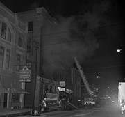
John E. Smith Block Fire - The Morning After
Notes
The John E. Smith Block was built in 1907.
Because of the fire, the building was badly gutted and the front wall bulged outward. As a result, the structure was condemned.
The Canadian Bank of Commerce had moved to the Canadian Imperial Bank of Commerce building at the corner of 8th Street & Rosser Avenue in mid-1960's, and their old building adjacent to Smith Block had since sat vacant. As a result, the stage was now set to clear the area where both buildings had stood for the construction of Scotia Tower. LAS.
[Mr. Stuckey put two negatives in same envelope, numbering them FA7 and FA7a. We have separated them.]
This wedge-shaped tract of woodland was located west of 34th Street on the south side of the Canadian Pacific Railway. It was formerly owned by the Great Northern Railway, and was acquired by the CPR when the GN line was abandoned in 1936. In 1978 Marathon Realty (CPR) sold this 7 acre property to a developer who planned to build condominiums. However this residential development was objected to for two reasons: [The proposed location] was home to many species of flora & fauna, and it was too close to the CPR mainline. Local residents took out a petition against the development. [Mr. Stuckey] wrote a letter to the editor of the Brandon Sun, [expressing the] attitudes of CPR officials, and read a statement to the Provincial Planning Board suggesting development be refused and the area become an undeveloped park. These efforts would prove successful - see file on same.
Custodial History
For custodial history see the collection level description of the Lawrence Stuckey collection.
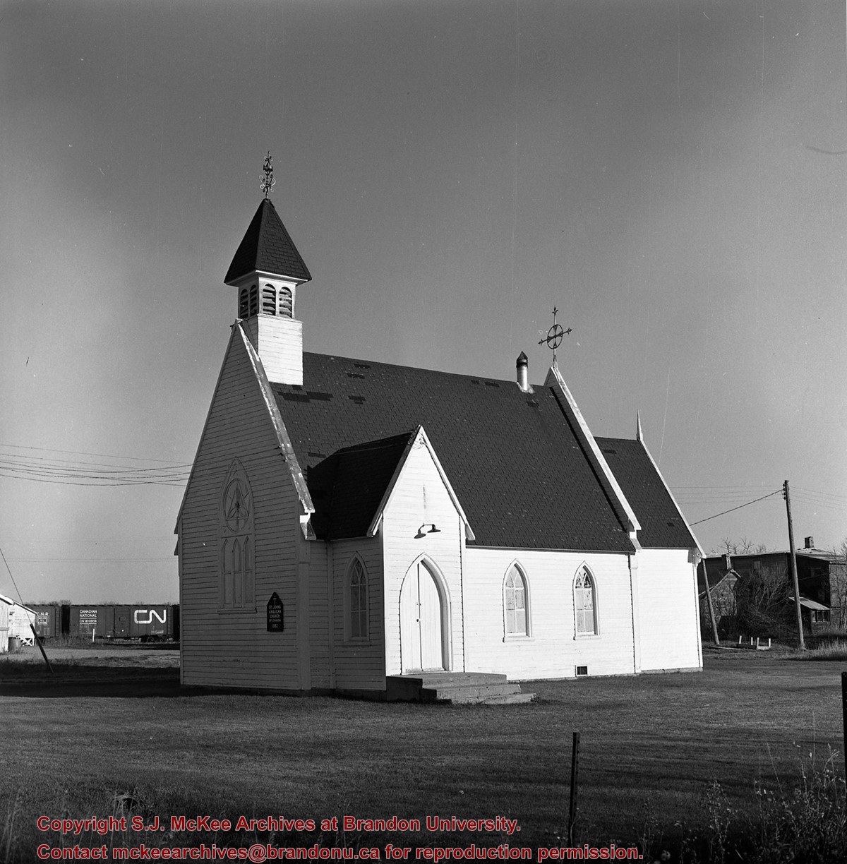
Scope and Content
John Indian's Bush (also known as Bang's Bush)
Notes
Additional historical information provided by the Fred McGuinness collection (20-2009). Stuckey's letter to the editor appears in the July 22, 1978 issue of The Brandon Sun.
This wedge-shaped tract of woodland was located west of 34th Street on the south side of the Canadian Pacific Railway. It was formerly owned by the Great Northern Railway, and was acquired by the CPR when the GN line was abandoned in 1936. In 1978 Marathon Realty (CPR) sold this 7 acre property to a developer who planned to build condominiums. However this residential development was objected to for two reasons: [The proposed location] was home to many species of flora & fauna, and it was too close to the CPR mainline. Local residents took out a petition against the development. [Mr. Stuckey] wrote a letter to the editor of the Brandon Sun, [expressed the] attitudes of CPR officials, and read a statement to the provincial planning board suggesting development be refused and the area become an undeveloped park. These efforts would prove successful - see file on same.
Custodial History
For custodial history see the collection level description of the Lawrence Stuckey collection.
Scope and Content
John Indian's Bush (also known as Bang's Bush).
Notes
Additional historical information provided by the Fred McGuinness collection (20-2009). Stuckey's letter to the editor appears in the July 22, 1978 issue of The Brandon Sun.


.jpg?width=1200&404=no-img.jpg&watermark=wmk)
.jpg?width=180&404=no-img.jpg)
.jpg?width=1200&404=no-img.jpg&watermark=wmk)
.jpg?width=180&404=no-img.jpg)
.jpg%3fmaxheight%3d1000%26maxwidth%3d1000%26watermark%3dwmk&description=John+Indian%27s+Bush)
.jpg%3fmaxheight%3d1000%26maxwidth%3d1000%26watermark%3dwmk&description=John+Indian%27s+Bush)