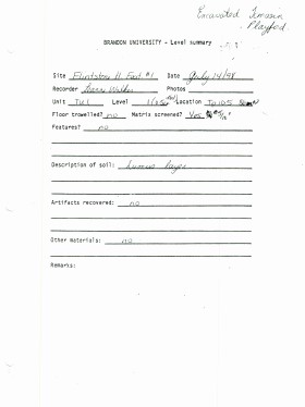
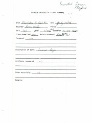
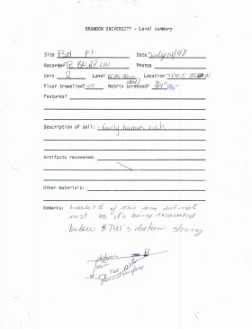
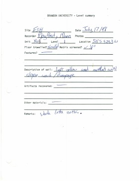
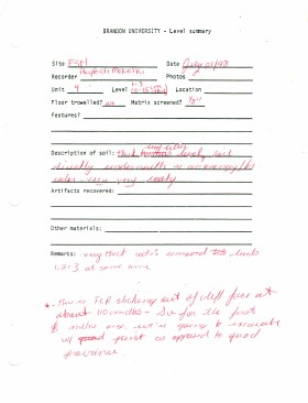
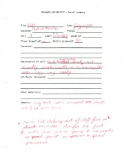
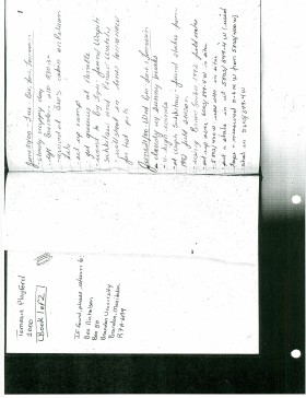
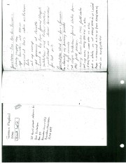
Site excavation records of excavation units may include: level summaries, floor plans, feature sheets, wall profiles, unit summaries and any other additional information relating to the unit.
Site excavation records of excavation units may include: level summaries, floor plans, feature sheets, wall profiles, unit summaries and any other additional information relating to the unit.
Site excavation records of excavation units may include: level summaries, floor plans, feature sheets, wall profiles, unit summaries and any other additional information relating to the unit.
Site excavation records of excavation units may include: level summaries, floor plans, feature sheets, wall profiles, unit summaries and any other additional information relating to the unit.
Site excavation records of excavation units may include: level summaries, floor plans, feature sheets, wall profiles, unit summaries and any other additional information relating to the unit.
The Atkinson site was named for the landowners Ken and Karen Atkinson who were very helpful to the archaeology and geoarchaeology crews that worked at the site. Their support made the project possible.
The Atkinson site story begins with the discovery of a charcoal lens eroding from the north bank of the Souris River in the summer of 2002. Study of Cultural Adaptations on the Prairie Ecozone (SCAPE) project geoarchaeologist Dr. Garry Running was exploring the stratigraphic layering in the bank when he noted the lens and reported it to Dr. Bev Nicholson. Upon closer examination, a tiny pressure flake was observed on the lens exposure and it was decided to collect a charcoal sample for radiocarbon dating.
The resulting date of 5250B.P cal. 4225 B.C. placed the site in the early Archaic period. A second date on bone collagen of 5580B.P. cal. 4500 B.C. confirmed the earlier date and gave an averaged date of circa 4400 B.C or 6,500 years ago.
The Atkinson site is one of the oldest excavated sites in Manitoba. Based on the date of the site and the kind of lithics (stone tools) present it is considered a Gowen occupation. The Atkinson site is evidence that bison hunters were active on the northern plains at a very early date. Similar sites have also been found on the High Plains in the U.S. and are referred to as the Mummy Cave Complex.
The Atkinson Site is of great importance as it is the first undisturbed site of this type to be excavated in Manitoba and extends the range of these sites south and east from the type-sites in central Saskatchewan. Based on the date and sample evidence further excavations were conducted by Dr. Nicholson's team. in 2003, 2004 and 2006.
Scope and Content
Sub series has been divided into three sub sub series including: (1) Atkinson 2003, (2) Atkinson 2004; (3) Atkinson 2006
The Sarah site was chosen for excavation based on the results of the Casselman survey. The survey recovered significant amounts of faunal remains, some ceramics and lithics from the test pits. Excavations took place in 2003 at Crepeele West (Units 1-5) and Crepeele East (Units 6-9). The site was subsequently renamed the Sarah site DiMe-28. In 2004 another 9 units were excavated (Units 10-18).
Based on the recoveries it was determined that the Sarah site is a stratified site with woodland ceramics in the upper occupation and late woodland points in both of the upper occupations. These upper occupations produced abundant bison bone including foetal bone. The lower occupations produced less bone and no foetal bone, although absence of foetal bone in the lower occupations does not necessarily indicate a warm season occupation. This could be due to sample error or perthotaxic factors such as scavenging of the fragile bone by dogs or other carnivores.
The dates from the Sarah site include 550+/-40 B.P.; 1430+/-80 B.P; 2810+/-80 B.P.; 3120+/-130 B.P. The lower occupations did not yield any diagnostic materials although debitage was abundant. These occupations were most productive at the edge of the large sand dune at the southern edge of the excavations. It is assumed that the major portion of these occupations have been overridden by the dune in the past 3000 years. Heavy earthmoving equipment would be required to remove this overburden which limits the possibility of future excavation.
Environment
The Sarah site is a large area located at the eastern end of the Crepeele locale. Ground cover is a mosaic of aspen poplar groves and patches of mesic grass prairie. Excavation profiles indicate that this has been the situation since early precontact times, although as local climatic conditions change (primarily rainfall), the relative size of these areas and where they may have occurred also changed. The soil is aeolian sand sheet derived from delta outwash deposits along the western edge of glacial Lake Hind. The present topography is a variable dune landscape reworked by aeolian activity that creates a mosaic of microhabitats. These include forested patches in the lee of sand dunes with grassland on the southern and western exposures and small damp lowlands that support balsam poplar, willows, red osier dogwood, high-bush cranberry and water birch. There is no permanent water source in the area although a small seasonal stream meanders through a damp lowland to the east of the Sarah site.
Scope and Content
Sub-series has been divided into sub sub series including: Sarah 2003 and Sarah 2004,
The Graham site is a located adjacent to the Crepeele site towards the western end of the Crepeele locale. The Graham site was initially designated as a separate site early in the testing of the Crepeele locale due to what appeared to be a distinction between Early and Late Woodland ceramics. Subsequent testing has shown that this distinction was premature and that the cultural mosaic represented in the western section of the Crepeele locale may not readily separate in this manner. However, due to the records management that was already in place, the original separate designations have been retained.
Environment
Ground cover is a mosaic of aspen poplar groves and patches of mesic grass prairie. Excavation profiles indicate that this has been the situation since early precontact times, although as local climatic conditions change (primarily rainfall), the relative size of these areas and where they may have occurred also changed. The soil is aeolian sand sheet derived from delta outwash deposits along the western edge of glacial Lake Hind. The present topography is a variable dune landscape reworked by aeolian activity that creates a mosaic of microhabitats. These include forested patches in the lee of sand dunes grassland on the southern and western exposures and small damp lowlands that support balsam poplar, willows, red osier dogwood, high-bush cranberry and water birch. There is no permanent water source in the area although a small seasonal stream meanders through a damp lowland along the eastern margin of the Crepeele locale.
Excavations at the Graham site took place from 2004 to 2008. Analyses of the recoveries shows that, with two exceptions, all of the occupations that have been tested produced bison foetal bone. The presence of foetal bison is a strong indicator of wintering occupations...The absence of foetal in some area does not necessarily indicate warm season occupations since these excavation series are small and the absence could be due to sample error or perthotaxic factors, such as scavenging of the fragile bone by dogs or other carnivores.
From this evidence the Graham site has been interpreted as being primarily a wintering area. This is consistent with the lack of surface water (snow would serve as a substitute in winter) and the abundance of wood for fuel – a critical requirement for winter occupation. Cultural occupations date from Mortlach circa 250 B.P to woodland circa 580 B.P.
Scope and Content
Sub-series has been divided into sub sub series including: Graham 2004, Graham 2005, Graham 2006 and Graham 2008
The Duthie site is the first site identified in the Makotchi-Ded Dontipi locale. It was reported to Dr. Bev Nicholson by Doug Jackson, a local collector who had observed archaeological materials that had been exposed during the construction of Maple Hill Road northwest of Lauder. The site is named after the landowner, Randy Duthie.
The initial inspection of the exposed materials indicated that the eastern half of the site had been severely impacted by raising a road grade using an elevating grader. However, an undetermined amount of the site remained to the west, flanked by a low sand dune. Testing and preliminary excavations were conducted in 1992-93. In 1994 a field school added to the excavated sample. The undisturbed portion of the site, west of Maple Hill Road was situated at the base of a low sand dune and had an aspen and willow forest cover. The water table was approximately one meter below surface at the time of excavation. A rising water table has since prevented further excavations.
Two dates on bone collagen were obtained during excavations. These were 880+/-80 B.P. (Beta 62705) and 970+/-40 B.P. cal. 1030 A.D. (TO 13366). These dates are consistent with an Initial Middle Missouri cultural assignment. The site occupation is identified by the distinctive ceramics found there. Ceramics at the Duthie Site are tool impressed with incising and lip modeling with fabric impressions on most vessels. Jill Taylor analysed the ceramics from the site for a Specialist thesis, Brandon University (1994) and a Masters of Arts degree from the University of Saskatchewan. (Taylor 1995).
Analysis of residue from Duthie site pottery by Matthew Boyd recovered corn (Zea mays) phytoliths and bean (Phaseolus sp.) starch grains indicating consumption of these domesticates at the Duthie site. (Boyd 2006)
The occupation of this site indicates a migration of people from the south who were well acquainted with horticultural farming. These people had previously migrated to South Dakota following river valleys into the central plains from the eastern woodlands during late Hopewell times. It appears that they later migrated well to the north into southern Manitoba but there is no evidence that they remained there for more than a single year.
Boyd, M., C. Surette and B.A. Nicholson. 2006 Archaeobotanical Evidence of Prehistoric Maize (Zea mays) Consumption at the Northern Edge of the Great Plains. Journal of Archaeological Science 33: 1129-1140.
Taylor, J. 1994 An analysis of the ceramics recovered during 1992 and 1993 at the Precontact Duthie Site (DiMe-16). Specialist thesis, Brandon University.
Scope and Content
The Series has been divided into seven sub-series, including (1) Duthie site (2) Jackson site (3) Twin Fawns site (4) Vera site (5) Schuddemat site (6) Bradshaw site (7) Hollow B site.
Radiocarbon date reports have been scanned in multi-page PDF files.
History / Biographical
The North Lauder locale has a long archaeological and geological history that is important for understanding the forces that shaped the region. Archaeological research in the locale shows that the area has been occupied by humans for at least the past 6,500 years. Environmental forces provided an area of diverse resources that attracted early peoples.
Archaeologists from Brandon University have been conducting research in the North Lauder locale that has focused on the Atkinson site, a 6,500 year old hunter-gatherer site and Flintstone Hill.
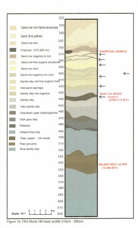
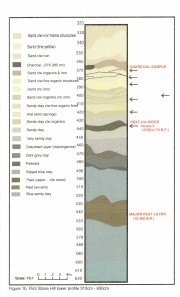
The geomorphology of the glacial Lake Hind Basin over the past 11,000 years is known primarily through the study of a cut bank along the Souris River. Flintstone Hill contains the most complete stratigraphic record for the post-glacial period on the northern plains. The site has been extensively studied by geoarchaeologists, geologists and paleoenvironmentalists over many years and their findings have contributed to our understanding of the region.
Radiocarbon dates were obtained from the Atkinson site and Flintstone Hill.
Radiocarbon dating
The technique of radiocarbon dating was developed by Willard Libby and his colleagues at the University of Chicago in 1949.
Radiocarbon dating is used to estimate the age of organic remains from archaeological sites. Organic matter has a radioactive form of carbon (C14) that begins to decay upon death. C14 decays at a steady, known rate of a half life of 5,730 years. The technique is useful for material up to 50,000 years. Fluctuations of C14 in the atmosphere can affect results so dates are calibrated against dendrochronology. Radiocarbon dates are calibrated to calendar years.
Dates are reported in radiocarbon years or Before Present. Before Present refers to dates before 1950. The introduction of massive amounts of C14, due to atomic bomb and surface testing of atomic weapons, has widely increased the standard deviation on all dates after A.D. 1700 causing these dates to be unreliable.
Accelerated mass spectrometry can more accurately measure C14 with smaller samples and can date materials to 80,000 years.
Scope and Content
Sub sub series contains radiocarbon dates from: the Atkinson site and Flintstone Hill.