Skip header and navigation

Revise Search

20 records – page 1 of 1.

Crepeele locale Radiocarbon Dates

http://archives.brandonu.ca/en/permalink/descriptions11966
Part Of
RG 7 Beverley Nicholson fonds
Description Level
Sub-series
GMD
textual records
Date Range
2003-2008
Accession Number
1-2010
Part Of
RG 7 Beverley Nicholson fonds
Description Level
Sub-series
Series Number
1.5
Accession Number
1-2010
GMD
textual records
Date Range
2003-2008
Material Details
Radiocarbon date reports have been scanned in multi-page PDF files.
History / Biographical
The Crepeele locale is located within the larger Lauder Sandhills area, located in southwestern Manitoba. The area is a complex region of high biodiversity made up of stabilized sand dunes and wetlands that encourage the development of mixed forest and grass prairie. This area provided a variety of subsistence resources for pre-European hunter-gatherers. At the present time the grass prairie is now farm land but the areas of vegetated sand dunes have not been cultivated and have revealed numerous pre-contact archaeological sites. Archaeological surveying was conducted in 2003. The results of the 2003 Casselman survey showed over 300 test uints contained cultural material and indicated several areas for further examination including the Crepeele site DiMe-29, Sarah site DiMe-28 and Graham sites DiMe-30. 
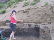
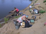
From 2003 to 2008 field work took place at the locale with 75 - 1m x1m units excavated. The Crepeele locale is a complex region of high biodiversity made up of stabilized sand dunes and wetlands that encourage the development of mixed forest and grass prairie. This area provided a variety of subsistence resources for pre-European hunter-gatherers. At the present time the grass prairie is now farm land but the areas of vegetated sand dunes have not been cultivated and have revealed numerous pre-contact archaeological sites. To help establish the cultural sequence at the locale Radiocarbon dates were obtained from the three sites in the Crepeele locale. Radiocarbon dating The technique of radiocarbon dating was developed by Willard Libby and his colleagues at the University of Chicago in 1949. Radiocarbon dating is used to estimate the age of organic remains from archaeological sites. Organic matter has a radioactive form of carbon (C14) that begins to decay upon death. C14 decays at a steady, known rate of a half life of 5,730 years. The technique is useful for material up to 50,000 years. Fluctuations of C14 in the atmosphere can affect results so dates are calibrated against dendrochronology. Radiocarbon dates are calibrated to calendar years. Dates are reported in radiocarbon years or Before Present. Before Present refers to dates before 1950. The introduction of massive amounts of C14, due to atomic bomb and surface testing of atomic weapons, has widely increased the standard deviation on all dates after A.D. 1700 causing these dates to be unreliable. Accelerated mass spectrometry can more accurately measure C14 with smaller samples and can date materials to 80,000 years.
Scope and Content
Sub sub series contains radiocarbon dates from: Crepeele, Sarah and Graham sites.
Name Access
Crepeele locale Radiocarbon Dates
Subject Access
Archaeology Crepeele locale Crepeele locale Radiocarbon Dates
Show Less

Atkinson site 2006 - hearth 3 north profile

http://archives.brandonu.ca/en/permalink/descriptions12269
Part Of
RG 7 Beverley Nicholson fonds
Description Level
Item
GMD
graphic
Date Range
2006
Accession Number
1-2010
Part Of
RG 7 Beverley Nicholson fonds
Description Level
Item
Series Number
2.1.4.5
Item Number
2.1.4.5.3
Accession Number
1-2010
GMD
graphic
Date Range
2006
Physical Description
1024 x768 (769)
Material Details
JPEG
History / Biographical
Photograph taken during 2006 Brandon University Archaeology excavations at Atkinson site.
Scope and Content
Photograph of hearth 3, unit 19 north profile.
Name Access
Atkinson site 2006 - hearth 3 north profile
Subject Access
Archaeology North lauder locale Atkinson site DiMe-27 Atkinson site 2006 photographs
Images
Show Less

Atkinson site 2006 - north wall of hearth 5

http://archives.brandonu.ca/en/permalink/descriptions12278
Part Of
RG 7 Beverley Nicholson fonds
Description Level
Item
GMD
graphic
Date Range
2006
Accession Number
1-2010
Part Of
RG 7 Beverley Nicholson fonds
Description Level
Item
Series Number
2.1.4.5
Item Number
2.1.4.5.12
Accession Number
1-2010
GMD
graphic
Date Range
2006
Physical Description
2560 x 1920 (1067)
Material Details
JPEG
History / Biographical
Photograph taken during 2006 Brandon University Archaeology excavations at Atkinson site.
Scope and Content
North wall of hearth 5.
Name Access
Atkinson site 2006 - north wall of hearth 5
Subject Access
Archaeology North lauder locale Atkinson site DiMe-27 Atkinson site 2006 photographs
Images
Show Less

Atkinson site 2006 - north wall profile of XU18

http://archives.brandonu.ca/en/permalink/descriptions12282
Part Of
RG 7 Beverley Nicholson fonds
Description Level
Item
GMD
graphic
Date Range
2006
Accession Number
1-2010
Part Of
RG 7 Beverley Nicholson fonds
Description Level
Item
Series Number
2.1.4.5
Item Number
2.1.4.5.10
Accession Number
1-2010
GMD
graphic
Date Range
2006
Physical Description
768 x 1024(395)
Material Details
JPEG
History / Biographical
Photograph taken during 2006 Brandon University Archaeology excavations at Atkinson site.
Scope and Content
North wall profile of excavation unit 18
Name Access
Atkinson site 2006 - north wall profile of XU18
Subject Access
Archaeology North lauder locale Atkinson site DiMe-27 Atkinson site 2006 photographs
Images
Show Less

Atkinson site 2004 - XU 6 north wall profile

http://archives.brandonu.ca/en/permalink/descriptions12257
Part Of
RG 7 Beverley Nicholson fonds
Description Level
Item
GMD
graphic
Date Range
2004
Accession Number
1-2010
Part Of
RG 7 Beverley Nicholson fonds
Description Level
Item
Series Number
2.1.2.5
Item Number
2.1.2.5.12
Accession Number
1-2010
GMD
graphic
Date Range
2004
Physical Description
1024 x 768 (440 KB)
Material Details
JPEG
History / Biographical
Photograph taken during 2004 Brandon University Archaeology excavations at Atkinson site.
Scope and Content
Excavation unit 6, north wall profile.
Name Access
Atkinson site 2004 - XU 6 north wall profile
Subject Access
Archaeology North lauder locale Atkinson site DiMe-27 Atkinson site 2004 photographs
Images
Show Less

Atkinson site 2004 - XU 7 north wall profile

http://archives.brandonu.ca/en/permalink/descriptions12217
Part Of
RG 7 Beverley Nicholson fonds
Description Level
Item
GMD
graphic
Date Range
2004
Accession Number
1-2010
Part Of
RG 7 Beverley Nicholson fonds
Description Level
Item
Series Number
2.1.2.5
Item Number
2.1.2.5.13
Accession Number
1-2010
GMD
graphic
Date Range
2004
Physical Description
2048 x 1536 (1501 KB)
Material Details
JPEG
History / Biographical
Photograph taken during 2004 Brandon University Archaeology excavations at Atkinson site.
Scope and Content
Excavation unit 7, north wall profile.
Name Access
Atkinson site 2004 - XU 7 north wall profile
Subject Access
Archaeology North lauder locale Atkinson site DiMe-27 Atkinson site 2004 photographs
Images
Show Less

Atkinson II site 2004 - profile of the north wall of XU 13

http://archives.brandonu.ca/en/permalink/descriptions12253
Part Of
RG 7 Beverley Nicholson fonds
Description Level
Item
GMD
graphic
Date Range
2004
Accession Number
1-2010
Part Of
RG 7 Beverley Nicholson fonds
Description Level
Item
Series Number
2.1.3.5
Item Number
2.1.3.5.13
Accession Number
1-2010
GMD
graphic
Date Range
2004
Physical Description
768 x 1024 (607)
Material Details
JPEG
History / Biographical
Photograph taken during 2004 Brandon University Archaeology excavations at Atkinson II site.
Scope and Content
Profile of the north wall of excavation unit 13 at the Atkinson II site 2004.
Name Access
Atkinson II site 2004 - profile of the north wall of XU 13
Subject Access
Archaeology North lauder locale Atkinson site DiMe-27 Atkinson II site 2004 photographs
Images
Show Less

Flintstone Hill 1998-2000 - Test Unit 3 north profile

http://archives.brandonu.ca/en/permalink/descriptions12318
Part Of
RG 7 Beverley Nicholson fonds
Description Level
Item
GMD
graphic
Date Range
1998-2000
Accession Number
1-2010
Part Of
RG 7 Beverley Nicholson fonds
Description Level
Item
Series Number
2.2.2.5
Item Number
2.2.2.5.5
Accession Number
1-2010
GMD
graphic
Date Range
1998-2000
Physical Description
528 x 792(311)
Material Details
JPEG
History / Biographical
Photograph taken during 1998-2000 Brandon University Archaeology survey at Flintstone Hill.
Scope and Content
Test Unit 3 north profile, 125 cm deep.
Name Access
Flintstone Hill 1998-2000 - Test Unit 3 north profile
Subject Access
Archaeology North lauder locale Flintstone Hill DiMe-26 Flintstone Hill 1998-2000 - Test Unit 3 north profile
Images
Show Less

Flintstone Hill 1998-2000 - Test Unit 4 north profile

http://archives.brandonu.ca/en/permalink/descriptions12319
Part Of
RG 7 Beverley Nicholson fonds
Description Level
Item
GMD
graphic
Date Range
1998-2000
Accession Number
1-2010
Part Of
RG 7 Beverley Nicholson fonds
Description Level
Item
Series Number
2.2.2.5
Item Number
2.2.2.5.6
Accession Number
1-2010
GMD
graphic
Date Range
1998-2000
Physical Description
536 x 792(244)
Material Details
JPEG
History / Biographical
Photograph taken during 1998-2000 Brandon University Archaeology survey at Flintstone Hill.
Scope and Content
Test Unit 4 north profile, 150 cm deep.
Name Access
Flintstone Hill 1998-2000 - Test Unit 4 north profile
Subject Access
Archaeology North lauder locale Flintstone Hill DiMe-26 Flintstone Hill 1998-2000 - Test Unit 4 north profile
Images
Show Less

Flintstone Hill 1998-2000 - Test Unit 5 north profile

http://archives.brandonu.ca/en/permalink/descriptions12320
Part Of
RG 7 Beverley Nicholson fonds
Description Level
Item
GMD
graphic
Date Range
1998-2000
Accession Number
1-2010
Part Of
RG 7 Beverley Nicholson fonds
Description Level
Item
Series Number
2.2.2.5
Item Number
2.2.2.5.7
Accession Number
1-2010
GMD
graphic
Date Range
1998-2000
Physical Description
536 x 796(247)
Material Details
JPEG
History / Biographical
Photograph taken during 1998-2000 Brandon University Archaeology survey at Flintstone Hill.
Scope and Content
Test Unit 5 north profile, 150 cm deep.
Name Access
Flintstone Hill 1998-2000 - Test Unit 5 north profile
Subject Access
Archaeology North lauder locale Flintstone Hill DiMe-26 Flintstone Hill 1998-2000 - Test Unit 4 north profile
Images
Show Less

Casselman survey - Bev Nicholson leading a group through the Crepeele locale

http://archives.brandonu.ca/en/permalink/descriptions10979
Part Of
RG 7 Beverley Nicholson fonds
Description Level
Item
GMD
graphic
Date Range
2003
Accession Number
1-2010
Part Of
RG 7 Beverley Nicholson fonds
Description Level
Item
Series Number
1.1.5
Item Number
1.1.5.1
Accession Number
1-2010
GMD
graphic
Date Range
2003
Physical Description
2500 x 1875 (3233 KB )
Material Details
JPEG
Scope and Content
Bev Nicholson leading a group through the Crepeele locale during the Casselman survey
Name Access
Casselman survey - Bev Nicholson leading a group through the Crepeele locale
Subject Access
Archaeology Crepeele locale Casselman survey Casselman survey - photographs
Images
Show Less

Flintstone Hill - DiMe-26

http://archives.brandonu.ca/en/permalink/descriptions12283
Part Of
RG 7 Beverley Nicholson fonds
Description Level
Sub-series
GMD
multiple media
Date Range
1997-2000
Accession Number
1-2010
Part Of
RG 7 Beverley Nicholson fonds
Description Level
Sub-series
Series Number
2.2
Accession Number
1-2010
GMD
multiple media
Date Range
1997-2000
History / Biographical
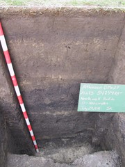
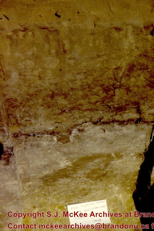
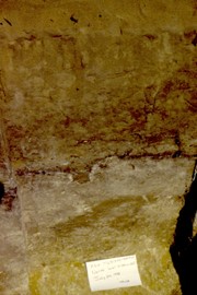
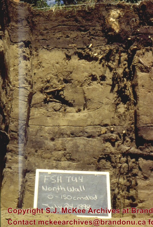
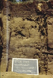
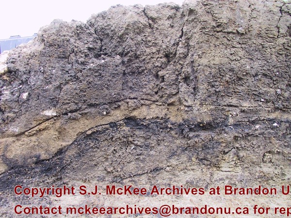
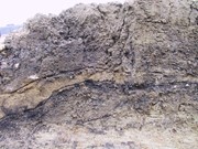
Flintstone Hill is located on the north bank of the Souris River. It is a deeply stratified lacustrine, fluvial and aeolian soil profile that has been exposed by the river through stream-bank erosion. This section is thought to be the most complete middle to late Holocene exposure on the northeastern plains. While the value of the site is primarily for paleo-environmental research and reconstruction, cultural deposits have been identified at the site. Local collectors have picked up lithic materials as they eroded out of the bank for the past several decades and it was they who had named the site. Mr. Bruce Timms from Lauder first drew the Flintstone Hill site to the attention of Dr. Nicholson of Brandon University. During the mid 1990’s to the early 2000’s archaeological testing took place on Flintstone Hill. In 1998, an archaeological field crew dug a series of overlapping trenches down the slope of the profile and produced a schematic drawing. A peat layer at the bottom of this profile, dated from the top at 9,400 RCY and at the bottom to 10,400 RCY, has provided details of marsh plant and insect communities at this time. 
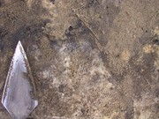
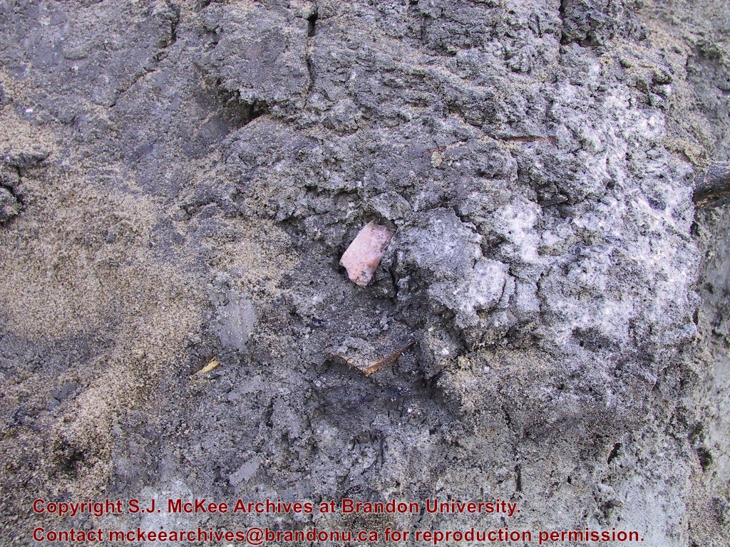
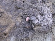
Subsequent archaeological investigations at the site recovered several cultural deposits including: a hearth dating to 3250+/-70 R.C.Y. (BETA 109529); a butchered atlas bone 4090+/-70 R.C.Y. (BETA 109990); and bone fragments accompanied by Swan River Chert and Knife River Flint lithic flakes 5350+/-50 (BETA 109530). While no diagnostic tools were recovered, these dates suggest that this occupation, which is contemporary with the Atkinson site, may be a Gowen occupation. Extensive paleo-environmental research has been conducted at the site. Dr. Running, a geomorphologist from the University of Wisconsin – Eau Claire, participated in the Study of Cultural Adaptations in the Prairie Ecozone (SCAPE) Project and he and his students tested the site for several years. He was joined in this effort by Dr. Havholm, Dr. Boyd, Dr. Wiseman, Dr. Beaudoin, and other SCAPE researchers in the interpretation of the paleo-environment of the Glacial Lake Hind basin. The following article is recommended reading. Running, Garry L., Karen G. Havholm, Matt Boyd and Dion J. Wiseman 2002 Holocene Stratigraphy and Geomorphology of Flintstone Hill, Lauder Sandhills, Glacial Lake Hind Basin, Southwestern Manitoba. Geographie Physique et Quaternaire 56(2-3):291-303.
Scope and Content
Sub series has been divided into two sub sub series including: (1) Flintstone Hill 1997 (2) Flintstone Hill 1998-2000
Name Access
Flintstone Hill - DiMe-26
Subject Access
Archaeology North Lauder locale Flintstone Hill - DiMe-26
Show Less

Atkinson site - DiMe-27

http://archives.brandonu.ca/en/permalink/descriptions12080
Part Of
RG 7 Beverley Nicholson fonds
Description Level
Sub-series
GMD
multiple media
Date Range
2003-2006
Accession Number
1-2010
Part Of
RG 7 Beverley Nicholson fonds
Description Level
Sub-series
Series Number
2.1
Accession Number
1-2010
GMD
multiple media
Date Range
2003-2006
History / Biographical
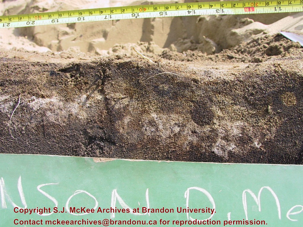
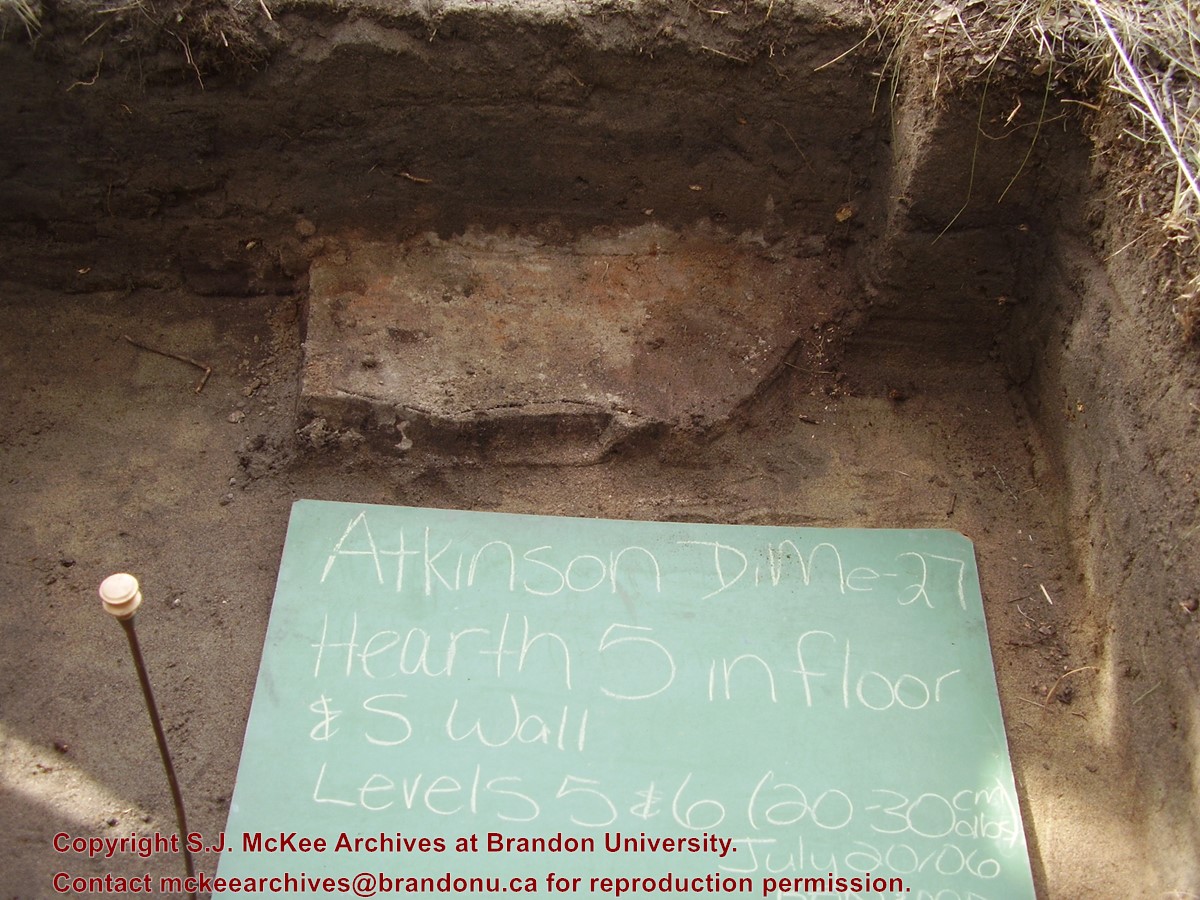
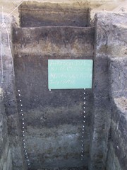
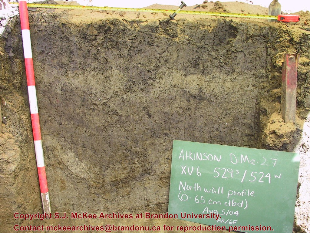
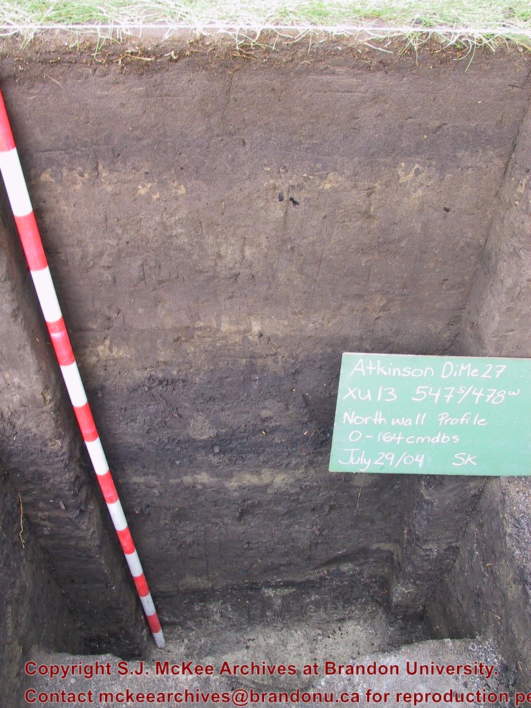
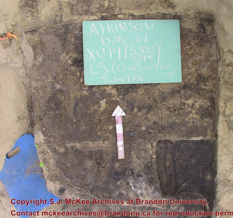
The Atkinson site was named for the landowners Ken and Karen Atkinson who were very helpful to the archaeology and geoarchaeology crews that worked at the site. Their support made the project possible. The Atkinson site story begins with the discovery of a charcoal lens eroding from the north bank of the Souris River in the summer of 2002. Study of Cultural Adaptations on the Prairie Ecozone (SCAPE) project geoarchaeologist Dr. Garry Running was exploring the stratigraphic layering in the bank when he noted the lens and reported it to Dr. Bev Nicholson. Upon closer examination, a tiny pressure flake was observed on the lens exposure and it was decided to collect a charcoal sample for radiocarbon dating. The resulting date of 5250B.P cal. 4225 B.C. placed the site in the early Archaic period. A second date on bone collagen of 5580B.P. cal. 4500 B.C. confirmed the earlier date and gave an averaged date of circa 4400 B.C or 6,500 years ago. The Atkinson site is one of the oldest excavated sites in Manitoba. Based on the date of the site and the kind of lithics (stone tools) present it is considered a Gowen occupation. The Atkinson site is evidence that bison hunters were active on the northern plains at a very early date. Similar sites have also been found on the High Plains in the U.S. and are referred to as the Mummy Cave Complex. The Atkinson Site is of great importance as it is the first undisturbed site of this type to be excavated in Manitoba and extends the range of these sites south and east from the type-sites in central Saskatchewan. Based on the date and sample evidence further excavations were conducted by Dr. Nicholson's team. in 2003, 2004 and 2006.
Scope and Content
Sub series has been divided into three sub sub series including: (1) Atkinson 2003, (2) Atkinson 2004; (3) Atkinson 2006
Name Access
Atkinson site DiMe-27
Subject Access
Archaeology North Lauder locale Atkinson site DiMe-27
Show Less

Atkinson site 2003 - Unit 4 west wall

http://archives.brandonu.ca/en/permalink/descriptions12256
Part Of
RG 7 Beverley Nicholson fonds
Description Level
Item
GMD
graphic
Date Range
2003
Accession Number
1-2010
Part Of
RG 7 Beverley Nicholson fonds
Description Level
Item
Series Number
2.1.1.5
Item Number
2.1.1.5.2
Accession Number
1-2010
GMD
graphic
Date Range
2003
Physical Description
600 x 450 (372 KB )
Material Details
JPEG
History / Biographical
Photograph taken during 2003 Brandon University Archaeology excavations at Atkinson site.
Scope and Content
Atkinson site 2003 close-up of the west wall of excavation 4
Name Access
Atkinson site 2003 - Unit 4 west wall
Subject Access
Archaeology North lauder locale Atkinson site DiMe-27 Atkinson site 2003 photographs
Images
Show Less

Atkinson site 2006 - crew at site

http://archives.brandonu.ca/en/permalink/descriptions12266
Part Of
RG 7 Beverley Nicholson fonds
Description Level
Item
GMD
graphic
Date Range
2006
Accession Number
1-2010
Part Of
RG 7 Beverley Nicholson fonds
Description Level
Item
Series Number
2.1.4.5
Item Number
2.1.4.5.1
Accession Number
1-2010
GMD
graphic
Date Range
2006
Physical Description
2048 x1536 (1380)
Material Details
JPEG
History / Biographical
Photograph taken during 2006 Brandon University Archaeology excavations at Atkinson site.
Scope and Content
Tomasin Playford, Michelle Drysdale and Jessica McKenzie at the site.
Name Access
Atkinson site 2006 - crew at site
Subject Access
Archaeology North lauder locale Atkinson site DiMe-27 Atkinson site 2006 photographs
Images
Show Less

Atkinson site 2006 - XU 18

http://archives.brandonu.ca/en/permalink/descriptions12267
Part Of
RG 7 Beverley Nicholson fonds
Description Level
Item
GMD
graphic
Date Range
2006
Accession Number
1-2010
Part Of
RG 7 Beverley Nicholson fonds
Description Level
Item
Series Number
2.1.4.5
Item Number
2.1.4.5.2
Accession Number
1-2010
GMD
graphic
Date Range
2006
Physical Description
2048 x1536 (1025)
Material Details
JPEG
History / Biographical
Photograph taken during 2006 Brandon University Archaeology excavations at Atkinson site.
Scope and Content
Photograph of unit 18 before excavation.
Name Access
Atkinson site 2006 - XU 18
Subject Access
Archaeology North lauder locale Atkinson site DiMe-27 Atkinson site 2006 photographs
Images
Show Less

Atkinson site 2006 - closeup of hearth 3

http://archives.brandonu.ca/en/permalink/descriptions12270
Part Of
RG 7 Beverley Nicholson fonds
Description Level
Item
GMD
graphic
Date Range
2006
Accession Number
1-2010
Part Of
RG 7 Beverley Nicholson fonds
Description Level
Item
Series Number
2.1.4.5
Item Number
2.1.4.5.4
Accession Number
1-2010
GMD
graphic
Date Range
2006
Physical Description
1024 x768 (958)
Material Details
JPEG
History / Biographical
Photograph taken during 2006 Brandon University Archaeology excavations at Atkinson site.
Scope and Content
Closeup of hearth 3, unit 19.
Name Access
Atkinson site 2006 - closeup of hearth 3
Subject Access
Archaeology North lauder locale Atkinson site DiMe-27 Atkinson site 2006 photographs
Images
Show Less

Atkinson site 2006 - Gowen projectile point

http://archives.brandonu.ca/en/permalink/descriptions12271
Part Of
RG 7 Beverley Nicholson fonds
Description Level
Item
GMD
graphic
Date Range
2006
Accession Number
1-2010
Part Of
RG 7 Beverley Nicholson fonds
Description Level
Item
Series Number
2.1.4.5
Item Number
2.1.4.5.5
Accession Number
1-2010
GMD
graphic
Date Range
2006
Physical Description
1024 x768 (920)
Material Details
JPEG
History / Biographical
Photograph taken during 2006 Brandon University Archaeology excavations at Atkinson site.
Scope and Content
Gowen projectile point.
Name Access
Atkinson site 2006 - Gowen projectile point
Subject Access
Archaeology North lauder locale Atkinson site DiMe-27 Atkinson site 2006 photographs
Images
Show Less

Atkinson site 2006 - XU 19 level 5

http://archives.brandonu.ca/en/permalink/descriptions12272
Part Of
RG 7 Beverley Nicholson fonds
Description Level
Item
GMD
graphic
Date Range
2006
Accession Number
1-2010
Part Of
RG 7 Beverley Nicholson fonds
Description Level
Item
Series Number
2.1.4.5
Item Number
2.1.4.5.6
Accession Number
1-2010
GMD
graphic
Date Range
2006
Physical Description
808 x757 (364)
Material Details
JPEG
History / Biographical
Photograph taken during 2006 Brandon University Archaeology excavations at Atkinson site.
Scope and Content
Excavation unit 19 level 5.
Name Access
Atkinson site 2006 - XU 19 level 5
Subject Access
Archaeology North lauder locale Atkinson site DiMe-27 Atkinson site 2006 photographs
Images
Show Less

Atkinson site 2006 - Crew at the site

http://archives.brandonu.ca/en/permalink/descriptions12273
Part Of
RG 7 Beverley Nicholson fonds
Description Level
Item
GMD
graphic
Date Range
2006
Accession Number
1-2010
Part Of
RG 7 Beverley Nicholson fonds
Description Level
Item
Series Number
2.1.4.5
Item Number
2.1.4.5.8
Accession Number
1-2010
GMD
graphic
Date Range
2006
Physical Description
1024 x 768 (609)
Material Details
JPEG
History / Biographical
Photograph taken during 2006 Brandon University Archaeology excavations at Atkinson site.
Scope and Content
Tomasin Playford removing charcoal from the hearth and Michelle Drysdale screening at the site.
Name Access
Atkinson site 2006 - Crew at the site
Subject Access
Archaeology North lauder locale Atkinson site DiMe-27 Atkinson site 2006 photographs
Images
Show Less

20 records – page 1 of 1.