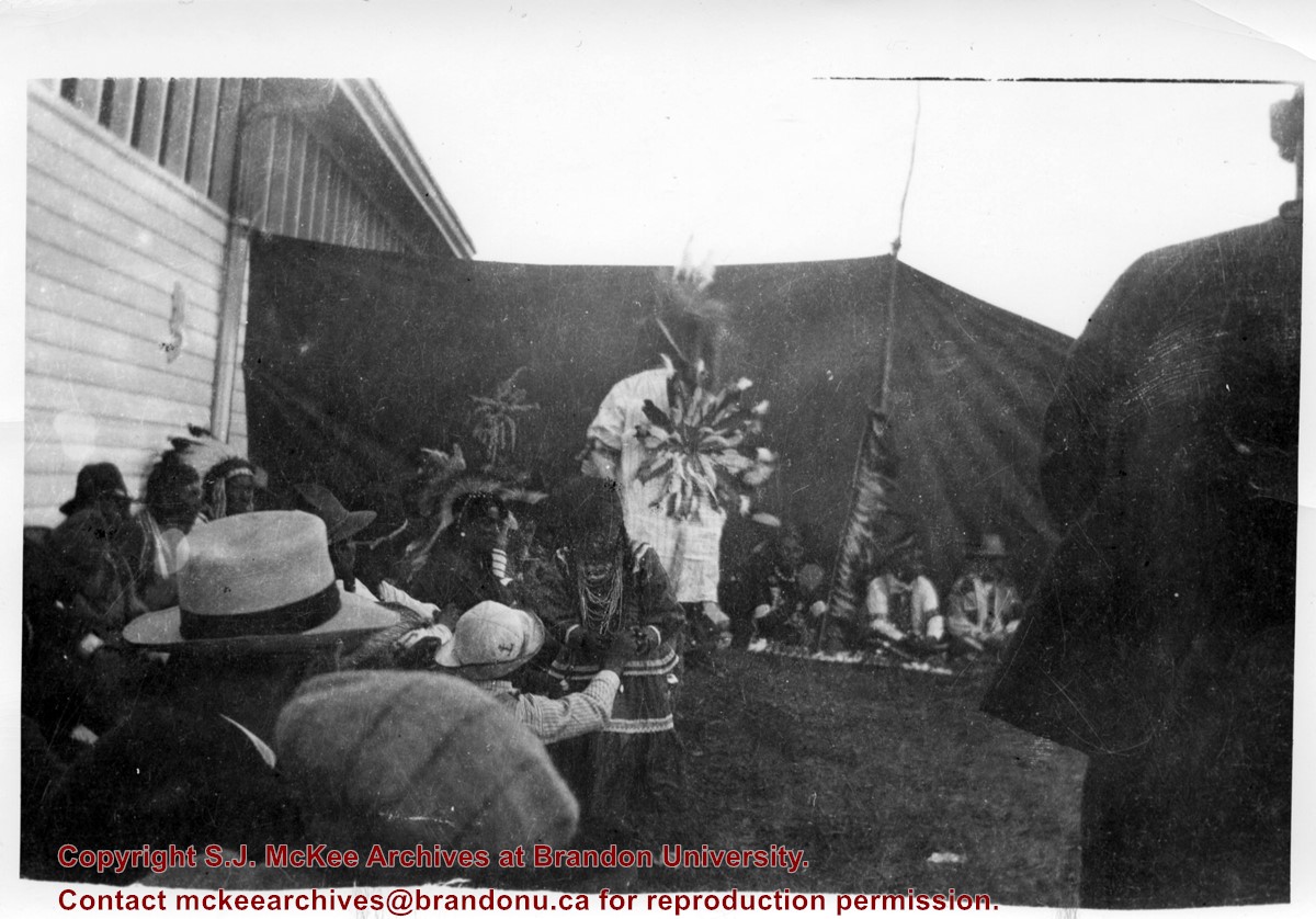
Photograph shows a group of Aboriginal peoples sitting near a fair building. Several members are dressed in regalia.
Notes
Writing on back of photograph reads: 6 prints [20-2009.145 to 20-2009.150]. Indians at the Brandon Fair. Camping off 18th St. back of fair grounds. 1923
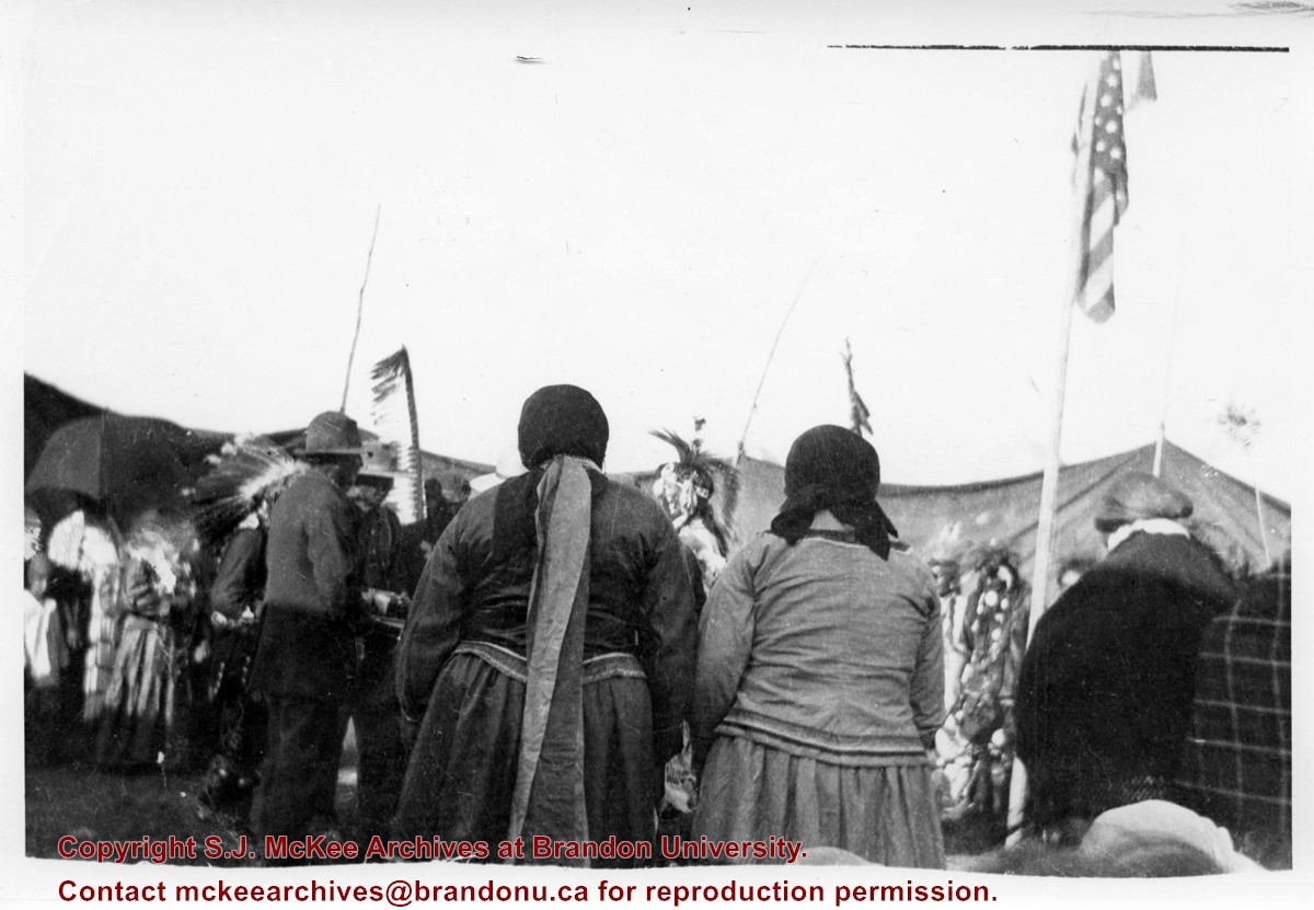
Photograph shows a group of Aboriginal peoples standing in a circle surrounding a group in traditional regalia. An American flag is visible in the foreground.
Notes
Writing on back of photograph reads: 6 prints [20-2009.145 to 20-2009.150]. Indians at the Brandon Fair. Camping off 18th St. back of fair grounds. 1923
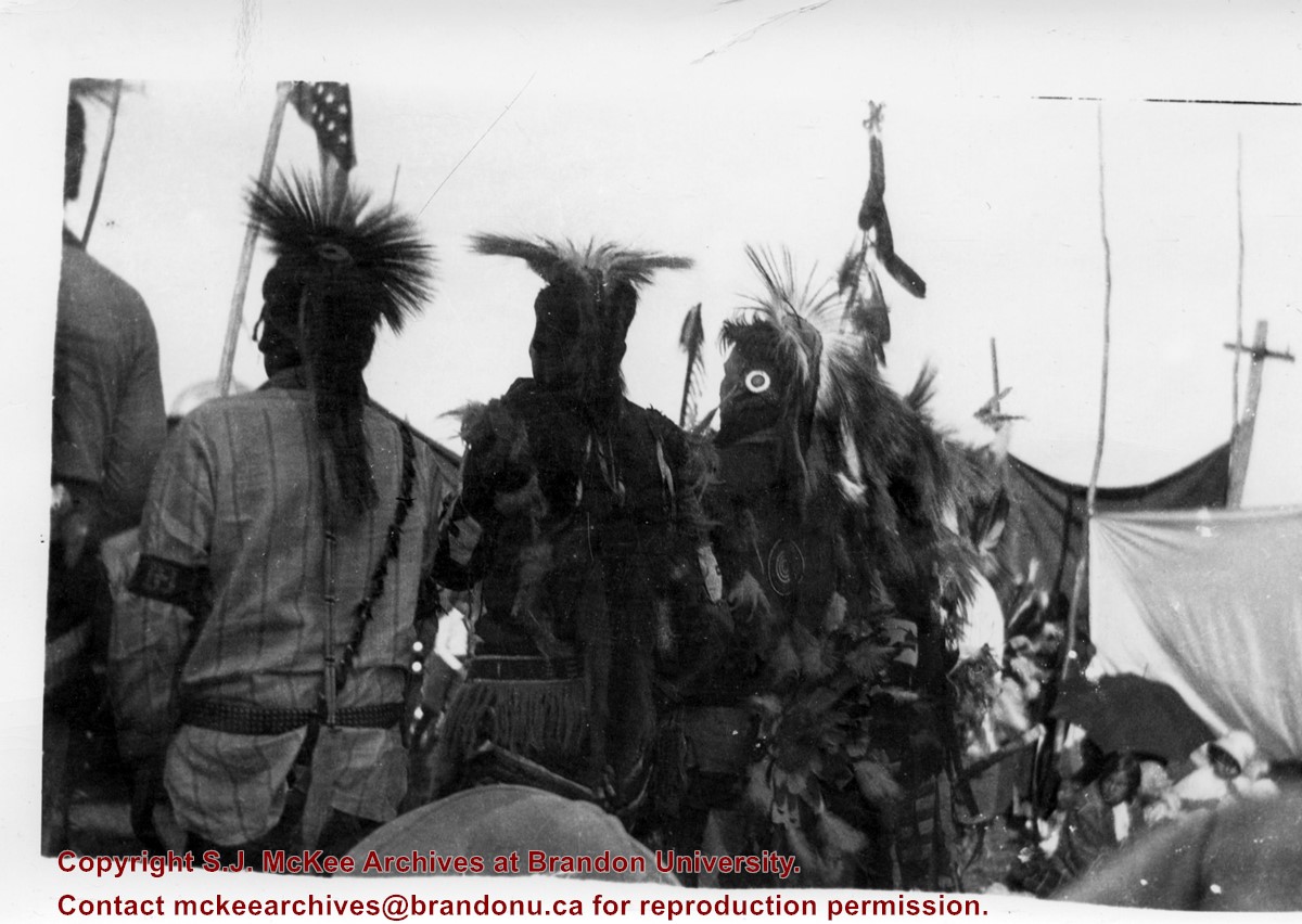
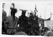
Photograph shows the backside of a group Aboriginal peoples dressed in traditional regalia. An American flag is visible in the background
Notes
Writing on back of photograph reads: 6 prints [20-2009.145 to 20-2009.150]. Indians at the Brandon Fair. Camping off 18th St. back of fair grounds. 1923
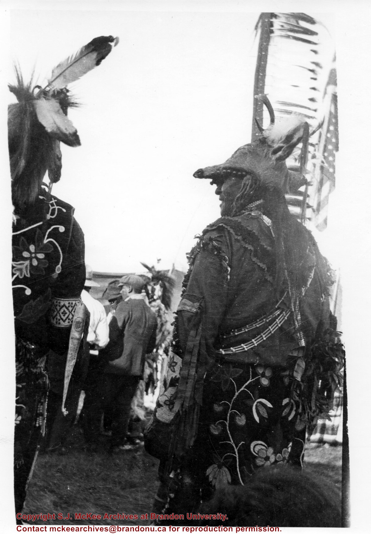
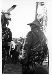
Photograph shows the backside of a pair of Aboriginal men dressed in traditional regalia. Both are wearing beaded clothing and one is wearing a deer head headdress. An American flag is visible in the background
Notes
Writing on back of photograph reads: 6 prints [20-2009.145 to 20-2009.150]. Indians at the Brandon Fair. Camping off 18th St. back of fair grounds. 1923
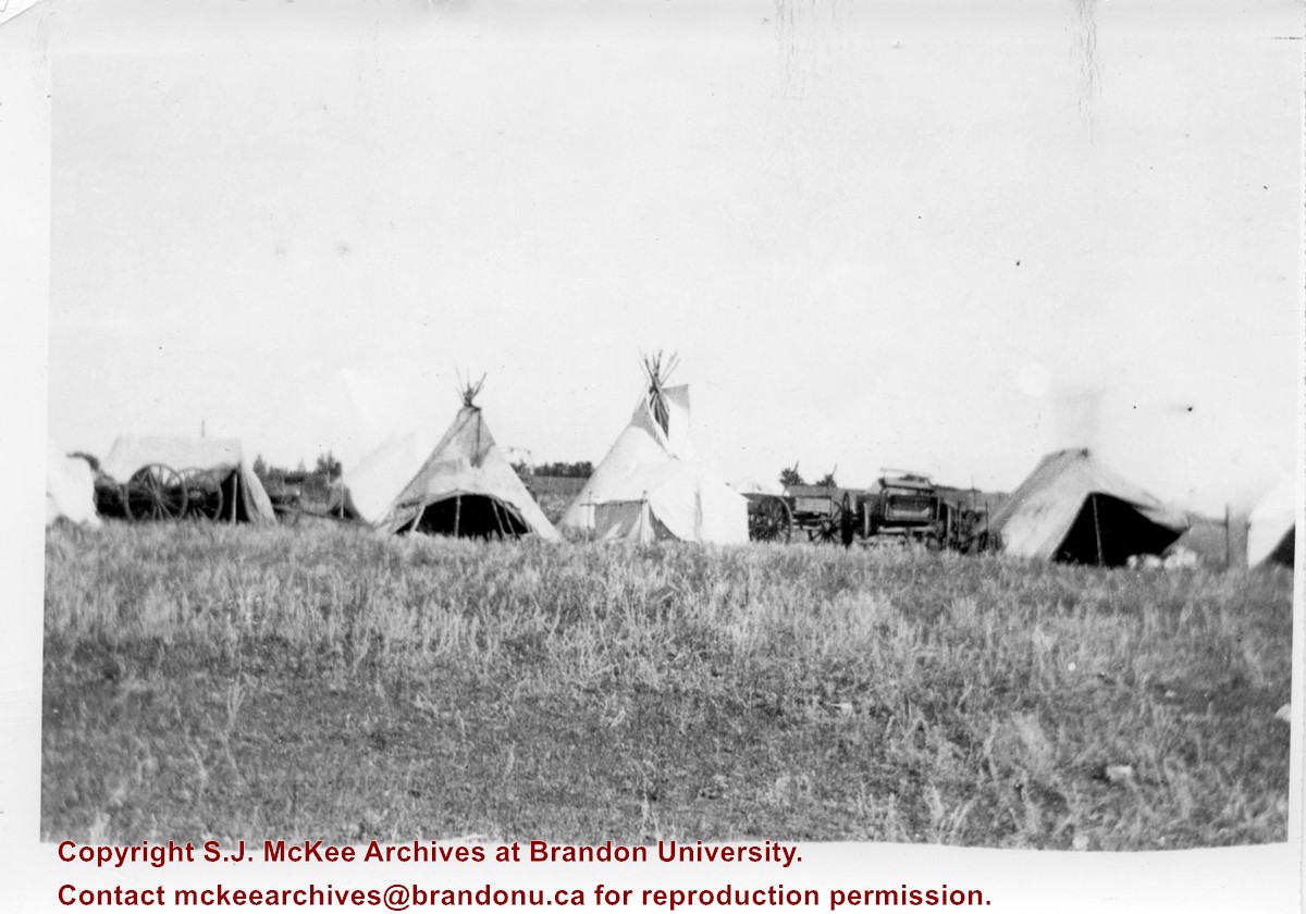
Photograph shows the Aboriginal camp site at the Brandon Fair. Pictured are wagon carts, tipis, and canvas tents.
Notes
Writing on back of photograph reads: 6 prints [20-2009.145 to 20-2009.150]. Indians at the Brandon Fair. Camping off 18th St. back of fair grounds. 1923
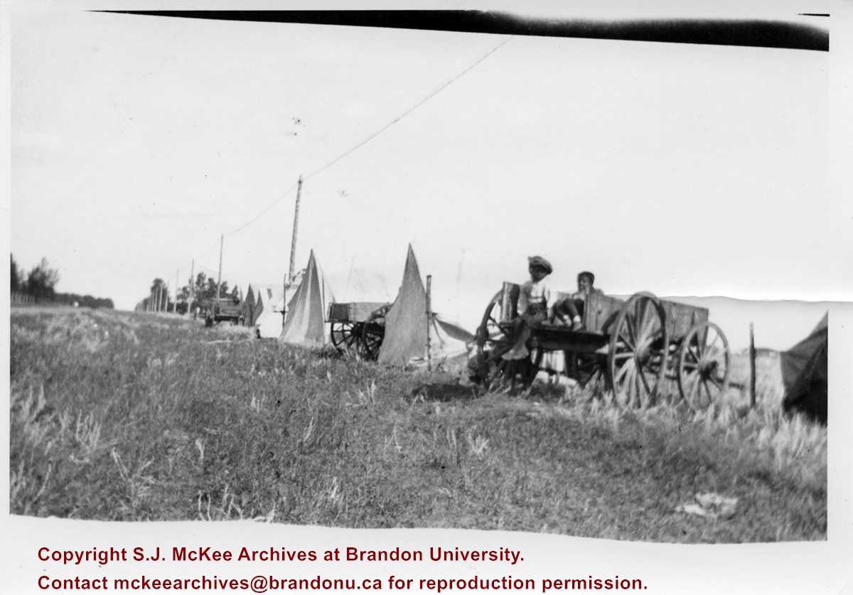
Photograph shows the Aboriginal camp site at the Brandon Fair. Pictured are wagon carts and canvas tents. Two children can be seen sitting in a wagon.
Notes
Writing on back of photograph reads: 6 prints [20-2009.145 to 20-2009.150]. Indians at the Brandon Fair. Camping off 18th St. back of fair grounds. 1923
Red ink stain is on the front right corner of postcard
Scope and Content
Photograph shows 10th Street facing south from Princess Avenue. Visible landmarks and businesses include: Manitoba Power Commission (MPC)'s power sub-station, First Baptist Church, Wheat City Arena, and the grand stand at the Exhibition Grounds.
The partial sign visible at the bottom of the photograph on the east side of 10th Street reads Yates and Neale, which refers to a plumbing and heating company that dissolved in 1943 to be replaced by Neale, Stothard and Chapman.
Businesses on the west side of 10th Street include: Dominion Tire & Radio Co., Bolts Barber Shop, Elviss T.E. Co. Stables.
Notes
Information concerning Yates and Neale courtesy Jack Stothard. Writing on the front of the postcard reads: Brandon, Looking S.W., Jerrett Photo. This photograph shows a rare view of the 200-block of 10th Street.
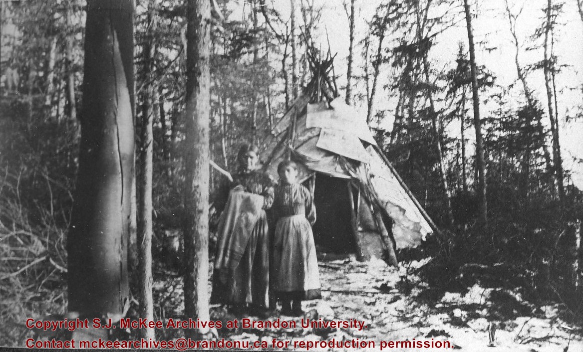
Photograph shows two aboriginal women standing before a tipi in the brush.
Notes
Writing beneath the photograph in the album reads: At the Indian Settlement. Based on provenience of images in the album, the aboringals in question may be from the Michipicoten band.
For custodial history see the collection level description of the Lawrence Stuckey collection.
Scope and Content
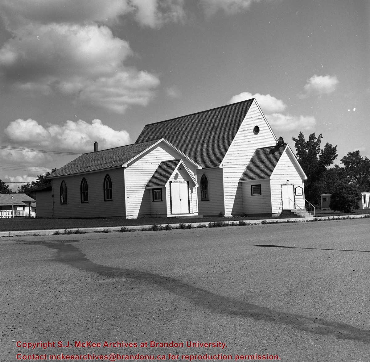
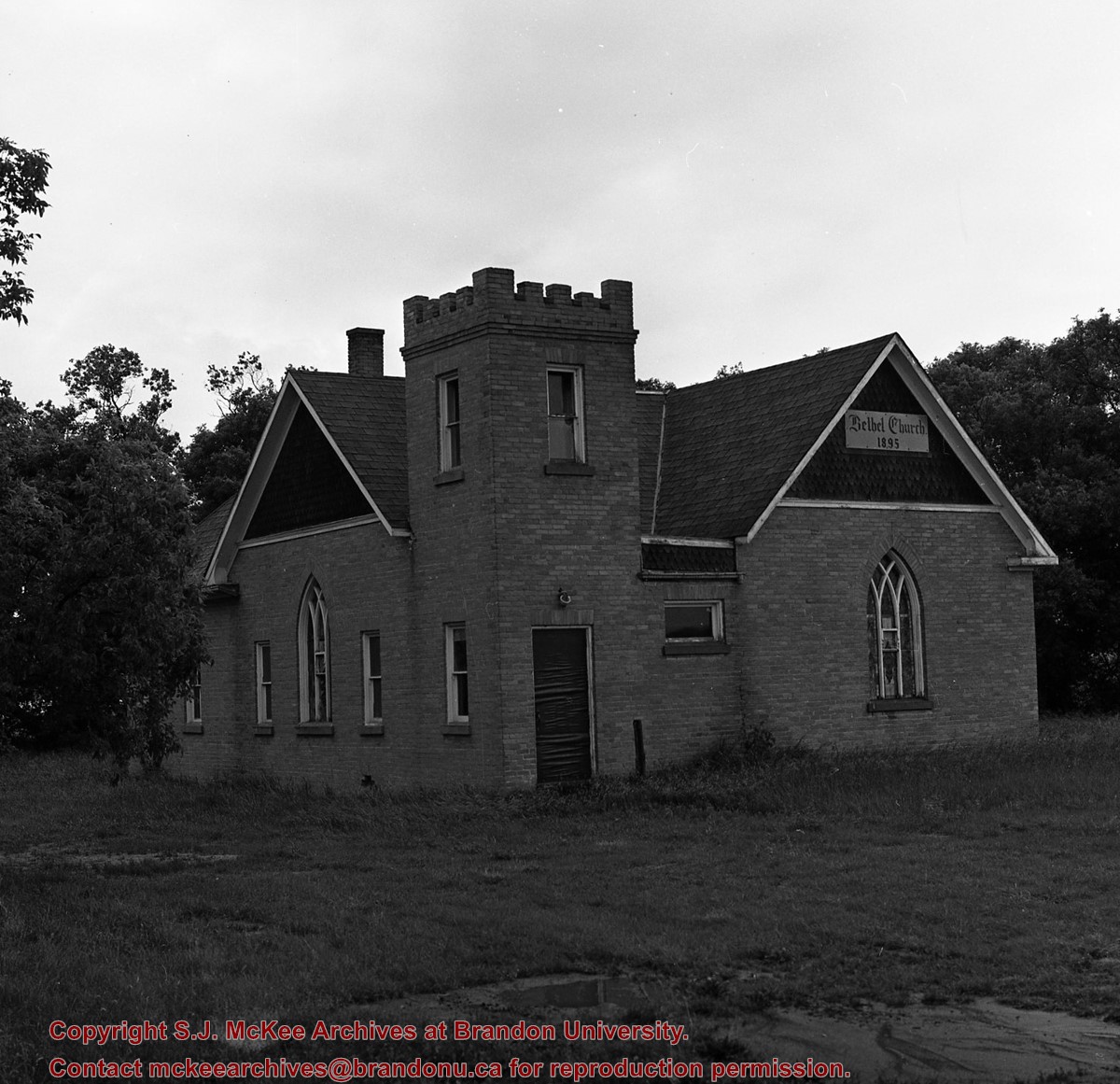
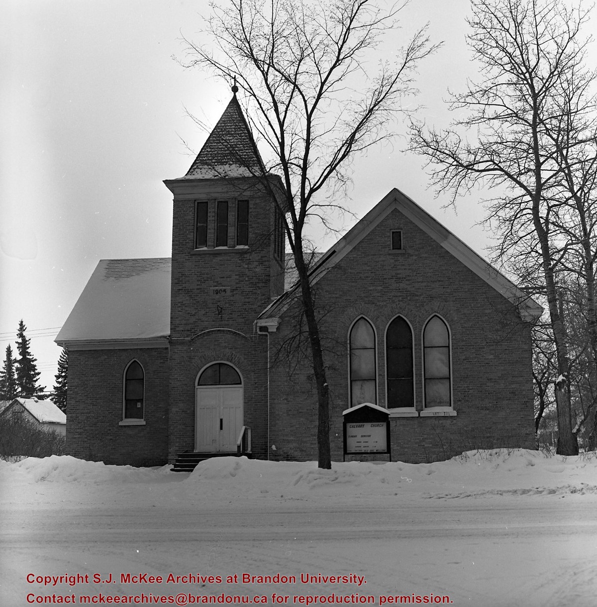
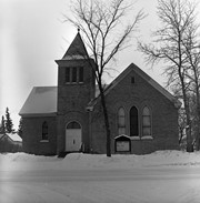
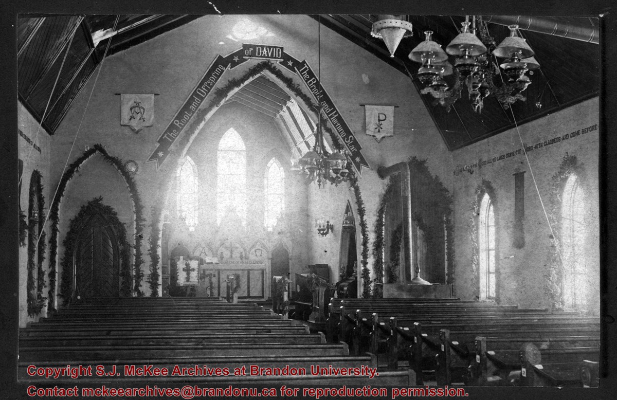
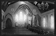
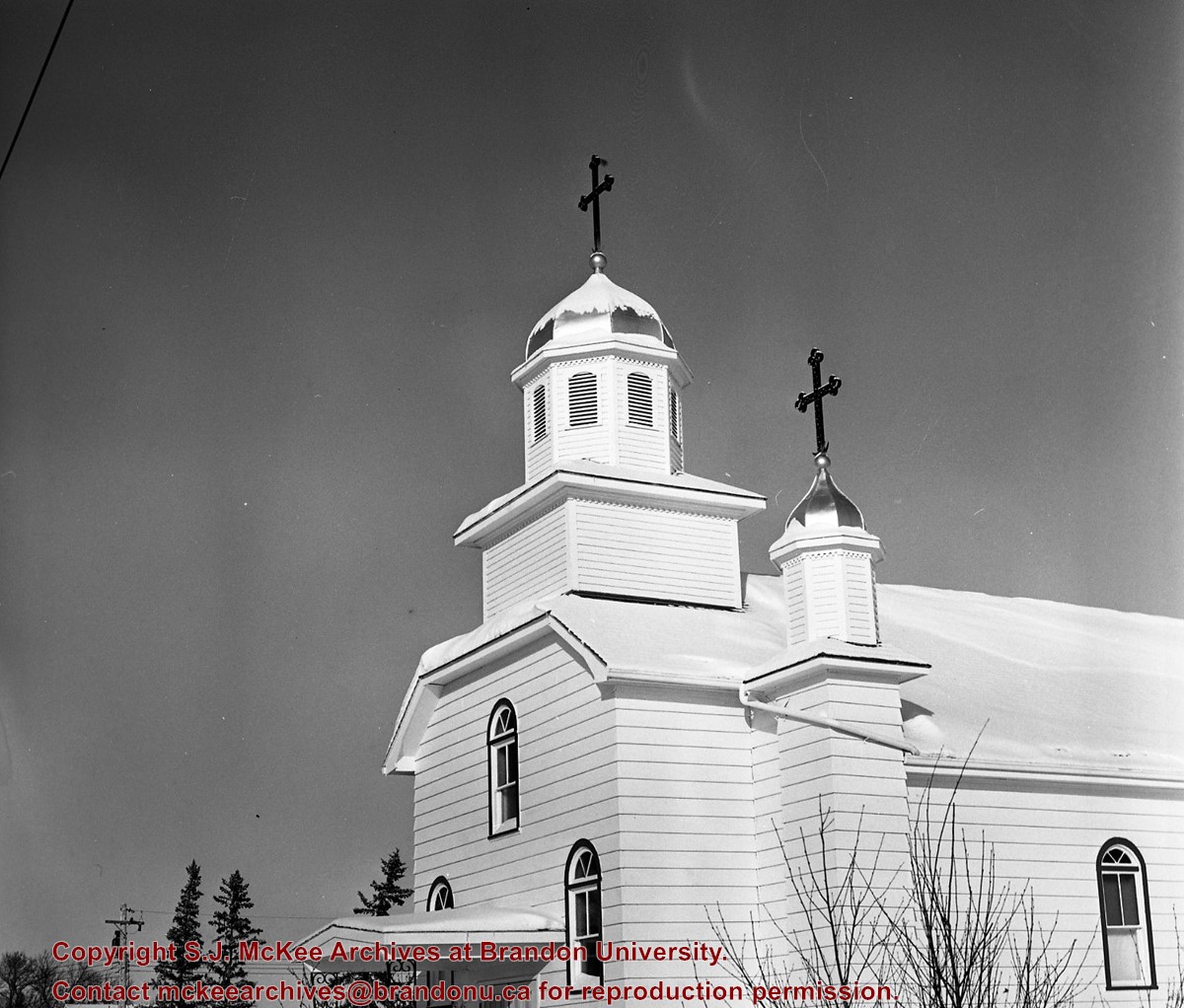
Image of Bethel Church (1895) on Highways 2 & 21 west of Deleau, Manitoba.
Notes
[Brandon SW includes communities south of Trans-Canada #1 highway and west of PTH #10.] [Images 349a and 349b are images of the exterior of the church, and images 349c-349-e are images of the stained glass windows.]
For custodial history see the collection level description of the Lawrence Stuckey collection.
Scope and Content
Image of Bethel Church (1895) on Highways 2 & 21 west of Deleau, Manitoba.
Notes
[Brandon SW includes communities south of Trans-Canada #1 highway and west of PTH #10.] [Images 349a and 349b are images of the exterior of the church, and images 349c-349-e are images of the stained glass windows.]
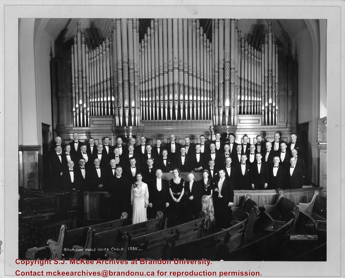
According to Henderson's 1935 Brandon City Directory, the First United Church was located on the corner of 8th Street and Lorne Avenue. The minister at the time was Reverend John H. Garden.
Scope and Content
Photograph shows the Brandon Male Voice Choir dressed in tuxedos and posing before the First United Church's pipe organ. A minister (possibly Rev. John H. Garden) and three women in formal attire are standing in the front row.
Notes
Writing on the back of the photograph reads: return to Bob Hoffman, Box #1, Brandon, R7A 5Y6
Photograph shows exterior views of five Brandon churches: Baptist Church, Presbyterian Church, St. Matthew's Church, Catholic Church and Monastery, and Methodist Church.
Notes
Part of "Christie's Brandon Series of Six Colored Picture Postcards of Brandon, Manitoba, The Crown Series, Published by Christie's Bookstore, Brandon, Man." [note: missing sixth postcard]. Writing on the front of the photograph reads: Baptist Church, Presbyterian Church Brandon Man., St. Matthew's Church, Catholic Church and Monastery, Methodist Church.


+on+Highway+2-21+near+Hartney+Junction)
+on+Highways++2+%26+21+west+of+Deleau%2c+Manitoba.)
+on+Highways++2+%26+21+west+of+Deleau%2c+Manitoba.)
+on+Highways++2+%26+21+west+of+Deleau%2c+Manitoba.)
+on+Highways++2+%26+21+west+of+Deleau%2c+Manitoba.)
+on+Highways++2+%26+21+west+of+Deleau%2c+Manitoba.)