Situated in the R.M. of Whitehead on the Little Saskatchewan River, the 10 Mile Dam was a 14 kilometer transmission line that supplied the city of Brandon with power. The Brandon Electric Light Company built the dam in 1900 and it is considered Manitoba's first hydroelectic power generating station. The dam spanned approximately 80 meters and was constructed from timber and reinforced with clay and stone. The station was decommissioned in 1924.
Scope and Content
Photograph shows 10 Mile Dam, also known as the Brandon Dam or Minnedosa River Hydro Plant.
Notes
Writing on the back of the photograph reads: "10 mile dam". Biographical information obtained from Manitoba Historical Society.
Photograph shows the Brandon Wheat Market along Pacific Avenue on November 30, 1885. Farmers can be seen driving wagon teams loaded with bags of grain in line on Pacific Avenue from 10 Street to at least 7th Street. On the north side of Pacific Avenue the CPR Land Office and grain elevators are pictured. On the south side of Pacific Avenue, the general merchant/hardware store Bower, Blackburn, Mundell & Porter is situated on the corner of Pacific Avenue and 10th Street. A 10th Street sign is affixed to the merchants' store. On the east side of the general store, Edie House, the Grand View Hotel, and a Farmers' boarding and lodging house can be seen. Most of the buildings appear to be woodframed except for the Grand View, which is constructed of brick. Sidewalks appear to be in place on the south side of Pacific and snow dusts the streets. A baby swathed in winter clothing sits in a pram/baby carriage in front of the general store.
Notes
Writing on the front of the photograph reads: Novemeber 30th, 1885, Brandon Wheat Market
In 1917 the Brandon Electric Light Co. and the Brandon Gas & Power Co. merged to form the Canada Gas & Electric Company; CG&EC was subsequently taken over by the Manitoba Power Commission;
Brandon's central heating system was taken over by the Brandon Steam Heat Users Co-operative;
On September 13, 1957 at 3:38 PM, an explosion in the boiler and stack destroyed the large stack causing two fatalities.
Custodial History
For custodial history see the collection level description of the Lawrence Stuckey collection.
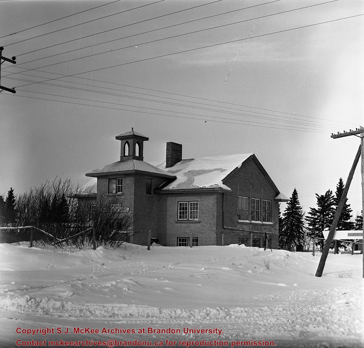
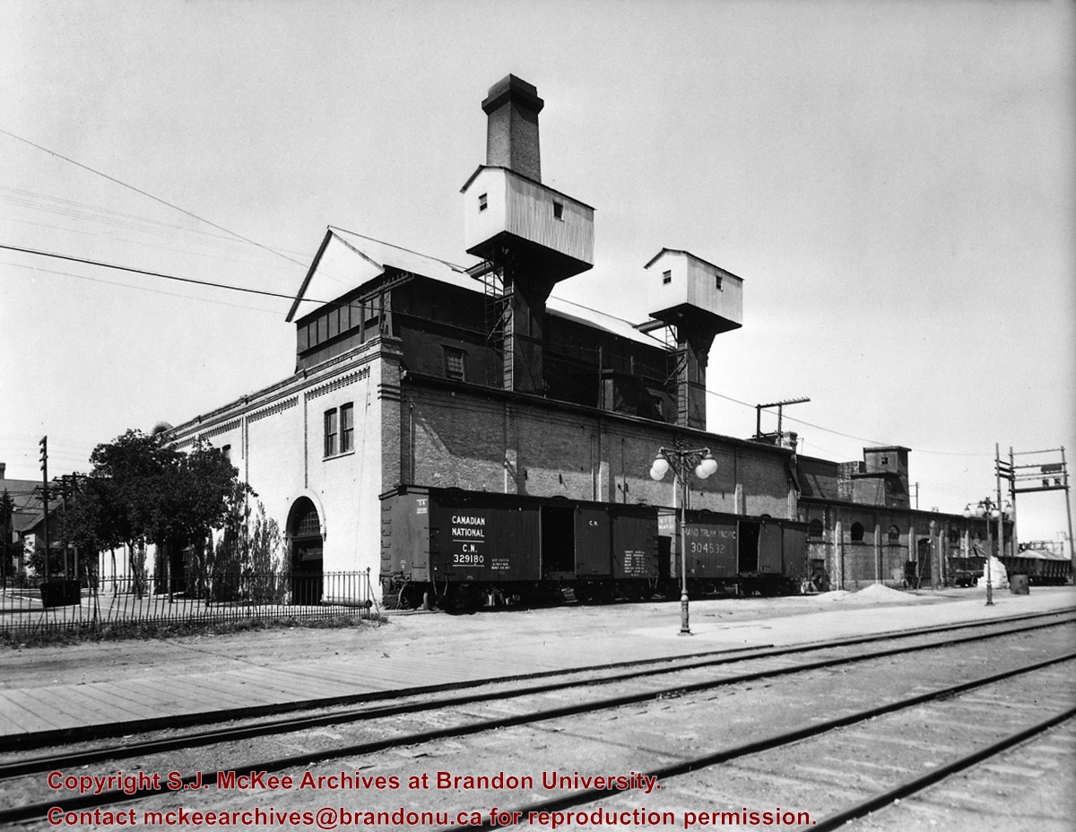
Scope and Content
Canada Gas & Electric Co. steam plant
Notes
View (from 10th St.) of the coal-powered steam generating plant located at 10th St. & Lorne Ave.
Copy negative from 8x10 negative by C.J. Smith (on file).
In 1917 the Brandon Electric Light Co. and the Brandon Gas & Power Co. merged to form the Canada Gas & Electric Company; CG&EC was subsequently taken over by the Manitoba Power Commission;
Brandon's central heating system was taken over by the Brandon Steam Heat Users Co-operative;
On September 13, 1957 at 3:38 PM, an explosion in the boiler and stack destroyed the large stack causing two fatalities.
Custodial History
For custodial history see the collection level description of the Lawrence Stuckey collection.
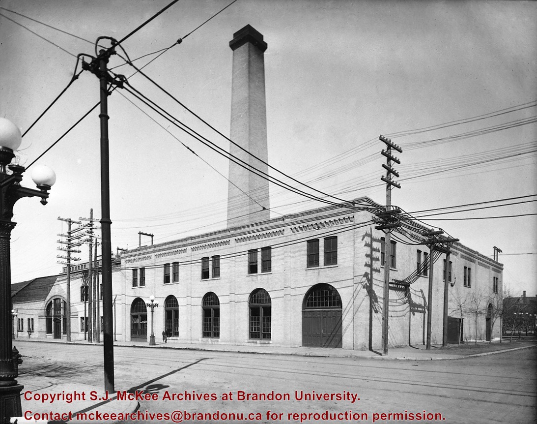
Scope and Content
Canada Gas & Electric Co. steam plant
Notes
Rear view of the coal-powered steam generating plant located at 10th St. & Lorne Avenue
Coal was fed from boxcars up elevators to crushers in two cupolas from which it was fed by gravity to chain grate boilers; The chain grate revolved slowly but constantly with coal fed at front edge, burned, and dumped as cinders in pit at far end
The two boxcars shown were used to haul the coal; One is lettered for the Canadian National, the other is still lettered for the merged Grand Trunk Pacific; Cinders were loaded in gondola cars at far right
Copy negative from 8x10 negative by C.J. Smith (on file).
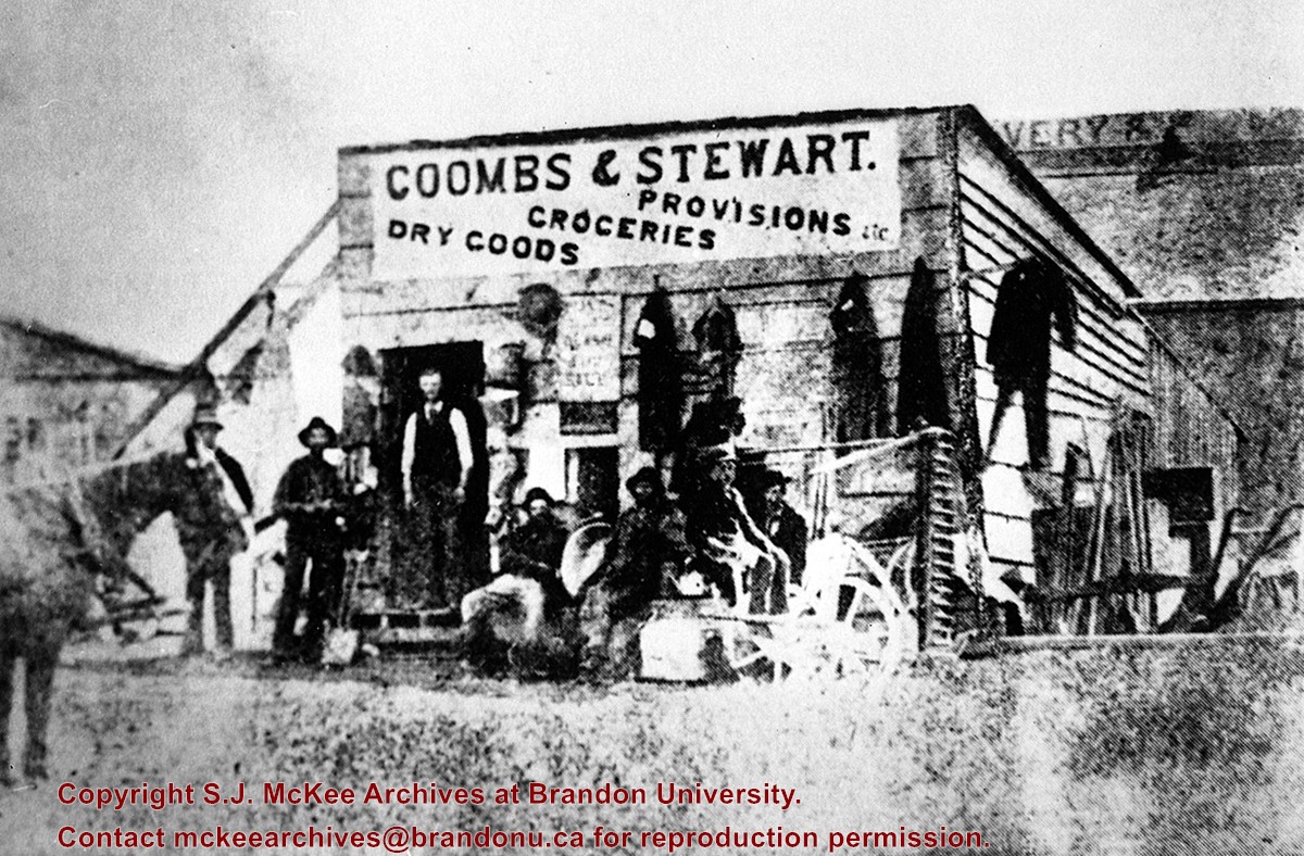
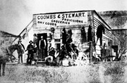
Photograph is stained and water damaged. A newspaper clipping about William (Billy) Muir is glued to the top left hand corner of the mat. The image is exfoliated in the right hand corner. The negative has been reverse printed.
History / Biographical
Coombs & Stewart opened the first general store in Brandon in 1881, which was located on 6th Street and Pacific Avenue. According to G.F. Barker (Brandon: A City, 1977, 291), William (Billy) Muir worked at the store until he opened his own grocery store in 1888.
Custodial History
Donated to Fred McGuinness by Allena Strath (nee Coombs).
Scope and Content
Photograph shows the Coombs & Stewart general store located on the corner of Pacific Avenue and 6th Street. A group of men pose in front of the wood-framed store.
Notes
Back of photograph reads: One of first stores in Brandon, Coombs...[?]
This store, the first established in Brandon (June 12, 1881), was erected on the southeast corner of 6th St. & Pacific Avenue, facing Pacific.
Coombs and Steward later opened a store on the northeast corner of 9th St. & Rosser Ave.
Billy Muir was Coombs & Stewart's first clerk. He later opened a store of his own on the west side of the 100 block of 6th St., which he operated for nearly 50 years. (I was often a customer as a kid - LAS). Billy Muir closed his 6th Street store June 1945 (Brandon Sun). [See E18]
Custodial History
For custodial history see the collection level description of the Lawrence Stuckey collection.
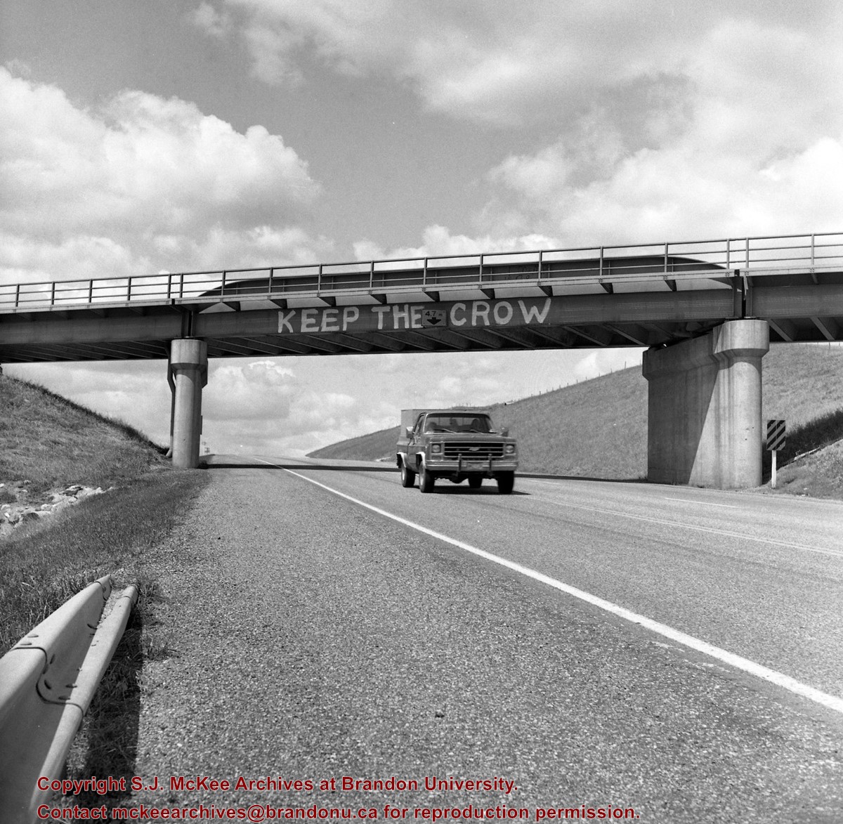
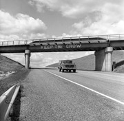
Mr. Stuckey's notes: Similar painting on other side "Refuse the Cruise." Bridge newly painted July or Aug. 83.
Custodial History
For custodial history see the collection level description of the Lawrence Stuckey collection.
Scope and Content
Image of CP Bridge over Hwy. 10 "KEEP THE CROW", Minnedosa, Manitoba. Image was taken along the CPR Minnedosa & Bredenbury subdivision (ex. Manitoba & N.W. Railway).
Notes
["KEEP THE CROW" appears to have been spray painted on the side of the bridge].
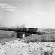
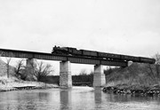
For custodial history see the collection level description of the Lawrence Stuckey collection.
Scope and Content
Image of CPR Highway 10 bridge (town in background) and XW 5693-5703-5918-5960-5947-3036, Minnedosa, Manitoba. Image was taken along the CPR Minnedosa & Bredenbury subdivision (ex. Manitoba & N.W. Railway).


%0a)
%0a)
%0a)
+and+XW+5693-5703-5918-5960-5947-3036%2c+Minnedosa%2c+Manitoba.)