View is southwest from approximatley 16th Street between Princess and Rosser Avenues. Photograph shows the Brandon University campus, as well as surrounding residential blocks, including Flemming, J.R. Reid and Vincent Massey schools.
View is west southwest from approximatley 16th Street between Princess and Lorne Avenues. Photograph shows the Brandon University campus, as well as surrounding residential blocks between 16th and 23rd Streets, Princess and Louise Avenues..
View is west from approximatley 17th Street between Lorne and Louise Avenues. Photograph shows a portion of the Brandon University campus (excluding the Education Building and anything north of it), as well as surrounding residential blocks from approximatley 17th Street to 22nd Street.
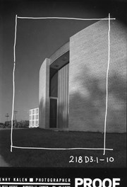
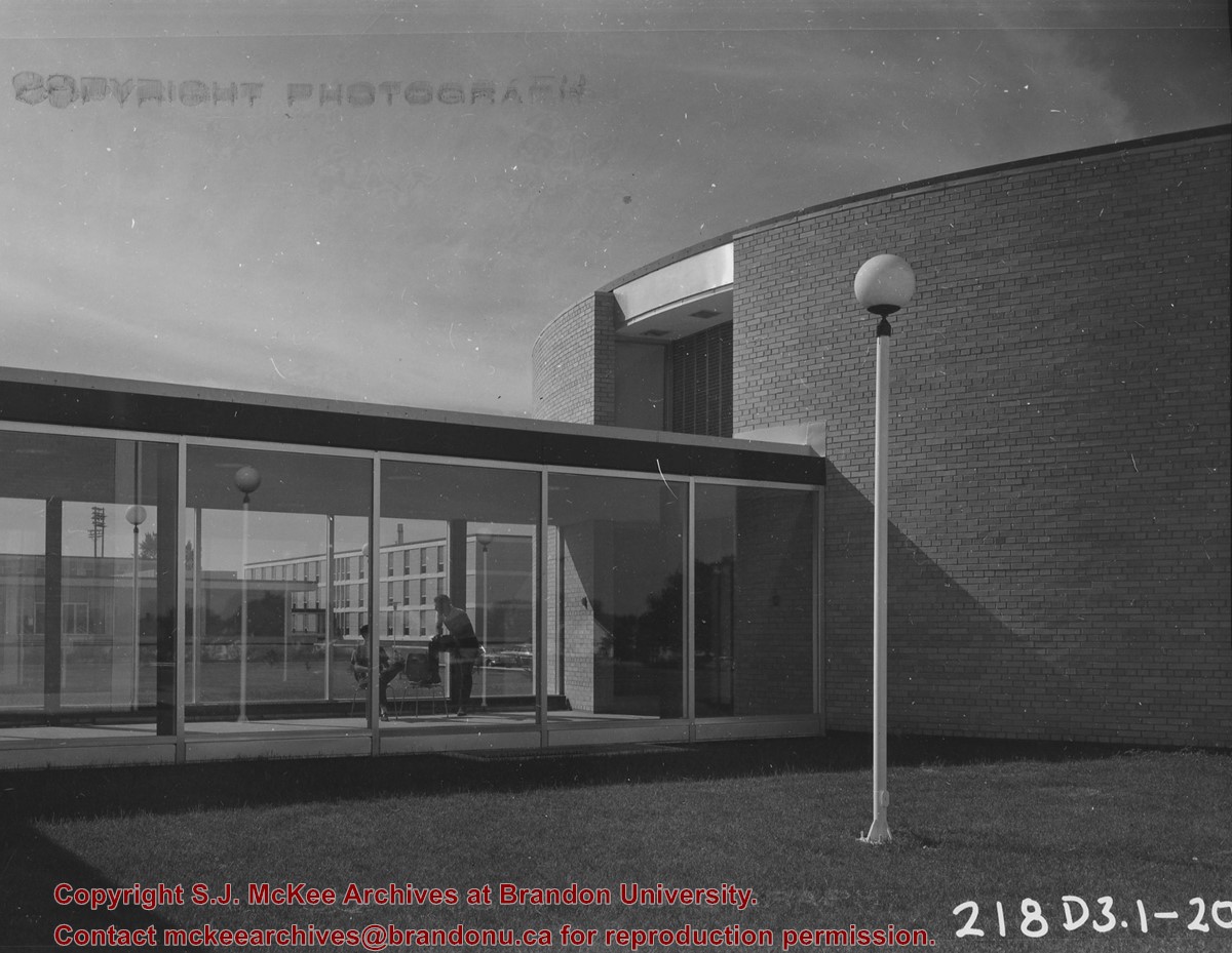
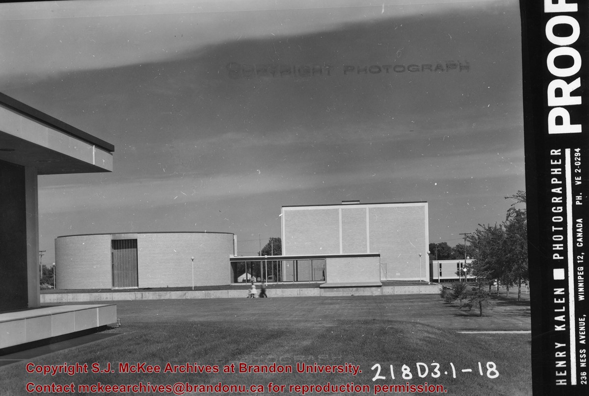
Photograph is looking southwest and shows the north side of the link and the east side of the J.R.C. Evans Lecture Theatre. The Dining Hall and Darrach Hall are visible through the link.
Photograph is looking north northwest and shows the south side of the J.R.C. Evans Lecture Theatre, the A.E. McKenzie Building and the link between the two buildings.
Photograph is looking north and shows the south side of the J.R.C. Evans Lecture Theatre, the A.E. McKenzie Building and the link between the two buildings. The photograph is looking across the quadrangle.
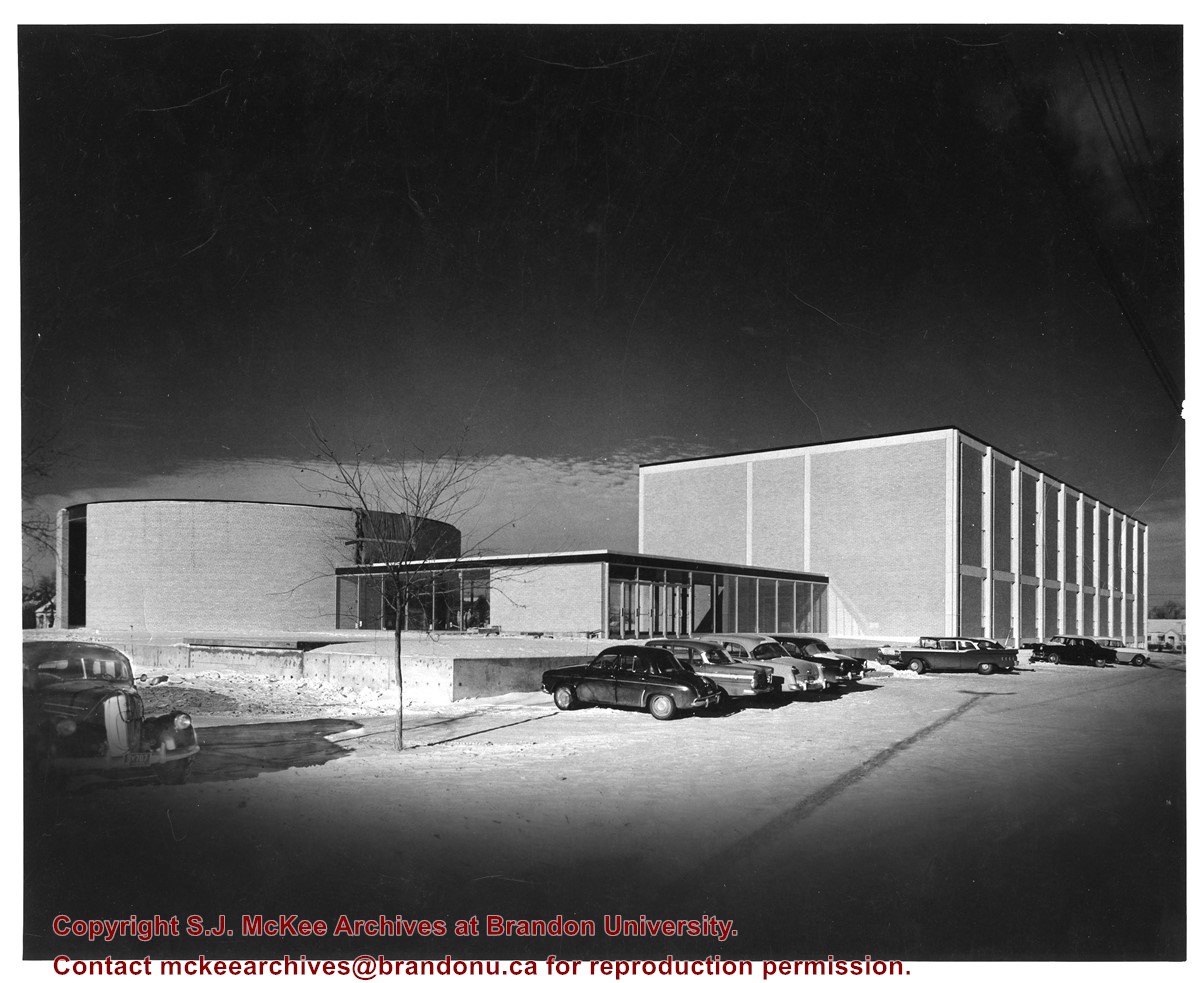
Photograph is looking northwest and shows the J.R.C. Evans Lecture Theatre, the A.E. McKenzie Building, the link between the two buildings and a number of cars parked on the east side of the buildings. Photograph was taken during winter.


