Photograph of 10th Street facing north from Princess Avenue. Vehicles are parallel parked on both sides of the street. The Welcome Brandon sign can be seen at the Rosser Avenue intersection.
Visible businesses on the west side of 10th Street include: Doig's, Box Brothers Hardware and Allied Hardware Stores in the Alexandra Block; followed by Simpsons-Sears in the Strathcona Block. Barry Neill Men's Wear, Kresge's and the Cecil Hotel are also visible. The Johnny Smith Block is visible in the background.
Visible businesses on the east side of 10th Street include: Ollies Steaks and Chops, Elna Sewing Centre, Carlton Cafe, Chop Suey. At the base of the hill the Canadian Pacific train station is visible at the base of the hill.
Notes
Writing on the front of the postcard reads: Tenth St. Brandon, Man.
Red ink stain is on the front right corner of postcard
Scope and Content
Photograph shows 10th Street facing south from Princess Avenue. Visible landmarks and businesses include: Manitoba Power Commission (MPC)'s power sub-station, First Baptist Church, Wheat City Arena, and the grand stand at the Exhibition Grounds.
The partial sign visible at the bottom of the photograph on the east side of 10th Street reads Yates and Neale, which refers to a plumbing and heating company that dissolved in 1943 to be replaced by Neale, Stothard and Chapman.
Businesses on the west side of 10th Street include: Dominion Tire & Radio Co., Bolts Barber Shop, Elviss T.E. Co. Stables.
Notes
Information concerning Yates and Neale courtesy Jack Stothard. Writing on the front of the postcard reads: Brandon, Looking S.W., Jerrett Photo. This photograph shows a rare view of the 200-block of 10th Street.
Photograph shows a sketch of the intersection at 10th Street and Princess Avenue, Brandon, Manitoba facing northeast. A proposed two-storey bowling alley is situated on the northeast corner of 10th Street and Princess Avenue.
One small hole, some pencil marks and stains. A couple of the names are illegible.
History / Biographical
The Brandon Normal School was an arm of the provincial Department of Education. Manitoba Normal schools were initiated in the early 1880s (1882 for protestant teachers and 1883 for Roman Catholic ones) to meet the demand for teachers in the province's schools. Normal schools were held in Brandon at various locations until the construction of the Brandon Normal School in 1912 under the Roblin government. The Brandon Normal School operated until 1946.
Custodial History
Photograph was donated to the McKee Archives by Janette Donnelly in 1999.
Scope and Content
Portraits of the students and staff of Brandon Normal School's third class spring term (1921).
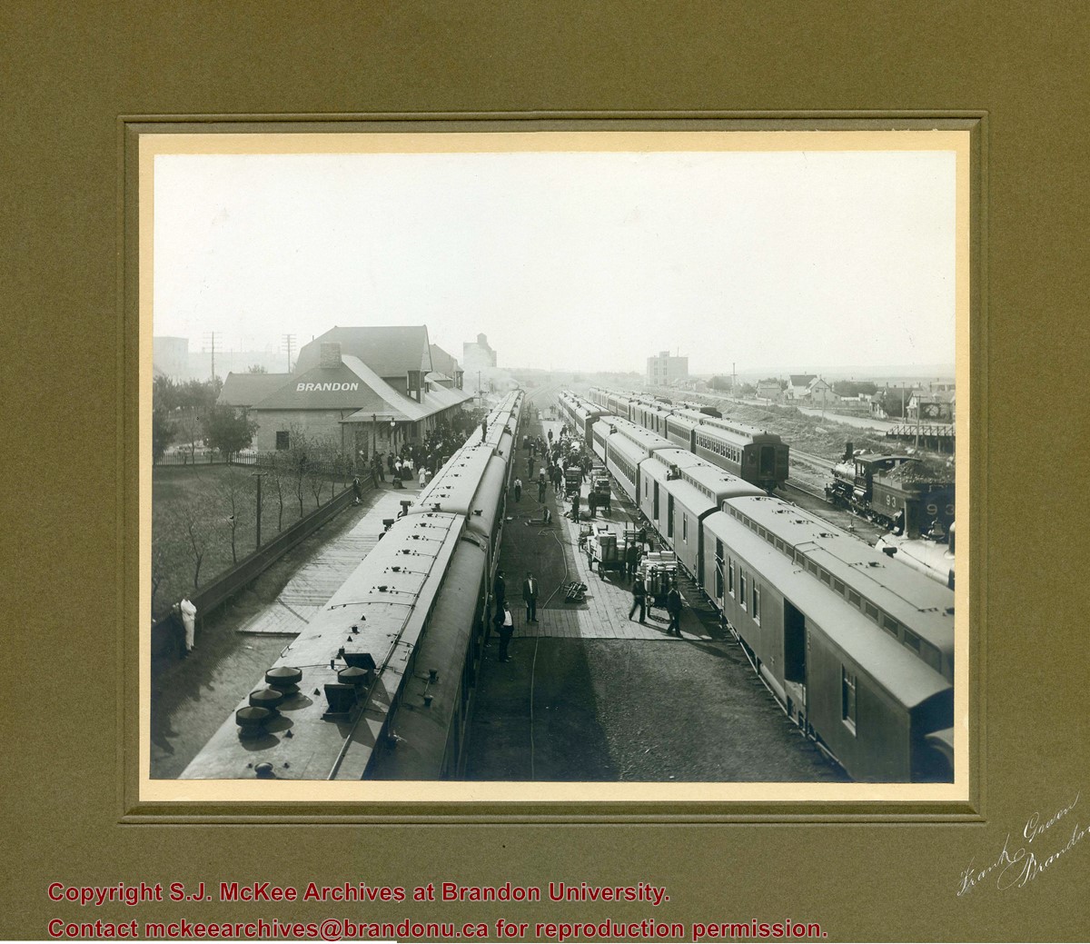
Photograph shows a CPR passenger trains at the old Brandon train station. Carts/trolleys appear to be loaded with wooden crates and metal milk containers. Photograph was likely taken from the 8th Street Bridge. The ramp to the 8th Street Bridge can be seen on the ride of the photograph, where residences line Assiniboine Avenue.
Photograph shows the intersection of 10th Street and Princess Avenue, Brandon, Manitoba. View is facing northwest along west side of the 100-block of 10th Street. A stationary policeman/divider is at the centre of the intersection. Visible businesses include: Doig's, Plaza Shoe Shop, and Cambridge Clothes Shop. A horse-drawn sled is parked in front of Doig's store. The Olympia Block, Cecil Hotel, and CPR Station are visible in the background.
Photograph of an east side of 10th Street facing north from Princess Avenue. Visible businesses include: Thunderbird Bowl, Canadian Pacific Telegraphs, Pittsburgh Paint & Glass, Strand Theatre, Trans Canada Credit Loans, Ted Heming Jewellers, Carlton Cafe, McKenzie Seeds, Clement Block, Mitrou's Cafe and Tea Room, and Brandon Musical Supply Ltd. Vehicles parked on 10th Street are facing north.
Notes
Photograph dated from "Tara's Bulba," the movie playing at the Strand Theatre and similiar vehicles captured in the photograph.
Photograph shows the Greyhound Bus Depot at 11th Street and Princess Avenue. Western Motors, Wheelers Esso Station, and the Prince Edward Hotel are visible along the south side of Princess Avenue. Traffic is travelling one-way on Princess Avenue.
Photograph shows the northwest corner of 10th Street and Princess Avenue. Traffic on the west side of Princess Avenue appears to travelling both ways. A car waits at the intersection.
Above the west entrance on the corner building is an electric sign that spells "Hughes Bldg." A second storey has yet to be added to the portion of the Doig's shop that is adjacent to the Alexandra Block.
Fitwell Tailors, a barber shop, and the Federal Building are visible on Princess Avenue.
Notes
A negative is contained in the same enclosure with the print.
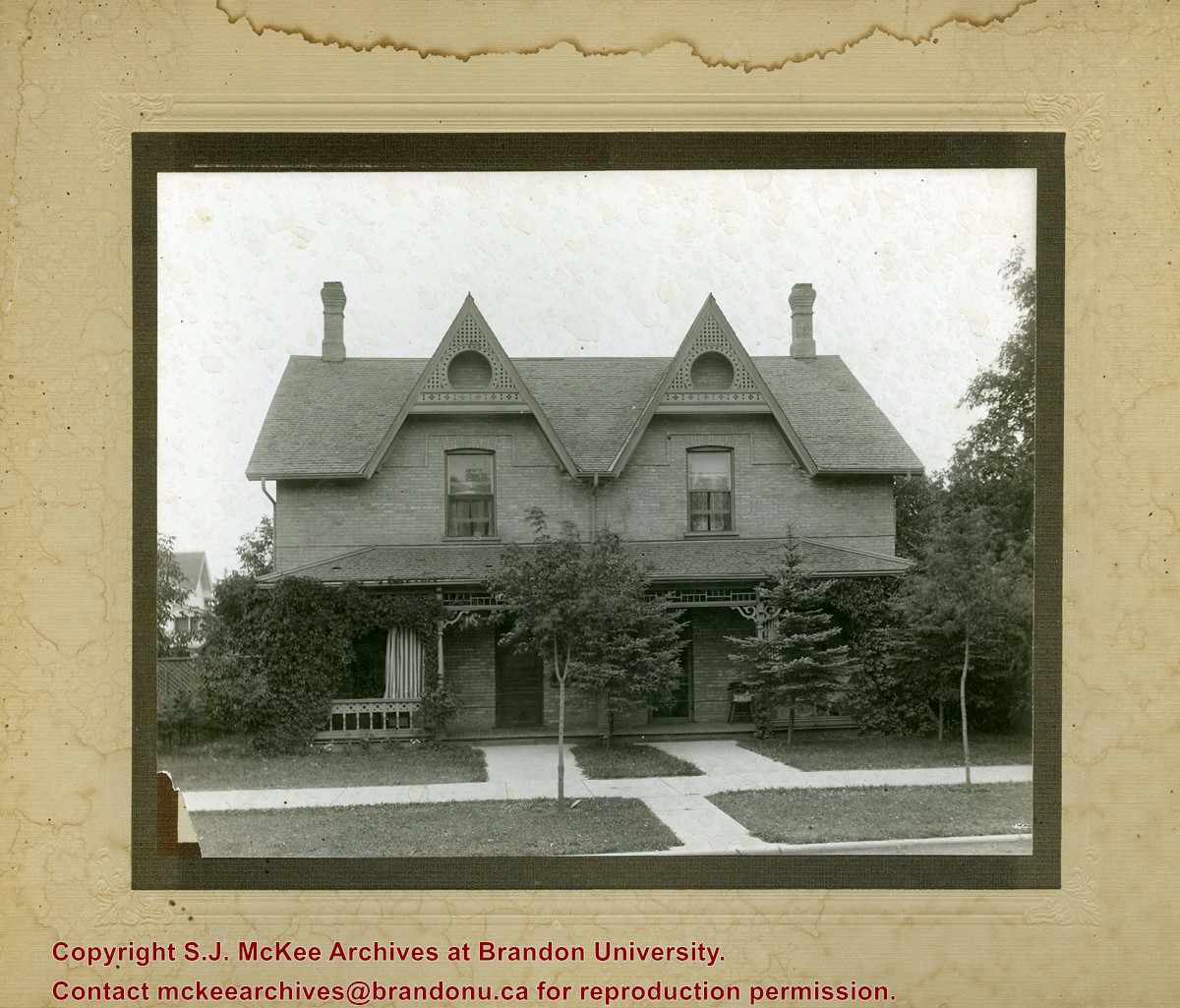
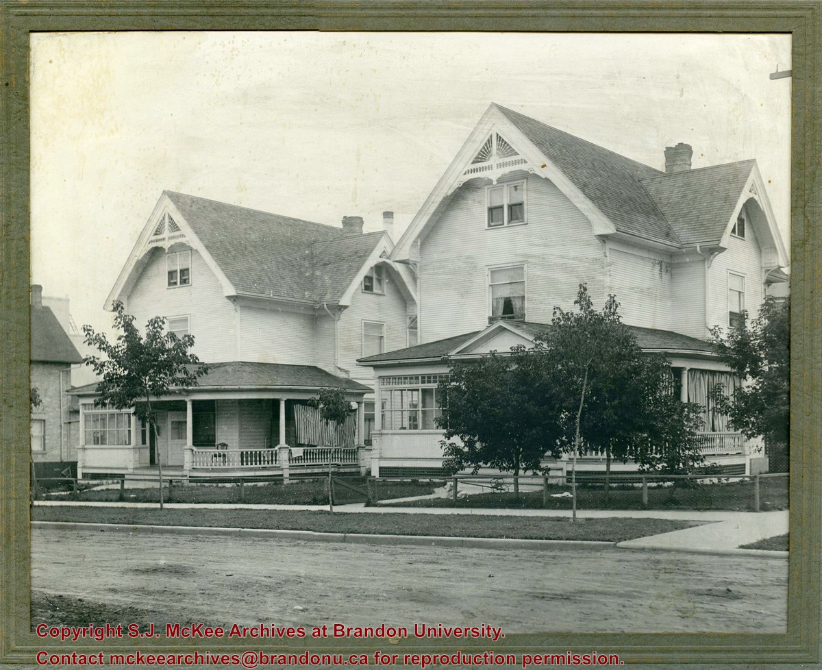
Photograph shows a two identical wood-framed homes. Both homes are three-stories, with wrap-around porches with a glassed-in sunroom and two gables with wooden sunburst ornamentation. The property on the right has curtains hanging in the porch, the other property has a striped blanket to block the sun. The properties are surrounded by a low chain-link/chicken wire-like fence with wooden posts. Saplings and grass have been planted on the boulevard in front of the properties. The road in front of the houses appears to be unpaved, while the curbs and sidewalks and appear to be concrete.
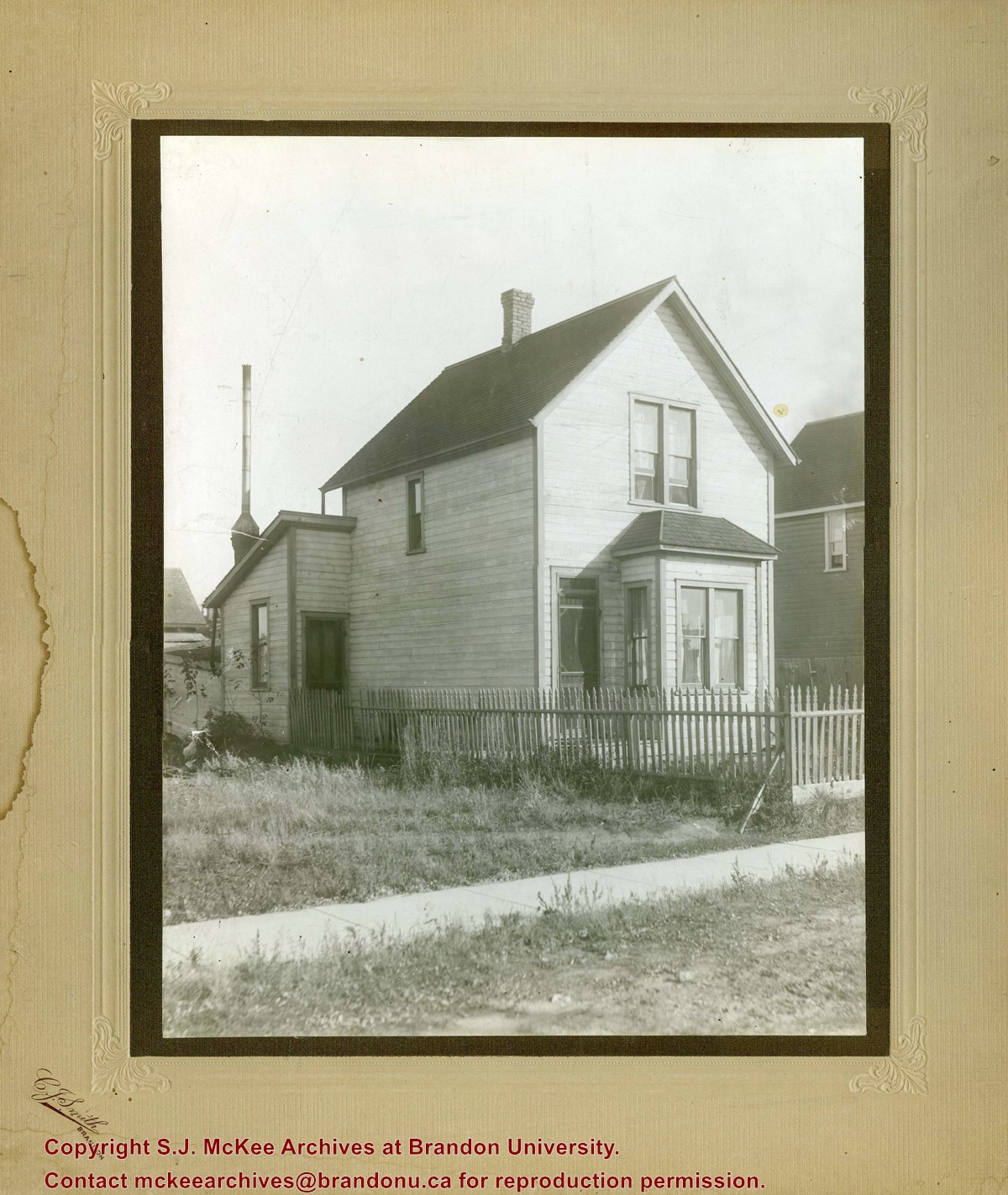
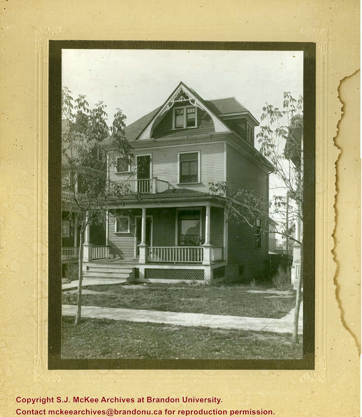
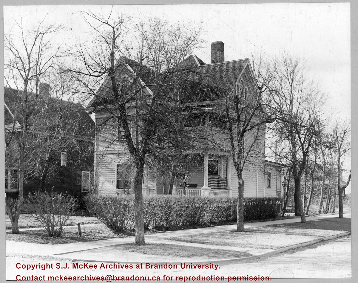
Photograph shows a three-storey wood framed house with a front porch, second storey balcony, and third-storey gable and dormer winder. Saplings have been planted on the boulevard.
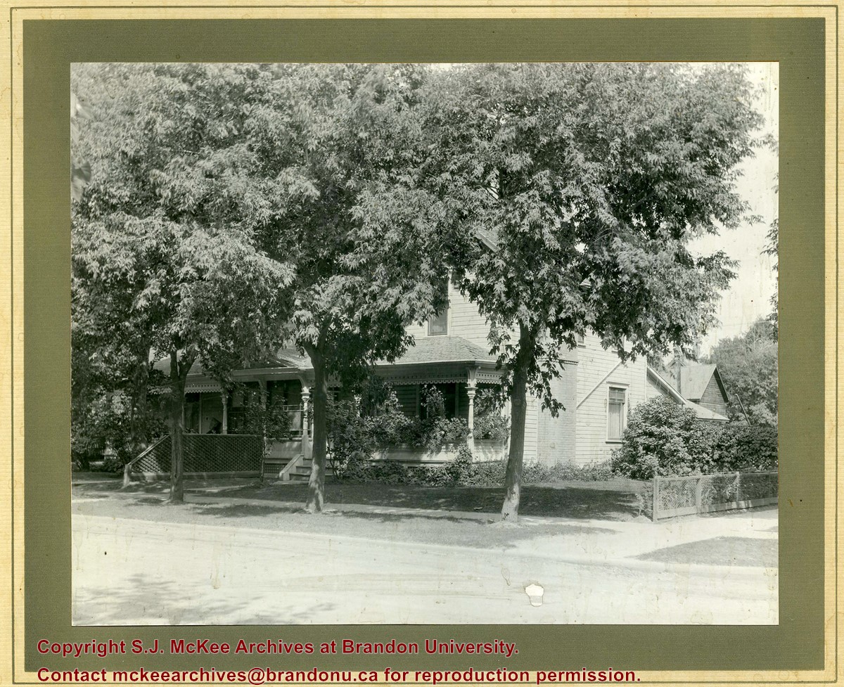
Photograph shows a two-storey wood-framed duplex. The building appears to be situated on a corner. The front verandas have wooden ornamentation and a lattice fence separates the front yards. Flowers and viriginia creeper appear in flower beds along the side of one house.
Notes
The location has been identified as the 7th Street Terrace between Lorne and Louise Avenues.
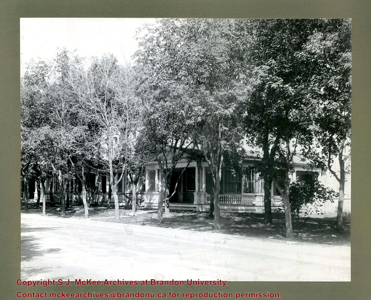
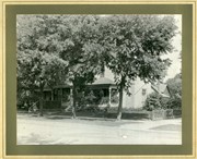
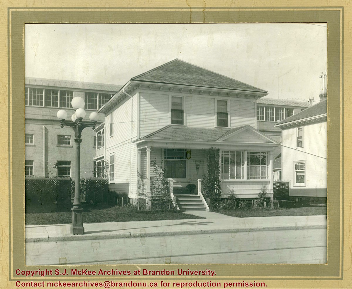
Photograph shows a two-storey wood-framed house with front porch and sunroom. Above a rocking chair and chez lounge, a Union Jack and pennant hang on the exterior wall on the porch. A five-globed black iron street lamp is on the sidewalk in front of the property. The Wheat City Arena can be seen behind the residence.
Notes
Based on the presence of the arena, the location has been identified as 10th Street near Victoria Avenue.
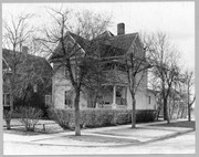
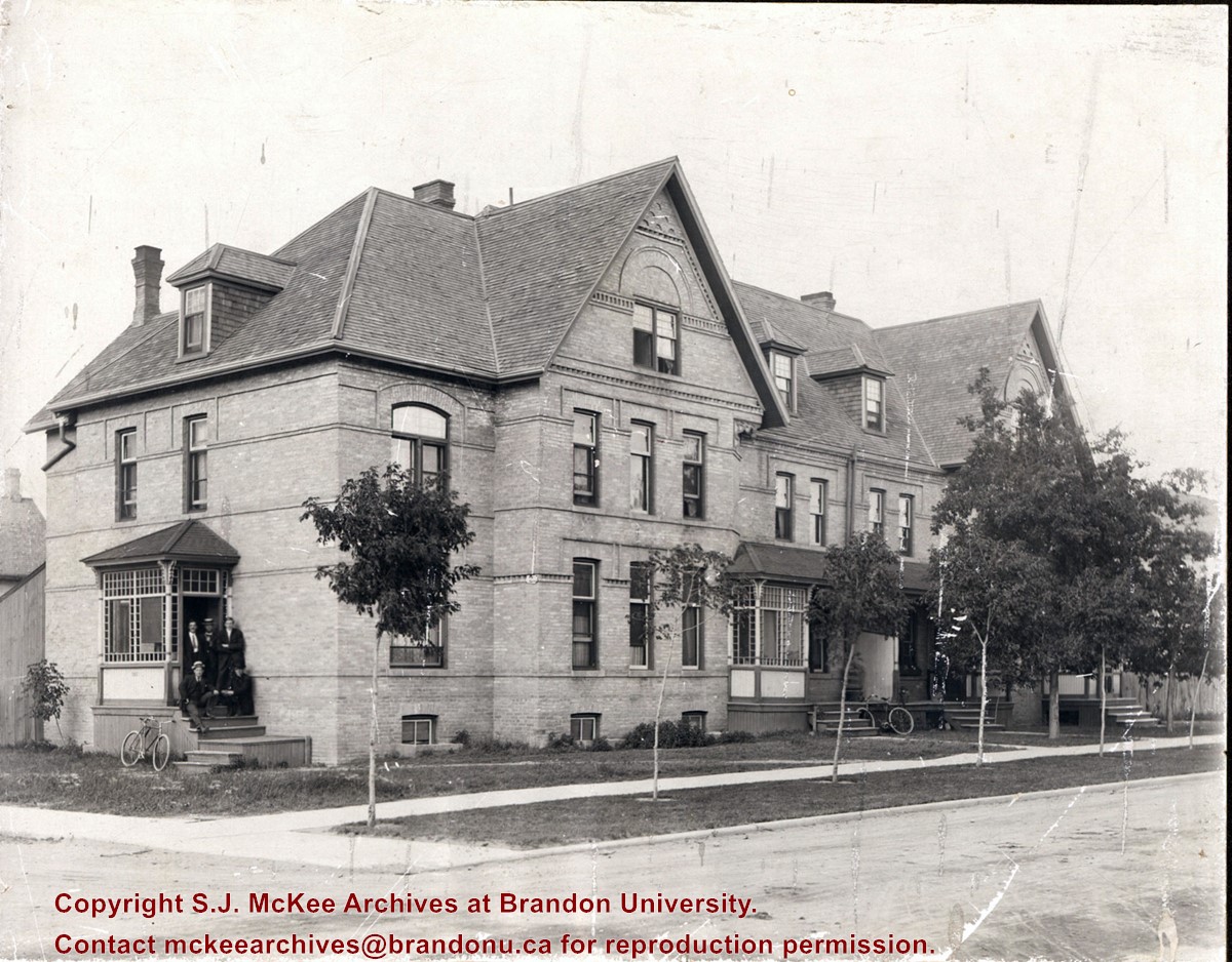
Photograph shows a three-storey multi-family brick house that appears to have at least four units. The structure also has a basement. A group of five men are posing on a stoop on the west side of the building. Sapplings have been planted on the boulevard in front the building.
Notes
Writing on the back of the photograph reads: Lorne Terrace, 12th and Lorne, always in the Hughes Family.
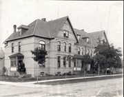
Photograph is scratche and scuffed. Top right corner is creased.
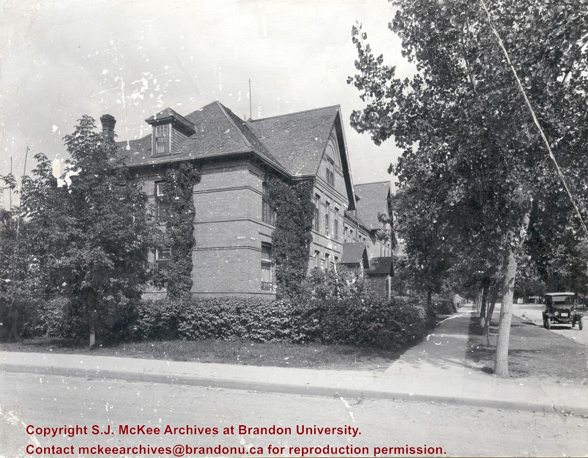
Scope and Content
Photograph shows the three storey brick terraced property at 12th Street and Lorne Avenue. The entrance/stoop on the west side of the property appears to have been removed and the Lorne Street entrances have been modified (see 3-1997.72 for a comparison). Ivy is growing up the side of the house and the tree on the boulevard have grown and tower above the roof-line. A motor car is parked on Lorne Avenue in front the property.


