Skip header and navigation

Revise Search

3 records – page 1 of 1.

Part Of
Brandon University Photograph collection
Description Level
Item
GMD
graphic
Date Range
c. 1985
Part Of
Brandon University Photograph collection
Description Level
Item
Series Number
2.1
Item Number
BUPC 2.1.60
GMD
graphic
Date Range
c. 1985
Physical Description
5" x 3.5" (colour)
Scope and Content
Photograph shows the removal of one of the houses formerly located on 20th Street between Louise and Princess Avenues. The houses on those blocks were removed to create parking lots for the University. A Fed Zavislak Ltd. Well Drilling & Trucking pickup truck is visible at the curb.
Subject Access
campus photographs
Brandon streets
Images
Show Less
Part Of
Brandon University Photograph collection
Description Level
Item
GMD
graphic
Date Range
c. 1985
Part Of
Brandon University Photograph collection
Description Level
Item
Series Number
2.1
Item Number
BUPC 2.1.61
GMD
graphic
Date Range
c. 1985
Physical Description
5" x 3.5" (colour)
Scope and Content
Photograph shows the removal of one of the houses formerly located on 20th Street between Louise and Princess Avenues. The houses on those blocks were removed to create parking lots for the University.
Subject Access
campus photographs
Brandon streets
Images
Show Less

North side of the A.E. McKenzie Building

http://archives.brandonu.ca/en/permalink/descriptions770
Part Of
Brandon University Photograph collection
Description Level
Item
GMD
graphic
Date Range
c. mid 1980s
Part Of
Brandon University Photograph collection
Description Level
Item
Series Number
2.4
Item Number
BUPC 2.4.3
GMD
graphic
Date Range
c. mid 1980s
Physical Description
3.5" x 5" (colour)
Scope and Content
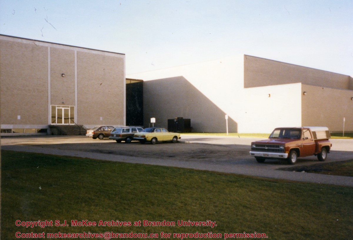
Photograph is looking southwest from in front of the Original Music Building and shows the north side of the A.E. McKenzie Building and the west side of the Queen Elizabeth II Music Building (including the link). A number of cars in the parking lot are also visible.
Images
Show Less