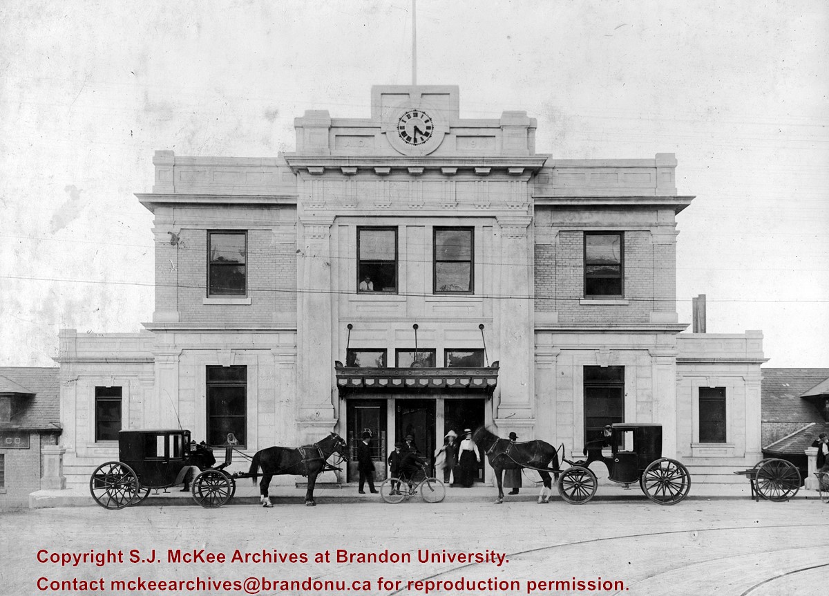
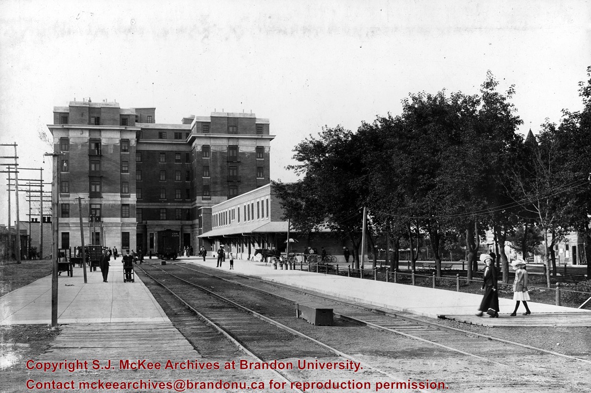
The 1911 station, shown in this photograph, was annexed to the old station by a breezeway. Addition architectural information is available in the Assiboine Historical Society's Brandon: An Architectural Walking Tour pamphlet (1982).
Custodial History
See fonds level description of the Alf Fowler collection for custodial history.
Scope and Content
Photo is looking north from 10th Street and shows the front of the Canadian Pacific Railway depot, located on the northside of Pacific Avenue. A number of people and vehicles a visible in front of the building.
Notes
History/Bio information taken from the Assiboine Historical Society's Brandon: An Architectural Walking Tour pamphlet (1982).
Storage Range
RG 5 Western Manitoba Manuscript collection - photograph storage drawer
See fonds level description of the Alf Fowler collection for custodial history.
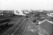
Scope and Content
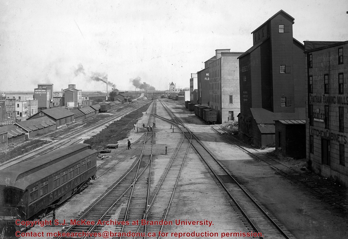
Photo shows the Canadian Pacific Railway tracks looking east from the Overhead bridge. Businesses in the photograph include: Chatham Fanning Mills; Ogilvie; Hanbury Manufacturing Co.; and Western Canada Flour Mills Co. Ltd. The rail car in the bottom left of the photo reads "The World's Greatest Independent Show, The Great Sells-Floto, Circuses Consolidated."
Storage Range
RG 5 Western Manitoba Manuscript collection - photograph storage drawer
See fonds level description of the Alf Fowler collection for custodial history.
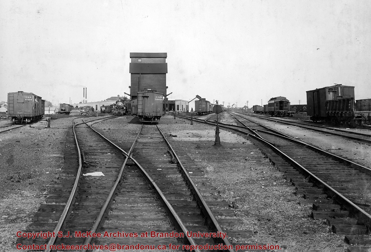
Scope and Content
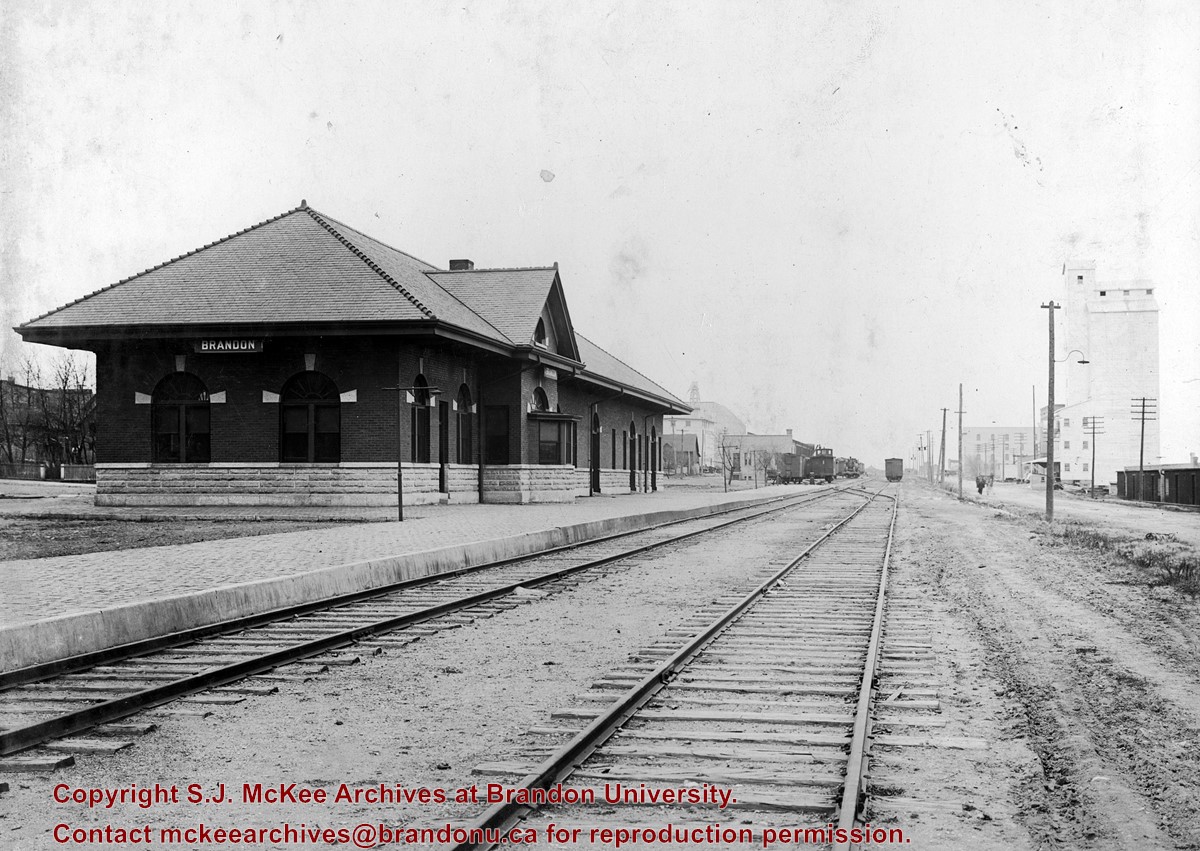
Photo of the Canadian Northern Railway depot, located between 9th and 10th Streets. The Prince Edward Hotel is in the background.
Notes
An 11.75" x 8" (b/w) print of this photograph is located with the original at 6-1999.19. A digital scan of the photograph is available on a CD located in the Archives' office.
Storage Range
RG 5 Western Manitoba Manuscript collection - photograph storage drawer
See fonds level description of the Alf Fowler collection for custodial history.
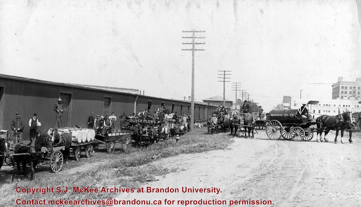
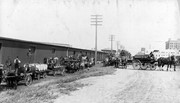
Scope and Content
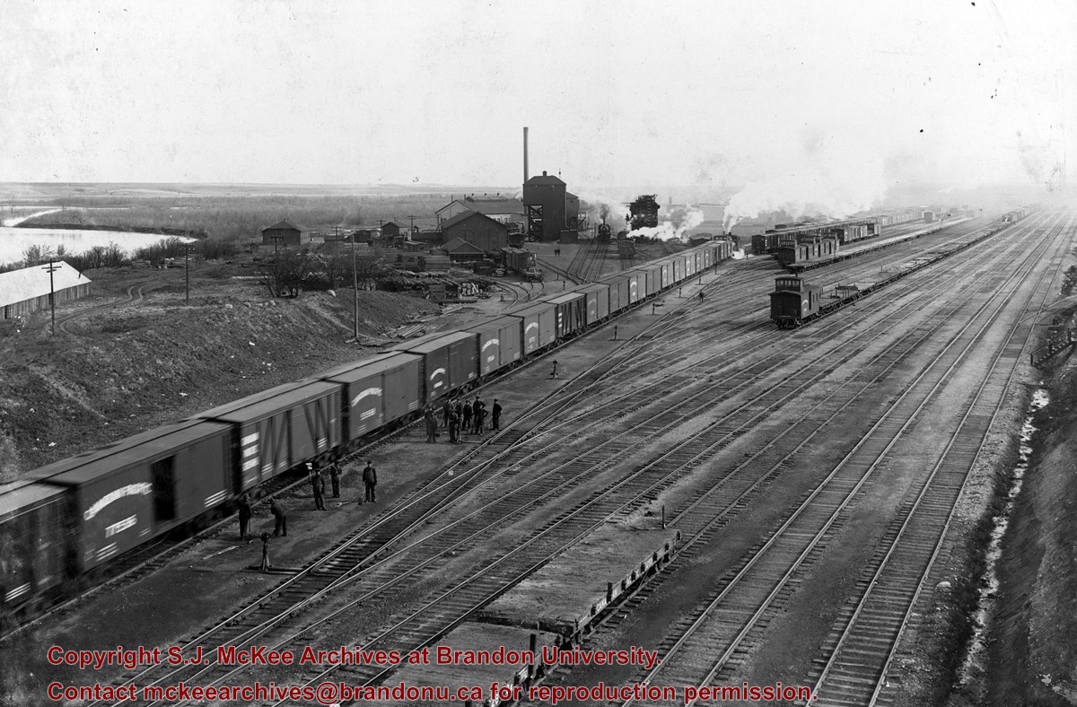
Photo shows a number of horse-drawn vehicles parked alongside the Canadian Pacific Railway freight sheds. Includes carts for: Campbell's (for rugs and linoleum), Oliver Plows and Imperial Oil Co. The Codville Company Limited, wholesale dealers is visible in the background on the right.
Storage Range
RG 5 Western Manitoba Manuscript collection - photograph storage drawer
View is southwest from approximatley 16th Street between Princess and Rosser Avenues. Photograph shows the Brandon University campus, as well as surrounding residential blocks, including Flemming, J.R. Reid and Vincent Massey schools.
View is west southwest from approximatley 16th Street between Princess and Lorne Avenues. Photograph shows the Brandon University campus, as well as surrounding residential blocks between 16th and 23rd Streets, Princess and Louise Avenues..
View is west from approximatley 17th Street between Lorne and Louise Avenues. Photograph shows a portion of the Brandon University campus (excluding the Education Building and anything north of it), as well as surrounding residential blocks from approximatley 17th Street to 22nd Street.
View is west northwest from approximatley 16th Street and Louise Avenue. Photograph shows the Brandon University campus, prior to the Library Extension, and a large portion of the city to the west of the campus.
View is northwest from approximatley 16th Street and Louise Avenue. Photograph shows the Brandon University campus, prior to the Library Extension, and a large portion of the city to the west of the campus.
Photograph shows the removal of one of the houses formerly located on 20th Street between Louise and Princess Avenues. The houses on those blocks were removed to create parking lots for the University. A Fed Zavislak Ltd. Well Drilling & Trucking pickup truck is visible at the curb.
Photograph shows the removal of one of the houses formerly located on 20th Street between Louise and Princess Avenues. The houses on those blocks were removed to create parking lots for the University.
View is northeast probably from the roof of McMaster Hall. Photograph shows the construction of the new roof on Clark Hall and the Brandon College Building. A portion of the east side of the 000 and 100 blocks of 18th Street, as well as the corner of 18th Street and Rosser Avenue are visible in the upper left hand corner. This includes the "Downtown Brandon" sign.


