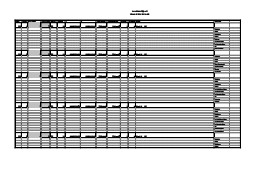
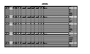
Artifact catalogue containing records from the excavation units 56 to 65 at Lovstrom Block B.
Scope and Content
Spreadsheet containing information about the artifacts recovered, including: unit, level, artifact number, catalogue number, depth, co-ordinates, entry date, date recovered,count, weight, UTM co-ordinates, notes(excavators initials and comments) and artifact identification.
Jane Gibson was crew chief for the Lovstrom locale in 1987. Her field journals contain information about all Block/sites excavated. This journal related to Block C on pages 27 to 49.
Scope and Content
Record of excavation methods, items recovered, features, local environment and weather noted by teaching assistant.
ARCH 2: North Lauder Locale
The North Lauder locale has a long archaeological and geological history that is important for understanding the forces that shaped the region. Archaeological research in the locale shows that the area has been occupied by humans for at least the past 6,500 years. Environmental forces provided an area of diverse resources that attracted early peoples.
Environment of the Lauder Sandhills
The North Lauder locale is part of the greater Lauder Sandhills area. The glaciers that covered this region began to recede approximately 11,000 years ago leaving a large lake known as glacial Lake Hind. The Souris River, the Lauder Sandhills and the Oak Lake Aquifer are remnants of the environmental and geological forces that shaped the region.
The Lauder Sandhills region is characterized by a landscape of sand sheets and stabilized sand dunes interspersed with a variety of wetlands. This complex topographic and hydrological situation favoured the development of an island mosaic of mixed forest, wetland and meadow, surrounded by mixed grass prairie. The result was a large, isolated ecotone which provided a rich variety of subsistence resources for hunter-gatherers.
Research in the Lauder Sandhills
Archaeologists from Brandon University have been conducting research in the Lauder Sandhills since 1991. Research in the North Lauder locale has focused on the Atkinson site, a 6,500 year old hunter-gatherer site and Flintstone Hill.
The Atkinson site
The Atkinson site is one of the oldest excavated sites in Manitoba and has been Radiocarbon dated to 6,500 years before present. The Atkinson site is located on the bank of the Souris River and was discovered when a hearth (fire pit) was seen eroding out of the bank. Based on the date of the site and the kind of lithics (stone tools) present it is considered a Gowen occupation. The Atkinson site is evidence that bison hunters were active on the northern plains at a very early date. Similar sites have also been found on the High Plains in the U.S. and are referred to as the Mummy Cave Complex.
The Atkinson Site is of great importance as it is the first undisturbed site of this type to be excavated in Manitoba and extends the range of these sites south and east from the type-sites in central Saskatchewan.
Flintstone Hill
The geomorphology of the glacial Lake Hind Basin over the past 11,000 years is known primarily through the study of a cut bank along the Souris River. Flint Stone Hill contains the most complete stratigraphic record for the post-glacial period on the northern plains. The site has been extensively studied by geoarchaeologists, geologists and paleoenvironmentalists over many years and their findings have contributed to our understanding of the region.
The North Lauder locale Borden designations of Atkinson site DiMe-27 and Flintstone Hill site DiMe-26.
Borden System
Archaeological sites in Canada are identified by the Borden system, which is a uniform site designation system. The country is divided into grids based on latitude and longitude in blocks of 10 x 20 minutes. The first 4 letters indicate the block and the following numbers indicate the actual site. For example the area of the Lauder Sandhills in southwestern Manitoba is identified by the letters DM and the North Lauder locale within that area is DiMe. The Atkinson site is DiMe-27 and the Flintstone Hill site DiMe-26. As new sites are discovered they will be numbered sequentially.
Scope and Content
The Series has been divided into two sub-series, including (1) Atkinson site DiMe-27 and Flintstone Hill site DiMe-26.
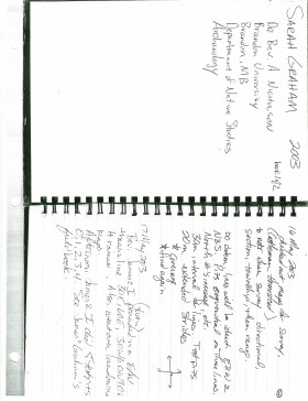
In 2003 Units 1 to 9 were excavated at the Sarah site by supervisor James Graham and crew of Sarah Graham, Mike Evans, Todd Kristensen, Shayne Kolesar, Lisa Sonnenburg and Emily Ansell.
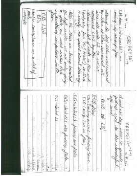
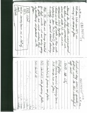
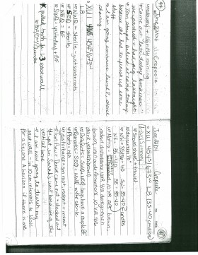
Excavations took place in 2003 at Crepeele West (Units 1-5) and Crepeele East (Units 6-9). The site was subsequently renamed the Sarah site DiMe-28. Sarah Graham's field journal contains notes on the Casselman survey and Crepeele 2003 as well as the Sarah site 2003.
Scope and Content
Record of excavation methods, items recovered, features, local environment and weather noted by teaching assistant.
Radiocarbon date reports have been scanned in multi-page PDF files.
History / Biographical
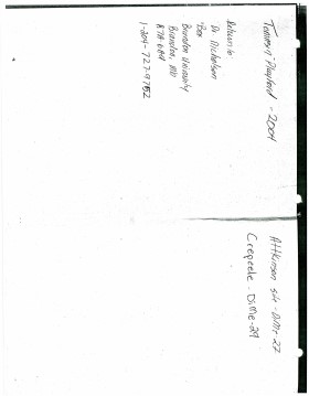
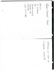
North Lauder Radiocarbon Date report by IsoTrace Laboratory for Atkinson site #TO-10640.
Radiocarbon dating
The technique of radiocarbon dating was developed by Willard Libby and his colleagues at the University of Chicago in 1949.
Radiocarbon dating is used to estimate the age of organic remains from archaeological sites. Organic matter has a radioactive form of carbon (C14) that begins to decay upon death. C14 decays at a steady, known rate of a half life of 5,730 years. The technique is useful for material up to 50,000 years. Fluctuations of C14 in the atmosphere can affect results so dates are calibrated against dendrochronology. Radiocarbon dates are calibrated to calendar years.
Dates are reported in radiocarbon years or Before Present. Before Present refers to dates before 1950. The introduction of massive amounts of C14, due to atomic bomb and surface testing of atomic weapons, has widely increased the standard deviation on all dates after A.D. 1700 causing these dates to be unreliable.
Accelerated mass spectrometry can more accurately measure C14 with smaller samples and can date materials to 80,000 years.
Scope and Content
Sub sub series contains radiocarbon dates from: Atkinson site and Flintstone Hill.
Images of a Prairie City was a photography display of early Brandon circa 1912. The exhibition presented images of Brandon in the years immediately prior to the Great War when the city had moved beyond a pioneer stage and taken on the features of a modern North American urban centre, boasting parks, exhibitions, paved streets, and the latest trends in architecture and transportation.
Custodial History
These photographic images were drawn from the Alfred Fowler collection held at the S.J. McKee Archives. They were used in an exhibit entitled "Images of a Prairie City" in March 2004. The exhibit was located on The Curve Gallery in the John E. Robbins Library and curated by Christy Henry.
Scope and Content
Consists of 21 photographic prints (in frames) used by the Archives.
Notes
Seven photographs and the information page are on display in Student Services, McKenzie Building, Room 102. Six are on dislay in McKenzie Building, Room 117 and two are on display in McKenzie Building, Room 104. The remainder of the display is in storage at RG 6 Brandon University fonds
Series 8: Library Services 8.2, S.J. McKee Archives. The prints stored in the Archives should be handled with great care.
Storage Location
RG 6 Brandon University fonds
Series 8: Library Services
8.2 S.J. McKee Archives
Elphinstone Co-operative Elevator Association Limited Organizational papers: 1927 - 1978 Memorandum of Association and General By-laws, 11 August 1927 Certificate of incorporation, 17 August 1927 Minutes of first general meeting of shareholders, 18 January 1928 Minutes of first permanent Directors' meeting, 18 January 1928 Memorandum of Agreement, By-laws 8, 9, 10 and 11, 12 November 1929 Minutes of the Shareholders' meeting, 25 July 1931 Directors meeting minutes, 25 July 1931 ECEAL By-law no. 12 \& 13, 25 July 1931 Agreement between Elphinstone CEAL and MPEL, 1 August 1931 Letter re Supplementary Agreement, 16 November 1933 Agreement between Elphinstone CEAL and MPEL, 2 February 1933 Letter, 28 June 1944 Agreement between Elphinstone CEAL and MPEL, 1 August 1937 Ageement between Elphinstone CEAL and MPEL, 1 November 1937 ECEAL By-law no. 16, 4 November 1939 Letter re By-law no. 16, 24 March 1941 ECEAL By-law to authorize cancellation of share capital, 2 November 1940 Letter, 24 March 1941 ECEAL By-laws 18, 19, 20 and General By-laws, 15 July 1941 MPE General By-laws, 23 October 1941 ECEAL By-law no. 21, 7 November 1947 Letter re By-law no.21, 27 August 1948 Letter re amendment to General By-laws, 6 May 1949 ECEAL By-law no. 22, 20 June 1949 MPEL By-law amending the general By-laws of the Co., 7 March 1950 Agreement between ECEAL and MPEL, 1 August 1951 ECEAL By-law no. 23, 21 November 1921 MPEL By-law no. 1961-148, 12 October 1961 Directors' resolution, 18 October 1961 Agreement between MPEL and ECEAL, 15 December 1966 ECEAL By-law no. 26, 4 April 1967 Letter re Pioneer Grain Co., 23 February 1978 Minutes of Executive Board meetings, volume 1, 4 February 1928 - volume 7, 13 November 1980 Minutes of Shareholders Annual meetings, 1929 - 1968 (37 reports) Financial records and statistics Statement of surplus, 1937 - 1955 (18 reports) Final statements, 1931 - 1952 (24 reports) Auditors' reports, 1929 - 1967 (26 reports) Analysis of operating results, 1951 - 1963 (11 reports) Detail of grain earnings, 1963 - 1967 (4 reports) Capital loan summary, 31 July 1951 Correspondence, 1929 - 1969 Membership list, 1929 - 1930, 1978 Corporate Name: Rural Municipality of Strathclair
Notes
File numbering is not congruous between sub-series arranged prior to 2009 and sub-series arranged or added to after 2009. This will be corrected in the future