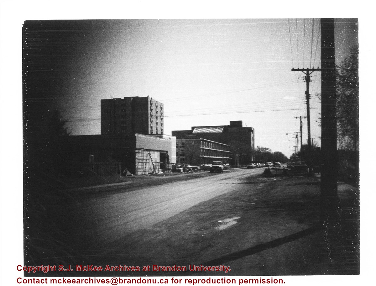
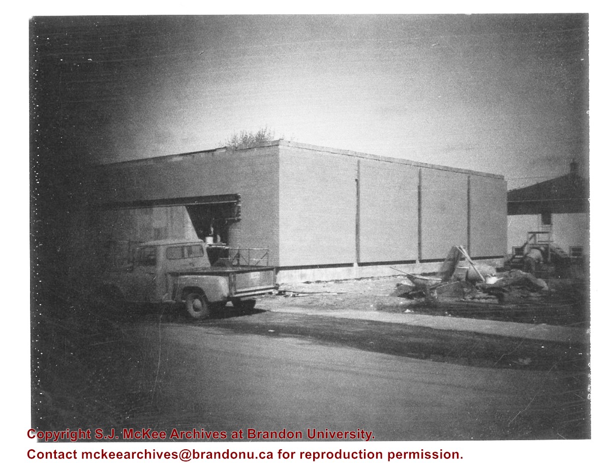
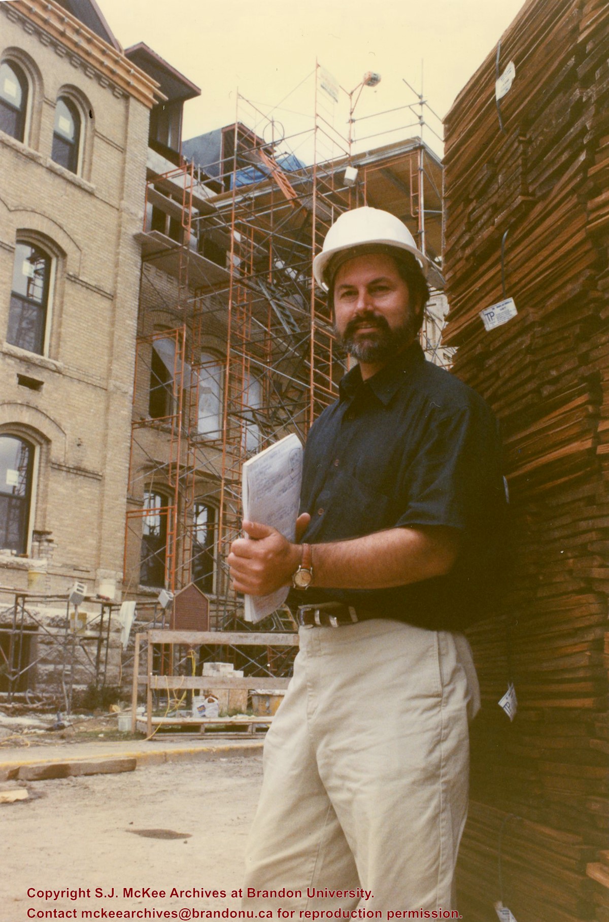
Donkersloot began working at Brandon University in 1970/1971 as the Clerk of Works. From 1973 until his retirement, he was the Director of Physical Plant.
The Site Services building was built in 1971.
Custodial History
Photograph was taken by Tom Donkersloot during construction and stored in albums in the Physical Plant H-Hut until they were transfered to the McKee Archives by Doug Duncalf in May 2008.
Scope and Content
Photograph shows construction of Brandon University's Site Services Building located on Louise Avenue at the corner of 20th Street. Also visible are McMaster Hall, Flora Cowan Women's Residence and the John R. Brodie Science Centre. Photograph is looking east/northeast from approximately 21st Street.
Notes
Donkersloot recorded the date and time each photograph was taken on the back of the photos.
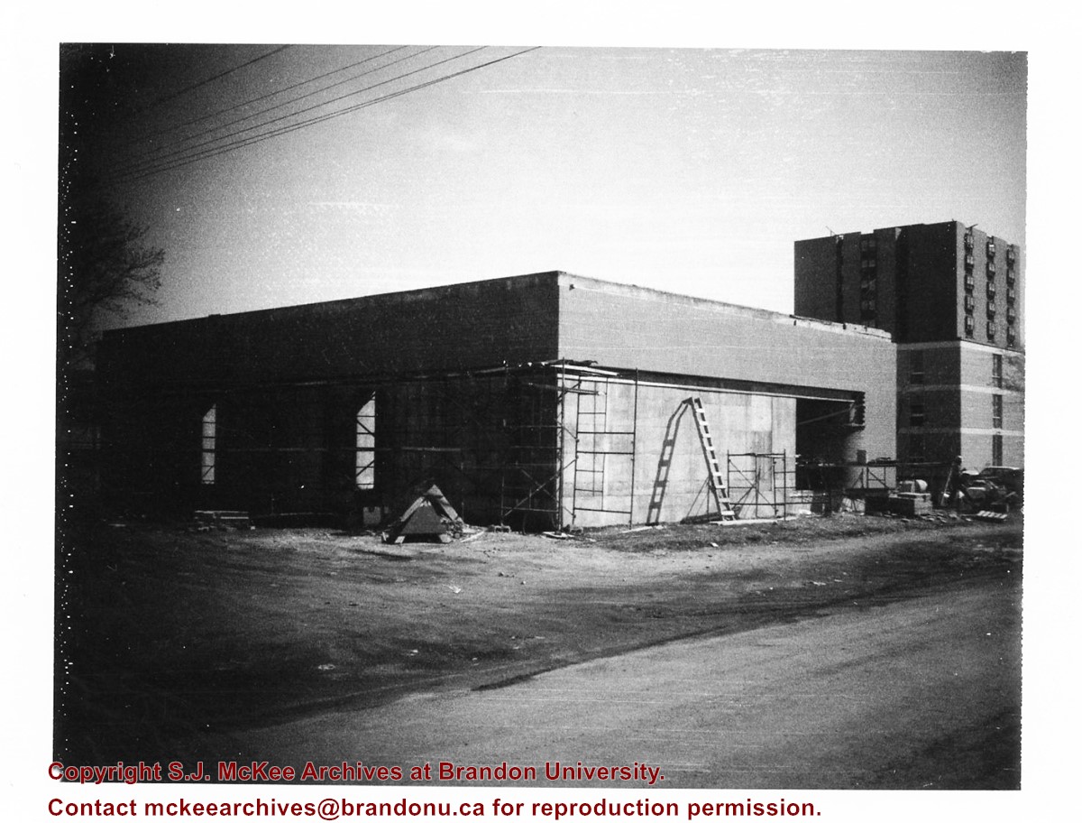
Donkersloot began working at Brandon University in 1970/1971 as the Clerk of Works. From 1973 until his retirement, he was the Director of Physical Plant.
The Site Services Building was built in 1971.
Custodial History
Photograph was taken by Tom Donkersloot during construction and stored in albums in the Physical Plant H-Hut until they were transfered to the McKee Archives by Doug Duncalf in May 2008.
Scope and Content
Photograph shows construction of Brandon University's Site Services Building located on Louise Avenue at the corner of 20th Street. Also visible are McMaster Hall and part of Darrach Hall. Photograph is looking northeast.
Notes
Donkersloot recorded the date and time each photograph was taken on the back of the photos.
Donkersloot began working at Brandon University in 1970/1971 as the Clerk of Works. From 1973 until his retirement, he was the Director of Physical Plant.
The Site Services Building was built in 1971.
Custodial History
Photograph was taken by Tom Donkersloot during construction and stored in albums in the Physical Plant H-Hut until they were transfered to the McKee Archives by Doug Duncalf in May 2008.
Scope and Content
Photograph shows construction of Brandon University's Site Services Building located on Louise Avenue at the corner of 20th Street. Photograph is looking northwest.
Notes
Donkersloot recorded the date and time each photograph was taken on the back of the photos.
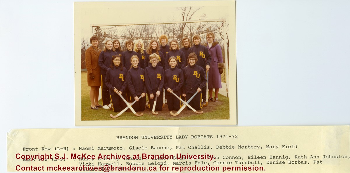
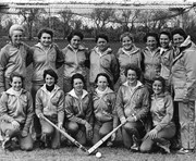
Portrait of the Brandon University Lady Bobcats field hockey team. Front Row (L to R): Naomi Marumoto, Gisele Bauche, Pat Challis, Debbie Norbery, Mary Field. Back Row (L to R): Nancy Stanley (Coach), Glenda Bodnariuk, Gwen Connon, Eileen Hannig, Ruth Ann Johnston, Vicki Hanwell, Bobbie Lelond, Marcia Hale, Connie Turnbull, Denise Horbas, Pat Butterfield (Manager).
There is a tear at the bottom of the photograph towards the right corner.
Scope and Content
Portrait of the Brandon University Lady Bobcats field hockey team. Back Row (L to R): Mary Jo Abbott, Diane Cop, Mona Harley, Brenda Johnson, Kirsty Henderson, Wendy Benyk, Jean Dell, Nancy Stanley (Coach). Front Row (L to R): Janet Fraser, Bev Cooper, Bev Morrison, Laurie King, Lucy Evans, Rona Henderson.
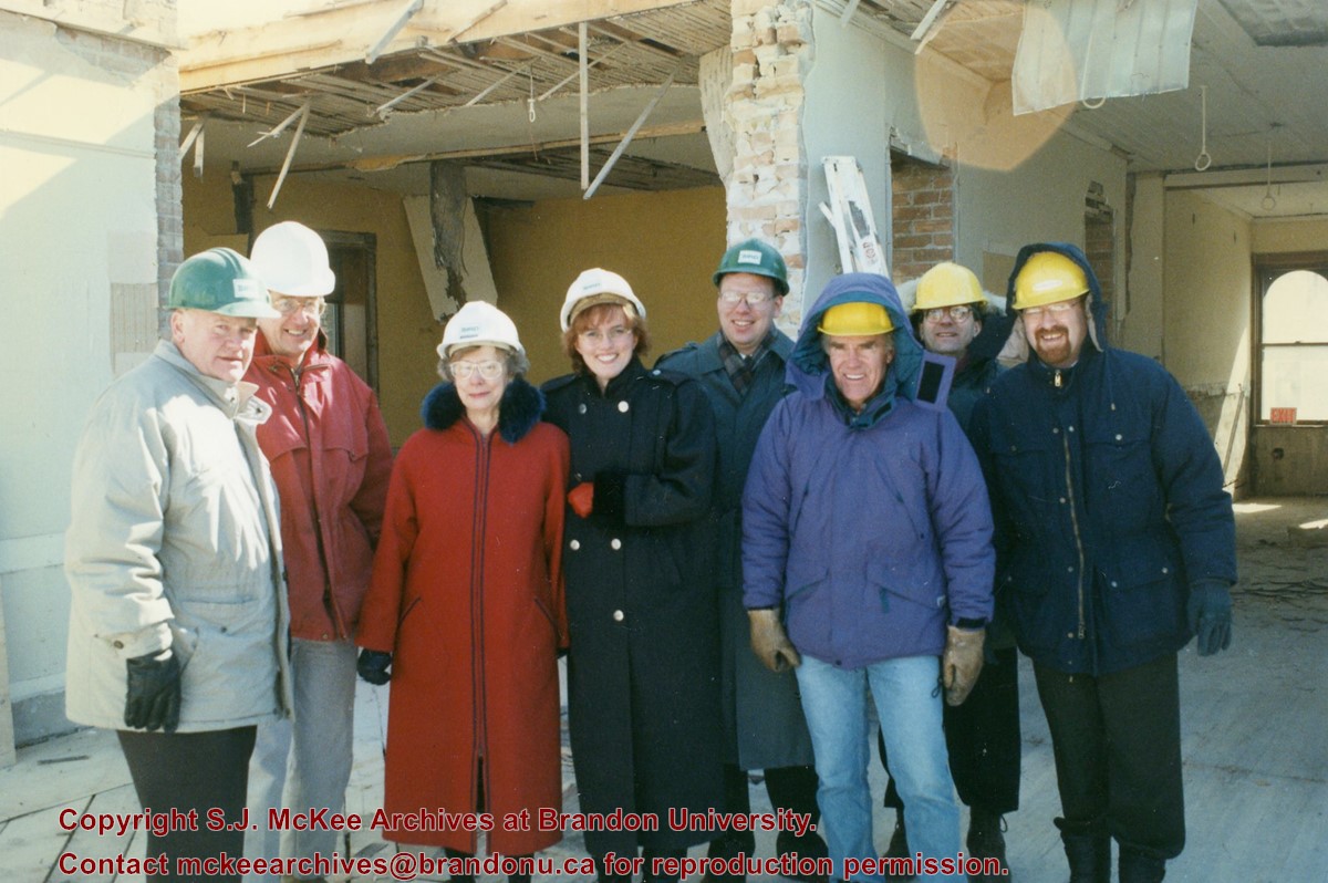
Photograph shows members of the Brandon University Foundation during a tour of the construction site. Members include: Scott Stewart, Doug Adams, Sheri Decter-Hirst.
McGill Field or the Brandon Municipal Airport is located 1.6 km north of Brandon. The historical buildings were part of the British Commonwealth Air Training plan during the Second World War. The Commonwealth Air Training Plan Museum now occupies those buildings.
Scope and Content
Photograph of McGill Field, including main terminal and outbuildings.
Repro Restriction
The McKee Archives is the copyright holder for the Stuckey materials.
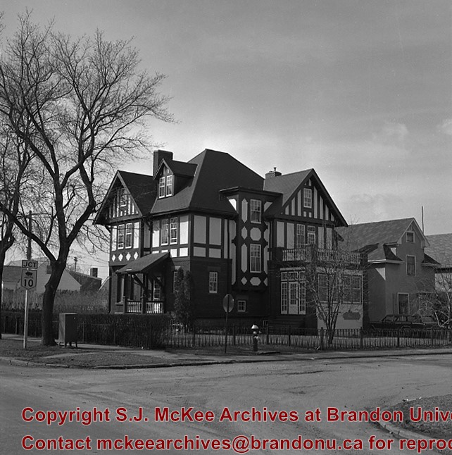
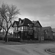
"Maley House was constructed in 1912 by Henry F. Maley, founder and owner of the Brandon Brewery Company. The house was purchased by Dr. McDiarmid, whose family occupied the home for the next sixty years. It is currently used as a bed and breakfast establishment" (Manitoba Culture, Heritage, Tourism and Sport). Maley House is listed as Manitoba Municipal Heritage Site No. 80.
Custodial History
For custodial history see the collection level description of the Lawrence Stuckey collection.
Scope and Content
[Maley House]; Elizabethan style
Notes
Located at 16th St. & Victoria Ave.
[Mr. Stuckey put two negatives in the same envelop, numbering them DE4a and DE4b. We have separated them.]
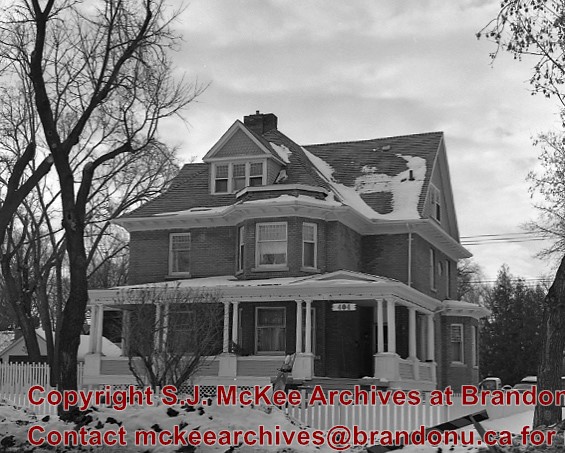
"Built in 1892 by Bell Brothers Construction, Lorne Terrace is a typical terrace house - a facility that combined several addresses in what would appear to be a very large house" (Manitoba Culture, Heritage, Tourism and Sport). It is currently listed as Manitoba Municipal Heritage Site No. 197.
Custodial History
For custodial history see the collection level description of the Lawrence Stuckey collection.
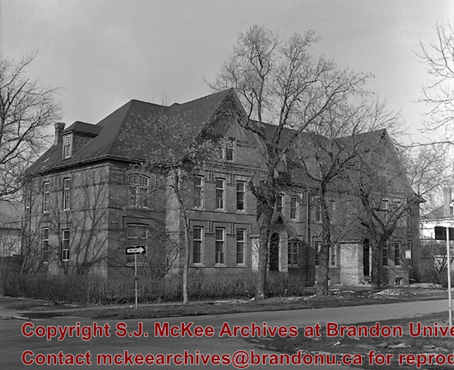
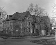
"Christie House was built in 1905 for Ernest Lisle Christie, founder of the huge stationary and school supply business that still bears his name. Christie and his family lived here until 1934, and the house was occupied by other family members until 1966. The house was designed by Brandon architect W.A. Elliott and was constructed by the local firm of G.C. Taylor" (Manitoba Culture, Heritage, Tourism and Sport). Christie House is listed as Manitoba Municipal Heritage Site No. 20.
Custodial History
For custodial history see the collection level description of the Lawrence Stuckey collection.
Introduction
Information on archaeological materials in this locale first came to the attention of Dr. Nicholson through Doug Jackson, a local artifact collector from Souris. Doug had observed archaeological materials that included bone, ceramics and lithic material that had been exposed by municipal road building activity, northwest of Lauder Manitoba
Environment
The Makotchi-Ded Dontipi locale is located among stabilized sand dunes in the Lauder Sandhills in Southwestern Manitoba, northwest of the village of Lauder. The area is a mosaic of medium grass prairie and copses of aspen poplar and aspen-oak, together with intermittent sedge grass marshes and small ponds. These wetlands are bordered with balsam poplar, water birch, willows and red osier dogwood.
The well-drained upland forest also contains saskatoon, chokecherry, wild current, hazelnut bushes and occasional wild plums. Lowland areas have nannyberries and high-bush cranberry. Wild strawberries grow in lightly shaded areas along trail margins and in open patches in aspen forest.
History of Excavations
The Makotchi-Ded Dontipi locale is a virtual "island" of forest and marshlands in a vast expanse of mixed grass prairie. This archaeologically and environmentally rich area was given the Dakota name Makotchi-Ded Dontipi, meaning "the place where we live".
Summation
Prior to European settlement, the area was a rich environment for hunter-gatherer people. Archaeological investigations from 1992 to 2002 have revealed numerous sites within the locale. Some of these sites have been extensively excavated while others have been identified or tested.
Seven sites that have been identified in this locale range in age from the historic through protohistoric periods and extend into the middle precontact period. The major sites are the initial Middle Missouri Duthie site, the late precontact Jackson, Bradshaw sites and the protohistoric Twin Fawns, Schuddemat and Hollow B sites. The multi-component Vera site includes historic Métis, late precontact Vickers Focus, and middle precontact Besant, Pelican Lake, McKean Complex and Oxbow occupations. Over 230 units were excavated as well as numerous test pits and several extensive surveys.
Scope and Content
Scope and Content
The Series has been divided into seven sub-series, including (1) Duthie site (2) Jackson site (3) Twin Fawns site (4) Vera site (5) Schuddemat site (6) Bradshaw site (7) Hollow B site.

.jpg?width=1200&404=no-img.jpg&watermark=wmk)
.jpg?width=180&404=no-img.jpg)
.jpg?width=1200&404=no-img.jpg&watermark=wmk)
.jpg?width=180&404=no-img.jpg)
.jpg?width=1200&404=no-img.jpg&watermark=wmk)
.jpg?width=180&404=no-img.jpg)
.jpg?width=1200&404=no-img.jpg&watermark=wmk)
.jpg?width=180&404=no-img.jpg)
.jpg?width=1200&404=no-img.jpg&watermark=wmk)
.jpg?width=180&404=no-img.jpg)
)
)
.jpg%3fmaxheight%3d1000%26maxwidth%3d1000%26watermark%3dwmk&description=McGill+field)
.jpg%3fmaxheight%3d1000%26maxwidth%3d1000%26watermark%3dwmk&description=Bell%27s+Field+Stone+Mansion)
.jpg%3fmaxheight%3d1000%26maxwidth%3d1000%26watermark%3dwmk&description=Bell%27s+Field+Stone+Mansion)
.jpg%3fmaxheight%3d1000%26maxwidth%3d1000%26watermark%3dwmk&description=Bell%27s+Field+Stone+Mansion)
.jpg%3fmaxheight%3d1000%26maxwidth%3d1000%26watermark%3dwmk&description=Bell%27s+Field+Stone+Mansion)