Brandon College looking south from 19th Street. Photograph was taken after Flora Cowan Hall was built but before construction of the Education Building.
Image shows the Brandon College campus from 17th Street looking southwest. The photo was taken after the completion of the original Music Building in 1963, but construction of the Education Building. Also visible are a number of properties on the 200 block of 18th Street and the 200 block of 20th Street.
Image is looking east northeast from approximately the 300 block of 23rd Street between Lorne and Louise Avenues. Photograph shows the Brandon College campus after the opening of the original Music Building in 1963, but before the construction of the Education Building in 1966. A number of house on the 300 blocks of 22nd and 21st Streets are visible in the foreground, with the A.E. McKenzie Seed Co., the Prince Edward Hotel and various grain elevators on the horizon.
For custodial history see the collection level description of the Lawrence Stuckey collection.
Scope and Content
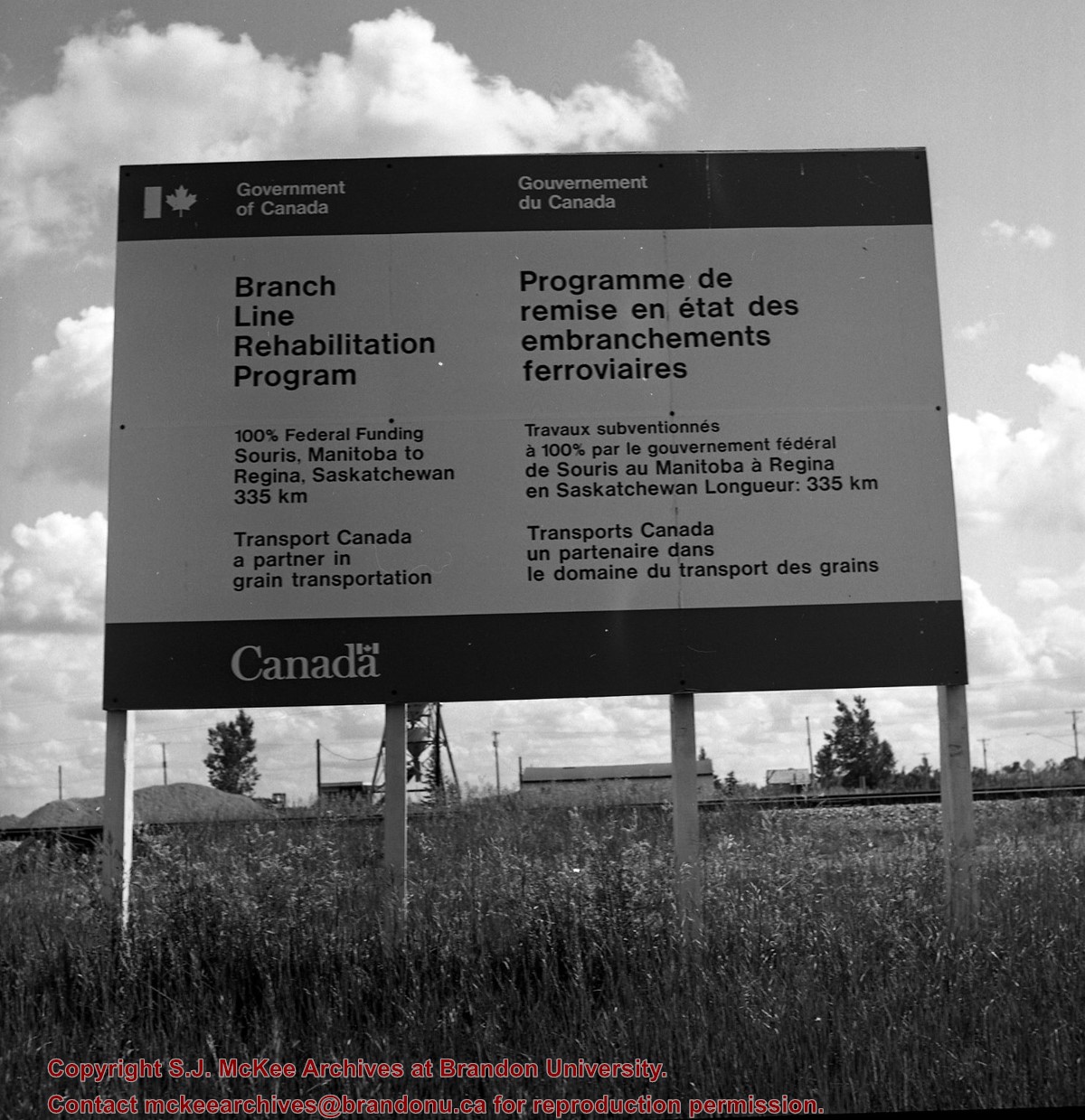
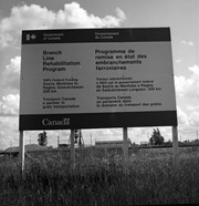
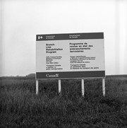
Image of a Prairie Branchline Rehabilitation Sign near Reston, Manitoba. Image was taken along the CPR lines south of the mainline.
Notes
[Image is of a Government of Canada sign which reads: Branch Line Rehabilitation Program. 100% federal funding. Souris, Manitoba to Regina Saskatchewan 335 km. Transport Canada, a partner in grain transportation].
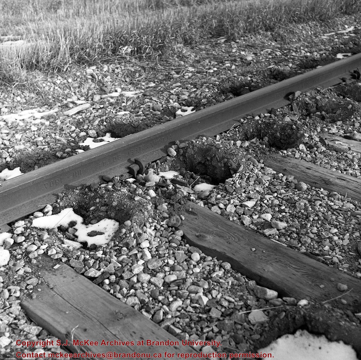
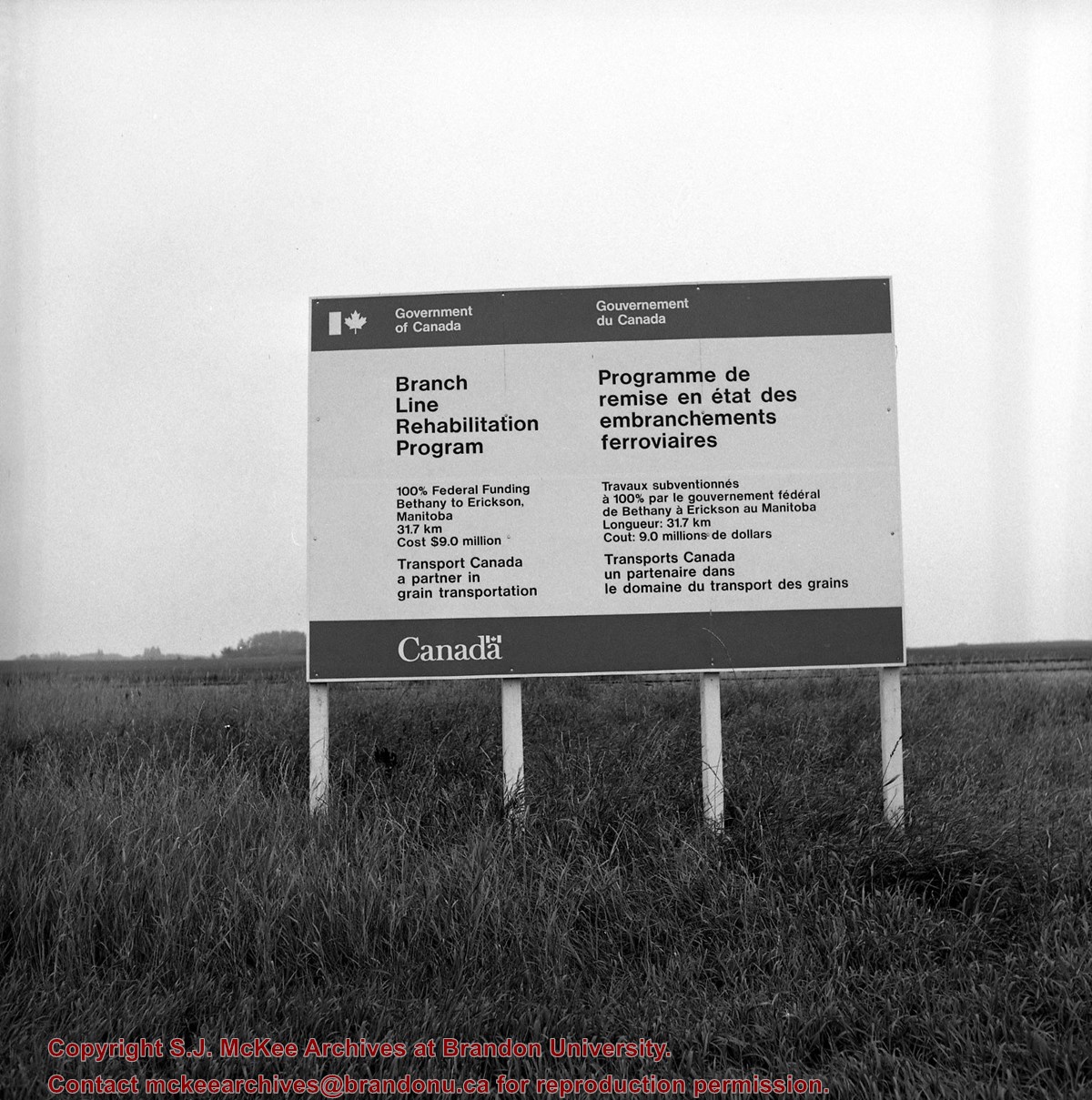
Stuckey's notes: Currently four ballast projects on Rossburn subdivision rails now in place. 60 pound Sammuels Steel 1902 will be replaced next year (CN employees).
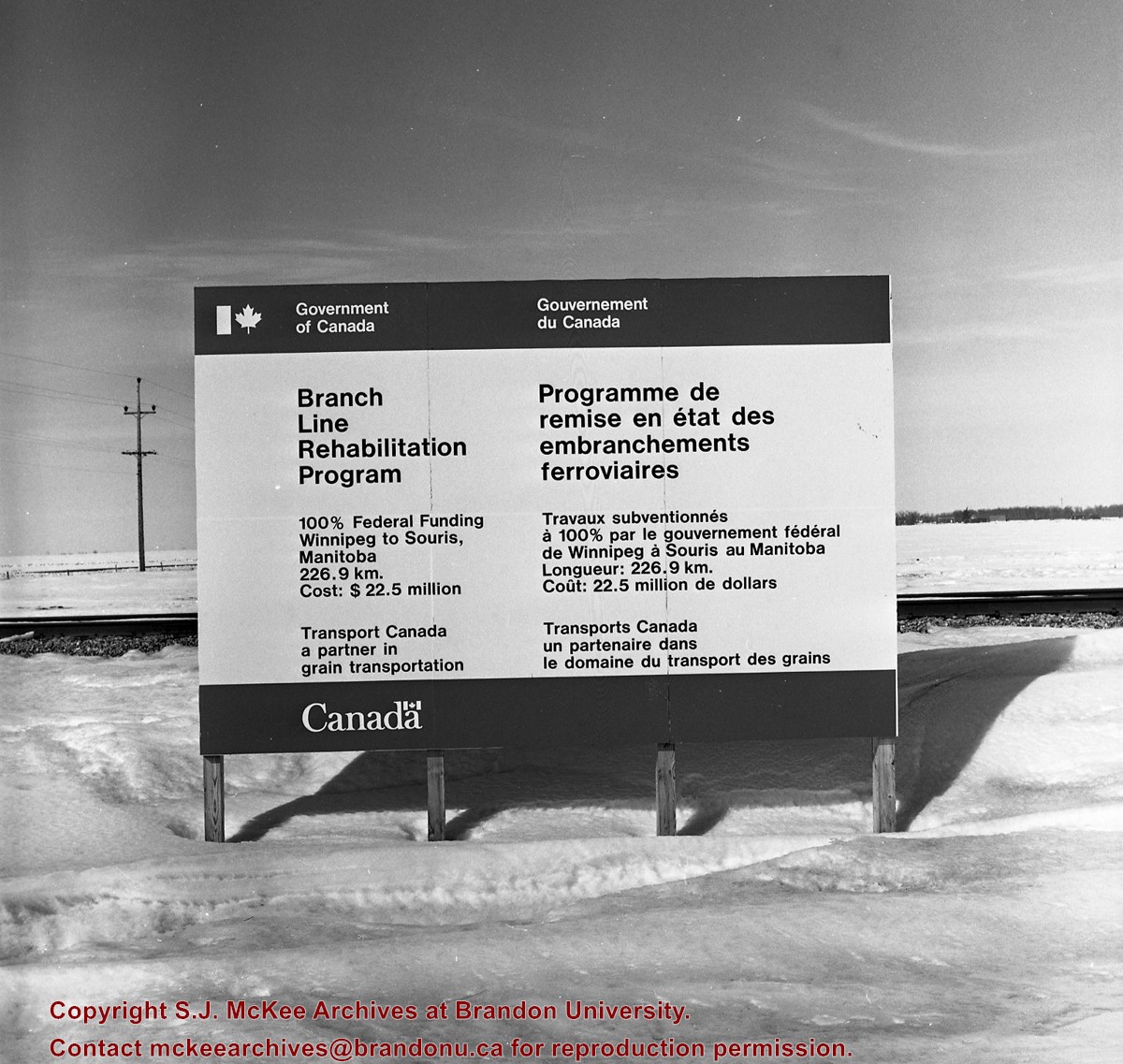
Custodial History
For custodial history see the collection level description of the Lawrence Stuckey collection.
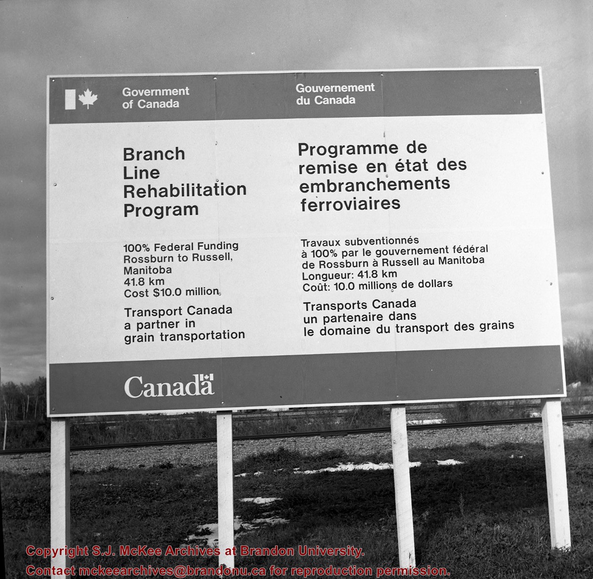
Scope and Content
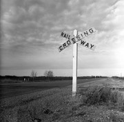
Image shows government branchline rehabilitation sign at Clanwilliam, Manitoba, taken along the CNR line, Rossburn subdivision.
Notes
[The words substation and subdivision have both been used for Stuckey's abbreviation sub. in Stuckey's rural archives collection].
View is southwest from approximatley 16th Street between Princess and Rosser Avenues. Photograph shows the Brandon University campus, as well as surrounding residential blocks, including Flemming, J.R. Reid and Vincent Massey schools.
View is west southwest from approximatley 16th Street between Princess and Lorne Avenues. Photograph shows the Brandon University campus, as well as surrounding residential blocks between 16th and 23rd Streets, Princess and Louise Avenues..
View is west from approximatley 17th Street between Lorne and Louise Avenues. Photograph shows a portion of the Brandon University campus (excluding the Education Building and anything north of it), as well as surrounding residential blocks from approximatley 17th Street to 22nd Street.
View is west northwest from approximatley 16th Street and Louise Avenue. Photograph shows the Brandon University campus, prior to the Library Extension, and a large portion of the city to the west of the campus.
View is northwest from approximatley 16th Street and Louise Avenue. Photograph shows the Brandon University campus, prior to the Library Extension, and a large portion of the city to the west of the campus.
Photograph shows the removal of one of the houses formerly located on 20th Street between Louise and Princess Avenues. The houses on those blocks were removed to create parking lots for the University. A Fed Zavislak Ltd. Well Drilling & Trucking pickup truck is visible at the curb.
Photograph shows the removal of one of the houses formerly located on 20th Street between Louise and Princess Avenues. The houses on those blocks were removed to create parking lots for the University.
Photograph shows a backhoe digging a sewer hole near the sidewalk between the Brandon College Building and the Citizens' Science Building. The Knowles-Douglas Students' Union Centre, John R. Brodie Science Centre and a portion of the driveway are visible in the background.


