Frank Pimentel's images of 'One Room Dwellings' provide a commentary on people's lives and their place in the society. The portraits of people in their homes, surrounded by objects that define their daily life, their aspirations or dreams, seem first straightforwardly objective. Nevertheless, the political content in these images is not accidentally delivered by the camera lens. Pimentel is not merely an eye behind the camera; rather than sentimental longings, the artist offers his audience a critical and at the same time understanding view of human condition.
Dimensions
40 X 32 cm
Size Overall
50.5 X 40.5 cm
Medium
Limited edition portfolio of 30 Ektacolor photographs
Modern school geography and atlas : authorized by the councils of Public Instruction for the provinces of Ontario, Quebec, New Brunswick and Prince Edward Island
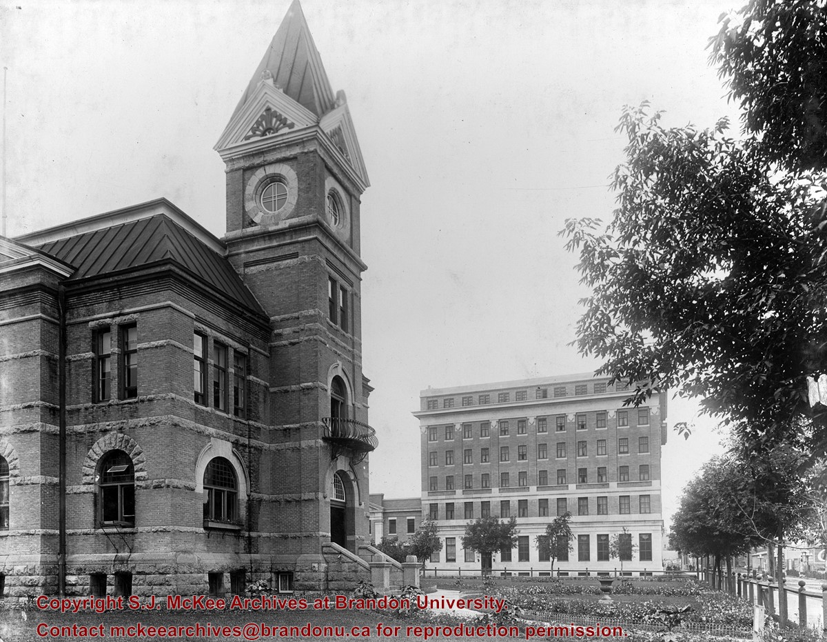
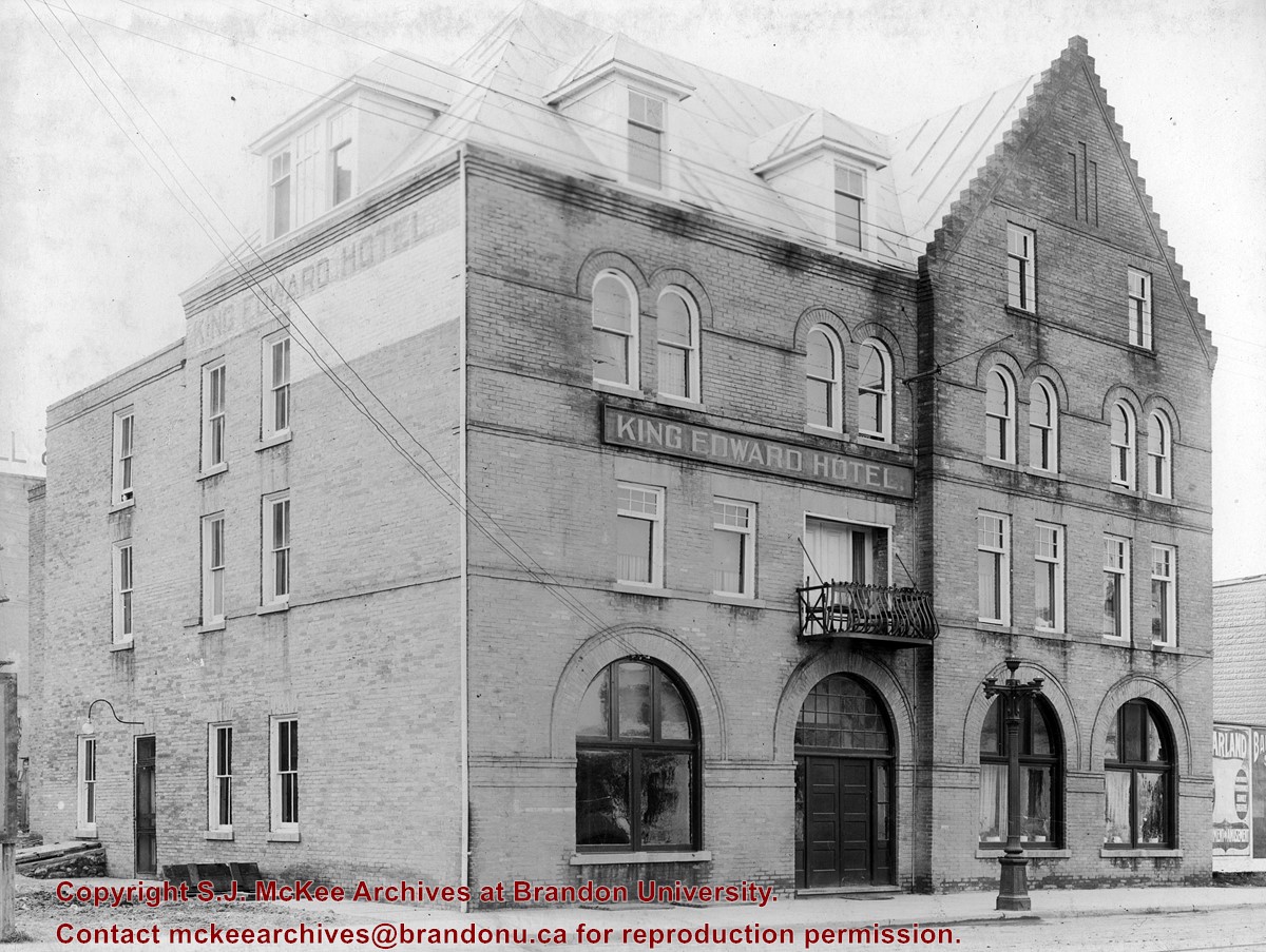
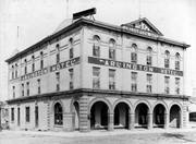
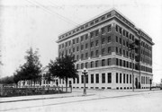
The Prince Edward Hotel was located on the south side of Princess Avenue between 9th and 10th Streets. Completed in 1912, the Prince Eddy opened with a charity ball on June 1, 1912. The site, occupied by the Salvation Army Barracks, was purchased in 1907 by the Canadian Northern Railway, later part of the Canadian National Railway. Designed by Winnipeg architects Pratt & Ross, the Prince Eddy was a six storey brick structure built of reinforced concrete, with walls of Tyndall limestone and Roman brick. Connected to the hotel on the south was the railway terminus, which housed offices and waiting rooms. Both the hotel and station were demolished in 1980.
Custodial History
See fonds level description of the Alf Fowler collection for custodial history.
Scope and Content
Photo shows the Prince Edward Hotel. The view is southwest.
Notes
History/Bio information taken from the Assiniboine Historical Society's Brandon: An Architectural Walking Tour pamphlet (1982).
Storage Range
RG 5 Western Manitoba Manuscript collection - photograph storage drawer
View is southwest from approximatley 16th Street between Princess and Rosser Avenues. Photograph shows the Brandon University campus, as well as surrounding residential blocks, including Flemming, J.R. Reid and Vincent Massey schools.
View is west southwest from approximatley 16th Street between Princess and Lorne Avenues. Photograph shows the Brandon University campus, as well as surrounding residential blocks between 16th and 23rd Streets, Princess and Louise Avenues..
View is west from approximatley 17th Street between Lorne and Louise Avenues. Photograph shows a portion of the Brandon University campus (excluding the Education Building and anything north of it), as well as surrounding residential blocks from approximatley 17th Street to 22nd Street.
View is west northwest from approximatley 16th Street and Louise Avenue. Photograph shows the Brandon University campus, prior to the Library Extension, and a large portion of the city to the west of the campus.
View is northwest from approximatley 16th Street and Louise Avenue. Photograph shows the Brandon University campus, prior to the Library Extension, and a large portion of the city to the west of the campus.
Photograph shows the removal of one of the houses formerly located on 20th Street between Louise and Princess Avenues. The houses on those blocks were removed to create parking lots for the University. A Fed Zavislak Ltd. Well Drilling & Trucking pickup truck is visible at the curb.
Photograph shows the removal of one of the houses formerly located on 20th Street between Louise and Princess Avenues. The houses on those blocks were removed to create parking lots for the University.


