Modern school geography and atlas : authorized by the councils of Public Instruction for the provinces of Ontario, Quebec, New Brunswick and Prince Edward Island
Some accretion in lower right part of image. Two tears in upper part of painting (TL c.. 6cm; TR c.. 3 cm). One tear in area left on center. Two poke holes in area down from center. Two gobs of gum-like substance in BR area, as well as paint abrasio
Aerial photographs of the campus were generally commissioned by the College/University to record important milestones, such as centennials, changes in status, and building projects. The general campus photographs were placed in this sub-series because the composition of the images made it difficult to place them with individual buildings.
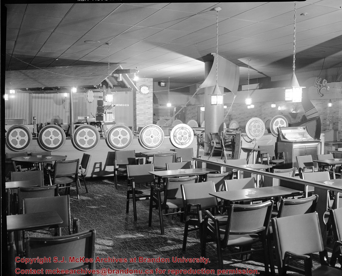
Scope and Content
Sub-series consists of photographs of the Brandon College and Brandon University campus.
Brandon College looking south from 19th Street. Photograph was taken after Flora Cowan Hall was built but before construction of the Education Building.
Image shows the Brandon College campus from 17th Street looking southwest. The photo was taken after the completion of the original Music Building in 1963, but construction of the Education Building. Also visible are a number of properties on the 200 block of 18th Street and the 200 block of 20th Street.
Image is looking east northeast from approximately the 300 block of 23rd Street between Lorne and Louise Avenues. Photograph shows the Brandon College campus after the opening of the original Music Building in 1963, but before the construction of the Education Building in 1966. A number of house on the 300 blocks of 22nd and 21st Streets are visible in the foreground, with the A.E. McKenzie Seed Co., the Prince Edward Hotel and various grain elevators on the horizon.
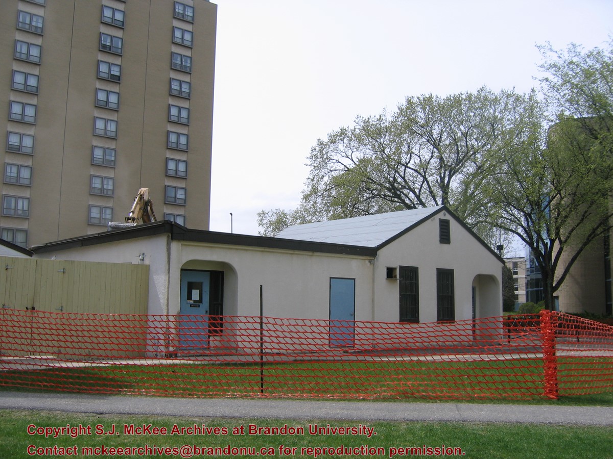
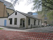
Located at the centre of the Brandon University campus, the Physical Plant H-Hut was destroyed following the opening of the new $3.9M, 13,600 square-foot physical plant on 07 April 2010.
Custodial History
Photograph was taken by McKee Archives project archivist Jill Sutherland.
Scope and Content
Photograph shows the demolition of the Physical Plant H-Hut.
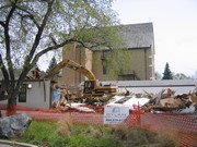
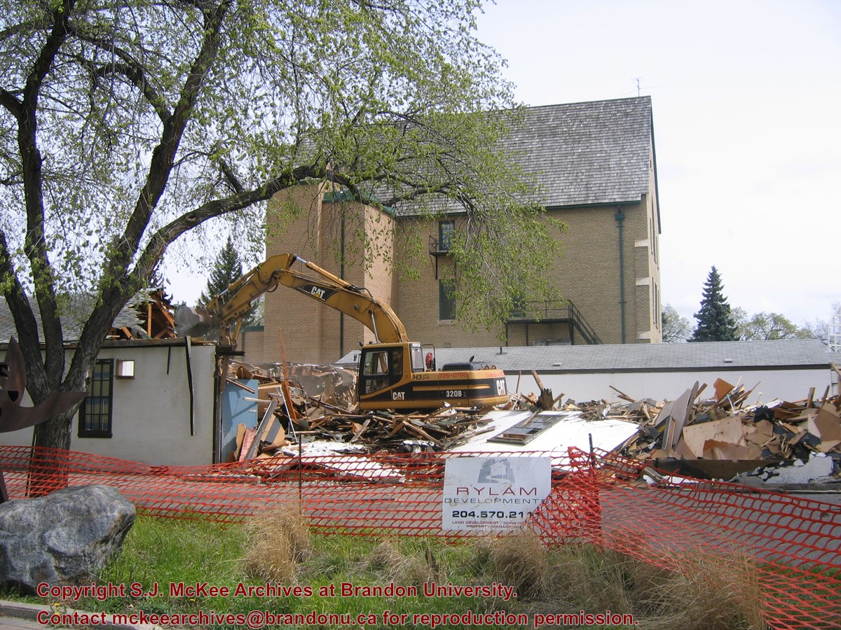
Located at the centre of the Brandon University campus, the Physical Plant H-Hut was destroyed following the opening of the new $3.9M, 13,600 square-foot physical plant on 07 April 2010.
Custodial History
Photograph was taken by McKee Archives project archivist Jill Sutherland.
Scope and Content
Photograph shows the demolition of the Physical Plant H-Hut. A sign for Rylam Development is visible on the snow fence fencing off the demolition site.


 and (2).jpg?width=1200&404=no-img.jpg&watermark=wmk)
 and (2).jpg?width=180&404=no-img.jpg)
.jpg?width=1200&404=no-img.jpg&watermark=wmk)
.jpg?width=180&404=no-img.jpg)
.jpg?width=1200&404=no-img.jpg&watermark=wmk)
.jpg?width=180&404=no-img.jpg)


%2520and%2520(2).jpg%3fmaxheight%3d1000%26maxwidth%3d1000%26watermark%3dwmk&description=British+American+dealers+(Prince+Edward+Service%2c+Brandon))
.jpg%3fmaxheight%3d1000%26maxwidth%3d1000%26watermark%3dwmk&description=British+American+dealers+-+Prince+Edward+Service+(Brandon))
.jpg%3fmaxheight%3d1000%26maxwidth%3d1000%26watermark%3dwmk&description=British+American+dealers+-+Prince+Edward+Service+(Brandon))
)