"A thesis submitted in partial fulfillment of the requirements for the degree of master of arts in The Faculty of Granduate Studies, School of Community and Regional Planning"
"We accept this thesis as conforming to the required standard"
Barry Burdeny, whose home was at Vita, Manitoba, won first place at age 17 (in 1962) in a school art competition with some 10,000 plus entries and a prize of several thousand dollars. He produced many paintings in the next two years and entered Brandon College in 1964. (BU Art Catalogue, 1983)
See fonds level description of the Alf Fowler collection for custodial history.
Scope and Content
Photo was taken of 10th Street from Pacific Avenue looking sourth. Visible businesses include: the Cecil Hotel; the Canadian Bank of Commerce; Campbell and Campbell; and the Bank of British North America
Storage Range
RG 5 Western Manitoba Manuscript collection - photograph storage drawer
See fonds level description of the Alf Fowler collection for custodial history.
Scope and Content
Photo was taken of Rosser Avenue from 7th Street looking west. Visible businesses include: ? and Ball; Vincent & MacPherson; W.N. Finlay; Christie's; J. Burchill; the Empire Hotel; and Fleming's Drug Store. A number of people and vehicles are visible on both sides of the street.
Notes
A digital scan of the photograph is available on a CD located in the Archives' office.
Storage Range
RG 5 Western Manitoba Manuscript collection - photograph storage drawer
See fonds level description of the Alf Fowler collection for custodial history.
Scope and Content
Photo was taken of Rosser Avenue, looking east from 11th Street. Visible in the photo are the Merchant's Bank of Canada, A. Smith, and the Union Bank of Canada. A number of people and vehicles are also visible.
Storage Range
RG 5 Western Manitoba Manuscript collection - photograph storage drawer
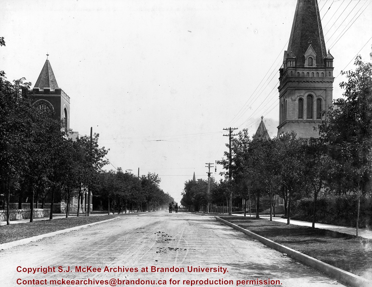
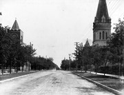
See fonds level description of the Alf Fowler collection for custodial history.
Scope and Content
Photo shows the the corner of 10th Street and Rosser Avenue, looking northwest. Visible businesses include: the Canadian Bank of Commerce; The Sun; Canadian Pacific; Brandon Brick Co.; T. Bronson; Fraser and Co.; and the John E. Smith Block.
Storage Range
RG 5 Western Manitoba Manuscript collection - photograph storage drawer
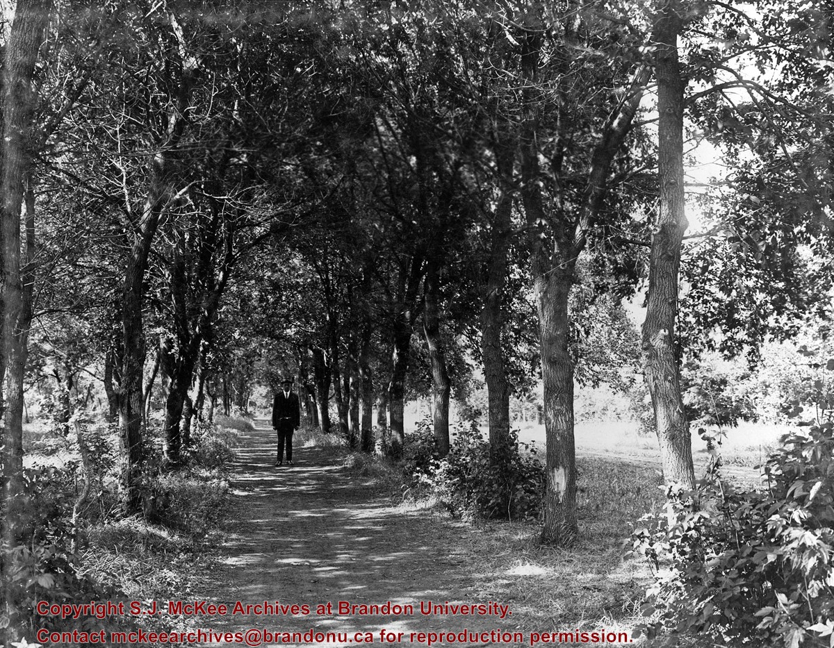
See fonds level description of the Alf Fowler collection for custodial history.
Scope and Content
Photo shows a man standing in the middle of a lane, which is lined with trees. The parkland was south of Richmond Avenue and may be part of Patmore Nurseries.
Storage Range
RG 5 Western Manitoba Manuscript collection - photograph storage drawer
View is southwest from approximatley 16th Street between Princess and Rosser Avenues. Photograph shows the Brandon University campus, as well as surrounding residential blocks, including Flemming, J.R. Reid and Vincent Massey schools.
View is west southwest from approximatley 16th Street between Princess and Lorne Avenues. Photograph shows the Brandon University campus, as well as surrounding residential blocks between 16th and 23rd Streets, Princess and Louise Avenues..
View is west from approximatley 17th Street between Lorne and Louise Avenues. Photograph shows a portion of the Brandon University campus (excluding the Education Building and anything north of it), as well as surrounding residential blocks from approximatley 17th Street to 22nd Street.


