See fonds level of the CKX records for custodial history.
Scope and Content
Image is looking southwest across Brandon College campus. Visible are Clark Hall, the Brandon College Building, the Citizens' Science Building and the A.E. McKenzie Building.
See fonds level of the CKX records for custodial history.
Scope and Content
Image is looking northwest across Brandon College campus. Visible are the H-Huts and the Citizen's Science Building. Behind the Citizen's Science Building are the Brandon College Building and Clark Hall.
See fonds level of the CKX records for custodial history.
Scope and Content
Image is looking south southwest across Brandon College campus. Visible are Clark Hall, the Brandon College Building and the Citizens' Science Building.
See fonds level of the CKX records for custodial history.
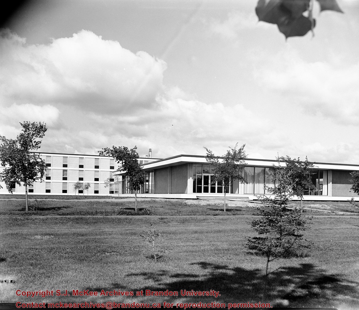
Scope and Content
Image is looking northwest across Brandon College campus. Visible is part of an H-Hut, the J.R.C. Evans Lecture Theatre and the A.E. McKenzie Building.
See fonds level of the CKX records for custodial history.
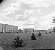
Scope and Content
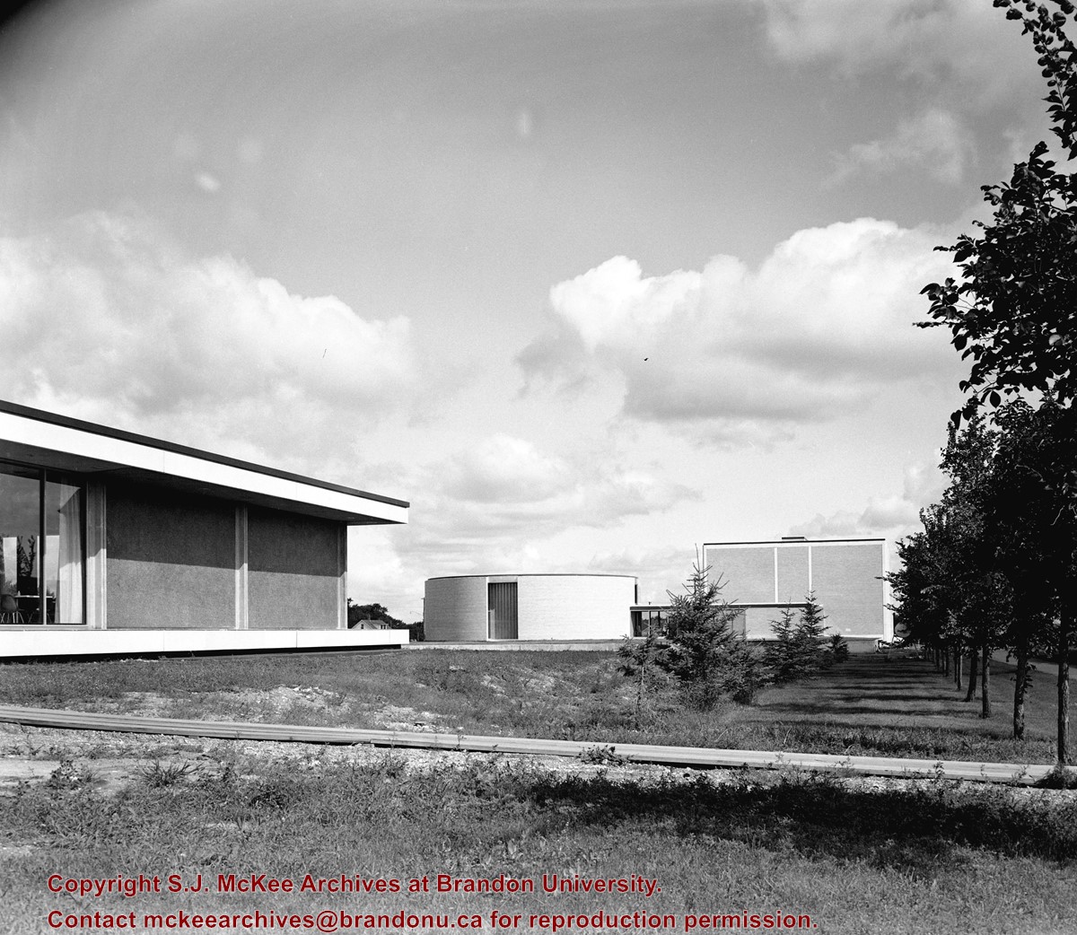
Image is looking north northwest across Brandon College campus. Visible are the Dining Room, the J.R.C. Evans Lecture Theatre and the A.E. McKenzie Building.
See fonds level of the CKX records for custodial history.
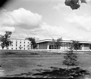
Scope and Content
Image is looking southeast across the Brandon College campus. Visible are portions of the A.E. McKenzie Building, the J.R.C. Evans Lecture Theatre, the Dining Room, and Darrach Hall.
View is southwest from approximatley 16th Street between Princess and Rosser Avenues. Photograph shows the Brandon University campus, as well as surrounding residential blocks, including Flemming, J.R. Reid and Vincent Massey schools.
View is west southwest from approximatley 16th Street between Princess and Lorne Avenues. Photograph shows the Brandon University campus, as well as surrounding residential blocks between 16th and 23rd Streets, Princess and Louise Avenues..
View is west from approximatley 17th Street between Lorne and Louise Avenues. Photograph shows a portion of the Brandon University campus (excluding the Education Building and anything north of it), as well as surrounding residential blocks from approximatley 17th Street to 22nd Street.
View is west northwest from approximatley 16th Street and Louise Avenue. Photograph shows the Brandon University campus, prior to the Library Extension, and a large portion of the city to the west of the campus.
View is northwest from approximatley 16th Street and Louise Avenue. Photograph shows the Brandon University campus, prior to the Library Extension, and a large portion of the city to the west of the campus.
View is northwest from the roof of the John R. Brodie Science Centre. Photograph shows the roof of the Knowles Douglas Students' Union Centre, the Citizens' Science Building, and the Brandon College Building and Clark Hall during renovation.
Photograph was taken from the roof of the Library and shows the walkway and flower bed on the southeast corner of the George T. Richardson Centre. The Physical Plant H-Hut is visible in the top right hand corner.
View is southwest from the roof of the George T. Richardson Centre. Photograph shows the curved glass wall of the John E. Robbins Library, the walkway between the Library and the Dining Hall, the Dining Hall and Darrach Hall.


