See fonds level description of the Alf Fowler collection for custodial history.
Scope and Content
Photo was taken of Rosser Avenue from 7th Street looking west. Visible businesses include: ? and Ball; Vincent & MacPherson; W.N. Finlay; Christie's; J. Burchill; the Empire Hotel; and Fleming's Drug Store. A number of people and vehicles are visible on both sides of the street.
Notes
A digital scan of the photograph is available on a CD located in the Archives' office.
Storage Range
RG 5 Western Manitoba Manuscript collection - photograph storage drawer
See fonds level description of the Alf Fowler collection for custodial history.
Scope and Content
Photo was taken of Rosser Avenue, looking east from 11th Street. Visible in the photo are the Merchant's Bank of Canada, A. Smith, and the Union Bank of Canada. A number of people and vehicles are also visible.
Storage Range
RG 5 Western Manitoba Manuscript collection - photograph storage drawer
See fonds level description of the Alf Fowler collection for custodial history.
Scope and Content
Photo shows the the corner of 10th Street and Rosser Avenue, looking northwest. Visible businesses include: the Canadian Bank of Commerce; The Sun; Canadian Pacific; Brandon Brick Co.; T. Bronson; Fraser and Co.; and the John E. Smith Block.
Storage Range
RG 5 Western Manitoba Manuscript collection - photograph storage drawer
View is southwest from approximatley 16th Street between Princess and Rosser Avenues. Photograph shows the Brandon University campus, as well as surrounding residential blocks, including Flemming, J.R. Reid and Vincent Massey schools.
View is west southwest from approximatley 16th Street between Princess and Lorne Avenues. Photograph shows the Brandon University campus, as well as surrounding residential blocks between 16th and 23rd Streets, Princess and Louise Avenues..
View is west from approximatley 17th Street between Lorne and Louise Avenues. Photograph shows a portion of the Brandon University campus (excluding the Education Building and anything north of it), as well as surrounding residential blocks from approximatley 17th Street to 22nd Street.
View is west northwest from approximatley 16th Street and Louise Avenue. Photograph shows the Brandon University campus, prior to the Library Extension, and a large portion of the city to the west of the campus.
View is northwest from approximatley 16th Street and Louise Avenue. Photograph shows the Brandon University campus, prior to the Library Extension, and a large portion of the city to the west of the campus.
Photograph shows the removal of one of the houses formerly located on 20th Street between Louise and Princess Avenues. The houses on those blocks were removed to create parking lots for the University. A Fed Zavislak Ltd. Well Drilling & Trucking pickup truck is visible at the curb.
Photograph shows the removal of one of the houses formerly located on 20th Street between Louise and Princess Avenues. The houses on those blocks were removed to create parking lots for the University.
View is northeast probably from the roof of McMaster Hall. Photograph shows the construction of the new roof on Clark Hall and the Brandon College Building. A portion of the east side of the 000 and 100 blocks of 18th Street, as well as the corner of 18th Street and Rosser Avenue are visible in the upper left hand corner. This includes the "Downtown Brandon" sign.
View is north northeast probably from the roof of McMaster Hall. Photograph shows the construction of the new roof on Clark Hall and the Brandon College Building, as well as the construction of the extension to Clark Hall and the skywalk. Portions of the city as far north as the Assiniboine River are also visible.
View is northeast from the Brandon College Building. Photograph shows the inside of the Brandon College Building after it had been gutted and then partially rebuilt. The exterior fascade of the west side of the building can be clearly seen in this photograph. A number of houses on the east side of 200 block of 18th Street are also visible, as is the stone fence on Princess Avenue and the flag pole on the front lawn.
View is north northeast from the roof of McMaster Hall. Photograph shows the campus under construction during the renovation of the Brandon College Building and Clark Hall. The photograph was taken in late fall after the roof had been removed from the buildings but before the construction of the extension of Clark Hall. Construction materials litter the courtyard and driveway. The view looking north extends to The North Hill - a number of residential blocks, particularly to the northeast of 18th Street are visible. Buildings include the International Harvester Building and Kin Village.
View is north northeast probably from the roof of McMaster Hall. Photograph shows the construction of the new roof on Clark Hall and the Brandon College Building, as well as the construction of the extension to Clark Hall and the skywalk. The view looking north extends to The North Hill - a number of residential blocks, particularly to the northeast of 18th Street are visible. Buildings include the International Harvester Building and Kin Village.
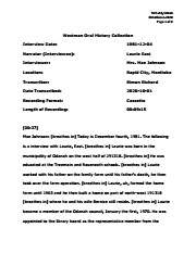
Laurence Overton "Laurie" East was born in the municipality of Odanah on the west half of 29-13-18, on March 13, 1911. He attended Tremaine and Roseneath schools and worked on the family farm, eventually leaving school to work due to his father's ill health and then taking over the operation in 1936, after his father died. Laurie retired from farming in 1976. Laurie married Bernice McDonald (1916-2006), a teacher, on July 4, 1942. They had no children. Laurie's hobbies were music, dancing and travel; he took part in local entertainment and taught square dancing classes. He was a member of the Hunterville United Church, serving on the board and volunteering as Sunday School Superintendent or teacher. In the 1940s, Laurie was part of local commmittees to secure telephone and postal service. From 1970-1983, he was a member of Elton Municipal Council. Shortly after joining the council, Laurie was appointed as a representive to the library board; he joined representatives from Minnedosa and Minto councils, as there was support in the region for the organization and establishment of a regional library. Laurie East died on April 18, 2003 in Brandon, MB and is buried at the Rapid City Cemetery.
Custodial History
As part of the Westman Oral History Collection, this collection was accessioned by the McKee Archives in 1998. The original tapes from the Westman Oral History project were deposited in the Brandon Public Library. Copies of these originals were made by Margaret Pollex of the Brandon University Language Lab at the request of Eileen McFadden, University Archivist in the early 1990s. These copies compose the collection held in the McKee Archives.
Scope and Content
Item is an audiocassette tape containing an interview with Laurie East about the Minnedosa Regional Library. Interviewer is Mae Johnson.
Notes
History/bio information from the records and East's obituary. Transcript by Simon Richard (2020). Description by Christy Henry.
Language Note
English
Audio Tracks
Media missing or recording not available.
An unexpected error occurred.
Update Required
To play the media you will need to update your
browser to a recent version, or update your Flash plugin.
Berncie Caroline East (nee McDonald) was born on August 30, 1914 at Brookdale, MB in the RM of North Cypress. She attended Brookdale school, Brandon Collegiate Institute (BCI) and the Winnipeg Normal School. Her BA was achieved by corresondence and night classes from the University of Manitoba in 1963. As a teacher, Bernice taught at Tremaine, Brookdale, Minnedosa and Elton. Bernice married Laurence Overton East (1911-2003) on July 4, 1942. They did not have any children. The couple farmed in the Hunterville district until Laurie retired in 1976. They moved to Brandon in 1992. Bernice loved the oudoors and gardening, as well as square dancing and music. For a number of years, Bernice and Laurie kept a Bluebird line. The couple also enjoyed travel. Bernice was also active and supportive in community affairs, spending time as a Director on the Manitoba Agricultural Hall of Fame Board. Bernice East died on April 13, 2006 in Brandon, MB. She is buried at Rapid City Cemetery.
Custodial History
As part of the Westman Oral History Collection, this collection was accessioned by the McKee Archives in 1998. The original tapes from the Westman Oral History project were deposited in the Brandon Public Library. Copies of these originals were made by Margaret Pollex of the Brandon University Language Lab at the request of Eileen McFadden, University Archivist in the early 1990s. These copies compose the collection held in the McKee Archives.
Scope and Content
Item is an audiocassette tape containing an interview with Bernice East about aspects of education in Odanah Municipality, 1880-1981. Interviewer is Mae Johnson.
Notes
History/bio information from the records and East's obituary. Description by Christy Henry.
Language Note
English
Related Material
OH044 Lawrie O. East
Audio Tracks
Media missing or recording not available.
An unexpected error occurred.
Update Required
To play the media you will need to update your
browser to a recent version, or update your Flash plugin.
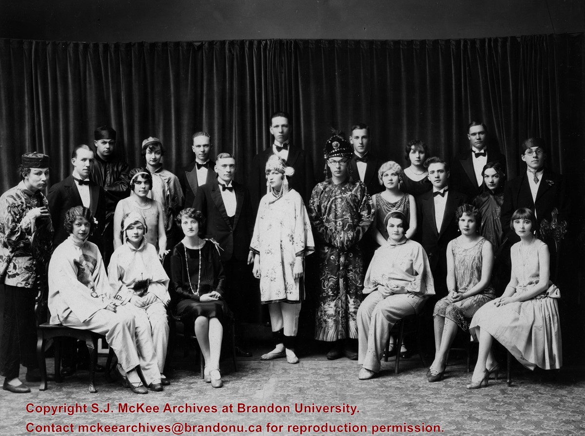
Brandon College Dramatic production “East is East and West is West” produced by Miss Marjorie McKenzie with some members of the Class of 1929-30 and others including Tommy Douglas second row third from right.


