See MG 1 Brandon College Teaching and Administration, 1.11 Martin Johns fonds for custodial history.
Scope and Content
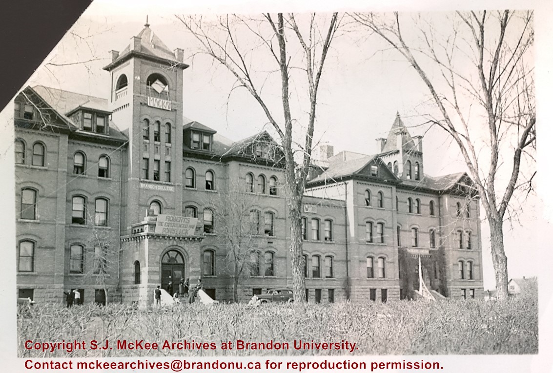
Photograph is looking northwest from 18th Street and shows the Brandon College Building and Clark Hall. There are a number of handmade election signs on the buildings.
See MG 1 Brandon College Teaching and Administration, 1.11 Martin Johns fonds for custodial history.
Scope and Content
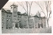
Photograph is looking southwest from 18th Street and shows Clark Hall and the Brandon College Building with the Citizens' Science Building partially visible on the lefthand side of the photo.
Notes
Writing on the back of the photo reads: "Brandon College and boys' res. is joined to Clark Hall" "from Marion(?)/Marvin(?) McLure(?)"
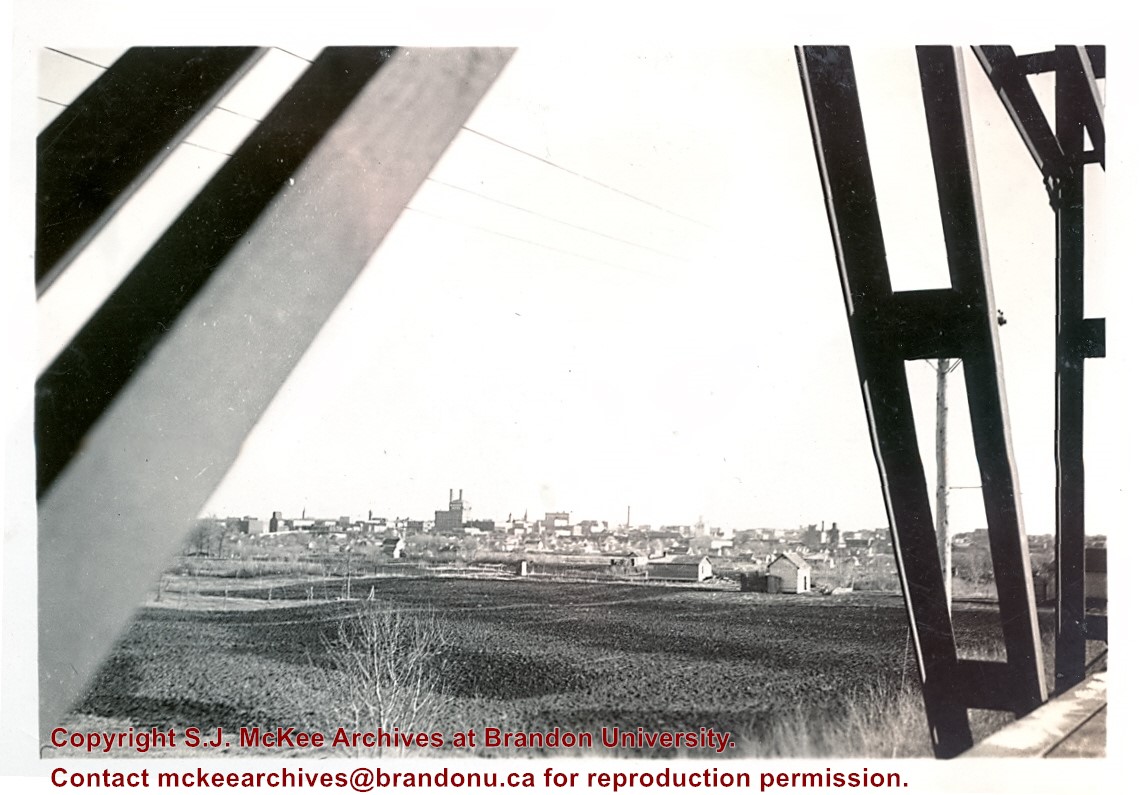
See MG 1 Brandon College Teaching and Administration, 1.11 Martin Johns fonds for custodial history.
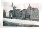
Scope and Content
Photograph is looking south southeast from the Assiniboine bridge on 18th Street and shows the Brandon cityscape in the background.
Notes
Writing on the back of the photo reads: "Brandon from the Assiniboine bridge. The 2 girls were just local coloring. Don't ask me who they were or are? The College is just off the street on the right away in the background."
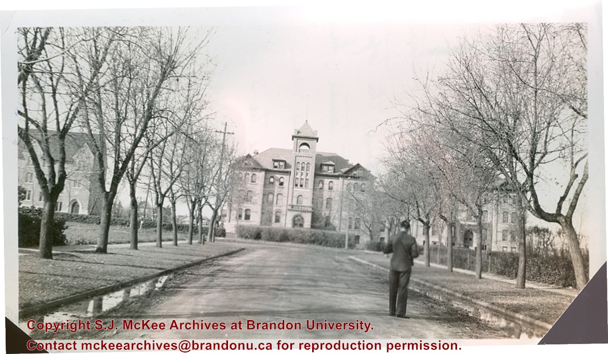
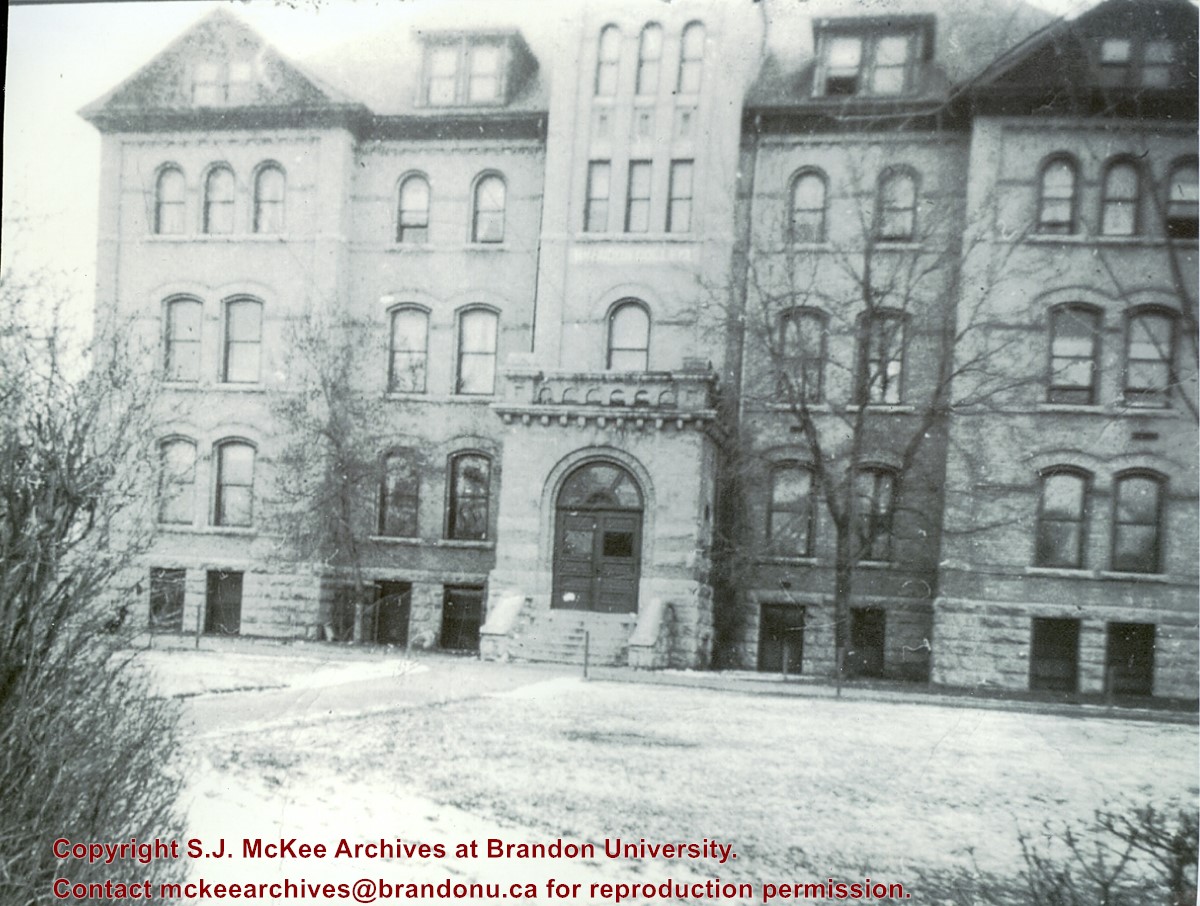
See MG 1 Brandon College Teaching and Administration, 1.11 Martin Johns fonds for custodial history.
Scope and Content
Photograph is looking west down Lorne Avenue towards the Brandon College Building. Clark Hall and the Citzens' Science Building are visible through the trees.
Notes
Writing on the back of the photo reads: "Brandon College from 16th Street and Lorne Ave. Looking up Lorne Ave (i.e. looking west). Laurie is in the foreground taking a picture. My room is behind the top 3 windows of the tower. Laurie's directly below me and Dalton's are the 3 at the extreme right on the same floor. Science building is at the left." Laurie may be a reference to Lawrence H. Cragg who taught Chemistry at Brandon College from 1937-1943. Dalton refers to W.H. Dalton Vernon who taught Philosophy and Psychology at Brandon College from 1938-1940.
Erected by the village of Wawanesa, the memorial is dedicated to the local citizens who died as a result of the First and Second World Wars. It was unveiled on November 11, 1921.
Scope and Content
Photograph shows the dedication of a war memorial in the village of Wawanesa, MB. The memorial is located near the bank of the Souris River. The photograph was taken from Wawanesa Mutual. The street on the left is 4th Street.
Notes
History/Bio information taken from the Canadian National Defense website.
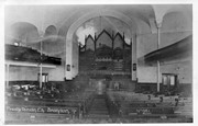
St. Paul's Presbyterian Church, which became St. Paul's United Church, and then Central United Church was located at 327 8th Street in Brandon, MB. The original church was destroyed by fire in 1986.
Scope and Content
Photograph shows the interior of the St. Paul's Presbyterian Church in Brandon, MB.
Notes
History/Bio information provided by Jim Stettner, Organ Historical Society Database (2022).
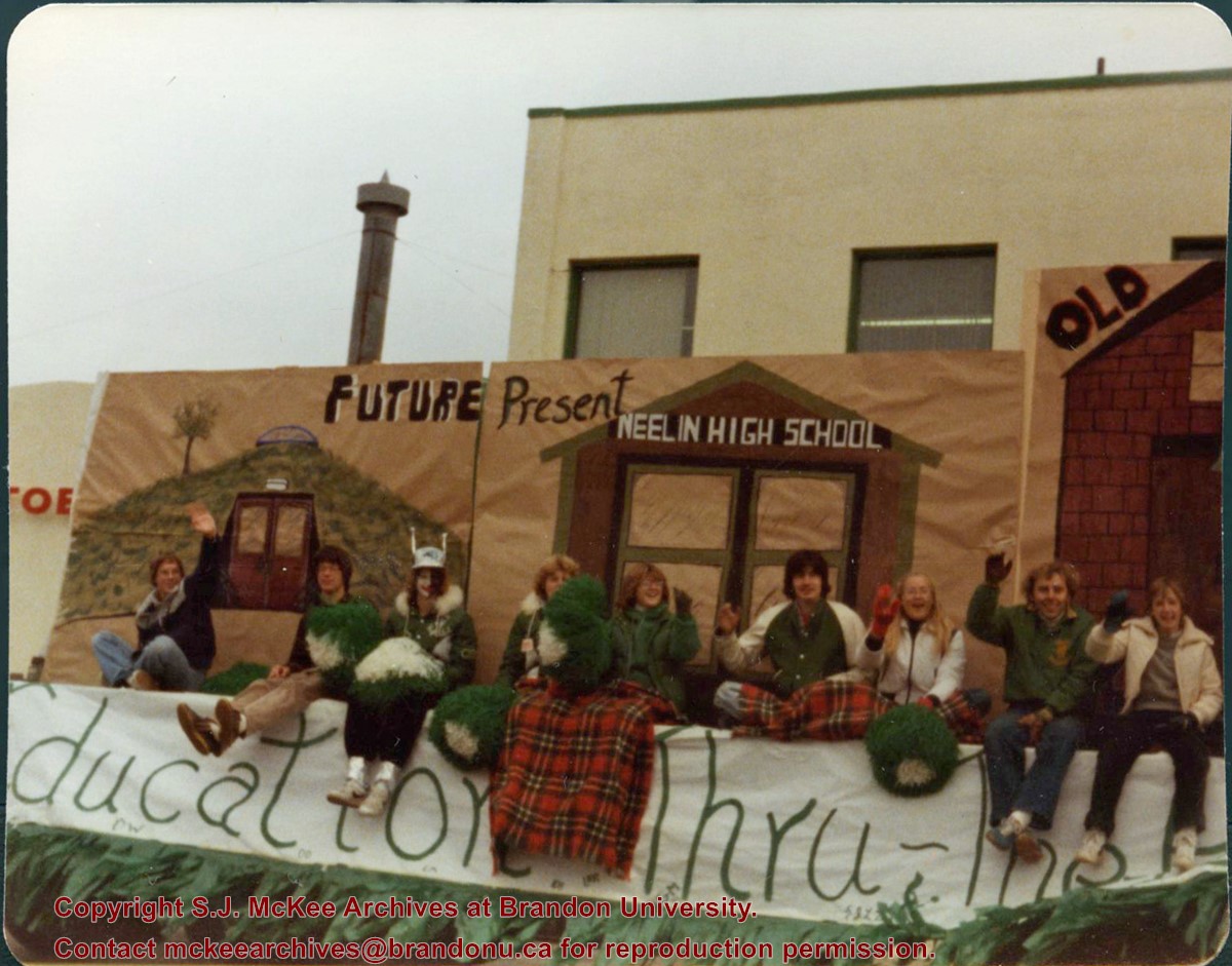
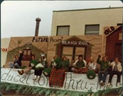
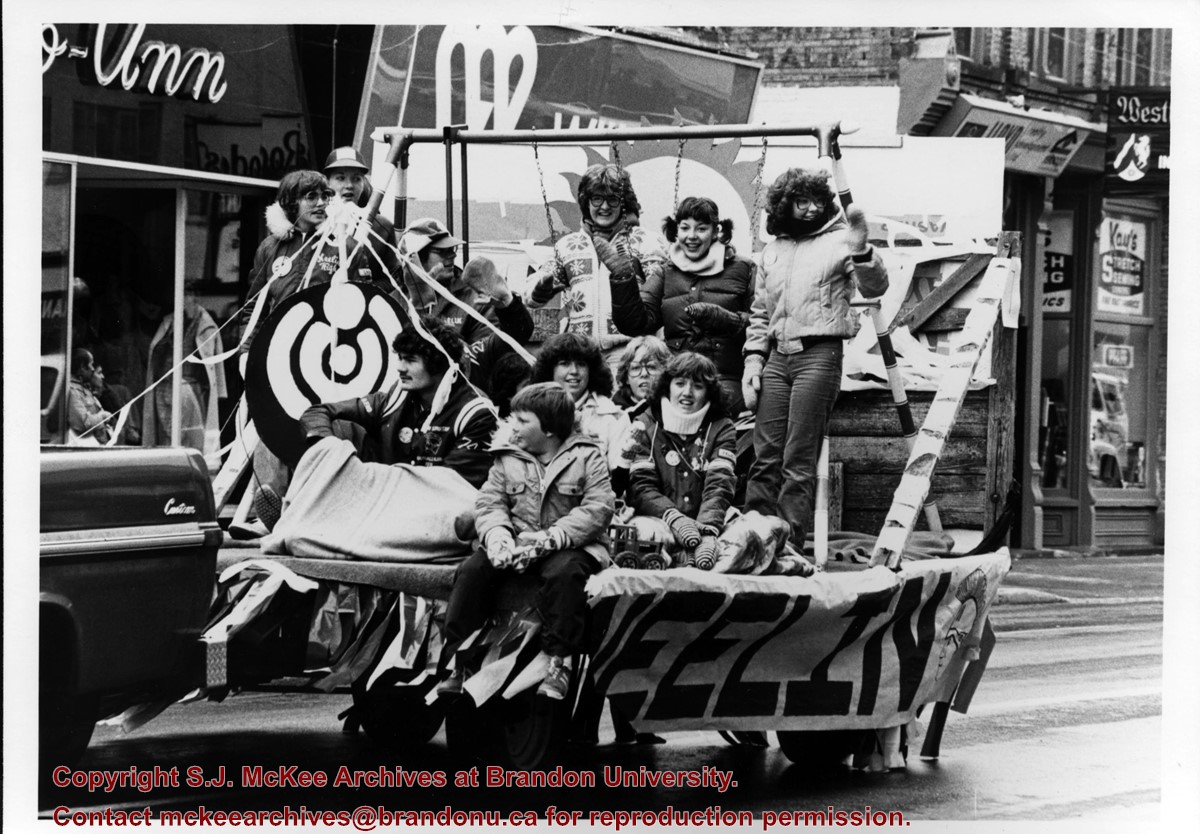
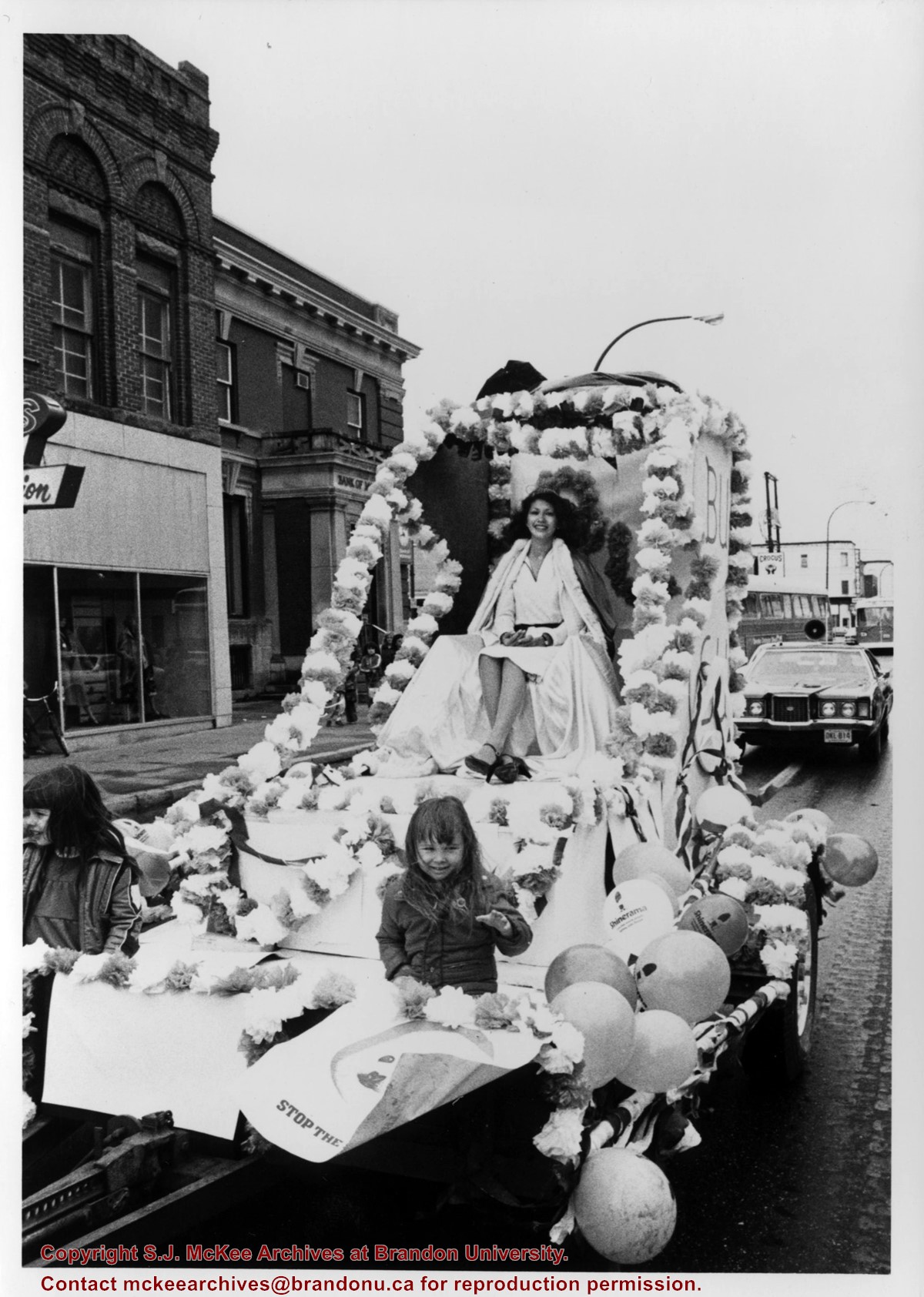
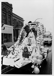
Photograph of the Neelin High School float travelling east on Rosser Avenue during Brandon University's Homecoming parade. The float won "best entry from the Westman community." Individuals on the float include: Rick Piche, Lynn Nicol, Susan Anderson, Karen Ashby, Jill Stewart, Jill Habing, Susan Medd, Felicity Adams and Wendy Muirhead.
Notes
Names and float information provided by Susan Medd.
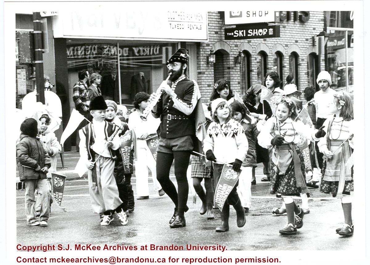
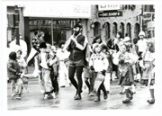
Photograph shows Robert (Bob) Ford dressed as the Pied Piper playing a soprano saxophone surrounded by children in costume, some carrying Brandon University Alumni pennants. Photo was taken during the Brandon University Homecoming Parade held in downtown Brandon.
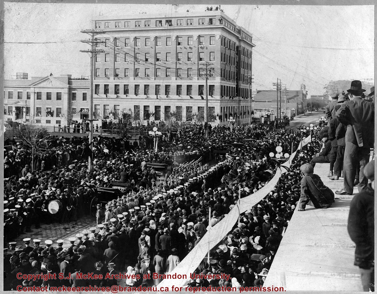
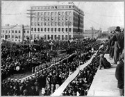
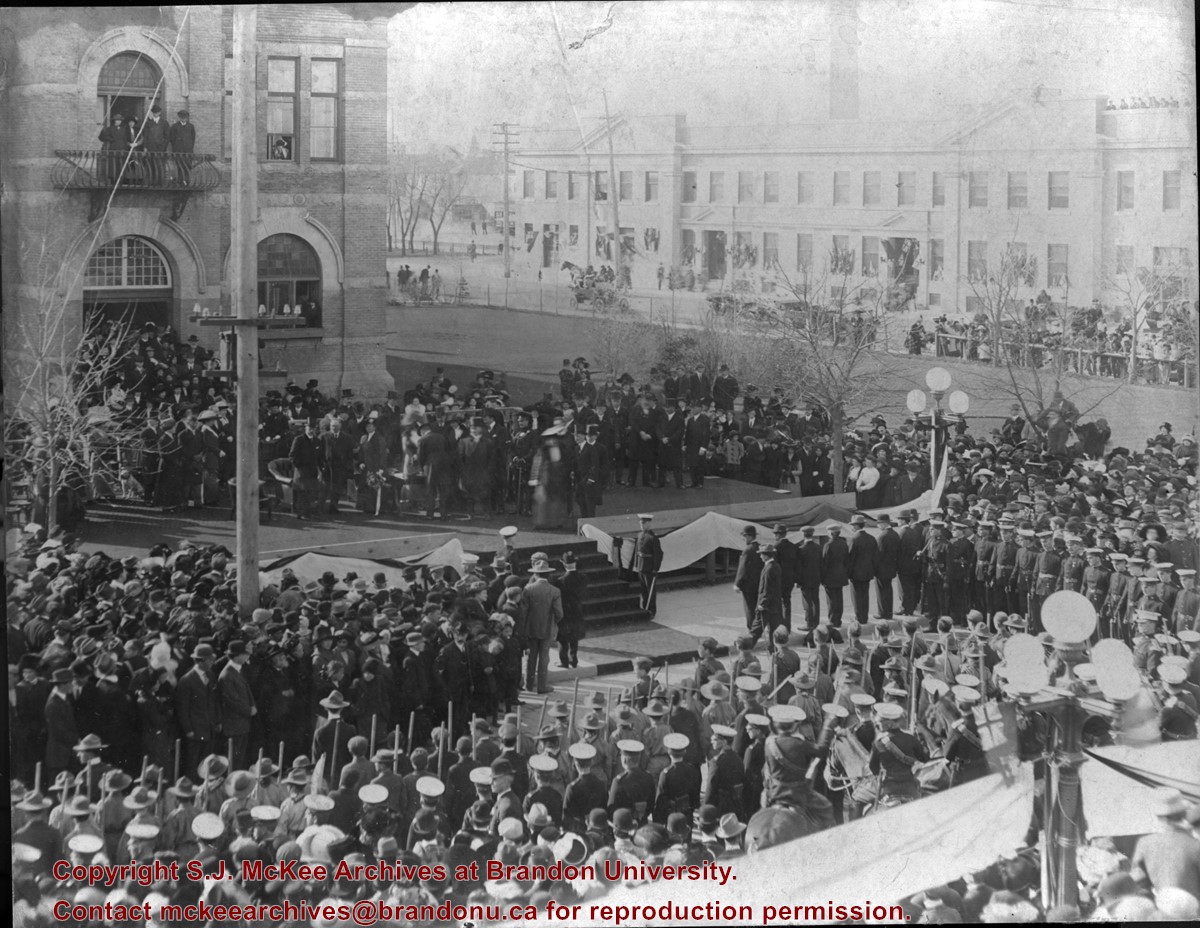
Photograph shows a public reception for the Governor General of Canada, HRH the Duke of Connaught during a visit to Brandon, MB. The reception was held on Princess Avenue at City Hall. The photograph is looking southwest from the north side of Princess Avenue. The building in the background is the recently constructed Prince Edward Hotel.
There is staining from the top left corner towards the centre of the image.
Custodial History
Jack Stothard purchased the image at a yard sale, location unknown. He donated it to the Archives in 2006.
Scope and Content
Photograph of a public reception for the Governor General of Canada, HRH the Duke of Connaught. The reception was held in fromt of the Brandon City Hall, which was located at 9th Street and Princess Avenue. The photograph is looking south southeast. A portion of the recently constructed Prince Edward Hotel is visible in the background.
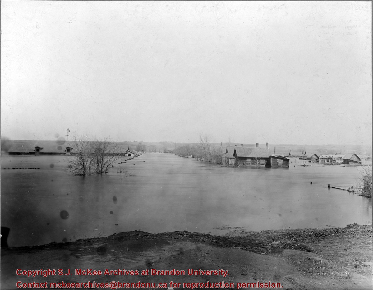
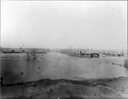
The "flats" refers to the Assiniboine River floodplane from 18th Street to First Street on either side of the river. See p. 223 of G.F. Barker's Brandon: A City for a description of the 1922 flood.
Custodial History
The photo was owned by Mrs. Wes Railton prior to its donation to the Archives.
Scope and Content
Photograph contains an image of houses on the Assiboine floodplane (Brandon's "flats") submerged in flood-waters.
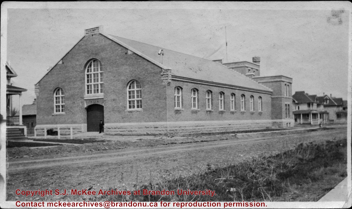
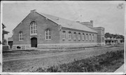
The Brandon Armoury was built in 1907. The extension on the southside was built in 1937.
Custodial History
The photograph was donated to the Archives by Cy Kenny in 2005.
Scope and Content
Photograph is looking northwest from the east side of 11th Street. It shows the back and east side of the Brandon Armoury, which is located on the at 1116 Victoria Avenue.
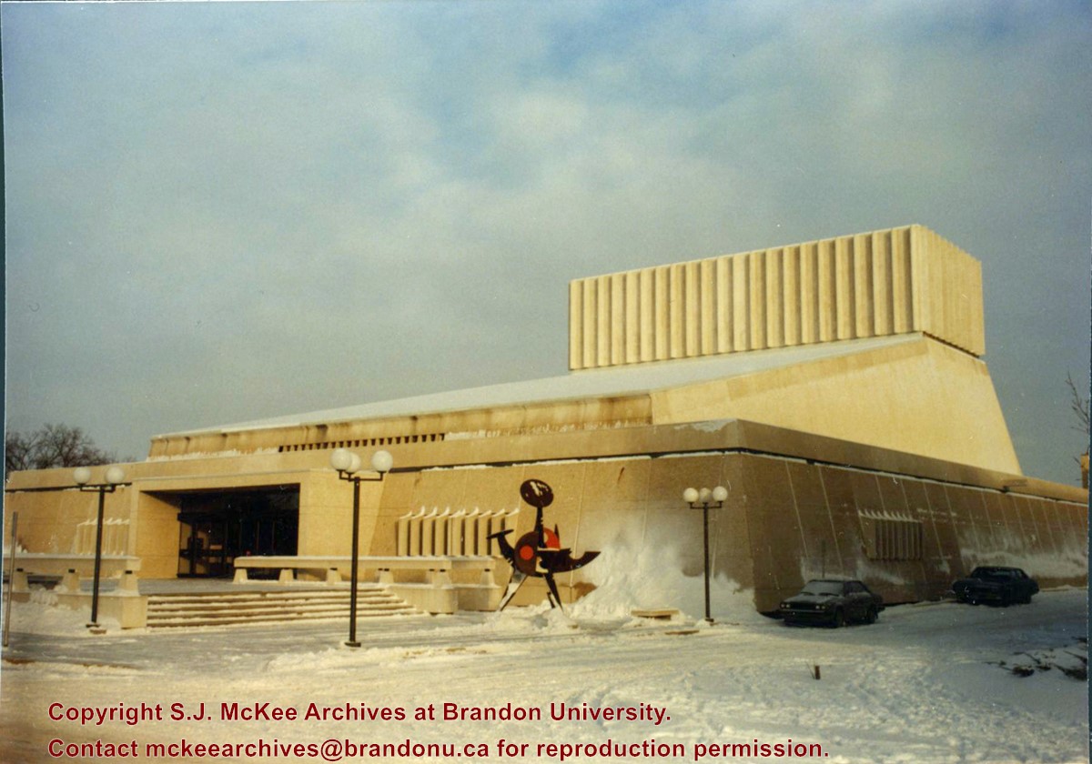
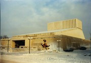
Photograph of the Western Manitoba Centennial Auditorium (WMCA). View is looking northeast from 20th Street. Victory Tolgesy's "Explorer" in the foreground.
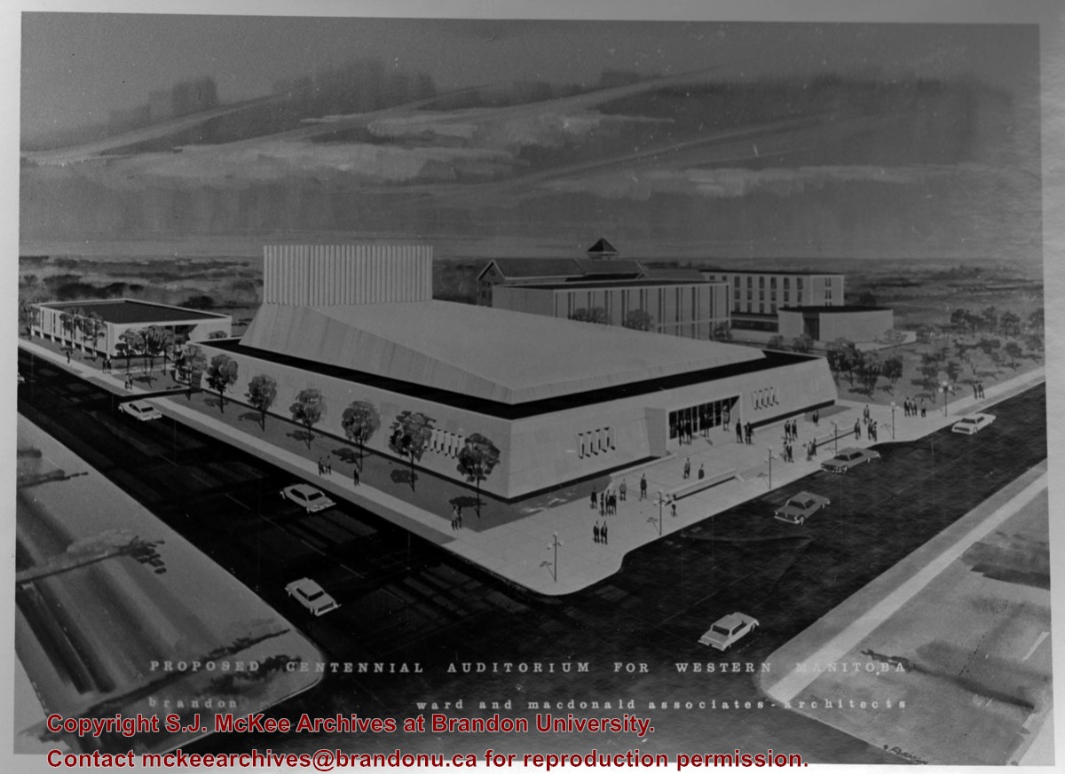
Photograph is a proposed model for a centennial auditorium for western Manitoba prepared by Ward and Macdonald Associates - Architects. View is southeast from the northwest corner of Princess Avenue and 20th Street. The model includes the proposed auditorium as well as a number of buildings on the Brandon College campus.


