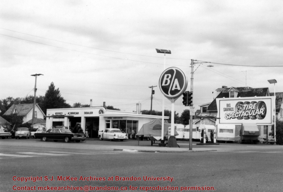
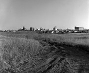
The British American gas station was located on the north side of Victoria Avenue between 10th and 11th Streets. An Esso gas station later occupied the site; at present it is the parking lot and building for the Manitoba Liquor Commission retail outlet.
Scope and Content
Photograph is looking northwest from across Victoria Avenue and shows the British American station building, signs, gas pumps and various cars in the lot.
Repro Restriction
The McKee Archives is the copyright holder for the Stuckey materials.
For history/bio information see the collection level description of the Lawrence Stuckey collection.
Custodial History
For custodial history see the collection level description of the Lawrence Stuckey collection.
Scope and Content
This sub-series consists of photographic negatives related to the history of Brandon, Manitoba.
All of the images contained within this sub-series were part of Mr. Stuckey’s lifelong personal collection of photographic negatives and prints. Images include those related to people, street scapes, buildings, various city departments and so forth.
Notes
All of the images from Mr. Stuckey’s collection of negatives and prints were reproduced and digitized using an Epson scanner and software suite. All attempts have been made to reproduce the images in such a manner that balances our desire to portray the negatives and photographs as they originally appear, with the need to create an optimal digital image for viewing. Therefore it is noted that minor alterations to image size and contrast have occurred.
With few exceptions, all digitizing and database entry of images and descriptions was conducted during the summer of 2009 at Brandon University by Patrick Elves.
Repro Restriction
The McKee Archives is the copyright holder for the Stuckey materials.
Storage Location
Lawrence Stuckey collection
Arrangement
Unless otherwise noted, the arrangement of these images was drawn from the original classification scheme used by Mr. Stuckey.
The information specific to each image, for the most part, was gained from Mr. Stuckey’s personal notes regarding that particular photograph or similar photograph. Observations or notes contained within square brackets are explanatory or missing materials that have been added by someone other than Mr. Stuckey.
We have attempted to present the information that accompanies each image in the same format as was used by Mr. Stuckey himself.
Subseries 1 - Brandon History
A. People
B. Bridges
C. Streets
D. Buildings
E. Business
F. Fire Dept.
G. Hospitals
H. Industries
I. Streetcars
J. Utilities
K. Construction
L. Transportation (other than rail)
M. Exhibition
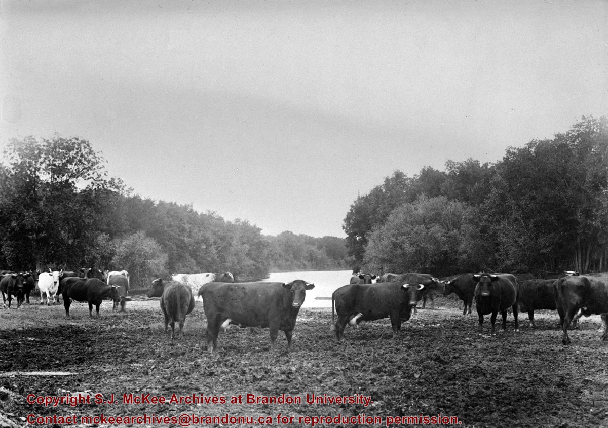
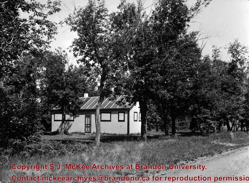
N. Misc. History
O. Environs
P. Railroads
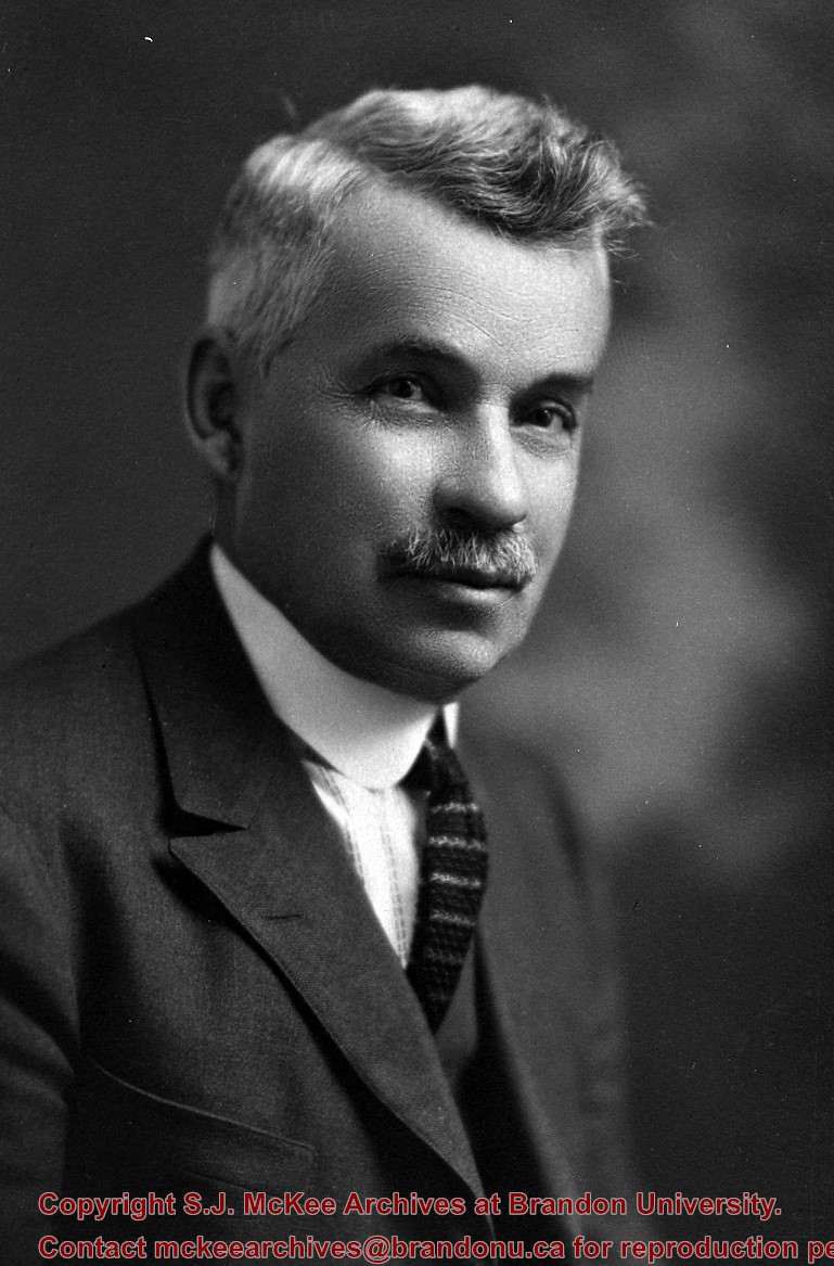
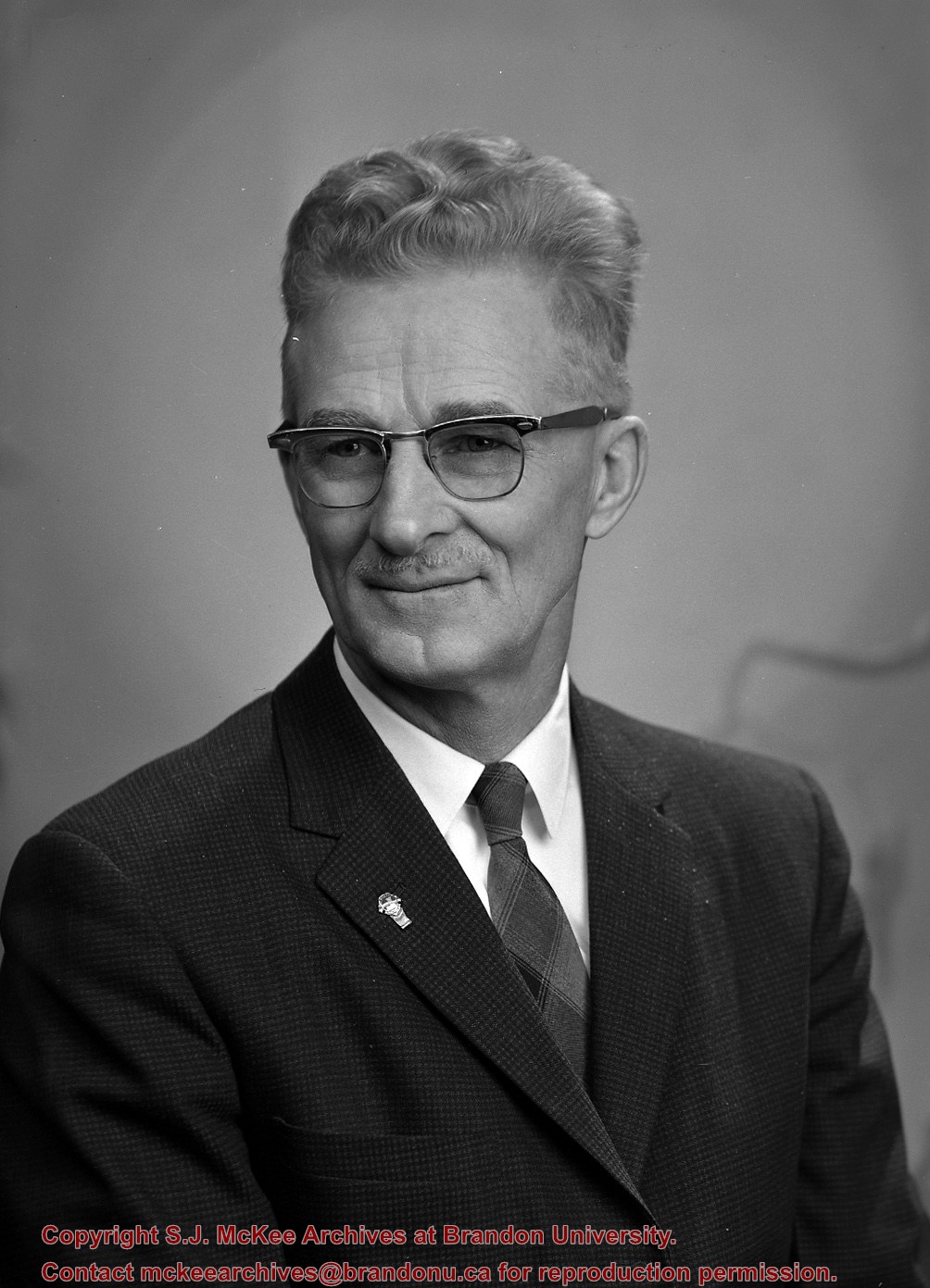
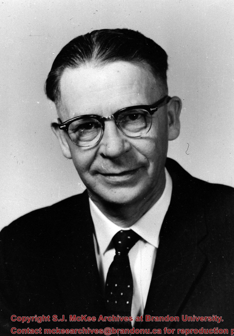
Principal of Normal School 1913-1938; author of Hales' Botany text.
His collection of mounted birds and animals - what was left of it after improper storage in various places, damage and dispersals - found a home as the B.J. Hales Natural History Museum at Brandon College in 1965.
Custodial History
For custodial history see the collection level description of the Lawrence Stuckey collection.
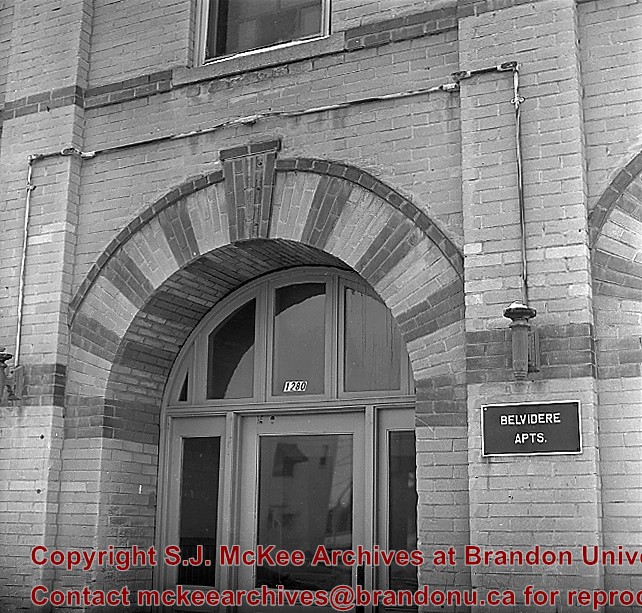
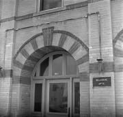
Building was built as the Reno Hotel in 1910, the city's best; was soon overshadowed by Canadian Northern Railway's Prince Edward Hotel in 1912; Became Belvidere Apts. 1918
This is the only building, apart from houses, completely faced with "Samson's" brick from Brandon Sand & Brick Co. (plant at 30th St. & Princess Ave - presently playground of Valleyview School) to survive into the 1980's. Ornamentation around door and windows is the only surviving example of their red dyed brick, known.
Custodial History
For custodial history see the collection level description of the Lawrence Stuckey collection.
Scope and Content
Front entrance of Belvidere Apartments (ex. Reno Hotel), 1280 Rosser Ave.
Notes
[Mr. Stuckey put two negatives (DC5 and DC5a) in same envelope, which we have separated, along with a print we numbered DC5(b).]
The Snye was a former channel (oxbow lake) of the Assiniboine River. It was located south of the Assiniboine between about 14th and 24th Streets, and during high water in the spring it carried overflow. For many years it was used as a log storage area for Hanbury's Mill. I remember there being bridges over it at 18th & 22nd Streets. It was dammed with a one way flipper valve at 14th Street that allowed water to flow out to the river, but prevented river water backing into it. Water within the Snye became stagnant in summer and formed a breeding area for mosquitoes. It was deemed a health hazard and the river was gradually filled in. LAS.
Custodial History
For custodial history see the collection level description of the Lawrence Stuckey collection.
Scope and Content
Snye River
Notes
[This negative was produced using a previous published image. P.E. 22/07/09]
Additional historical information provided by the Fred McGuinness collection (20-2009).
Due to the increasing volume of long-distance auto traffic in the 1920's, the city designated the block between Hill & Queen's Avenues and 9th & 10th streets as a "Tourist Camp" with a few basic facilities. LAS.
Custodial History
For custodial history see the collection level description of the Lawrence Stuckey collection.
Scope and Content
First Tourist Camp
Notes
Courtesy of the Brandon Sun
[Mr. Stuckey put two negatives in the same envelope, numbered N4 and N4a. We have separated them.]
For custodial history see the collection level description of the Lawrence Stuckey collection.
Scope and Content
Stanley Park from old PC.
Notes
Shows bandstand
[By "PC" Mr. Stuckey likely meant to indicate Park School (built 1904, demolished 1978). Park School was, at the time the photo was taken, located directly across Lorne Avenue from Stanley Park. P.E. 22/07/09]


