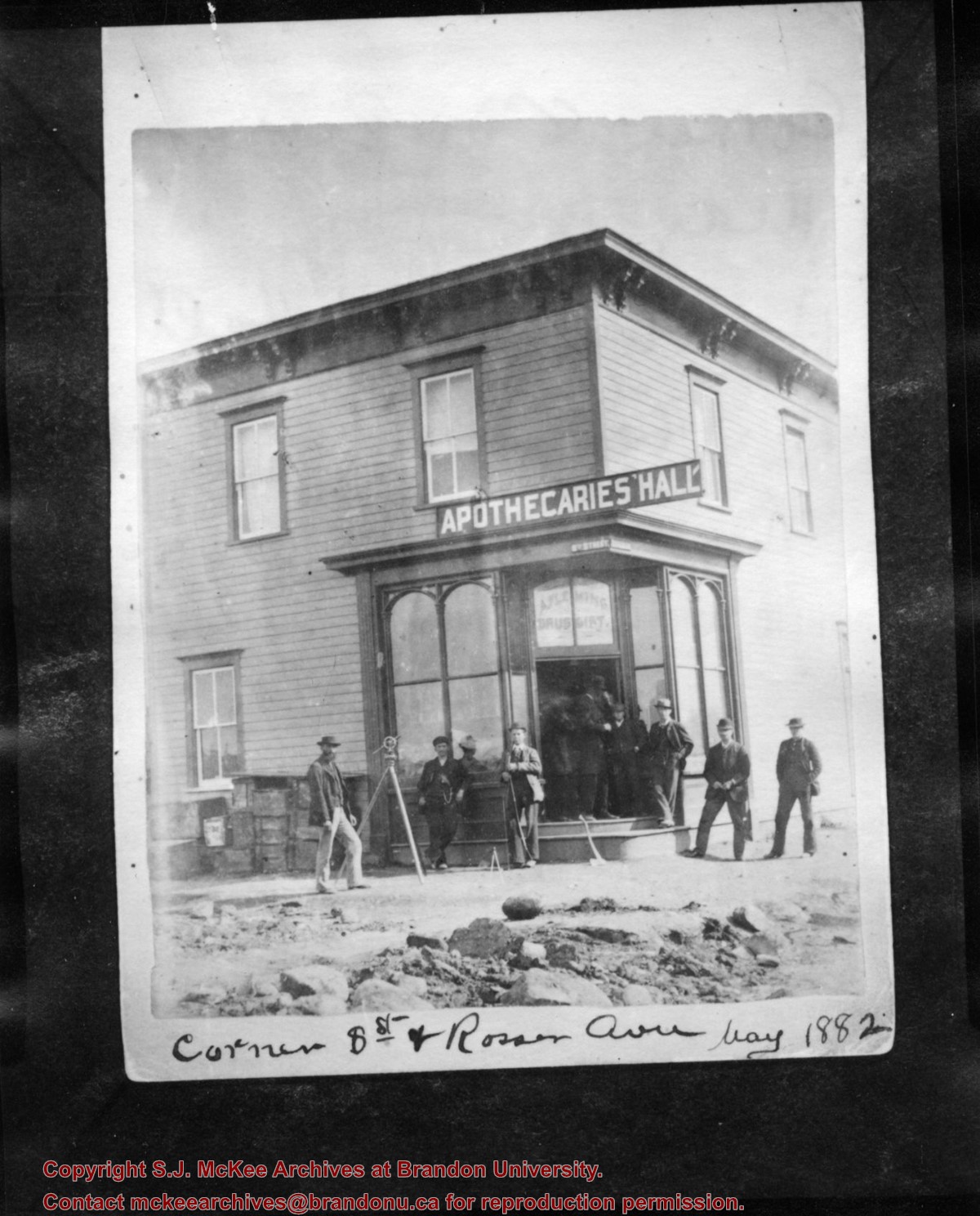
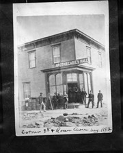
Photograph shows eight men posing in front of a wood-framed building on the corner of 8th Street and Rosser Avenue. Above the building's entrance is a painted sign that reads: Apothecaries' Hall. A. Fleming, Druggist is painted in the window above the door. Street signs designating 8th Street and Rosser Avenue are affixed to the building. A transit/theodolite is mounted on a tripod in front of the store.
Notes
Writing on the front of the photograph reads: Corner 8th St and Rosser Ave May 1882. Writing on the back of the photograph reads: Corner 8th St and Rosser, May 1882, Apthecaries' Hall, A. Fleming, Druggist. Photograph is stamped Public Archives Canada.
Photograph sent to Fred McGuinness from Leila McDiarmid Leck of Mission, BC, on 08 Feb 1983 in response to his Park School column (see F.A. Rosser, “Sunbeams – Park School reminiscences from a far away friends, Brandon Sun 25 Jan 1983)
Scope and Content
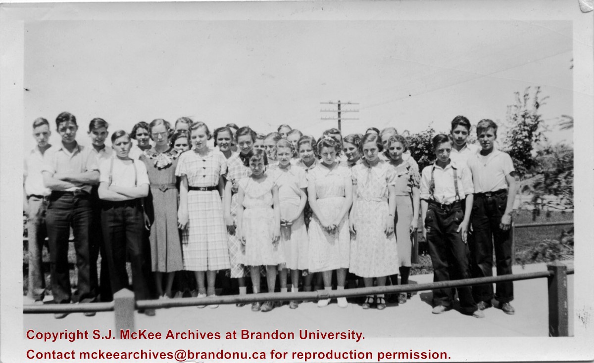
Photograph shows a group of co-ed students standing on a sidwalk between two railings. Students have been identified as: Glen Speers, Clifford Kitson, Rae McKenzie, Ellis McLaren, Shirley Lane, Beth (Babs) Kingston, Helen Tackaberry, Mina Collins, Mary Watson, Thelma Brownell, Jean Muirhead [dark head], Mary McDonald, Lorna Lawrence, Leila McDiarmid, Eleanor Wyre [head], Eleanor Sellers, Beth Crawford [head], Margaret Robinson, Florence Roberts, Eileen Muirhead? [head], Beulah Cristal, Marjorie Carruthers, Josephine Hamm [dark head], Dorothy Tinline?, Mary Wgner, Clayton Copp, Bob Epton, Howard Bell, and Anna Roberts in front.
Notes
Signatures of the students are on the back of the photograph. Names of obtained from correspondence dated 08 Feb 1983 to Fred McGuinness from Leia McDiarmid Leck.
The Medicine Hat Exhibition and Stampede Parade Day was held on Thursday, July 19, 1962, at 9:30 a.m. The local newspaper reported that approximately 24,000 people were in attendance to see parade marshall Rod Ashburner leading 175 entries consisting of 90 floats, 75 horses, and 10 bands. There were 19 parade categories eligible for $12,000 in prize money and included: junior and senior cowboys and cowgirls; fancy and Shetland ponies; sulky class open; comic, commercial, industrial and organizational floats; decorated cars; special ranch class; 4-H Clubs; and a non-competitive class.
The parade route started at Second St. and Allowance Ave., from Second St. to Ash Ave., north on Ash to First St. SE., from First St. S.E. to Fourth Ave., south to Second St. to South Railway St., south on South Railway St. to Third St., with a finish at McLeod Trail. A route map was published in the Medicine Hat News the day before the parade.
Aerial photographs of the parade were taken by Medicine Hat News photographer Howard Heid (1930-2005) from the private helicopter of John Bourn. Bourn was a pilot from Woodville, Wisconsin, who chartered his four-seater helicopter for sight-seers at exhibitions and stampedes across the county.
(Sources: Pat Currie, "Let 'Er Go!," Medicine Hat News, 19 July 1962,1; Harald Gunderson, "'Eye in the Sky' Best Parade View," Medicine Hat News, 19 July 1962,1; "Parade Starts at 9:30 Sharp," 18 July 1962)
Scope and Content
Photograph shows an aerial view of the Medicine Hat Exhibition and Stampede Parade route, with a focus on Second Street SE. A residential area showing homes with extensive backyard gardens can be seen. The South Saskatchewan River can be see on the right of the photograph.
Notes
This photograph shows the neighbourhood before rezoning and commercial development.
The Medicine Hat Exhibition and Stampede Parade Day was held on Thursday, July 19, 1962, at 9:30 a.m. The local newspaper reported that approximately 24,000 people were in attendance to see parade marshall Rod Ashburner leading 175 entries consisting of 90 floats, 75 horses, and 10 bands. There were 19 parade categories eligible for $12,000 in prize money and included: junior and senior cowboys and cowgirls; fancy and Shetland ponies; sulky class open; comic, commercial, industrial and organizational floats; decorated cars; special ranch class; 4-H Clubs; and a non-competitive class.
The parade route started at Second St. and Allowance Ave., from Second St. to Ash Ave., north on Ash to First St. SE., from First St. S.E. to Fourth Ave., south to Second St. to South Railway St., south on South Railway St. to Third St., with a finish at McLeod Trail. A route map was published in the Medicine Hat News the day before the parade.
Aerial photographs of the parade were taken by Medicine Hat News photographer Howard Heid (1930-2005) from the private helicopter of John Bourn. Bourn was a pilot from Woodville, Wisconsin, who chartered his four-seater helicopter for sight-seers at exhibitions and stampedes across the county.
(Sources: Pat Currie, "Let 'Er Go!," Medicine Hat News, 19 July 1962,1; Harald Gunderson, "'Eye in the Sky' Best Parade View," Medicine Hat News, 19 July 1962,1; "Parade Starts at 9:30 Sharp," 18 July 1962)
Scope and Content
Photograph shows an aerial view of the Medicine Hat Exhibition and Stampede Parade route with a focus on the First Street SE and Ash Street. A residential area showing homes with extensive backyard gardens can be seen.
Notes
This photograph shows the neighbourhood before rezoning and commercial development.
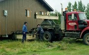
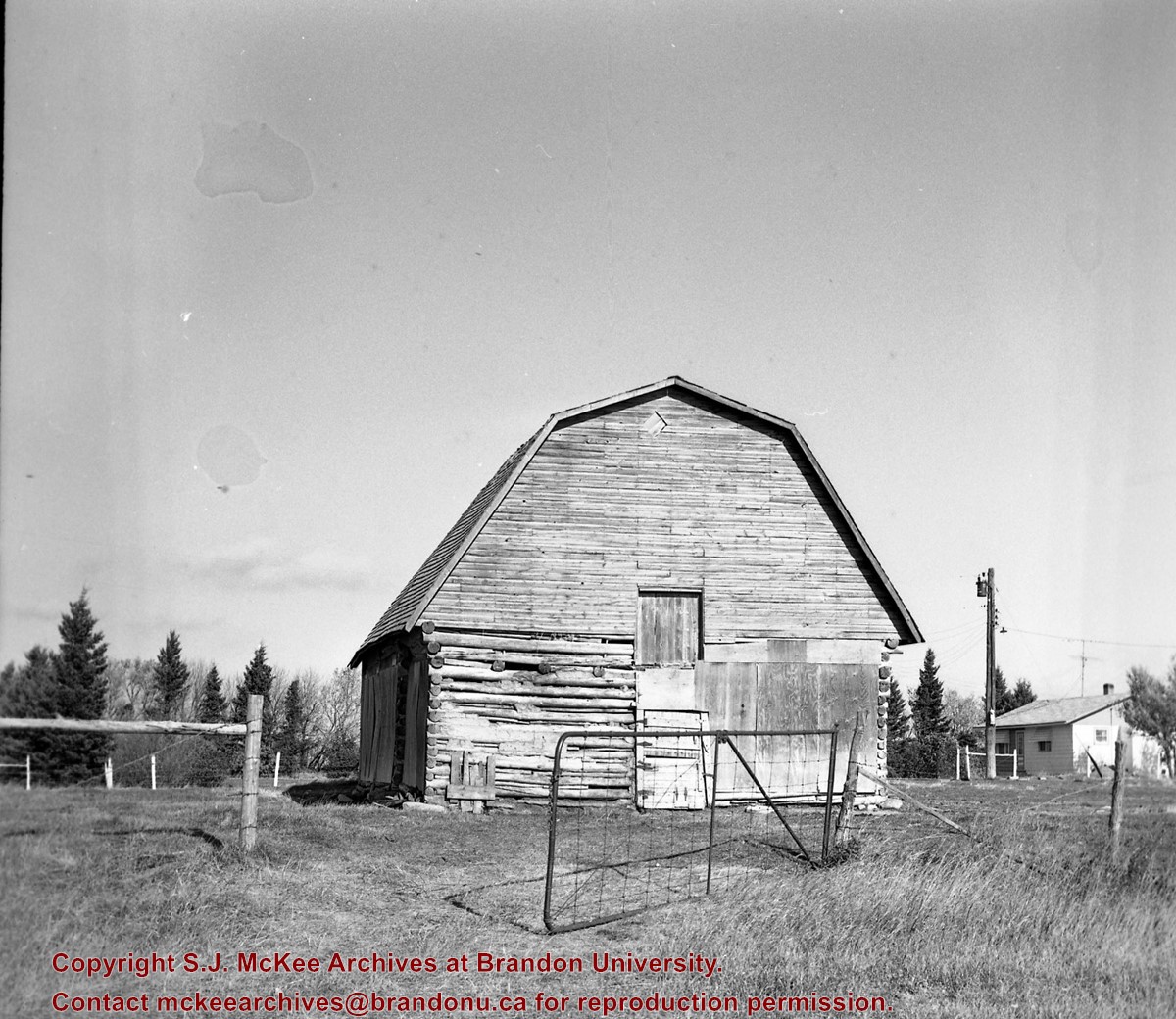
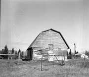
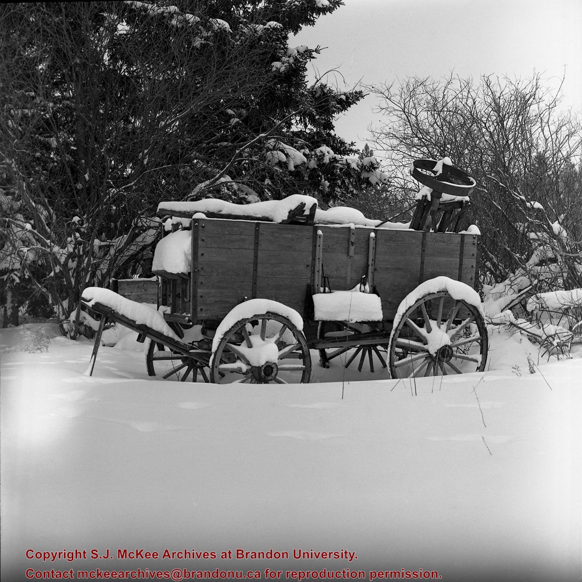
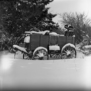
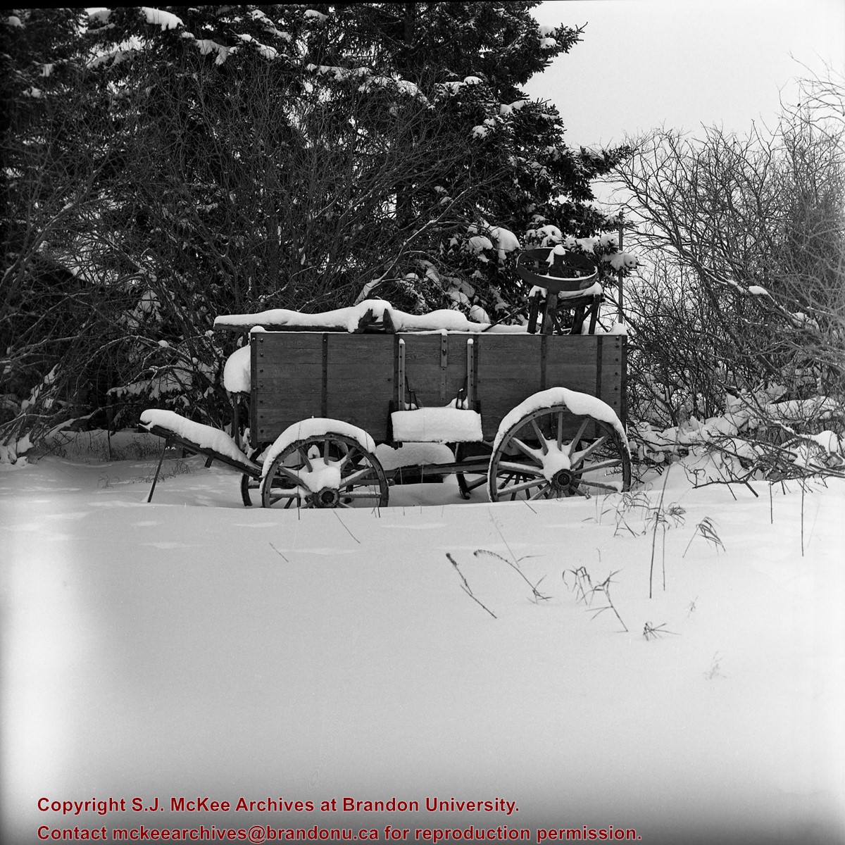
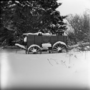
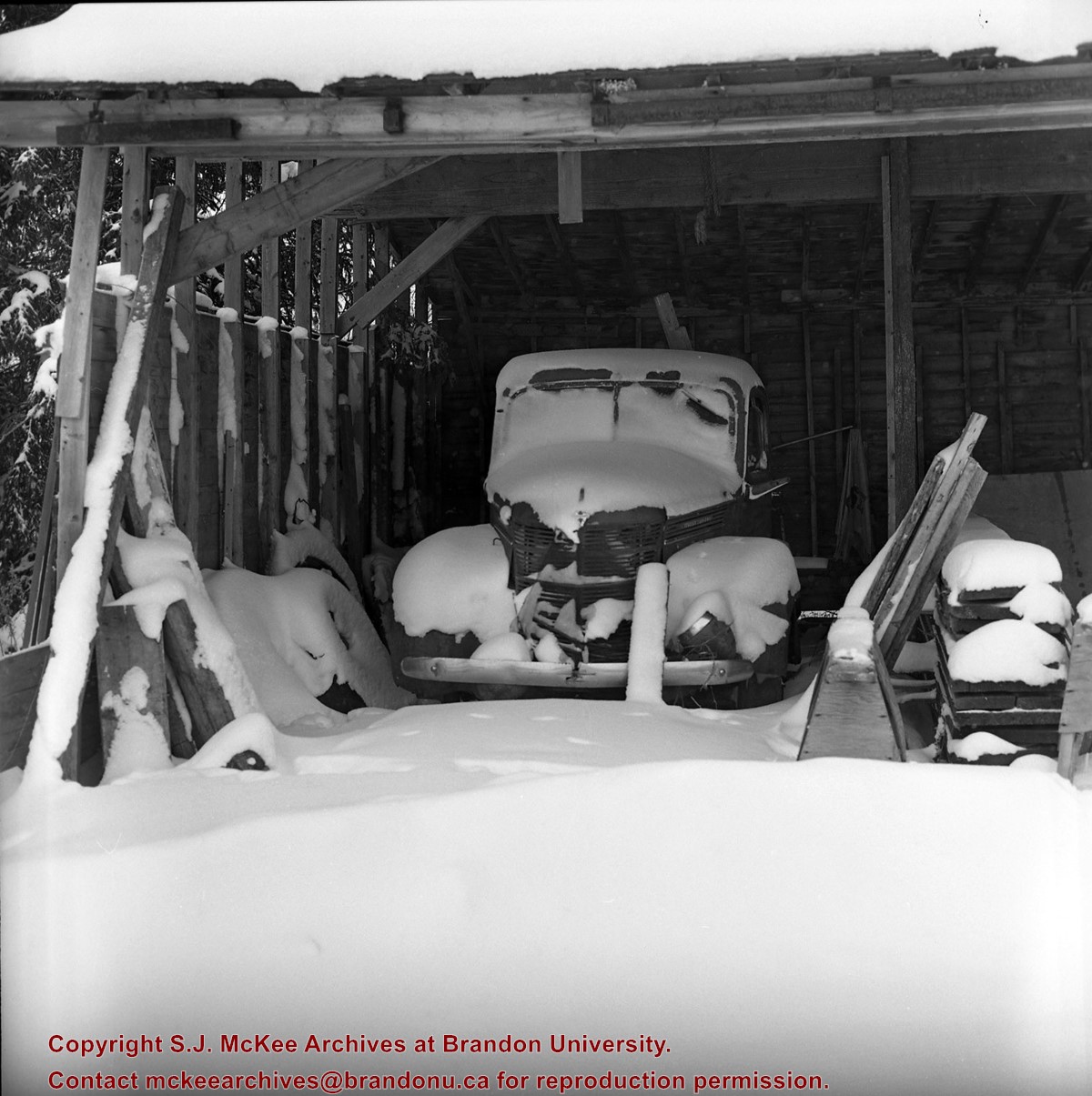
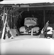
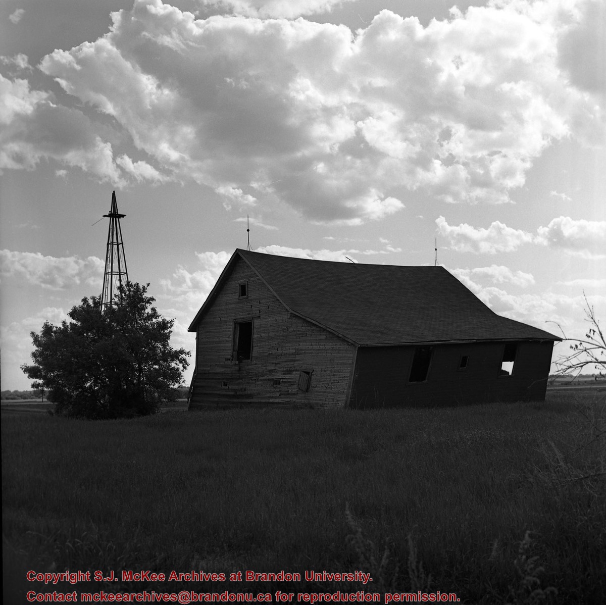
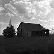
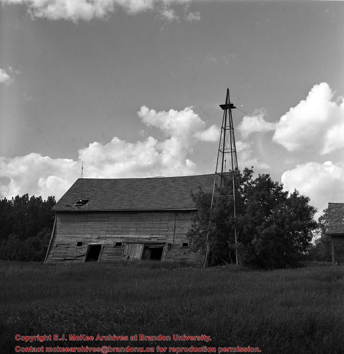
Fred McGuinness is popularly known for his work as the prairie essayist for CBC Radio’s Morningside with Peter Gzowski, a position he held for 17 years. Many of McGuinness’ Morningside essays were autobiographical in nature. He often reported about life on Christmas Tree Farm, a section of land where he and his wife, Christine, built their dream home in the late 1970s. The couple planted a Christmas tree farm on the property and Christine maintained an extensive kitchen garden, while Fred tended honey bees. Life on the farm made its way into radiobroadcasts, Neighborly News columns, and the book "Letters from Section 17: A Collection of Morningside Essays" (Winnipeg: Great Plains Publishing, 1999).
Scope and Content
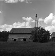
Set consists of 27 negatives showing different views of the McGuinness property, Christmas Tree Farm, Section 17
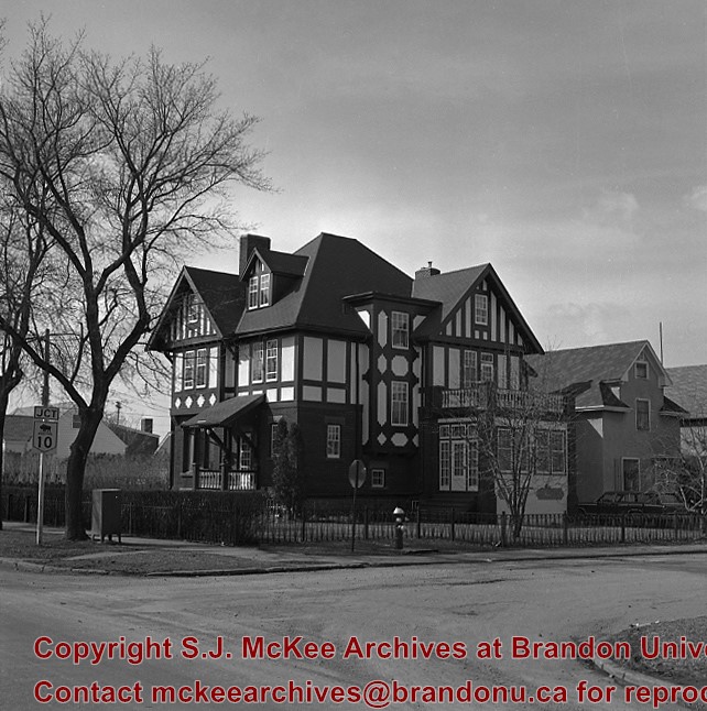
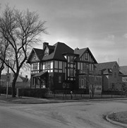
"Maley House was constructed in 1912 by Henry F. Maley, founder and owner of the Brandon Brewery Company. The house was purchased by Dr. McDiarmid, whose family occupied the home for the next sixty years. It is currently used as a bed and breakfast establishment" (Manitoba Culture, Heritage, Tourism and Sport). Maley House is listed as Manitoba Municipal Heritage Site No. 80.
Custodial History
For custodial history see the collection level description of the Lawrence Stuckey collection.
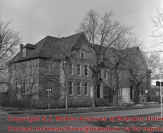
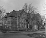
Scope and Content
[Maley House]; Elizabethan style
Notes
Located at 16th St. & Victoria Ave.
[Mr. Stuckey put two negatives in the same envelop, numbering them DE4a and DE4b. We have separated them.]
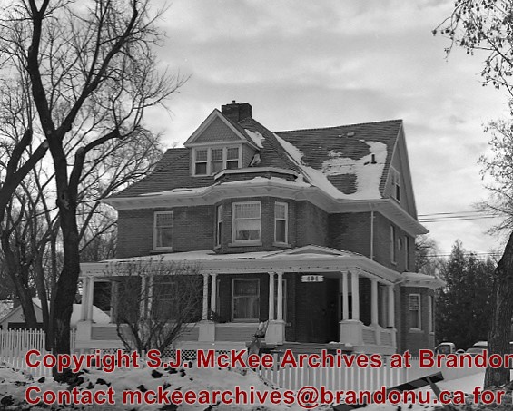
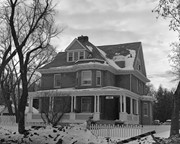
"Built in 1892 by Bell Brothers Construction, Lorne Terrace is a typical terrace house - a facility that combined several addresses in what would appear to be a very large house" (Manitoba Culture, Heritage, Tourism and Sport). It is currently listed as Manitoba Municipal Heritage Site No. 197.
Custodial History
For custodial history see the collection level description of the Lawrence Stuckey collection.
"Christie House was built in 1905 for Ernest Lisle Christie, founder of the huge stationary and school supply business that still bears his name. Christie and his family lived here until 1934, and the house was occupied by other family members until 1966. The house was designed by Brandon architect W.A. Elliott and was constructed by the local firm of G.C. Taylor" (Manitoba Culture, Heritage, Tourism and Sport). Christie House is listed as Manitoba Municipal Heritage Site No. 20.
Custodial History
For custodial history see the collection level description of the Lawrence Stuckey collection.


.jpg?width=1200&404=no-img.jpg&watermark=wmk)
.jpg?width=180&404=no-img.jpg)
)
%0a)
.jpg%3fmaxheight%3d1000%26maxwidth%3d1000%26watermark%3dwmk&description=Fire+Station+No.+1)