The Medicine Hat Exhibition and Stampede Parade Day was held on Thursday, July 19, 1962, at 9:30 a.m. The local newspaper reported that approximately 24,000 people were in attendance to see parade marshall Rod Ashburner leading 175 entries consisting of 90 floats, 75 horses, and 10 bands. There were 19 parade categories eligible for $12,000 in prize money and included: junior and senior cowboys and cowgirls; fancy and Shetland ponies; sulky class open; comic, commercial, industrial and organizational floats; decorated cars; special ranch class; 4-H Clubs; and a non-competitive class.
The parade route started at Second St. and Allowance Ave., from Second St. to Ash Ave., north on Ash to First St. SE., from First St. S.E. to Fourth Ave., south to Second St. to South Railway St., south on South Railway St. to Third St., with a finish at McLeod Trail. A route map was published in the Medicine Hat News the day before the parade.
Aerial photographs of the parade were taken by Medicine Hat News photographer Howard Heid (1930-2005) from the private helicopter of John Bourn. Bourn was a pilot from Woodville, Wisconsin, who chartered his four-seater helicopter for sight-seers at exhibitions and stampedes across the county.
(Sources: Pat Currie, "Let 'Er Go!," Medicine Hat News, 19 July 1962,1; Harald Gunderson, "'Eye in the Sky' Best Parade View," Medicine Hat News, 19 July 1962,1; "Parade Starts at 9:30 Sharp," 18 July 1962)
Scope and Content
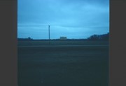
Photograph shows an aerial view of the Medicine Hat Exhibition and Stampede Parade route, with a focus on Second Street SE. A residential area showing homes with extensive backyard gardens can be seen. The South Saskatchewan River can be see on the right of the photograph.
Notes
This photograph shows the neighbourhood before rezoning and commercial development.
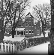
Fred McGuinness is popularly known for his work as the prairie essayist for CBC Radio’s Morningside with Peter Gzowski, a position he held for 17 years. Many of McGuinness’ Morningside essays were autobiographical in nature. He often reported about life on Christmas Tree Farm, a section of land where he and his wife, Christine, built their dream home in the late 1970s. The couple planted a Christmas tree farm on the property and Christine maintained an extensive kitchen garden, while Fred tended honey bees. Life on the farm made its way into radiobroadcasts, Neighborly News columns, and the book "Letters from Section 17: A Collection of Morningside Essays" (Winnipeg: Great Plains Publishing, 1999).
Scope and Content
Set consists of 27 negatives showing different views of the McGuinness property, Christmas Tree Farm, Section 17
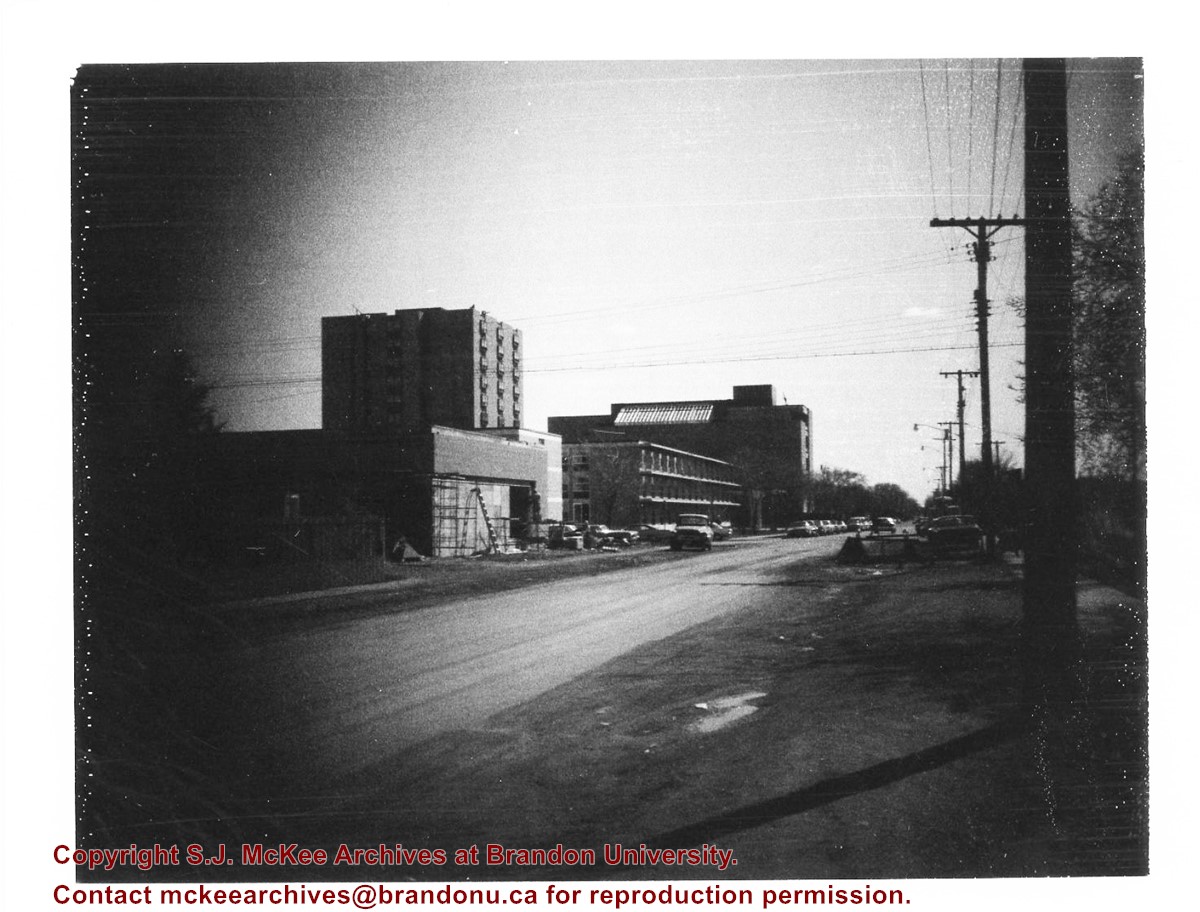
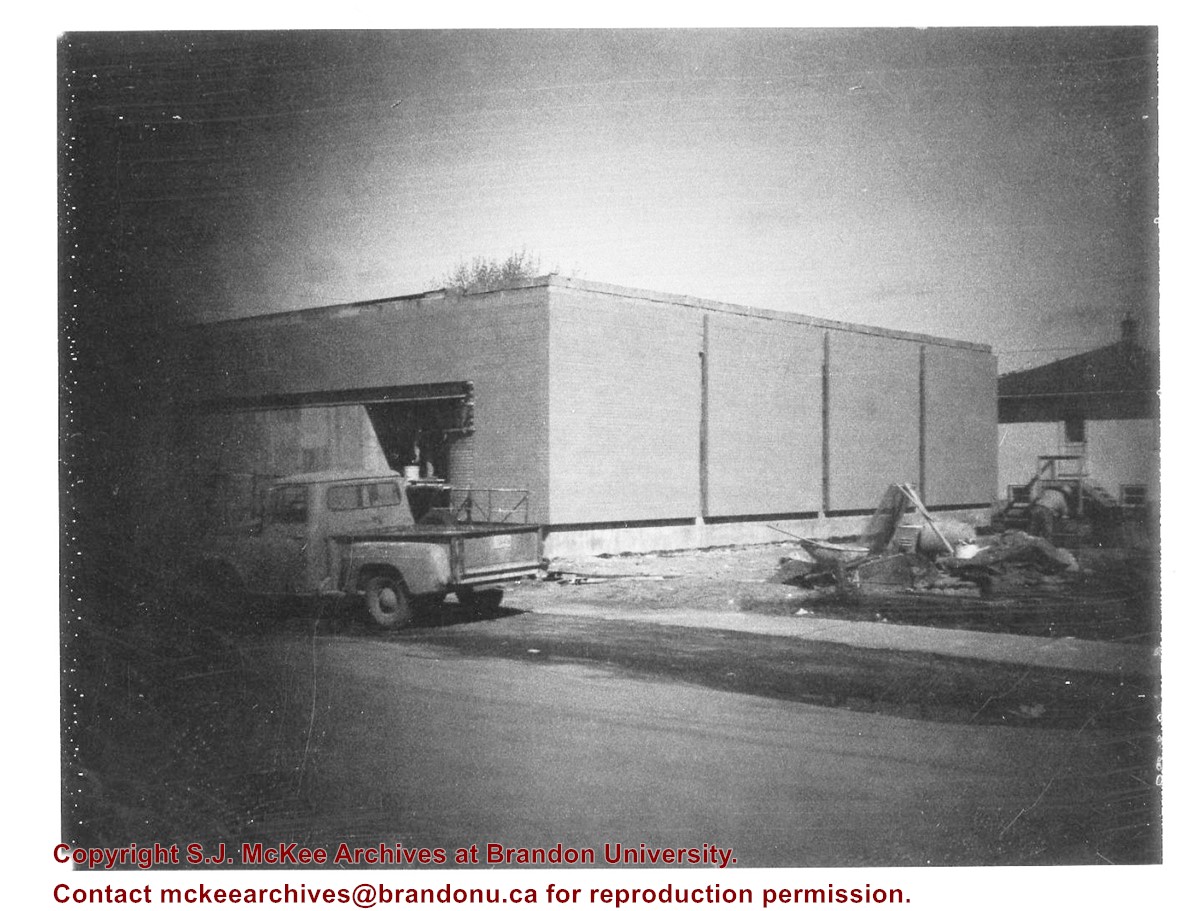
Donkersloot began working at Brandon University in 1970/1971 as the Clerk of Works. From 1973 until his retirement, he was the Director of Physical Plant.
The Site Services building was built in 1971.
Custodial History
Photograph was taken by Tom Donkersloot during construction and stored in albums in the Physical Plant H-Hut until they were transfered to the McKee Archives by Doug Duncalf in May 2008.
Scope and Content
Photograph shows construction of Brandon University's Site Services Building located on Louise Avenue at the corner of 20th Street. Also visible are McMaster Hall, Flora Cowan Women's Residence and the John R. Brodie Science Centre. Photograph is looking east/northeast from approximately 21st Street.
Notes
Donkersloot recorded the date and time each photograph was taken on the back of the photos.
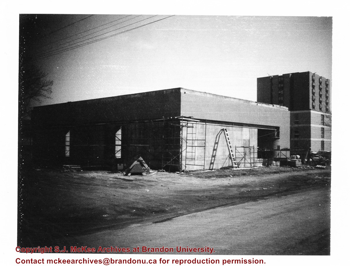
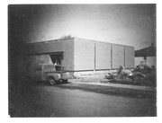
Donkersloot began working at Brandon University in 1970/1971 as the Clerk of Works. From 1973 until his retirement, he was the Director of Physical Plant.
The Site Services Building was built in 1971.
Custodial History
Photograph was taken by Tom Donkersloot during construction and stored in albums in the Physical Plant H-Hut until they were transfered to the McKee Archives by Doug Duncalf in May 2008.
Scope and Content
Photograph shows construction of Brandon University's Site Services Building located on Louise Avenue at the corner of 20th Street. Also visible are McMaster Hall and part of Darrach Hall. Photograph is looking northeast.
Notes
Donkersloot recorded the date and time each photograph was taken on the back of the photos.
Donkersloot began working at Brandon University in 1970/1971 as the Clerk of Works. From 1973 until his retirement, he was the Director of Physical Plant.
The Site Services Building was built in 1971.
Custodial History
Photograph was taken by Tom Donkersloot during construction and stored in albums in the Physical Plant H-Hut until they were transfered to the McKee Archives by Doug Duncalf in May 2008.
Scope and Content
Photograph shows construction of Brandon University's Site Services Building located on Louise Avenue at the corner of 20th Street. Photograph is looking northwest.
Notes
Donkersloot recorded the date and time each photograph was taken on the back of the photos.
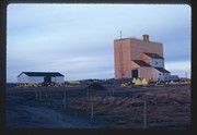
Operated as Pool A, this wooden grain elevator was built by Manitoba Pool Elevators between 1983 and 1984. It was closed by 2007 and demolished by 2008.
Custodial History
Slide was in the possession of John Everitt before its donation to the SJ McKee Archives in 2007.
Scope and Content
Item is an image of the new Manitoba Pool Elevator at Brandon, MB, under construction. The elevator was located at highways #1 and #10.
The SJ McKee Archives is the copyright holder for the John Everitt collection and as such is providing access to the John Everitt slide collection for educational and research purposes only. To publish, copy or otherwise use these images, written permission must be obtained from the SJ McKee Archives. Any issues arising from the use of an item is the responsibility of the persons desiring to use the item, as is the securing of any necessary permissions for use.
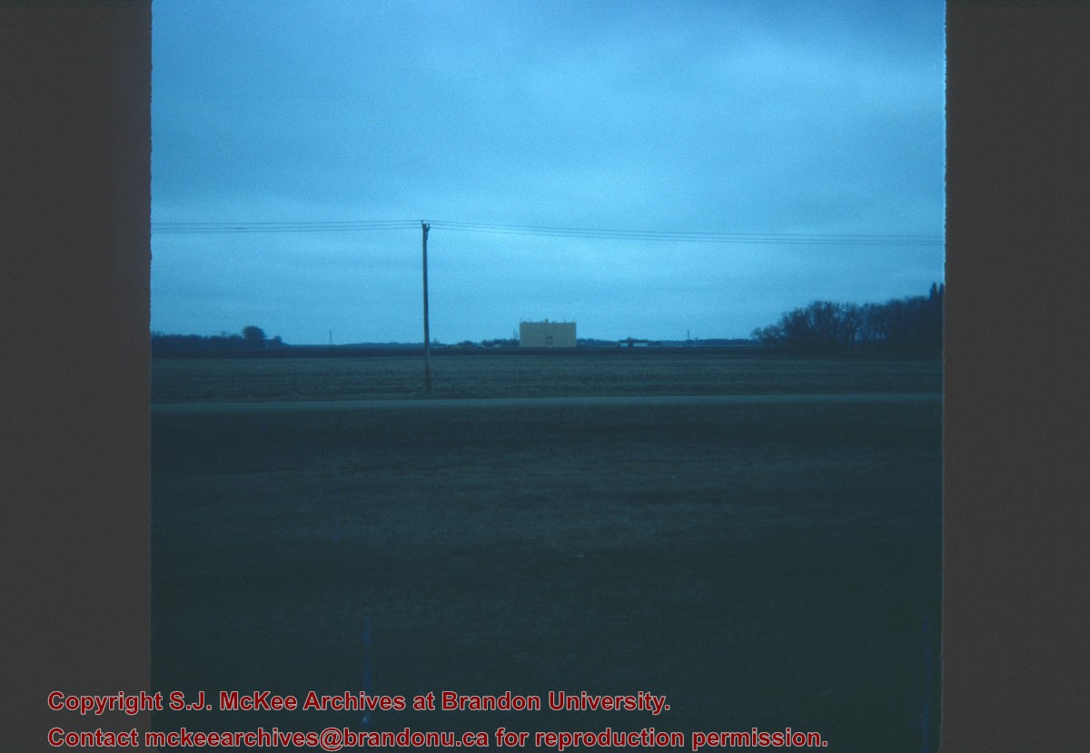
Operated as Pool A, this wooden grain elevator was built by Manitoba Pool Elevators between 1983 and 1984. It was closed by 2007 and demolished by 2008.
Custodial History
Slide was in the possession of John Everitt before its donation to the SJ McKee Archives in 2007.
Scope and Content
Item is an image of the new Manitoba Pool Elevator at Brandon, MB as seen from #1 highway.
The SJ McKee Archives is the copyright holder for the John Everitt collection and as such is providing access to the John Everitt slide collection for educational and research purposes only. To publish, copy or otherwise use these images, written permission must be obtained from the SJ McKee Archives. Any issues arising from the use of an item is the responsibility of the persons desiring to use the item, as is the securing of any necessary permissions for use.
See fonds level description of RG 4 for history/bio of MPE
Scope and Content
This sub-series consists of summaries of elevator operations. The records include the following:
Box 1:
Summary of Operations 1925-1968 Alexander-Gretna
Summary of Operations 1925-1968 Hamiota-Morris
Summary of Operations 1925-1968 Napinka-Woodnorth
Box 2:
Association Financial and Debt Repayment Summary 1925-1963
Association Financial and Debt Repayment Summary 1925-1963
Box 3:
Summary of Operations 1964-1968
Summary of Operations 1964-1968
Summary of Operations 1964-1968
Box 4:
Summary of Operations A-K 1925-1996
Summary of Operations L-Z 1925-1996
Elevator Points Closed A-L 1926-1987
Elevator Points Closed M-Z 1926-1987
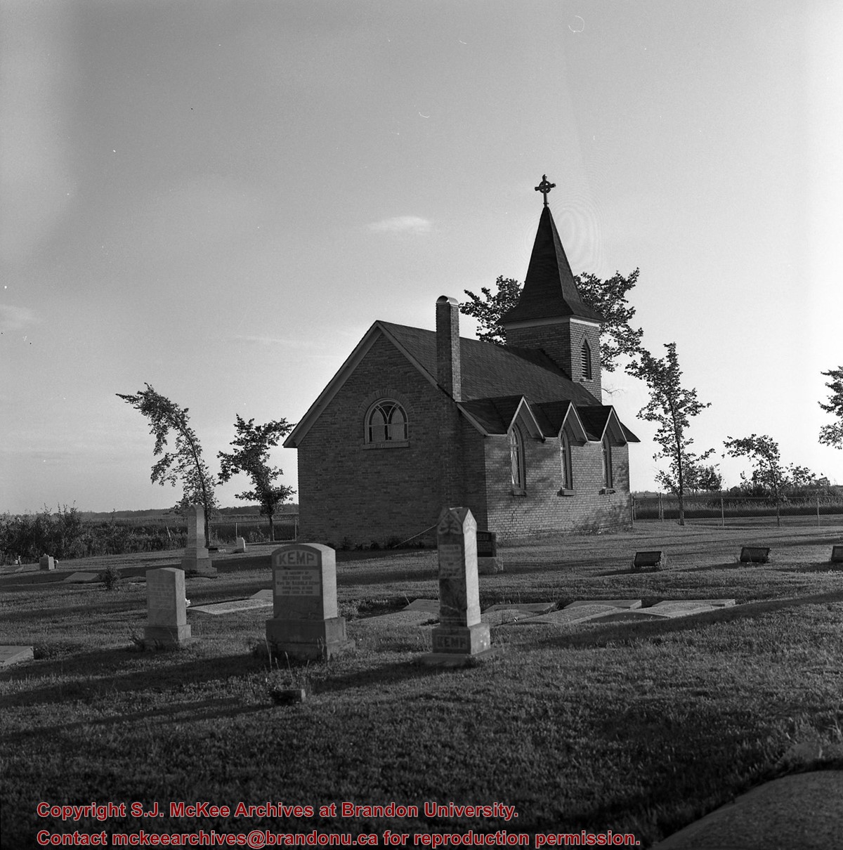
The Duthie site is the first site identified in the Makotchi-Ded Dontipi locale. It was reported to Dr. Bev Nicholson by Doug Jackson, a local collector who had observed archaeological materials that had been exposed during the construction of Maple Hill Road northwest of Lauder. The site is named after the landowner, Randy Duthie.
The initial inspection of the exposed materials indicated that the eastern half of the site had been severely impacted by raising a road grade using an elevating grader. However, an undetermined amount of the site remained to the west, flanked by a low sand dune. Testing and preliminary excavations were conducted in 1992-93. In 1994 a field school added to the excavated sample. The undisturbed portion of the site, west of Maple Hill Road was situated at the base of a low sand dune and had an aspen and willow forest cover. The water table was approximately one meter below surface at the time of excavation. A rising water table has since prevented further excavations.
Two dates on bone collagen were obtained during excavations. These were 880+/-80 B.P. (Beta 62705) and 970+/-40 B.P. cal. 1030 A.D. (TO 13366). These dates are consistent with an Initial Middle Missouri cultural assignment. The site occupation is identified by the distinctive ceramics found there. Ceramics at the Duthie Site are tool impressed with incising and lip modeling with fabric impressions on most vessels. Jill Taylor analysed the ceramics from the site for a Specialist thesis, Brandon University (1994) and a Masters of Arts degree from the University of Saskatchewan. (Taylor 1995).
Analysis of residue from Duthie site pottery by Matthew Boyd recovered corn (Zea mays) phytoliths and bean (Phaseolus sp.) starch grains indicating consumption of these domesticates at the Duthie site. (Boyd 2006)
The occupation of this site indicates a migration of people from the south who were well acquainted with horticultural farming. These people had previously migrated to South Dakota following river valleys into the central plains from the eastern woodlands during late Hopewell times. It appears that they later migrated well to the north into southern Manitoba but there is no evidence that they remained there for more than a single year.
Boyd, M., C. Surette and B.A. Nicholson. 2006 Archaeobotanical Evidence of Prehistoric Maize (Zea mays) Consumption at the Northern Edge of the Great Plains. Journal of Archaeological Science 33: 1129-1140.
Taylor, J. 1994 An analysis of the ceramics recovered during 1992 and 1993 at the Precontact Duthie Site (DiMe-16). Specialist thesis, Brandon University.
Scope and Content
The Series has been divided into seven sub-series, including (1) Duthie site (2) Jackson site (3) Twin Fawns site (4) Vera site (5) Schuddemat site (6) Bradshaw site (7) Hollow B site.
Edwin Association Minutes 1928-1981; Sub-district #101 Minutes Oct 6 1969-July 18 1978; Agent's Letters Dec 24 1928-July 15 1947; Cirrculars Spet 19 1969-August 15 1978; Correspondence Nov 7 1960-Sept 8 1978; Memo of Association and By-laws 1928-1953; Member Certificates 1947-1953; Newsletters Jan 1976-August 1978; Attendance records 1946-1962; Financial 1929-1983; Miscellaneous (correspondance, Grain Handling Commission, Crop Development and Seed Clubs, publications) 1951-1978; Membership Lists 1955-1978
Notes
Description by Jill Sutherland (2010)
The records for Edwin Association are unique in that more that just minute books were sent to the McKee archives
Forrest Association Minutes 1927-1991; Circulars April 21 1965-Oct 19 1981; Correspondance May 22 1927-May 25 1981; Documents Feb 11 1927-July 31 1969; Financial 1928-1968; Membership 1948-1969; Miscellaneous 1952-1980
Notes
Description by Jill Sutherland (2010)
The records for Forrest Association are unique in that more that just minute books were sent to the McKee archives
Border Fertilizers Ltd was a parnership agreement between the Pool and M.G. Smerchanski to provide better fertilizer services to Pool members. MPE entered the agreement in 1963 but sold their shares in 1969 due to heavy losses.
See also fonds level description of RG 4 for history/bio of MPE
Scope and Content
This sub-series consists of legal documents, financial statements, proposals and reports.


)
%0a)
%0a)