The Westman Recycling Council was started by a small group of avid recyclers with financial and volunteer help from the Kiwanis Club of Brandon, among others. Volunteers organized the first outdoor recycling depots in June and October 1989. The first event with recorded minutes was the first annual meeting, November 15, 1989.
The organization was incorporated in February 1990, and became a registered charity in 1995. The Mission Statement was: "to support and promote the reduction, re-use, and recycling of material resources for the benefit of Westman's environment and future generations."
The major partner in the work of the organization was the City of Brandon. In 2003, Westman Recycling, in partnership with the City, built a Material Recovery Facility (MRF) at the Brandon Landfill; Westman Recycling owned the building on the City-owned land. It was a $4 million structure - financed by federal and provincial grants (about one-quarter of the total) and a mortgage (about three-quarters). Details are in the Board and other Committee minutes and agreements.
In late 2005, Westman Recycling faced a severe cash crunch - as a result of poor markets for recyclables, changes in support funding from the Manitoba Product Stewardship Corporation (MPSC), and a drop in public recycling levels. In February 2006, the City decided to sign a contract with another organization to operate the MRF; after that there appeared to be no role for Westman Recycling.
A general meeting on September 22, 2008 voted to dissolve the organization. At that meeting, the suggestion was made (agreed to by consensus) that the files of the organization be donated to Brandon University to be made available for researchers. A Board of Directors meeting on the same date voted to donate all remaining funds to a perpetual "Westman Recycling" fund with the Brandon Area Community Foundation.
A final wind-up meeting was held on March 26, 2009
Custodial History
The organization was overseen by volunteers / volunteer Board of Directors. The files were first held by volunteers / Board members in their homes. In May 1991, the organization hired David McConkey as Coordinator / General Manager, who was directed by the Board to manage the files on a daily basis from that date forward.
The files were kept in the organization's rented office space in the 1300 block of Pacific Avenue from May 1991 to September 1992, and then in the rented space in the Massey building at 6th Street and Pacific Avenue. The files were kept at the new facility at the landfill from April 2003 to February 2006. They were then stored in the basement of the Marquis Project, 912 Rosser Avenue, until August 2011 when they were donated to the S.J. McKee Archives, Brandon University.
Some files (e.g. minutes from 1995-96) were found to be missing entirely. Other files were disposed of by recycling and/or shredding as they were judged to be confidential (e.g. personnel), of an ordinary business nature only (e.g. invoices), or not useful for future research (e.g. extra copies, routine correspondence, building and equipment plans and other arrangements).
Scope and Content
Fonds consists of records that document the origin, activities, demise, and legacy of the Westman Recycling Council. Records include minutes, financial summaries, scrapbooks, newsletters, brochures, media clippings, photographs and miscellaneous documents related to the construction in collaboration with the City of Brandon of Brandon's principal recycling facility.
Notes
Administrative history courtesy David McConkey. See additional notes on the organization in the curatorial file. Description by Tom Mitchell.
View is east northeast from the sidewalk on the southeast corner of the George T. Richardson Centre (John R. Robbins Library). Photographs shows the campus during winter, including the Physical Plant and Development H-Huts, as well as the Brandon College Building and Clark Hall after the majority of the renovations were completed.
View is southwest from 18th Street, just north of the Brandon University sign. Tken during the summer, the photograph shows the front lawn, a portion of the flower bed, the Citizens' Science Building, the Knowles Douglas Students' Union Centre, the John R. Brodie Science Centre and McMaster Hall.
View is northeast. Photograph shows the green space before the Library extension in 1993. Brandon College Building and the Development H-Hut in the background.
View is northwest from the roof of the John R. Brodie Science Centre. Photograph shows part of McMaster Hall, the H-Huts, the Citzens' Science Building, the Brandon College Building and Clark Hall, the driveway, the J.R.C. Evans Lecture Theatre, the A.E. McKenzie Building and the Queen Elizabeth II Music Building.
View is northwest from the sidewalk on the west side of 18th Street. Photograph shows the John R. Brodie Science Centre sign, McMaster Hall and its entrance, the lawn in from of McMaster Hall, a portion of the Knowles Douglas Students' Union Centre and the Citizens' Science Building.
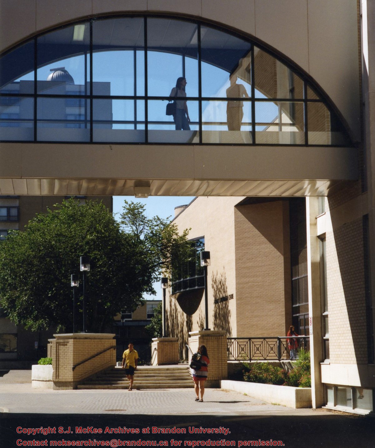
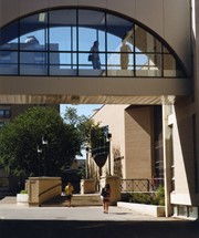
View is southwest from the corner of Clark Hall and the Clark Hall extension. Photograph shows students entering and exiting the George T. Richardson Centre and walking through the courtyard.
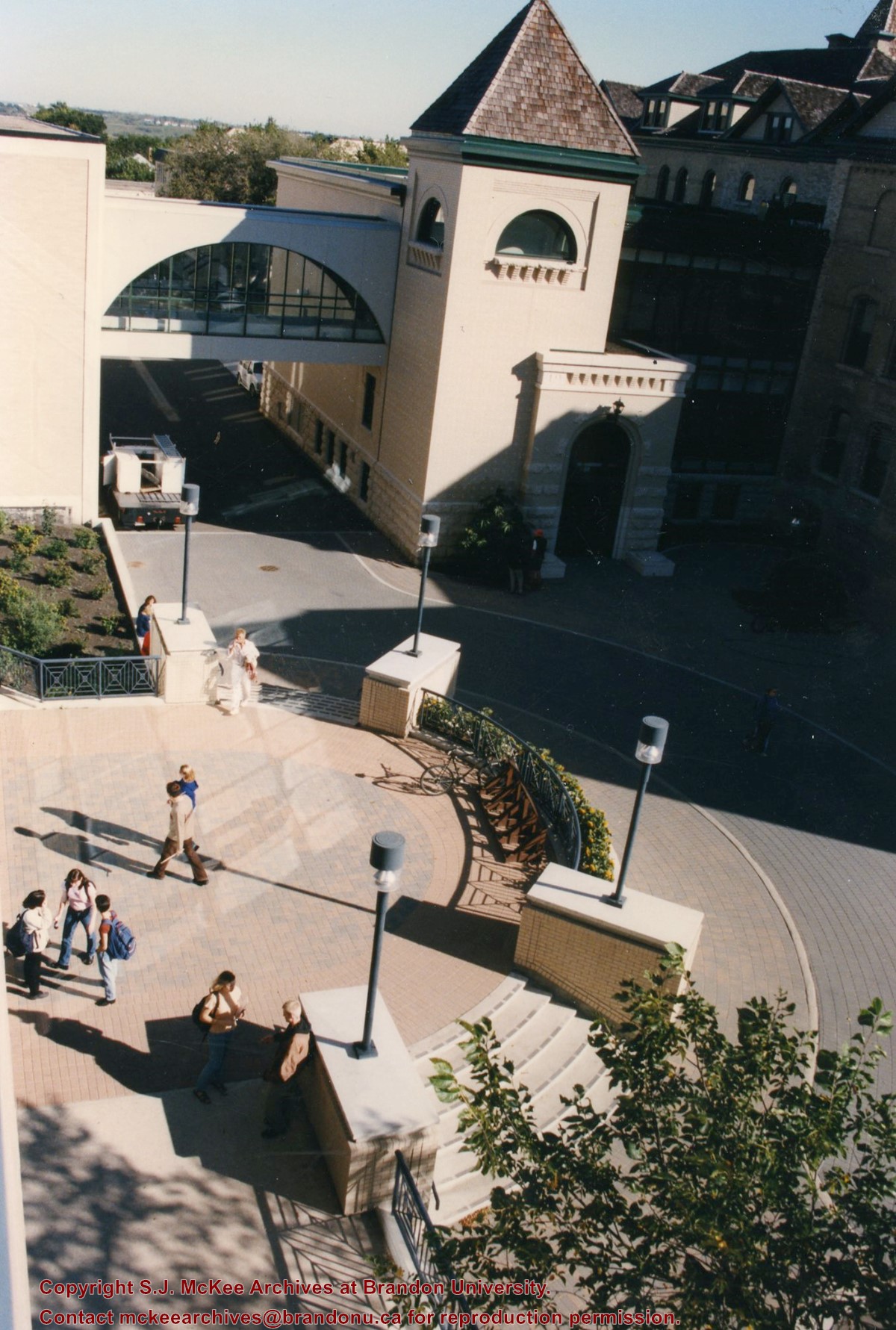
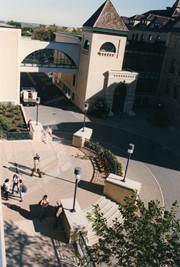
View is south from appromately the skywalk. Photograph shows the walkway that runs in front of the A.E. McKenzie Building south to the George T. Richardson Centre staircase and entrance. McMaster Hall in the background.
View is north northeast from the roof of the John E. Robbins Library in the George T. Richardson Centre. Photograph shows the entrance to the Richardson Building, part of the courtyard and the Clark Hall extension.
View is northeast from in front of the John E. Robbins Library in the George T. Richardson Centre. Photograph shows the entrance to the Richardson Building, most of the courtyard, Clark Hall and its extension.
View is northeast from the roof of the George T. Richardson Centre (John E. Robbins Library). Photograph shows the courtyard and the west side of the Brandon College building and Clark Hall, as well as the Clark Hall extension and part of the skywalk.
View is east southeast from the roof of the A.E. McKenzie Building. Photograph shows the courtyard and the west side of the Brandon College Building, as well as the Citizens' Science Building and the greenspace in between the two buildings.
View is from the front steps of the Education Building looking south down the east side of the Brandon College Building and Clark Hall to the Knowles Douglas Students' Union Centre and the John R. Brodie Science Centre in the background.
View is north northwest from the roof of McMaster Hall. Photograph shows part of the Citizens' Science Building, a number of H-Huts, the Brandon College Building, the greenspace, the J.R.C. Evans Lecture Theatre, the A.E. McKenzie Building, the Queen Elizabeth II Music Building and the Western Manitoba Centennial Auditorium. A number of residential blocks are also visible.
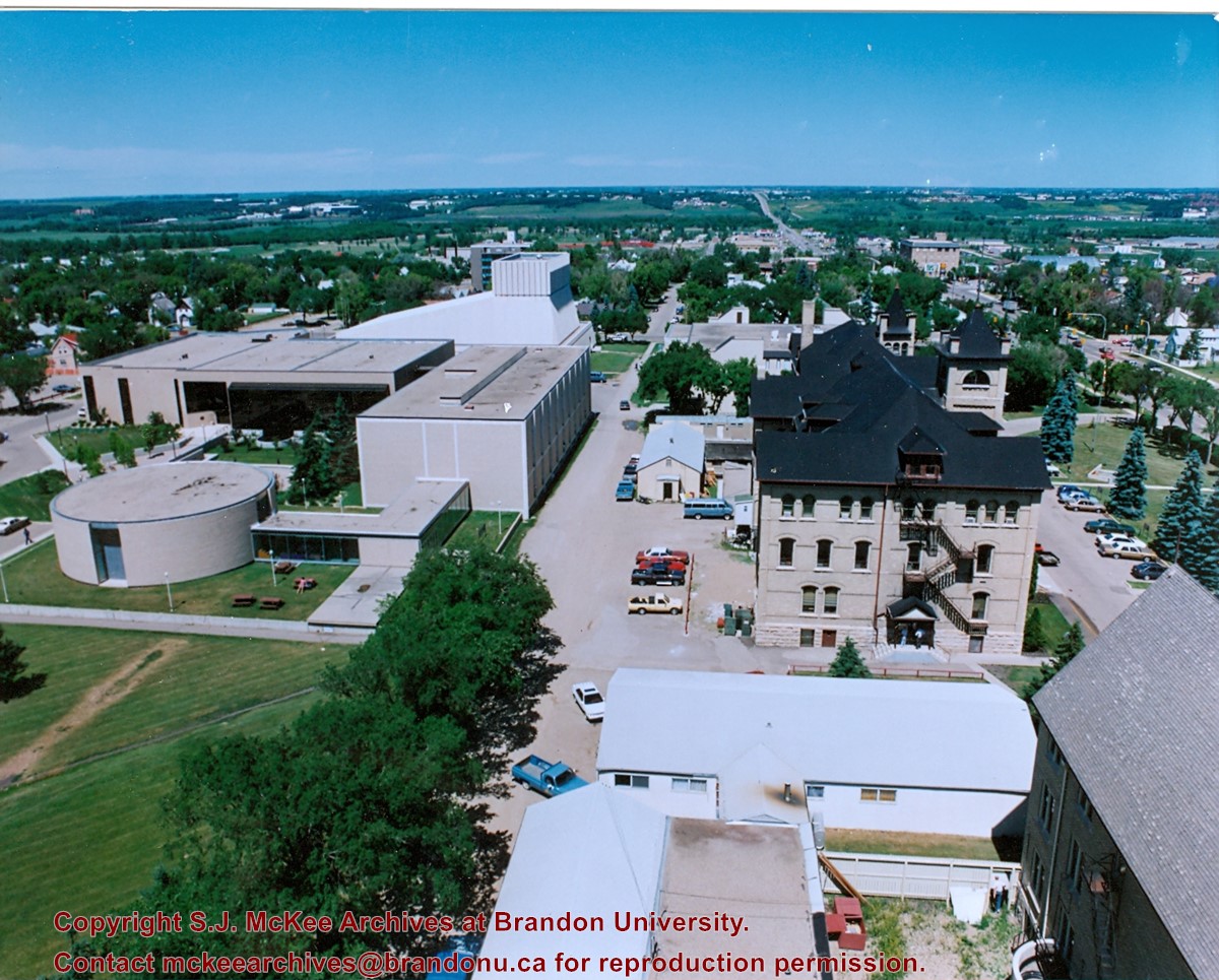
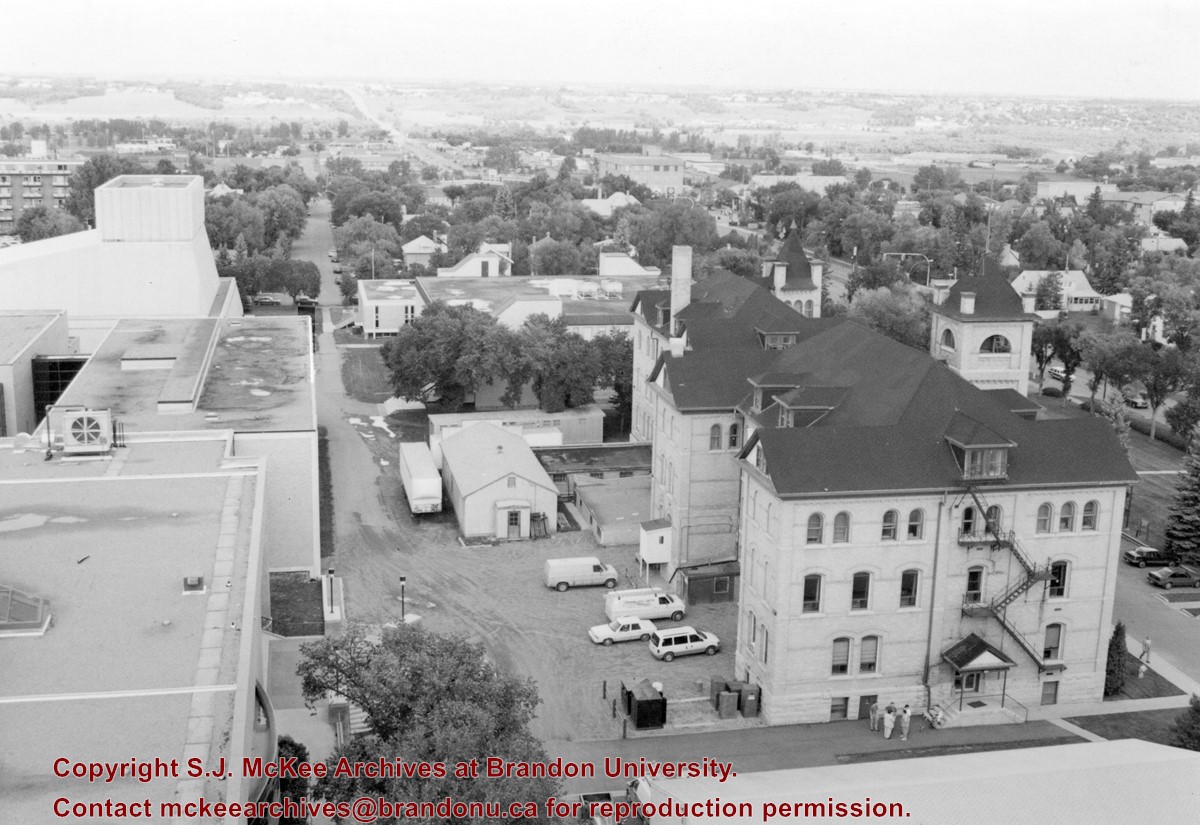
View is north northeast from the roof of McMaster Hall. Photograph shows a couple of H-Huts, the Brandon College Building, Clark Hall, the George T. Richardson Centre, the A.E. McKenzie Building, the original Music Building and the Western Manitoba Centennial Auditorium. A number of residential blocks are also visible.
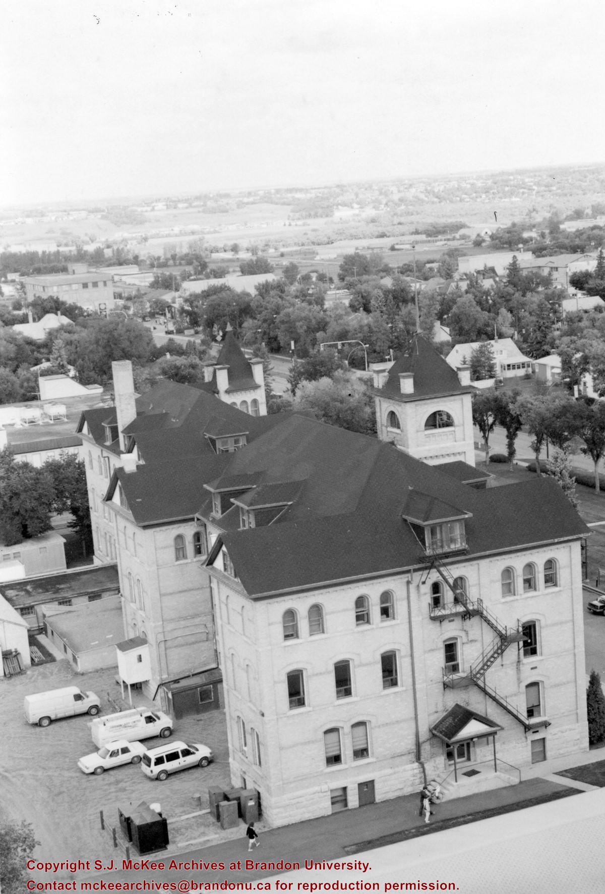
View is northeast from the roof of McMaster Hall. Photograph shows the Brandon College Building and Clark Hall, as well as the roof of the Education Building and portions of two H-Huts. A number of residential blocks are also visible.
View is northeast from the Dining Hall. Photograph shows the greenspace, the J.R.C. Evans Lecture Theatre, the A.E. McKenzie Building, the Brandon College Building and Clark Hall.


