Donkersloot began working at Brandon University in 1970/1971 as the Clerk of Works. From 1973 until his retirement, he was the Director of Physical Plant.
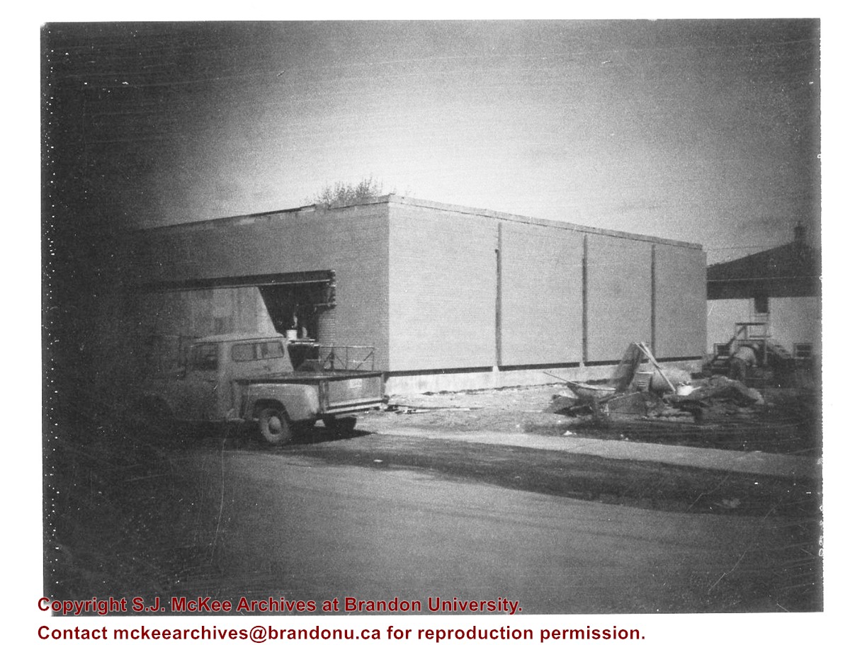
The Site Services building was built in 1971.
Custodial History
Photograph was taken by Tom Donkersloot during construction and stored in albums in the Physical Plant H-Hut until they were transfered to the McKee Archives by Doug Duncalf in May 2008.
Scope and Content
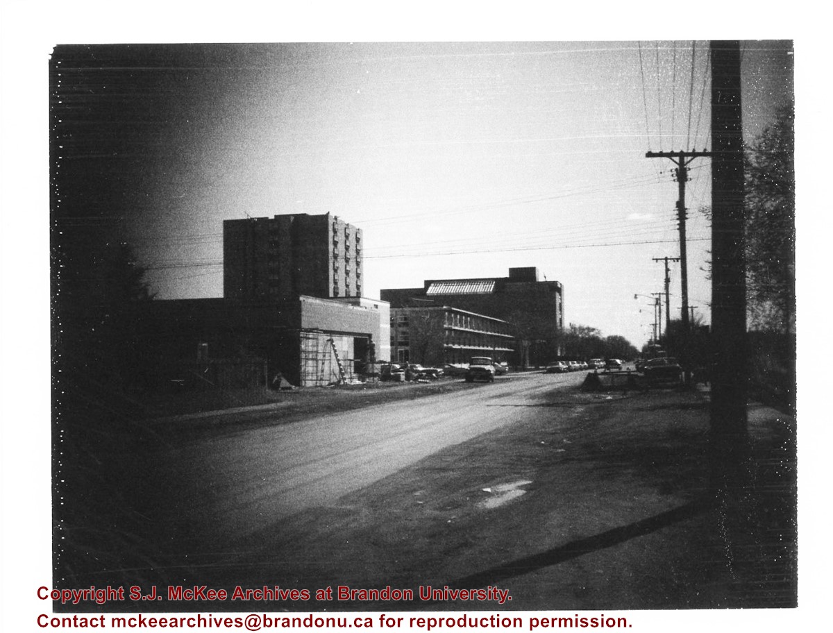
Photograph shows construction of Brandon University's Site Services Building located on Louise Avenue at the corner of 20th Street. Also visible are McMaster Hall, Flora Cowan Women's Residence and the John R. Brodie Science Centre. Photograph is looking east/northeast from approximately 21st Street.
Notes
Donkersloot recorded the date and time each photograph was taken on the back of the photos.
Donkersloot began working at Brandon University in 1970/1971 as the Clerk of Works. From 1973 until his retirement, he was the Director of Physical Plant.
The Site Services Building was built in 1971.
Custodial History
Photograph was taken by Tom Donkersloot during construction and stored in albums in the Physical Plant H-Hut until they were transfered to the McKee Archives by Doug Duncalf in May 2008.
Scope and Content
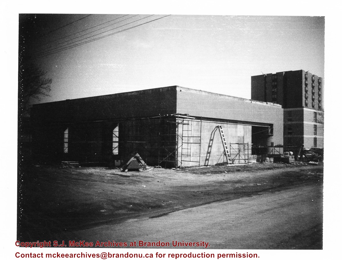
Photograph shows construction of Brandon University's Site Services Building located on Louise Avenue at the corner of 20th Street. Also visible are McMaster Hall and part of Darrach Hall. Photograph is looking northeast.
Notes
Donkersloot recorded the date and time each photograph was taken on the back of the photos.
Donkersloot began working at Brandon University in 1970/1971 as the Clerk of Works. From 1973 until his retirement, he was the Director of Physical Plant.
The Site Services Building was built in 1971.
Custodial History
Photograph was taken by Tom Donkersloot during construction and stored in albums in the Physical Plant H-Hut until they were transfered to the McKee Archives by Doug Duncalf in May 2008.
Scope and Content
Photograph shows construction of Brandon University's Site Services Building located on Louise Avenue at the corner of 20th Street. Photograph is looking northwest.
Notes
Donkersloot recorded the date and time each photograph was taken on the back of the photos.
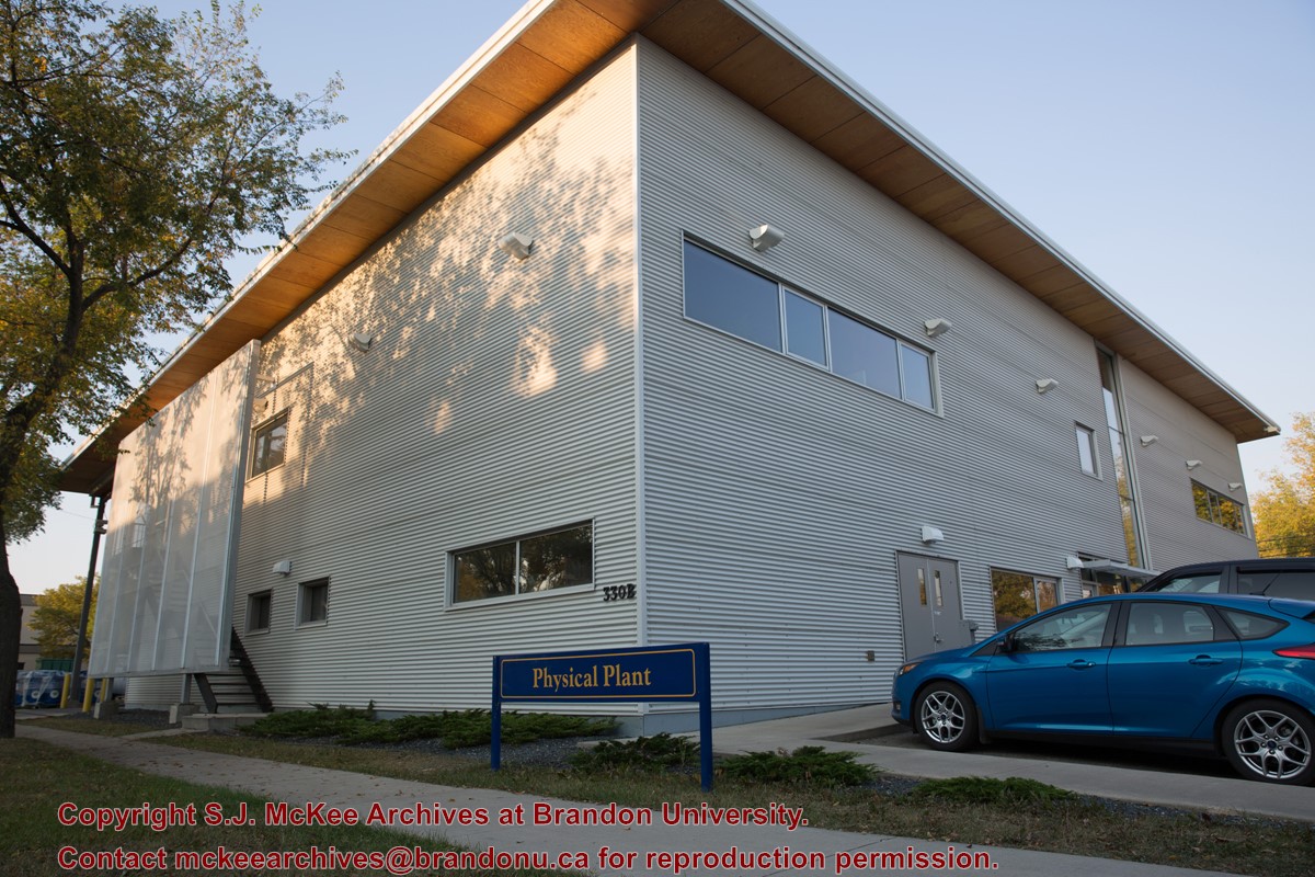
A $3.9M, 13,600 square-foot physical plant was opened on 07 April 2010. Located south of the steam plant on 20th Street by Darrach Hall, the building replaced the old Physical Plant occupying the World War II H-Huts. The new building serves as the hub for many campus operations, providing services from security and technical support, to building maintenance, deliveries, grounds keeping, cleaning, and capital project management.
Custodial History
Photograph is part of a series of campus images commissioned by the McKee Archives and Communications in the lead up to Brandon University's 50th Anniversary celebration.
Scope and Content
Photograph shows the new Physical Plant building located on the west side of 20th Street, just north of Louise Avenue. The photograph is looking southwest and shows the exterior of the building, as well as part of the parking lot.
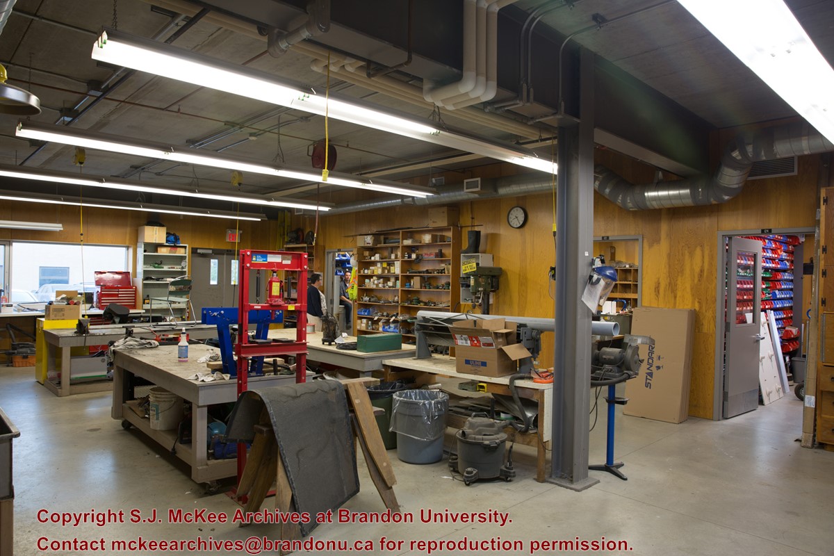
A $3.9M, 13,600 square-foot physical plant was opened on 07 April 2010. Located south of the steam plant on 20th Street by Darrach Hall, the building replaced the old Physical Plant occupying the World War II H-Huts. The new building serves as the hub for many campus operations, providing services from security and technical support, to building maintenance, deliveries, grounds keeping, cleaning, and capital project management.
Custodial History
Photograph is part of a series of campus images commissioned by the McKee Archives and Communications in the lead up to Brandon University's 50th Anniversary celebration.
Scope and Content
Photograph shows a storage/work space inside the new Physical Plant building located on the west side of 20th Street, just north of Louise Avenue. The man with his back to the camera is Al Puhach, Maintenacne Supervisor. The man facing the camera is Gord Neal, Director of Physical Plant.
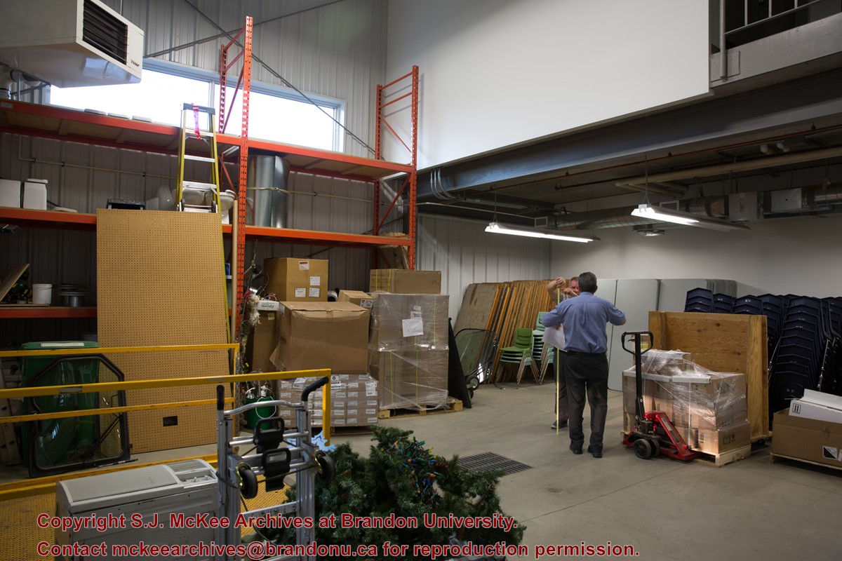
A $3.9M, 13,600 square-foot physical plant was opened on 07 April 2010. Located south of the steam plant on 20th Street by Darrach Hall, the building replaced the old Physical Plant occupying the World War II H-Huts. The new building serves as the hub for many campus operations, providing services from security and technical support, to building maintenance, deliveries, grounds keeping, cleaning, and capital project management.
Custodial History
Photograph is part of a series of campus images commissioned by the McKee Archives and Communications in the lead up to Brandon University's 50th Anniversary celebration.
Scope and Content
Photograph shows a work space inside the new Physical Plant building located on the west side of 20th Street, just north of Louise Avenue. The woman in the background is Stacey Harper, Physical Plant Office Assistant. The man in the background is Brent Cuvelier, Carpenter.
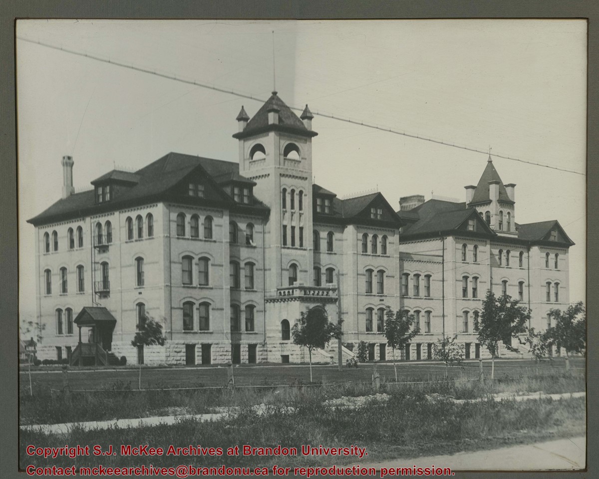
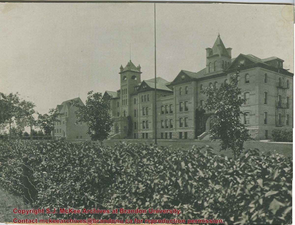
Photograph is looking southwest from the north end of the driveway and 18th Street and shows the Brandon College campus, including the front lawn, Clark Hall, the Brandon College Building and the Citizens' Science Building.
Notes
This photograph was used on a number of the Class photographs in BUPC 9. Duplicate is 9.43.
The photograph was taken for the Centennial of Brandon College/University.
Scope and Content
Aerial photograph taken looking southwest from approximately the northeast corner of Princess Avenue and 17th Street. The entire campus, as well as a number of residential streets are visible.
The photograph may have been taken for Brandon University's centennial.
Scope and Content
Photograph is looking northeast from approximately Victoria Avenue and 21st Street and shows the Brandon University campus, Kinsmen Stadium, the Assiniboine River and a number of residential neighbourhoods.
View is southwest from approximatley 16th Street between Princess and Rosser Avenues. Photograph shows the Brandon University campus, as well as surrounding residential blocks, including Flemming, J.R. Reid and Vincent Massey schools.
View is west southwest from approximatley 16th Street between Princess and Lorne Avenues. Photograph shows the Brandon University campus, as well as surrounding residential blocks between 16th and 23rd Streets, Princess and Louise Avenues..
View is west from approximatley 17th Street between Lorne and Louise Avenues. Photograph shows a portion of the Brandon University campus (excluding the Education Building and anything north of it), as well as surrounding residential blocks from approximatley 17th Street to 22nd Street.
View is west northwest from approximatley 16th Street and Louise Avenue. Photograph shows the Brandon University campus, prior to the Library Extension, and a large portion of the city to the west of the campus.
View is northwest from approximatley 16th Street and Louise Avenue. Photograph shows the Brandon University campus, prior to the Library Extension, and a large portion of the city to the west of the campus.
Photograph shows a backhoe digging a sewer hole near the sidewalk between the Brandon College Building and the Citizens' Science Building. The Knowles-Douglas Students' Union Centre, John R. Brodie Science Centre and a portion of the driveway are visible in the background.
View is northwest from the roof of the John R. Brodie Science Centre. Photograph shows the roof of the Knowles Douglas Students' Union Centre, the Citizens' Science Building, and the Brandon College Building and Clark Hall during renovation.
Photograph was taken from the roof of the Library and shows the walkway and flower bed on the southeast corner of the George T. Richardson Centre. The Physical Plant H-Hut is visible in the top right hand corner.
View is southwest from the roof of the George T. Richardson Centre. Photograph shows the curved glass wall of the John E. Robbins Library, the walkway between the Library and the Dining Hall, the Dining Hall and Darrach Hall.


