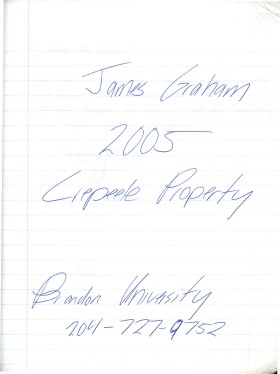
In 2005 the Brandon University Field School was held at the Crepeele site in the Crepeele locale.
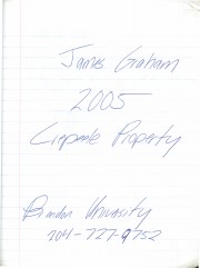
Denise Ens instructed the school and James Graham was teaching assistant. Field journals were kept by both instructors.
Scope and Content
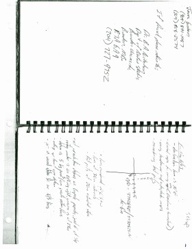
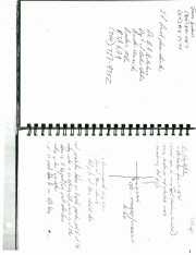
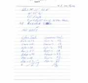
Record of excavation methods, items recovered, features, local environment and weather noted by teaching assistant.
In 2003 Units 1 to 9 were excavated at the Sarah site by supervisor James Graham and crew of Sarah Graham, Mike Evans, Todd Kristensen, Shayne Kolesar, Lisa Sonnenburg and Emily Ansell.
Excavations took place in 2003 at Crepeele West (Units 1-5) and Crepeele East (Units 6-9). The site was subsequently renamed the Sarah site DiMe-28. James Graham's field journal contains notes on the Casselman survey and Crepeele 2003 as well as the Sarah site 2003.
Scope and Content
Record of excavation methods, items recovered, features, local environment and weather noted by teaching assistant.
The Sarah site was initially chosen for excavation based on the results of the Casselman survey. The survey recovered significant amounts of faunal remains, some ceramics and lithics from the test pits. Excavations took place in 2003 at the Sarah site DiMe-28.
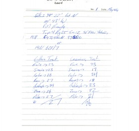
In 2004 further excavation took place as part of a Brandon University Archaeology Field School. Units 10 to 18 were excavated with Denise Ens as the instructor and James Graham teaching assistant.
Scope and Content
Record of excavation methods, items recovered, features, local environment and weather noted by teaching assistant.
Field journal by Brandon University Archaeology field school assistant James Graham of excavation methods, items recovered, features, local environment and weather.
View is southwest from approximatley 16th Street between Princess and Rosser Avenues. Photograph shows the Brandon University campus, as well as surrounding residential blocks, including Flemming, J.R. Reid and Vincent Massey schools.
View is west southwest from approximatley 16th Street between Princess and Lorne Avenues. Photograph shows the Brandon University campus, as well as surrounding residential blocks between 16th and 23rd Streets, Princess and Louise Avenues..
View is west from approximatley 17th Street between Lorne and Louise Avenues. Photograph shows a portion of the Brandon University campus (excluding the Education Building and anything north of it), as well as surrounding residential blocks from approximatley 17th Street to 22nd Street.
View is west northwest from approximatley 16th Street and Louise Avenue. Photograph shows the Brandon University campus, prior to the Library Extension, and a large portion of the city to the west of the campus.
View is northwest from approximatley 16th Street and Louise Avenue. Photograph shows the Brandon University campus, prior to the Library Extension, and a large portion of the city to the west of the campus.
Photograph shows the removal of one of the houses formerly located on 20th Street between Louise and Princess Avenues. The houses on those blocks were removed to create parking lots for the University. A Fed Zavislak Ltd. Well Drilling & Trucking pickup truck is visible at the curb.
Photograph shows the removal of one of the houses formerly located on 20th Street between Louise and Princess Avenues. The houses on those blocks were removed to create parking lots for the University.
View is northeast probably from the roof of McMaster Hall. Photograph shows the construction of the new roof on Clark Hall and the Brandon College Building. A portion of the east side of the 000 and 100 blocks of 18th Street, as well as the corner of 18th Street and Rosser Avenue are visible in the upper left hand corner. This includes the "Downtown Brandon" sign.
View is north northeast probably from the roof of McMaster Hall. Photograph shows the construction of the new roof on Clark Hall and the Brandon College Building, as well as the construction of the extension to Clark Hall and the skywalk. Portions of the city as far north as the Assiniboine River are also visible.
View is northeast from the Brandon College Building. Photograph shows the inside of the Brandon College Building after it had been gutted and then partially rebuilt. The exterior fascade of the west side of the building can be clearly seen in this photograph. A number of houses on the east side of 200 block of 18th Street are also visible, as is the stone fence on Princess Avenue and the flag pole on the front lawn.
View is north northeast from the roof of McMaster Hall. Photograph shows the campus under construction during the renovation of the Brandon College Building and Clark Hall. The photograph was taken in late fall after the roof had been removed from the buildings but before the construction of the extension of Clark Hall. Construction materials litter the courtyard and driveway. The view looking north extends to The North Hill - a number of residential blocks, particularly to the northeast of 18th Street are visible. Buildings include the International Harvester Building and Kin Village.
View is north northeast probably from the roof of McMaster Hall. Photograph shows the construction of the new roof on Clark Hall and the Brandon College Building, as well as the construction of the extension to Clark Hall and the skywalk. The view looking north extends to The North Hill - a number of residential blocks, particularly to the northeast of 18th Street are visible. Buildings include the International Harvester Building and Kin Village.
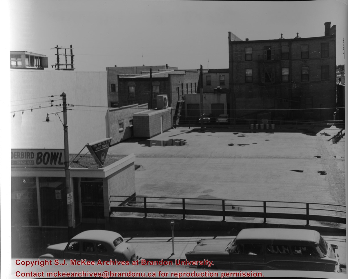
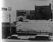
Photograph of an northeast corner 10th Street and Princess Avenue and the rear of buildings facing 200 block on 9th Street. The business in foreground is Thunderbird Bowl. The rear of the Brandon Inn is in the background.
Notes
Photograph dated from "Tara's Bulba," the movie playing at the Strand Theatre and similiar vehicles captured in the photograph.
Photograph shows a view of downtown Brandon from the northeast corner of 10th Street and Princess Avenue. Thunderbird Bowl is in the foreground. Painted advertisements on the sides of buildings include: The Mitrou's Cafe and Tea Room and Brandon Musical Supply Ltd. Vehicles parked on 10th Street are facing north.
Notes
Photograph dated from "Tara's Bulba," the movie playing at the Strand Theatre and similiar vehicles captured in the photograph.
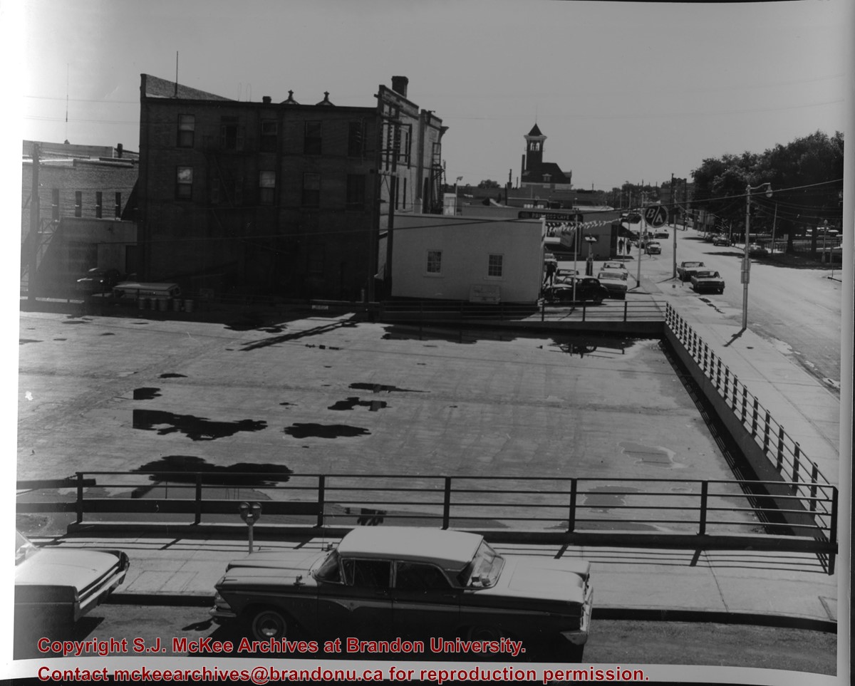
Photograph shows the northeast corner of 10th Street and Princess Avenue facing east. In the background the following Brandon businesses can be seen: back of the Brandon Inn, B/A gas station, The Princess Cafe, and the Central Fire Hall.
Notes
Photograph dated from "Tara's Bulba," the movie playing at the Strand Theatre and similiar vehicles captured in the photograph.


)
)
)