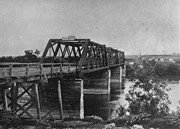
Some damage to matting, especially on the back. Photograph is good. There are two brads in the matting (one on the left edge, one on the right edge). The brads are connected to a (broken) red ribbon likely used to hang the photograph.
Custodial History
Kay Sullivan gave the photograph to Fred McGuinness in August 2007.
Scope and Content
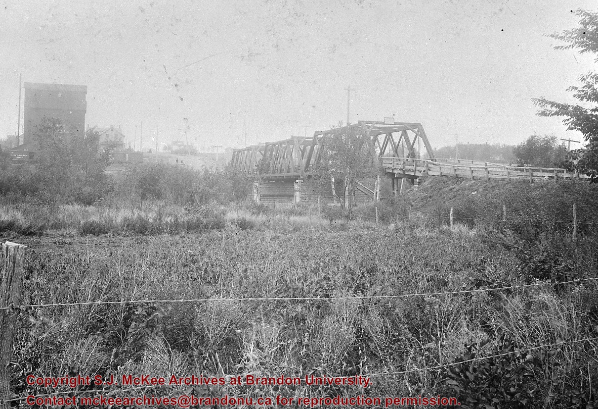
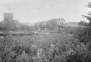
Photograph was taken from the riverbank and shows the steel bridge in Souris, MB. A second wooden bridge is visible behind the steel bridge. The residence of Dr. W.A. Sherrin can be seen to the right of the bridges.
Notes
Dr. Sherrin's residence was identified using the Illustrated Souvenir of Souris, Manitoba (p. 38).
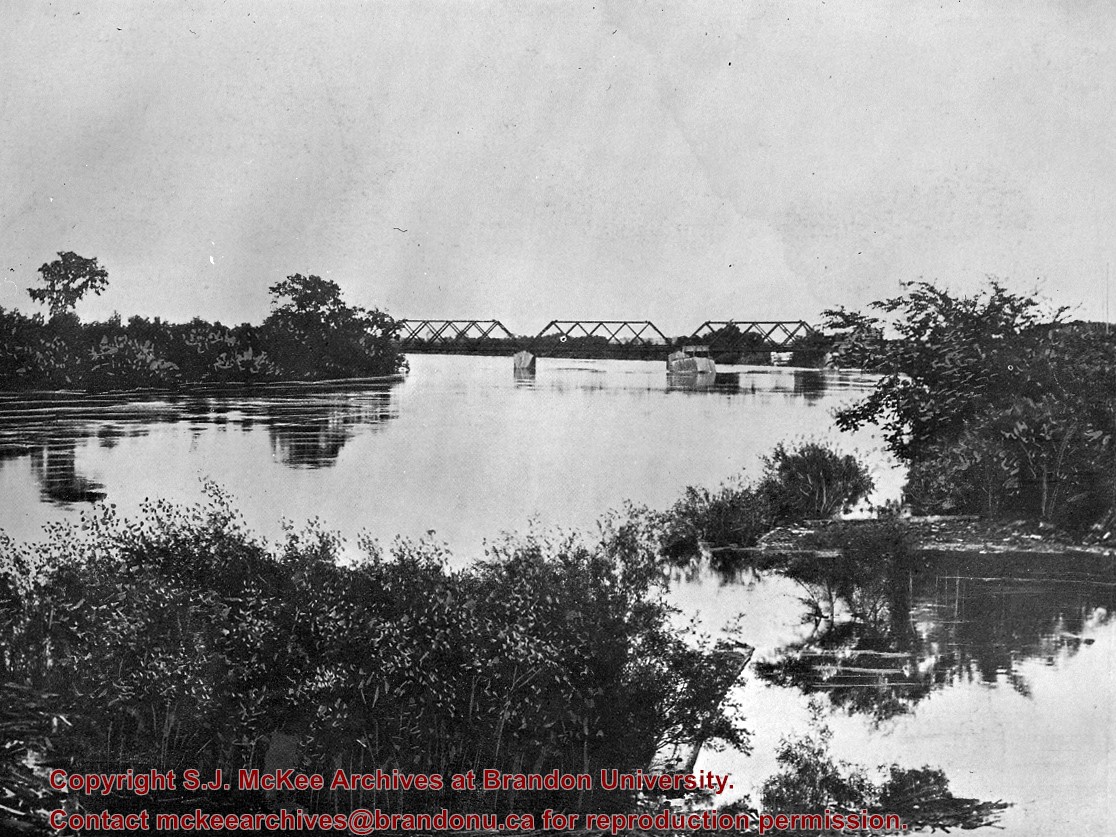
Some damage to matting, especially on the back. There is also significant water damage to the image. There are two brads in the matting (one on the left edge, one on the right edge). The brads are connected to a red ribbon likely used to hang the photograph.
Custodial History
Kay Sullivan gave the photograph to Fred McGuinness in August 2007.
Scope and Content
Photograph was taken from the riverbank and shows the suspension foot-bridge in Souris, MB. A number of buildings, both commerial and possibly residential, can be seen on the far side of the river.
Photograph has been glued to a backing board that has warped over time
History / Biographical
On 16 November 1906, Manitoba was hit by a severe winter storm that began that Thursday evening and extended through the weekend. The Brandon Daily Sun ("Storm Extends Over a Large Territory," 17 Nov. 1906, 1) reported that rail and telegraph services had been disrupted, country roads were impassable, and business in town was at a stand still. Following the weekend, the daily reported the blizzard was one of the greatest in recent memory. CPR trains had been caught in drifts by Carberry and an express car had caught fire and was destroyed ("Worst Storm in Many Years," Brandon Daily Sun, 19 Nov. 1906, 1).
Scope and Content
Photograph shows street view of intersection of the 000 block of 8th Street and Rosser Avenue in the winter. Businesses on the east side of 8th Street from Pacific to Rosser Avenues are clearly visible and include: a Lunch Room (likely Aagaard's Lunch Counter), the Hotel Imperial Annex, Liverpool House (a boarding house), R.S. Thompson and Company Real Estate Office (Land Office), a barber shop (likely J. Coulter's), Frank Gowen photography studio. Fleming's Drug Store on the corner of 8th Street and Rosser Avenue has been replaced by the Bank of Hamilton. The Imperial Hotel is visible on the west side of 8th Street. The 8th Street Bridge is visible in the background. Men in winter coats and hats are crossing the street at the intersection. A horse-drawn sleigh is parked on 8th Street.
Notes
Writing on the front of the photograph matting reads: 340, after the storm November 1906. Page appears to be from a photo album. The photograph appears to be taken from the interior of a builing on the southwest corner of 8th Street and Rosser Avenue.
Photographs have been glued to a backing board that has warped over time
History / Biographical
John Dickson (b. 17 Mar 1854, Scotland; d.15 April 1926, Brandon) was considered one of Brandon’s pioneer dentists. Dickson immigrated to Canada in 1857, where he lived in Hamilton, Ontario, for a number of years. Dickson then came to Manitoba and operated a grocery in Chater before he studied dentistry, graduating from the University of Minnesota in 1886. Dickson settled in Brandon where he married Anna Louise Harrison on 28 December 1891.
The couple had four children: Mrs. Irving Cross [Mary Louise, b.20 Dec 1892, Brandon; d. 22 Oct 1981, Saratoga, NY]; Dr. John Harrison Dickson [b. 26 Aug 1894, Brandon; d. 17 June 1956, Killarney]; Dr. Stanley Rodgers Dickson [b. 18 Feb 1896, Brandon; d. 25 July 1963, Brandon]; and Mrs. Emile Baldeschweiler [Isobel Marion Coates, b. 13 Nov 1900, Brandon; d.?] of New York.
Sources: “Pioneer Dentist of Brandon in Dr. John Dickson,” Brandon Daily Sun 16 Apr 1926 and Manitoba Vital Statistics database.
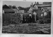
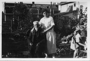
Scope and Content
Photograph is a family in a garden plot in a residential area. Four children, two women, and a man are standing amongst sweet peas. Out buildings of other properties can be seen. Possibly standing from left to right are members of the Dickson family: Mary, Isobel, John Harrison, Annie Louise (wife), Stanley Rodgers, Mrs. Harrison (mother-in-law), and John (husband).
Notes
Writing on the front of the photograph matting reads: 289. Page appears to be from a photo album.
Photographs have been glued to a backing board that has warped over time
History / Biographical
John Dickson (b. 17 Mar 1854, Scotland; d.15 April 1926, Brandon) was considered one of Brandon’s pioneer dentists. Dickson immigrated to Canada in 1857, where he lived in Hamilton, Ontario, for a number of years. Dickson then came to Manitoba and operated a grocery in Chater before he studied dentistry, graduating from the University of Minnesota in 1886. Dickson settled in Brandon where he married Anna Louise Harrison on 28 December 1891. (Source: “Pioneer Dentist of Brandon in Dr. John Dickson,” Brandon Daily Sun 16 Apr 1926)
The couple had four children: Mrs. Irving Cross [Mary Louise, b.20 Dec 1892, Brandon; d. 22 Oct 1981, Saratoga, NY]; Dr. John Harrison Dickson [b. 26 Aug 1894, Brandon; d. 17 June 1956, Killarney]; Dr. Stanley Rodgers Dickson [b. 18 Feb 1896, Brandon; d. 25 July 1963, Brandon]; and Mrs. Emile Baldeschweiler [Isobel Marion Coates, b. 13 Nov 1900, Brandon; d.?] of New York. (Source: Manitoba Vital Statistics database)
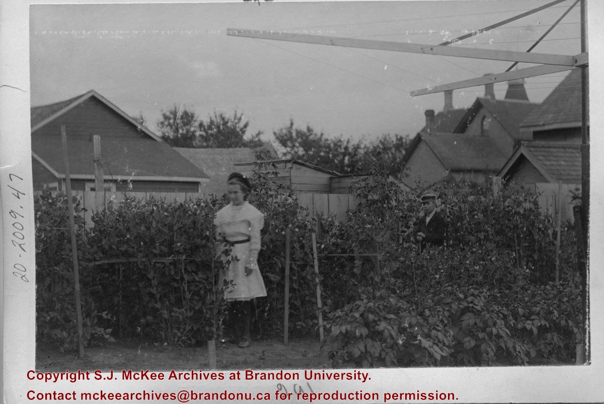
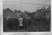
Scope and Content
Photograph is of a girl and a boy standing amongst sweet peas in a backyard garden. A clothes line is visible in the foreground. The children, Mary and Stanley, are possibly those of Brandon dentist John Dickson.
Notes
Writing on the front of the photograph matting reads: 291. Page appears to be from a photo album.
The International Peace Garden is situated on the international border between Manitoba and North Dakota, adjacent to the Canadian Border Services Boissevain port of entry and the U.S. Customs and Border Protection Agency's Dunseith port of entry. The dedication for the International Peace Garden was held on July 14, 1932. It was estimated that 50,000 people were in attendance on opening day. The park is 9.5-square kilometers or 3.54-square miles.
Custodial History
Pictures were sent to Fred McGuinness in 1970 from E.M. Bergson of Brandon.
Scope and Content
Photograph shows large crowds surrounding a stone cairn draped in American and Union Jack flags. According to the International Peace Garden website, the pictured cairn was built from stones gathered from Manitoba and North Dakota. The crowds gathered for the 1932 dedication of the International Peace Garden.
Notes
The back of the photograph is stamped: Enameloid Velox Print by the Jul 27 1932, Chicago Postal Photo Supplies, Regina, Sask.
The International Peace Garden is situated on the international border between Manitoba and North Dakota, adjacent to the Canadian Border Services Boissevain port of entry and the U.S. Customs and Border Protection Agency's Dunseith port of entry. The dedication for the International Peace Garden was held on July 14, 1932. It was estimated that 50,000 people were in attendance on opening day. The park is 9.5-square kilometers or 3.54-square miles.
Custodial History
Pictures were sent to Fred McGuinness in 1970 from E.M. Bergson of Brandon.
Scope and Content
Photograph shows the crowded parking lot at the International Peace Garden's 1932 dedication ceremony. People mill amongst the automobiles and tents can be seen in the background.
Notes
The back of the photograph is stamped: Enameloid Velox Print by the Jul 27 1932, Chicago Postal Photo Supplies, Regina, Sask.
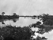
Kirkham's Bridge was built in 1906, to replace an earlier wooden bridge. The bridge was used until 1981, when it was purchased by the Town of Birtle and moved to a newsite. A former railway pridge was installed in its place.
Scope and Content
Photograph shows Kirkham's Bridge, a steel truss bridge that spanned the Little Saskatchewan River in the Municipality of Riverdale.
Notes
Identification of the bridge provided by Ken Storie (2023). Additional information taken from the Manitoba Historical Society website.
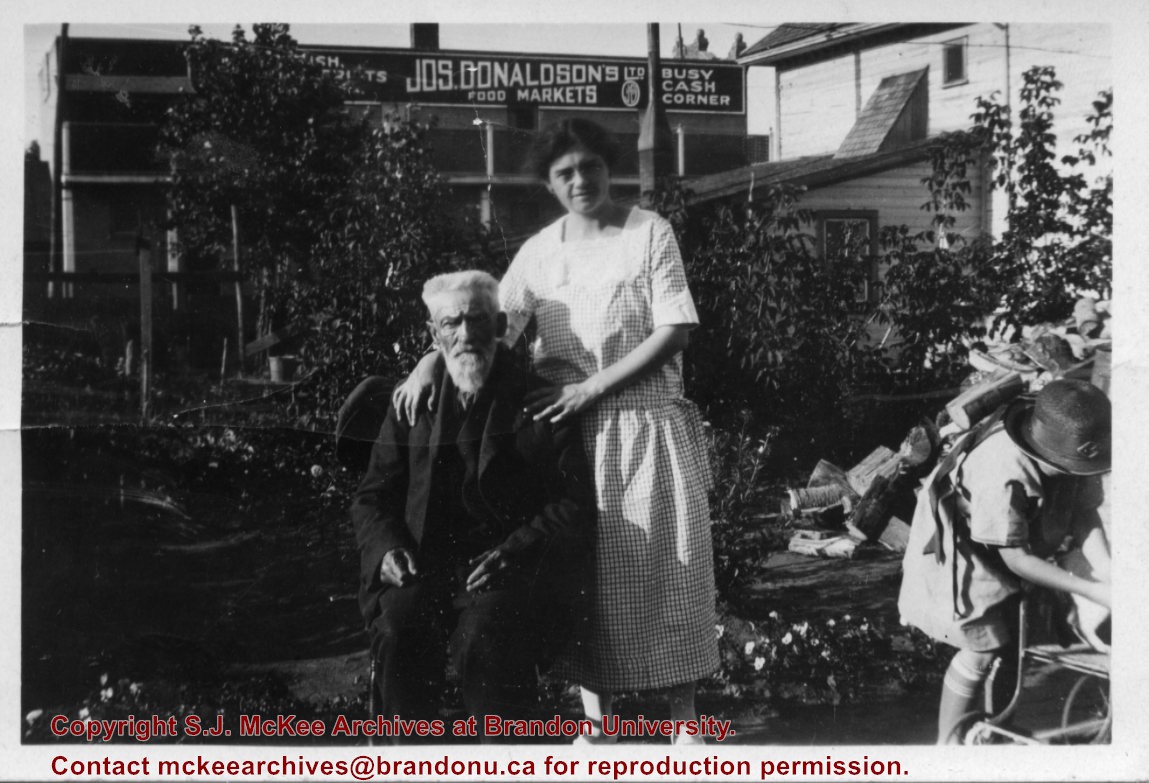
Joseph Donaldson's Ltd. Food Market appears in the Henderson's Brandon City Directory from 1906 to 1929. Donaldson's main meat/butcher shop was located at 813 Rosser Avenue. A second branch was opened by 1914 at 228 Rosser Avenue but relocated to 654 Tenth Street by 1917. The branch relocated by 1921 to 662 Tenth Street where it remained until ca.1929. This address was referred to as the "Busy Corner" in the Henderson's Directory. In 1931, butcher Ted Hill appears to have taken over the Donaldson's establishments.
Scope and Content
Photograph shows George Pope sitting in a backyard. Standing next to him is Isabella Louise McGuinness (Pope). A young girl, perhaps Ruth McGuinness, is standing over a stroller. A wood pile and garden plants can be seen in the backyard. An advertisement for Joseph Donaldson's Ltd Food Markets can be seen on a business beside the residence.
Notes
Writing on the back of the photograph reads: This is mum her uncle George Pope who came to Brandon in 1880 (I think) in the back yard of 708-10th Street. It looked like Ruth in the lower right corner. I was interested in the Donaldson advertising.
The Medicine Hat Exhibition and Stampede Parade Day was held on Thursday, July 19, 1962, at 9:30 a.m. The local newspaper reported that approximately 24,000 people were in attendance to see parade marshall Rod Ashburner leading 175 entries consisting of 90 floats, 75 horses, and 10 bands. There were 19 parade categories eligible for $12,000 in prize money and included: junior and senior cowboys and cowgirls; fancy and Shetland ponies; sulky class open; comic, commercial, industrial and organizational floats; decorated cars; special ranch class; 4-H Clubs; and a non-competitive class.
The parade route started at Second St. and Allowance Ave., from Second St. to Ash Ave., north on Ash to First St. SE., from First St. S.E. to Fourth Ave., south to Second St. to South Railway St., south on South Railway St. to Third St., with a finish at McLeod Trail. A route map was published in the Medicine Hat News the day before the parade.
Aerial photographs of the parade were taken by Medicine Hat News photographer Howard Heid (1930-2005) from the private helicopter of John Bourn. Bourn was a pilot from Woodville, Wisconsin, who chartered his four-seater helicopter for sight-seers at exhibitions and stampedes across the county.
(Sources: Pat Currie, "Let 'Er Go!," Medicine Hat News, 19 July 1962,1; Harald Gunderson, "'Eye in the Sky' Best Parade View," Medicine Hat News, 19 July 1962,1; "Parade Starts at 9:30 Sharp," 18 July 1962)
Scope and Content
Photograph shows an aerial view of the Medicine Hat Exhibition and Stampede Parade route, with a focus on Second Street SE. A residential area showing homes with extensive backyard gardens can be seen. The South Saskatchewan River can be see on the right of the photograph.
Notes
This photograph shows the neighbourhood before rezoning and commercial development.
The Medicine Hat Exhibition and Stampede Parade Day was held on Thursday, July 19, 1962, at 9:30 a.m. The local newspaper reported that approximately 24,000 people were in attendance to see parade marshall Rod Ashburner leading 175 entries consisting of 90 floats, 75 horses, and 10 bands. There were 19 parade categories eligible for $12,000 in prize money and included: junior and senior cowboys and cowgirls; fancy and Shetland ponies; sulky class open; comic, commercial, industrial and organizational floats; decorated cars; special ranch class; 4-H Clubs; and a non-competitive class.
The parade route started at Second St. and Allowance Ave., from Second St. to Ash Ave., north on Ash to First St. SE., from First St. S.E. to Fourth Ave., south to Second St. to South Railway St., south on South Railway St. to Third St., with a finish at McLeod Trail. A route map was published in the Medicine Hat News the day before the parade.
Aerial photographs of the parade were taken by Medicine Hat News photographer Howard Heid (1930-2005) from the private helicopter of John Bourn. Bourn was a pilot from Woodville, Wisconsin, who chartered his four-seater helicopter for sight-seers at exhibitions and stampedes across the county.
(Sources: Pat Currie, "Let 'Er Go!," Medicine Hat News, 19 July 1962,1; Harald Gunderson, "'Eye in the Sky' Best Parade View," Medicine Hat News, 19 July 1962,1; "Parade Starts at 9:30 Sharp," 18 July 1962)
Scope and Content
Photograph shows an aerial view of the Medicine Hat Exhibition and Stampede Parade route with a focus on the First Street SE and Ash Street. A residential area showing homes with extensive backyard gardens can be seen.
Notes
This photograph shows the neighbourhood before rezoning and commercial development.
The Medicine Hat Exhibition and Stampede Parade Day was held on Thursday, July 19, 1962, at 9:30 a.m. The local newspaper reported that approximately 24,000 people were in attendance to see parade marshall Rod Ashburner leading 175 entries consisting of 90 floats, 75 horses, and 10 bands. There were 19 parade categories eligible for $12,000 in prize money and included: junior and senior cowboys and cowgirls; fancy and Shetland ponies; sulky class open; comic, commercial, industrial and organizational floats; decorated cars; special ranch class; 4-H Clubs; and a non-competitive class.
The parade route started at Second St. and Allowance Ave., from Second St. to Ash Ave., north on Ash to First St. SE., from First St. S.E. to Fourth Ave., south to Second St. to South Railway St., south on South Railway St. to Third St., with a finish at McLeod Trail. A route map was published in the Medicine Hat News the day before the parade.
Aerial photographs of the parade were taken by Medicine Hat News photographer Howard Heid (1930-2005) from the private helicopter of John Bourn. Bourn was a pilot from Woodville, Wisconsin, who chartered his four-seater helicopter for sight-seers at exhibitions and stampedes across the county.
(Sources: Pat Currie, "Let 'Er Go!," Medicine Hat News, 19 July 1962,1; Harald Gunderson, "'Eye in the Sky' Best Parade View," Medicine Hat News, 19 July 1962,1; "Parade Starts at 9:30 Sharp," 18 July 1962)
Scope and Content
Photograph shows an aerial view of the Medicine Hat Exhibition and Stampede Parade route with a focus on the First Street SE and and the South Railway Street merge. A number of gas stations and garages are visible along this route and include Texaco, Shell, Ford, and B/A. The Fraternal Order of Eagles lodge is also visible.
Notes
This photograph shows the neighbourhood before rezoning and commercial development.
The Medicine Hat Exhibition and Stampede Parade Day was held on Thursday, July 19, 1962, at 9:30 a.m. The local newspaper reported that approximately 24,000 people were in attendance to see parade marshall Rod Ashburner leading 175 entries consisting of 90 floats, 75 horses, and 10 bands. There were 19 parade categories eligible for $12,000 in prize money and included: junior and senior cowboys and cowgirls; fancy and Shetland ponies; sulky class open; comic, commercial, industrial and organizational floats; decorated cars; special ranch class; 4-H Clubs; and a non-competitive class.
The parade route started at Second St. and Allowance Ave., from Second St. to Ash Ave., north on Ash to First St. SE., from First St. S.E. to Fourth Ave., south to Second St. to South Railway St., south on South Railway St. to Third St., with a finish at McLeod Trail. A route map was published in the Medicine Hat News the day before the parade.
Aerial photographs of the parade were taken by Medicine Hat News photographer Howard Heid (1930-2005) from the private helicopter of John Bourn. Bourn was a pilot from Woodville, Wisconsin, who chartered his four-seater helicopter for sight-seers at exhibitions and stampedes across the county.
(Sources: Pat Currie, "Let 'Er Go!," Medicine Hat News, 19 July 1962,1; Harald Gunderson, "'Eye in the Sky' Best Parade View," Medicine Hat News, 19 July 1962,1; "Parade Starts at 9:30 Sharp," 18 July 1962)
Scope and Content
Photograph shows an aerial view of the Medicine Hat Exhibition and Stampede Parade route with a focus on the First Street SE and Ash Street. A residential area showing homes with extensive backyard gardens can be seen.
Notes
This photograph shows the neighbourhood before rezoning and commercial development.
The Medicine Hat Exhibition and Stampede Parade Day was held on Thursday, July 19, 1962, at 9:30 a.m. The local newspaper reported that approximately 24,000 people were in attendance to see parade marshall Rod Ashburner leading 175 entries consisting of 90 floats, 75 horses, and 10 bands. There were 19 parade categories eligible for $12,000 in prize money and included: junior and senior cowboys and cowgirls; fancy and Shetland ponies; sulky class open; comic, commercial, industrial and organizational floats; decorated cars; special ranch class; 4-H Clubs; and a non-competitive class.
The parade route started at Second St. and Allowance Ave., from Second St. to Ash Ave., north on Ash to First St. SE., from First St. S.E. to Fourth Ave., south to Second St. to South Railway St., south on South Railway St. to Third St., with a finish at McLeod Trail. A route map was published in the Medicine Hat News the day before the parade.
Aerial photographs of the parade were taken by Medicine Hat News photographer Howard Heid (1930-2005) from the private helicopter of John Bourn. Bourn was a pilot from Woodville, Wisconsin, who chartered his four-seater helicopter for sight-seers at exhibitions and stampedes across the county.
(Sources: Pat Currie, "Let 'Er Go!," Medicine Hat News, 19 July 1962,1; Harald Gunderson, "'Eye in the Sky' Best Parade View," Medicine Hat News, 19 July 1962,1; "Parade Starts at 9:30 Sharp," 18 July 1962)
Scope and Content
Photograph shows an aerial view of the Medicine Hat Exhibition and Stampede Parade route with a focus west of the railway allowance, showing First Street SE, Second Street SE, and Third Street SE.
Notes
This photograph shows the neighbourhood before rezoning and commercial development.
The Medicine Hat Exhibition and Stampede Parade Day was held on Thursday, July 19, 1962, at 9:30 a.m. The local newspaper reported that approximately 24,000 people were in attendance to see parade marshall Rod Ashburner leading 175 entries consisting of 90 floats, 75 horses, and 10 bands. There were 19 parade categories eligible for $12,000 in prize money and included: junior and senior cowboys and cowgirls; fancy and Shetland ponies; sulky class open; comic, commercial, industrial and organizational floats; decorated cars; special ranch class; 4-H Clubs; and a non-competitive class.
The parade route started at Second St. and Allowance Ave., from Second St. to Ash Ave., north on Ash to First St. SE., from First St. S.E. to Fourth Ave., south to Second St. to South Railway St., south on South Railway St. to Third St., with a finish at McLeod Trail. A route map was published in the Medicine Hat News the day before the parade.
Aerial photographs of the parade were taken by Medicine Hat News photographer Howard Heid (1930-2005) from the private helicopter of John Bourn. Bourn was a pilot from Woodville, Wisconsin, who chartered his four-seater helicopter for sight-seers at exhibitions and stampedes across the county.
(Sources: Pat Currie, "Let 'Er Go!," Medicine Hat News, 19 July 1962,1; Harald Gunderson, "'Eye in the Sky' Best Parade View," Medicine Hat News, 19 July 1962,1; "Parade Starts at 9:30 Sharp," 18 July 1962)
Scope and Content
Photograph shows an aerial view of possibly 8th Street NW and Tweed Avenue NW. A Safeway grocery store, park and residential area are visible. Many of hte homes appear to have gardens.
Notes
This photograph shows the neighbourhood before rezoning and commercial development.
Jack Stothard was born on February 16, 1932 in Brandon, MB. He attended public schools in the city (Central School, Park School, and Earl Oxford) and graduated from Brandon Collegiate Institute (BCI). Stothard married Velma Pollock in 1957 and together they had two daughters: Debra and Kimberly. Stothard was employed in the plumbing and heating business until 1960, when he joined Manitoba Hydro. In the course of his employment with Manitoba Hydro, he became Station Superintendent of the Brandon Generating Station. Stothard retired in 1995. Stothard was a member of the Canadian Numismatic Association, the Canadian Association of Token Collectors and the Toronto Postcard Club. Jack Stothard died on November 3, 2021 in Brandon, MB.
Custodial History
Accession 1-2003 was in the possession of Stothard until donated to the McKee Archives in 2003. Accession 12-2006 was acquired by Lawrence Stuckey at some point after the photograph was taken. Stuckey later sold a copy of the photograph. This copy was later acquired by Jack Stothard in the course of his collecting of Brandon postcards. Stothard donated the image to the McKee Archives in 2004. Accession 8-2007 was prepared by Jack Stothard in the course of 2007. He provided a copy to the Archives upon its completion. Accession 8-2008 was in the possession of Fred McGuinness until he gave jit to Jack Stothard in February 2008. Stothard donated the records to the McKee Archives on February 12, 2008. Accession 18-2008 was donated to the McKee Archives by Stothard on August 18, 2008. Accession 11-2009 was donated to the McKee Archives by Stothard on February 20, 2009. Accession 4-2012 was donated to the McKee Archives by Stothard on August 24, 2011. Accession 4-2013 was donated to the McKee Archives by Stothard in March 2013. Accession 8-2016 was donated to the McKee Archives by Stothard on January 21, 2015.
Scope and Content
Accession 1-2003 contains brief research reports prepared by Stothard on various topics concerning historical Brandon. These include: a listing of hotels, inns and motels that have operated in Brandon since the 1880s; reports dealing with the Café Aagard, Central United Church, the 1913 Dominion Exhibition, Brandon, the Empire Hotel, Brandon’s Central Steam Heating System, the Post Office and the Clement Block. It also contains one booklet: Facts About Brandon: An Industrial Survey of the City of Brandon. Winnipeg: Department of Industry and Commerce [n.d.]
Accession 12-2006 consists of one photograph of the Great Northern Engine 208, built by Rogers Locomotive Company 1887. Cylinders 18 x 24, Drivers 63". G.N. line Church's Ferry, N.D. to Brandon, Manitoba. Opened 1906, Closed 1936.
Accession 8-2007 consists of a brief typed report entitled "The Day the Lights Went Out in Brandon - Strike of 1919" by Jack Stothard. Document provides an account of the sources and delivery of hydro electric power to Brandon beginning in the early 1900s and the brief power outage at the beginning of the Brandon General Strike May 25, 1919.
Accession 8-2008 consists of "The Brandon Sun Challenge Cup" ledger, which contains two b/w photographs, newspaper clippings and information on the history and first race (1908) of the cup; 3 additional b/w photographs of different races; and the Brandon Old Timers Association record book (c. 1900).
Accession 18-2008 consists of a copy of Stothard's Brandon Postcards index. The index is divided into various sub-headings and consists of colored reproductions of postcards in Stothard's collection. The index contains pages that were discarded by Stothard as he updated his inventory, therefore the index is only up to date as of August 18, 2008.
Accession 11-2009 consists of a typed research report entitled "Brandon Police Department Stations and Locations" by Jack Stothard. The report outlines the location of the Brandon Police Department from 1882 - 2008, and also includes a section on "What the Future Holds."
Accession 4-2012 consists of pages for Stothard's Brandon Postcards index (18-2008) and a photocopy of a Brandon Municipal Railway ticket.
Accession 4-2013 consits of eight binders of handwritten notes/facts about Brandon compiled by Jack Stothard. The notes are a collection of names, places, things, events and items related mostly to the first 100 years of Brandon (1882-1982), although the notes continue into the 2000's. Some notes centre on the late 1930's to early 1950's during the period of Stothard's youth. The information in the binders was taken from a variety of publications, while some notes are Stothard's own comments. A list of sources, as well as a cross reference index for all eight binders, can be found in Book No. 1.
The accession includes: Book No. 1 - Notes of Brandon (A to B); Book No. 2 - Notes of Brandon (C to F); Book No. 3 - Notes of Brandon (G to O); Book No. 4 - Notes of Brandon (P to Z); Book No. 5 - Notes of Brandon: Churches, Hostpitals, Hotels; Book No. 6 - Notes of Brandon: Police Department, Fire Department; Book No. 7 - Notes of Brandon: Brandon City Council, City of Brandon etc.; Book No. 8 - Notes of Brandon: Brandon College/University, Brandon Schools, ACC, Brandon School Board. Accession also includes pages from Stothard's Brandon Postcards index (18-2008).
Accession 6-2016 consists of local history books, pamphlets, bakery tokens, local magazines, one binder containing handwritten notes/facts about Brandon compiled from the Brandon Sun's "Looking Back" column, and an accordian file box containing newspaper clippings about Brandon.
The accession includes the following local history books: Betty Watson's "One Day in Brandon Manitoba 9/9/99" (Brandon, Manitoba: Bart Art Books, 1999); P.N. Breton's "Popular Illustrated Guide to Canadian Coins, Medals, &. &.," (Winnipeg: Canadian Numismatic Publishing Institute, 1963 [reprint]); "Facts About Brandon: An Industrial Survey of the City of Brandon," (Province of Manitoba: Department of Industry and Commerce, [1946]); The Polish Gymnastic Association Sokol's "75th Anniversary: From the Past to the Future!" ([Brandon, Manitoba: Polish Gymnastic Association Sokol, 1988]); and Brandon Kinsmen Club's "'Together...Once Again': A History of the Kinsmen Club of Brandon, Manitoba, 1925-1975 (Brandon, Manitoba: The Historical Committee of the Kinsmen Club of Brandon, 1975).
Pamplets and magazines include: Brandon Generating Station (1957) and (1969), The Brandon Quota Club presents...A Century in Revue (1982), Canadian Rail No. 168/July-August 1965 [featuring Brandon Municipal Railway], Prairie City Issue No. 3/1994, and Prairion May/June 1997.
The binder is titled Book No. 9 - "Year by year: miscellaneous items from 1969 to 2000"; an asterik (*) indicates notes have been made on each subject or item in the other Books. Each section is housed in
The files in the accordian file box have been rehoused and include the following topics: banks, Brandon 125 beer, Behlen Industries, breweries, Brandon Shoppers' Mall, calendars, Canadian Motors Ltd., Canexus/Nexen, Canada Games - Summer and Winter, Canadian Tire, CKX Radio & TV/CKLQ, Corral Centre, flour mills, hospitals, Keystone, Maple Leaf, Fred McGuinness, miscellaneous, A.E. McKenzie, people, railways, Simplot, Westman Recycling (new facility), weather-storms-floods, and extra copies of postcards.
Notes
Description by Christy Henry. Accession 4-2013: Book No. 1 contains a photocopied photograph of Aagaard's Cafe, photographs of the Dominion Bank and Barney's Drive Inn and a photo reproduction of the Bass Building. Book No. 2 contains a photograph of the Provincial Goal. Book No. 3 contains photographs of T. Eaton Company (4 construction photos) and a photo reproduction of tents on the Exhibition grounds (c. 1940). Book No. 4 contains photoraphs of the Oak Theatre and Western Motors. There are also photopied photographs of The Fun Shop.
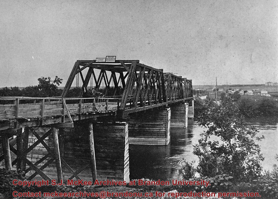
Built 1882 by Joseph E. Woodworth M.L.A. as a private enterprise toll bridge; See Barker pg. 3 [G. F. Barker, Brandon: City, 1881 - 1961. D.W. Friesen Printers: Altona, 1977 pp. 3 (P.E. 26/05/09).]
Custodial History
For custodial history see the collection level description of the Lawrence Stuckey collection.
Built 1882 by Joseph E. Woodworth M.L.A. as a private enterprise toll bridge; See Barker pg. 3 (G. F. Barker, Brandon: City, 1881 - 1961. D.W. Friesen Printers: Altona, 1977 pp. 3 [P.E. 26/05/09])
Custodial History
For custodial history see the collection level description of the Lawrence Stuckey collection.
Scope and Content
Original First Street Bridge
Notes
View from south bank about third street (about south end of the present dam); High water and leaves on trees indicate late May or early June.


