Aerial photographs of the campus were generally commissioned by the College/University to record important milestones, such as centennials, changes in status, and building projects. The general campus photographs were placed in this sub-series because the composition of the images made it difficult to place them with individual buildings.
Scope and Content
Sub-series consists of photographs of the Brandon College and Brandon University campus.
Brandon College looking south from 19th Street. Photograph was taken after Flora Cowan Hall was built but before construction of the Education Building.
Image shows the Brandon College campus from 17th Street looking southwest. The photo was taken after the completion of the original Music Building in 1963, but construction of the Education Building. Also visible are a number of properties on the 200 block of 18th Street and the 200 block of 20th Street.
Image is looking east northeast from approximately the 300 block of 23rd Street between Lorne and Louise Avenues. Photograph shows the Brandon College campus after the opening of the original Music Building in 1963, but before the construction of the Education Building in 1966. A number of house on the 300 blocks of 22nd and 21st Streets are visible in the foreground, with the A.E. McKenzie Seed Co., the Prince Edward Hotel and various grain elevators on the horizon.
See fonds level of the CKX records for custodial history.
Scope and Content
Image consists of an aerial view looking north at the intersection of Highways 1 and 10 and shows the British American dealer located at the intersection.
See fonds level of the CKX records for custodial history.
Scope and Content
Image consists of an aerial view looking southeast at the intersection of Highways 1 and 10 and shows the British American dealer located at the intersection.
See fonds level of the CKX records for custodial history.
Scope and Content
Image consists of an aerial view looking northeast at the intersection of Highways 1 and 10 and shows the British American dealer located at the intersection.
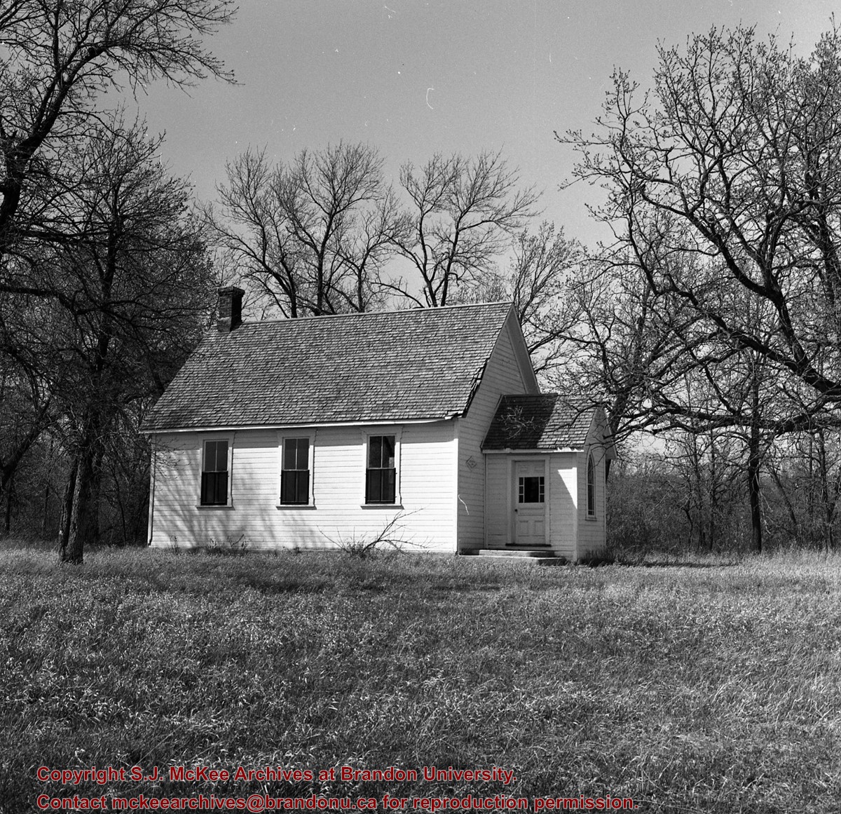
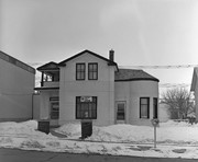
Before becoming the McPherson & Bedford funeral home, I am pretty sure this was the home of Dr. A.T. Condell, who arrived in 1904, left in 1906, returned in 1908, was district coroner for 30 years and died in 1943 (Barker). LAS.
Custodial History
For custodial history see the collection level description of the Lawrence Stuckey collection.
Scope and Content
Former McPherson & Bedford Funeral Home
Notes
Located on the west side of the 100 block of 11th Street
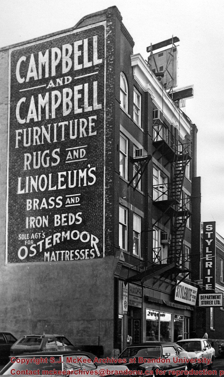
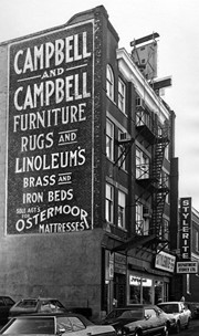
LS notes: Built 1905. This sign has weathered exceptionally well considering the Campbell & Campbell partnership ended in 1920. Company became Campbell & Ferguson with Campbell furniture and Ferguson undertaker.
Located at 29 10th Street, Campbell & Campbell remained in business until approximately 1925. In 1927 the business was known as Campbell Fergusson and Wright furniture. Campbell & Fergusson Ltd. continued operations in the building until around 1933. The Henderson's Directory lists the address as vacant in 1935 and 1937. Late in 1939 alterations were begun to turn the building into a barracks for the 71st Battery. In the summer of 1943, in cooperation with city council, the building was converted into a united services centre for the benefit of the personnel of His Majesty's Forces. Brandon's United Service Centre, which catered to more than a half million men and women in the armed services in 21 months officially closed its doors on November 30, 1945; the building had been sold to George Bass in October.
Custodial History
For custodial history see the collection level description of the Lawrence Stuckey collection.
Scope and Content
Campbell & Campbell Building
Notes
Located on the east side of 10th Street, just north of Rosser Avenue. History/Bio taken from Henderson's Directories and the Jack Stothard collection.
As of this date, most homes in the city have been heated with natural gas for 20 years. However there is still a good market for stoker coal in rural areas, and Cumming & Dobbie seem to be the last agents for it.
Custodial History
For custodial history see the collection level description of the Lawrence Stuckey collection.
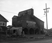
Scope and Content
Cumming & Dobbie Coal Dock
Notes
Located on the 600 block of 9th Street
This view [from the south] includes 3 Canadian National coal hoppers
[Mr. Stuckey put 2 negatives in same envelope. We separated them and numbered them EA30(1) and EA30(2).]
As of this date, most homes in the city have been heated with natural gas for 20+ years. However there is still a good market for stoker coal in rural areas, and Cumming & Dobbie seem to be the last agents for it.
Custodial History
For custodial history see the collection level description of the Lawrence Stuckey collection.
Scope and Content
Cumming & Dobbie Coal Dock
Notes
Located on the 600 block of 9th Street
This view, from the northwest, includes a Norfolk & Western hopper car of smith (forge) coal from Pennsylvania.
[Mr. Stuckey put 2 negatives in same envelope. We separated them and numbered them EA30(1) and EA30(2).]
This coal dock was purchased from W.E. Strange & Son in 1958. It was moved from the east side of the 300 block of 10th Street to this location on the west side of the 600 block of 8th Street.
Custodial History
For custodial history see the collection level description of the Lawrence Stuckey collection.
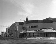
The Bank of Montreal rebuilt the former Bass Building directly across from it (southwest corner of 10th St. and Rosser Ave.), and moved into their new facilities in 1982.
Custodial History
For custodial history see the collection level description of the Lawrence Stuckey collection.
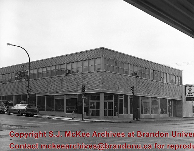
Scope and Content
Bank of Montreal
Notes
View of the southeast corner of 10th St. & Rosser Ave.
Built in 1956 on the southeast east corner of 10th St. and Rosser Avenue (former site of the Olympia Cafe)
In the summer of 1981 the S.S. Kresge store closed, and the Bass Building was purchased by the Bank of Montreal with the intention to renovate and open in 1982.
Custodial History
For custodial history see the collection level description of the Lawrence Stuckey collection.
Scope and Content
Bass Building (ex. S.S. Kresge store)
Notes
[Mr. Stuckey indicated on the envelope that there are two negatives, but only one in enclosed.]


.jpg?width=1200&404=no-img.jpg&watermark=wmk)
.jpg?width=180&404=no-img.jpg)
.jpg?width=1200&404=no-img.jpg&watermark=wmk)
.jpg?width=180&404=no-img.jpg)

.jpg?width=1200&404=no-img.jpg&watermark=wmk)
.jpg?width=180&404=no-img.jpg)
.jpg?width=1200&404=no-img.jpg&watermark=wmk)
.jpg?width=180&404=no-img.jpg)


.jpg%3fmaxheight%3d1000%26maxwidth%3d1000%26watermark%3dwmk&description=Metropolitan+Store)
.jpg%3fmaxheight%3d1000%26maxwidth%3d1000%26watermark%3dwmk&description=Metropolitan+Store)
.jpg%3fmaxheight%3d1000%26maxwidth%3d1000%26watermark%3dwmk&description=Cumming+%26+Dobbie+Coal+Dock)
.jpg%3fmaxheight%3d1000%26maxwidth%3d1000%26watermark%3dwmk&description=Cumming+%26+Dobbie+Coal+Dock)