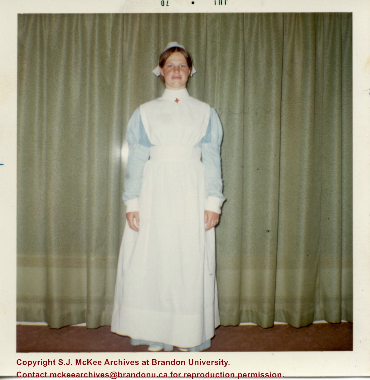
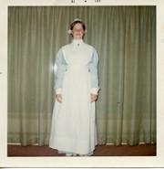
Photographs have been glued to a backing board that has warped over time
Scope and Content
Photograph shows street view of north side of Rosser Avenue, primarily the 700 block, along which sewer pipe is being laid. Visible buildings and businesses include: The Fleming Block with Lowes Brothers Clothing and Manitoba Farmers Hedge and Wire Fence Company, the Beaubier Block and its Empire Hotel, A.M. Percival (a grocer), the Brandon Hardware Company (600 block), and the Arlington Hotel (500 block) are visible along the north side of the avenue. The Bank of Hamilton Building is on the southeast corner of 8th Street and Rosser Avenue.
Notes
Writing on the front of the photograph matting reads: 290. Page appears to be from a photo album.
According to the Manitoba Historical Society, the Volunteer Monument was unveiled at Winnipeg's Old City Hall on September 28, 1886. The monument commemorated the soldiers of 90th Winnipeg Rifles (also known as the "Little Black Devils") who were killed during the 1885 North West Rebellion. In 1968, the monument was moved to the east side of Main Street, between the Centennial Concert Hall and the Manitoba Museum.
Scope and Content
Photograph shows a parade marching south along Main Street in front of the Volunteer Monument on Winnipeg's Old City Hall grounds (1886-1962). The parade was in honour of Queen Victoria's Diamond Jubilee that was held June 22, 1899. Businesses visible on the west (left) side of Main Street include: the Great Northern Railway Line, Gurney Stove & Range Co., Sherman House, The Arlington Hotel, Hurtley & Co., Central Drug Hall, Inman Optical Co. On the east side of Main Street, the Conferation Life Block is draped with bunting and a large ensign flag is flying from its tower. Specators line the streets and can be seen on roof tops and leaning from windows.
Notes
The front of the photograph reads: Jublee [sic.] Procession June 22/99 Winnipeg
According to Russ Gourluck (Silver Screens on the Prairie, Winnipeg: Great Plains Publications, 2012, 26), the Orpheum Theatre was in operation from 1917 to 1920 when it then became the Willis Theatre.
Scope and Content
Postcard shows the 100 block of 10th Street facing north. The CPR train station can be seen at the end of 10th Street. The sign for the Rex Cafe is visible on the west side of 10th Street. On the east side of 10th Street, billboards for Campbell & Campbell furniture are visible as well as signs for Pianos and the Orpheum Theatre. Motorists and cyclists share the road. Street car tracks run the length of 10th Street.
Notes
Postcard was manufactured by T.B. [Tichnor Brothers, Inc., 1908-1987] Cambridge, Massachusetts.
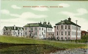
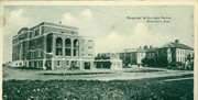
Photograph shows the buildings of the Brandon General Hospital
Notes
Part of "Christie's Brandon Series of Six Colored Picture Postcards of Brandon, Manitoba, The Crown Series, Published by Christie's Bookstore, Brandon, Man." [note: missing sixth postcard]. Writing on the front of the photograph reads: Brandon General Hospital, Brandon, Man.
Photograph shows a street view of 10th Street facing north. There are many automobiles parked along the street and several pedestrians in summer dress are on the sidewalks and street. Visible business signs include: Hentzman & Co. Pianos (possibly belonging to J.J.H. McLean Co. Ltd.), the Strand Theatre, T & D Clothes, Campbell & Campbell, the CPR Station, and Bowling Alley and Billiards.
Notes
Part of "Souvenir of Brandon, Manitoba, Canada [viewbook], Printed by Photogelatine Engraving Co. Limited, Ottawa." Dates obtained from the Burchill's Music Store Henderson's Brandon City Directory listings (1927-1929). Writing on the front of the photograph reads: 10th St., looking north (C.P.R. Station at end of Street) Brandon, Man.
Photograph shows the CPR Train Station on Pacific Avenue and 10th Street.
Notes
Part of "Souvenir of Brandon, Manitoba, Canada [viewbook], Printed by Photogelatine Engraving Co. Limited, Ottawa." Dates obtained from the Burchill's Music Store Henderson's Brandon City Directory listings (1927-1929). Writing on the front of the photograph reads: CPR Station, Brandon, Man.
Photograph shows a panorama, bird's-eye-view of downtown Brandon, between Pacific and Rosser Avenues and 7th Street facing east. Photoraph likely taken from the McKenzie Seeds Building. Visible businesses include: Western Canada Flour Mills, Hanbury Hardware Co. Ltd., Cockshutt Plow Co., New Pacific Hotel, Gordon McKay Building, and Arlington Hotel.
Notes
Part of "Souvenir of Brandon, Manitoba, Canada [viewbook], Printed by Photogelatine Engraving Co. Limited, Ottawa." Dates obtained from the Burchill's Music Store Henderson's Brandon City Directory listings (1927-1929). Writing on the front of the photograph reads: Panorama of Brandon, Man.
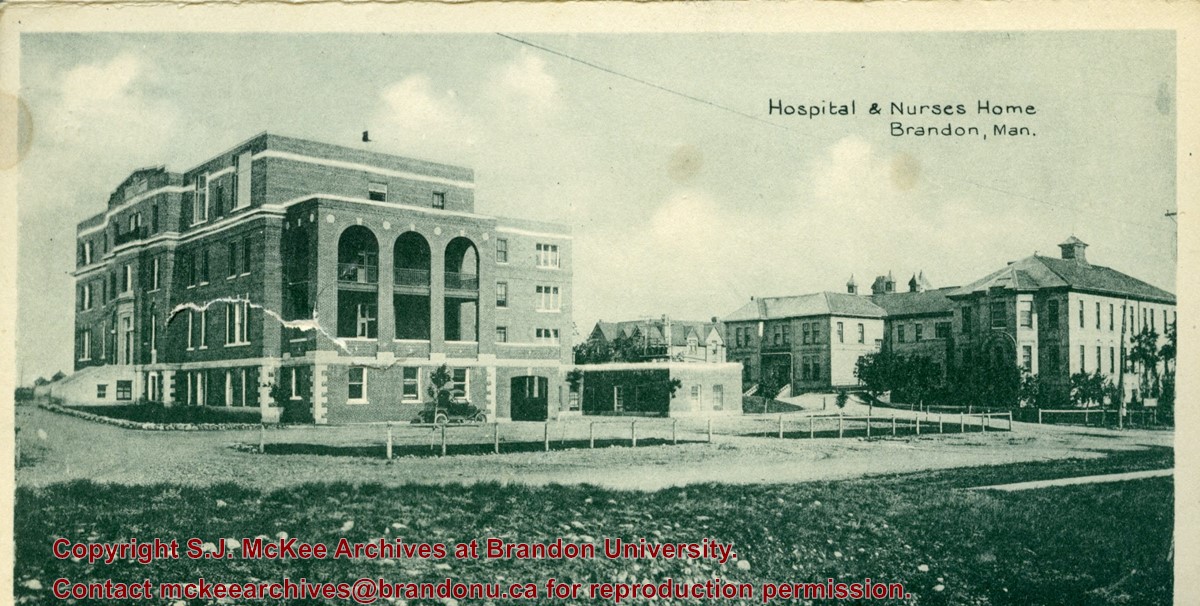
Photograph shows an eastern view of the hospital grounds, including the 1922 hospital building.
Notes
Part of "Souvenir of Brandon, Manitoba, Canada [viewbook], Printed by Photogelatine Engraving Co. Limited, Ottawa." Dates obtained from the Burchill's Music Store Henderson's Brandon City Directory listings (1927-1929). Writing on the front of the photograph reads: Hospital & Nurses Home, Brandon, Man.
Photograph shows a southwestern view of Clark Hall and the Brandon College Original Building. The Citizen Science Building is absent from the campus grounds.
Notes
Part of "Souvenir of Brandon, Manitoba, Canada [viewbook], Printed by Photogelatine Engraving Co. Limited, Ottawa." Dates obtained from the Burchill's Music Store Henderson's Brandon City Directory listings (1927-1929). Writing on the front of the photograph reads: Brandon College, Brandon, Man.


