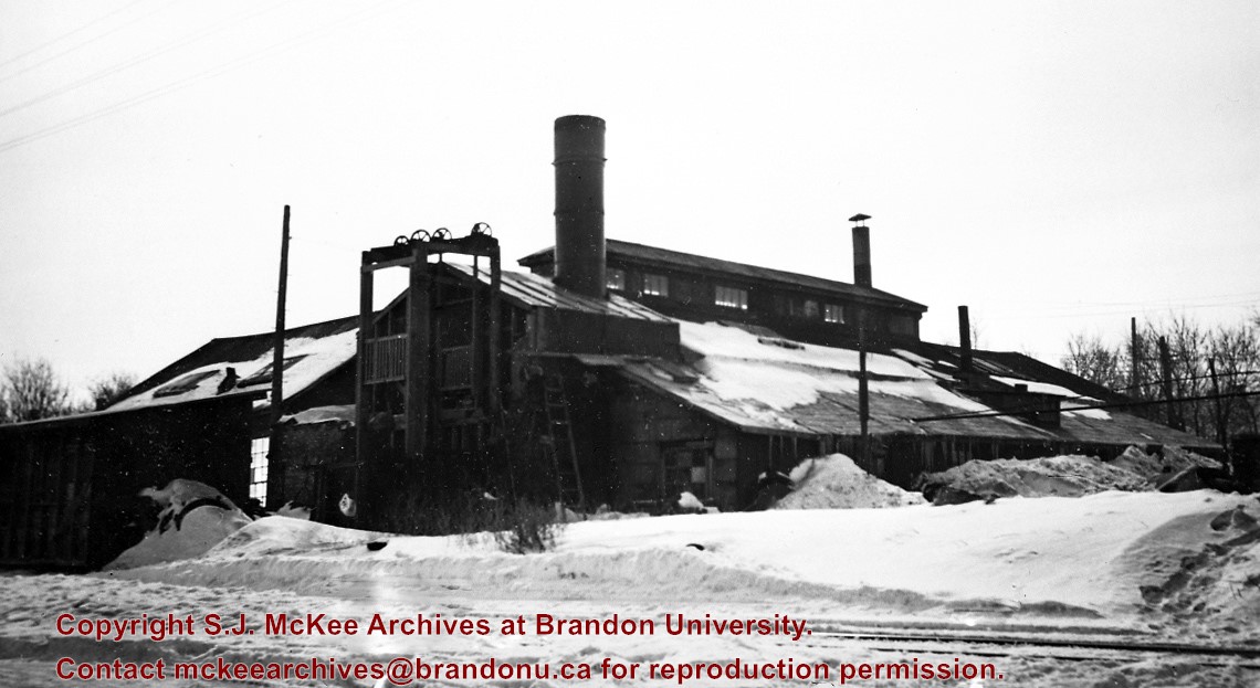
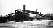
Situated in the R.M. of Whitehead on the Little Saskatchewan River, the 10 Mile Dam was a 14 kilometer transmission line that supplied the city of Brandon with power. The Brandon Electric Light Company built the dam in 1900 and it is considered Manitoba's first hydroelectic power generating station. The dam spanned approximately 80 meters and was constructed from timber and reinforced with clay and stone. The station was decommissioned in 1924.
Scope and Content
Photograph shows 10 Mile Dam, also known as the Brandon Dam or Minnedosa River Hydro Plant.
Notes
Writing on the back of the photograph reads: "10 mile dam". Biographical information obtained from Manitoba Historical Society.
Situated in the R.M. of Whitehead on the Little Saskatchewan River, the 10 Mile Dam was a 14 kilometer transmission line that supplied the city of Brandon with power. The Brandon Electric Light Company built the dam in 1900 and it is considered Manitoba's first hydroelectic power generating station. The dam spanned approximately 80 meters and was constructed from timber and reinforced with clay and stone. The station was decommissioned in 1924.
Alonzo Archibald Rowe (b. 1862, London, ON; d. 22 Oct 1951, Brandon). The Rowes were considered Brandon area pioneers. Alonzo’s father, Alonzo L. Rowe, came to Brandon with his family in 1881, where the family had a furniture and undertaker business on the west side of 10th Street between Rosser and Princess Avenues. In 1885, the family began farming west of Brandon and Alonzo Archibald served as a councilor and then a reeve in the R.M. of Whitehead. He returned to Brandon in 1907 and served with the Brandon Police Department until 1910, when he returned to farming, this time in Arrow River. A.A. Rowe returned to Brandon in 1915 to work as a Provincial Licenses Inspector, a position he held until 1938. (Source: Obituary, Brandon Daily Sun 22 Oct 1951)
Custodial History
Photograph was in possession of Mrs. Ruby Miles, who passed the image on to Fred McGuinness. McGuinness makes reference to Mrs. Miles and this photograph in his Sunbeams column (Source: F.A. Rosser, "Another interesting chat with a daughter of the plains," Brandon Sun 18 Aug 1981).
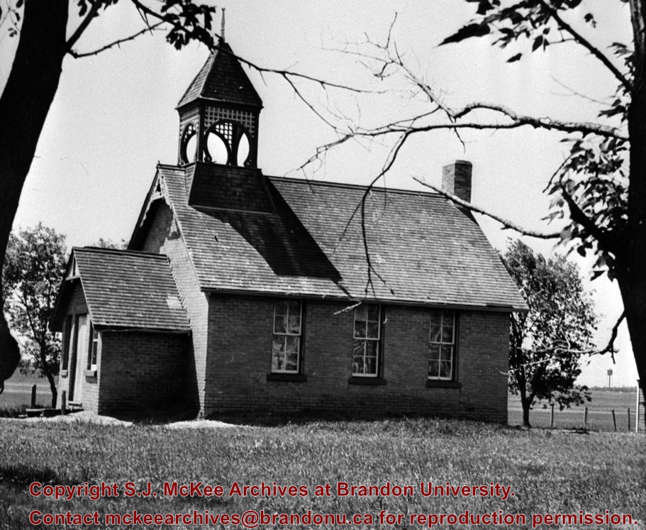
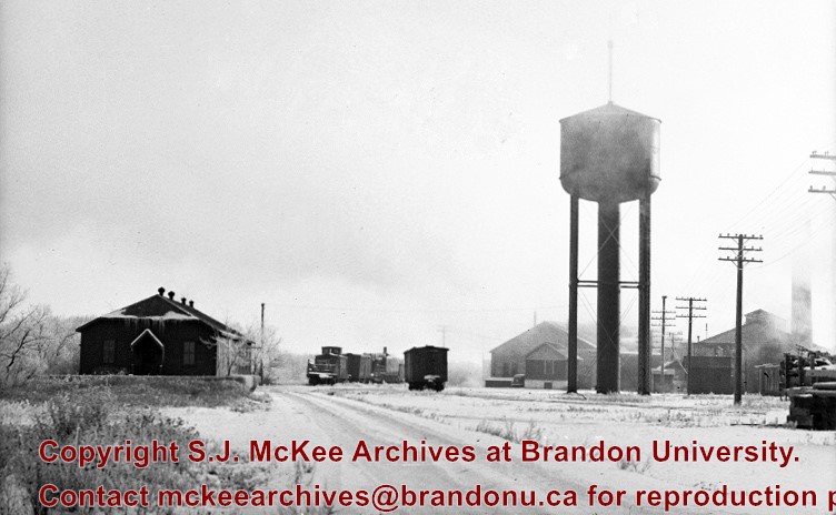
Scope and Content
Photograph shows four fishermen at 10 Mile Dam, also known as the Brandon Dam or Minnedosa River Hydro Plant. The fishermen in the photo are identified as George H. Rowe and his father A.A. Rowe, Dr. Wilfred Bigelow, and Al Collins.
Notes
Writing on the back of the photograph reads: at Brandon Dam, [right to left] son and father - George H. ROWE, Mr. A.A. ROWE, Dr. BIGELOW, Al COLLINS (dam?, 1906?, George born March 1897); Jerrett's Photo-Services, May 7 1938.
Situated in the R.M. of Whitehead on the Little Saskatchewan River, the 10 Mile Dam was a 14 kilometer transmission line that supplied the city of Brandon with power. The Brandon Electric Light Company built the dam in 1900 and it is considered Manitoba's first hydroelectic power generating station. The dam spanned approximately 80 meters and was constructed from timber and reinforced with clay and stone. The station was decommissioned in 1924.
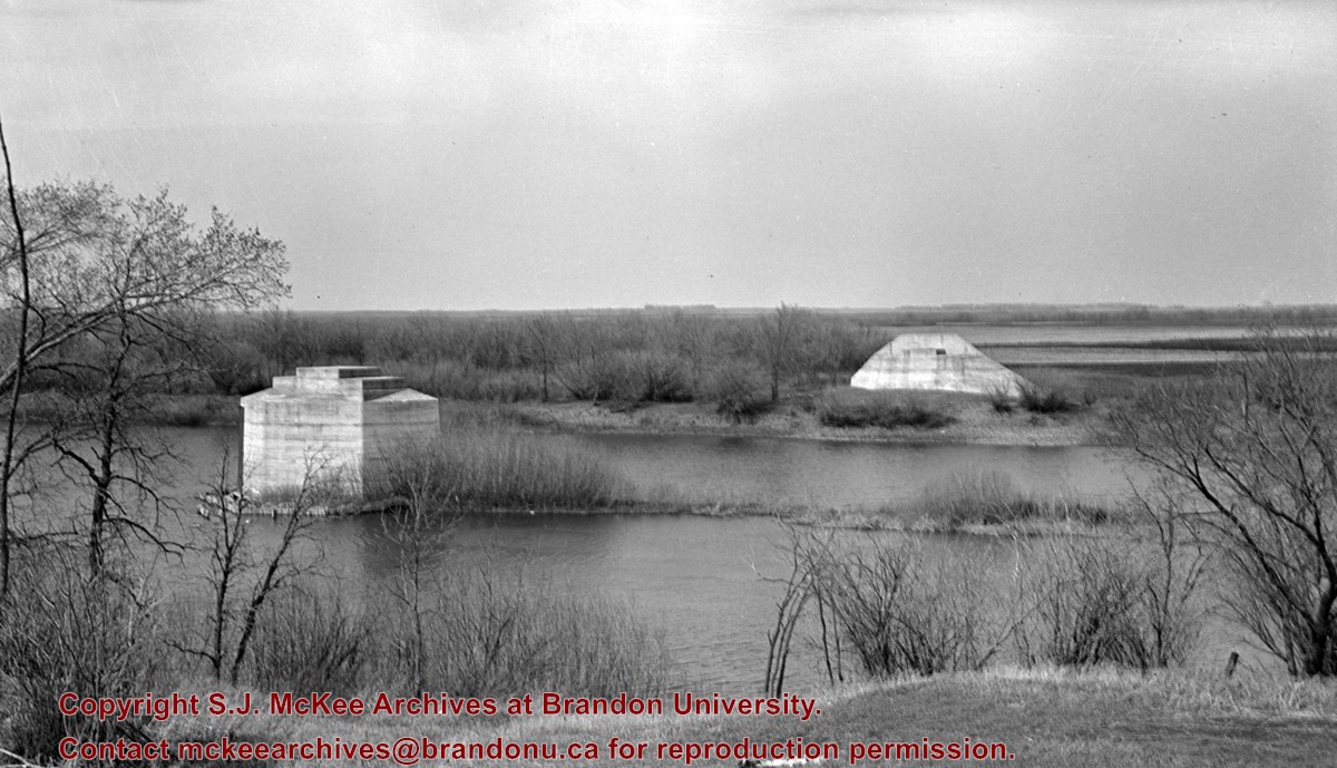
Scope and Content
Photograph shows 10 Mile Dam, also known as the Brandon Dam or Minnedosa River Hydro Plant. The dam's timber construction is quite evident in the picture.
Notes
Writing on the back of the photograph reads: McGuinness (Manitoba Hydro), on Little Saskatchewan.
For custodial history see the collection level description of the Lawrence Stuckey collection.
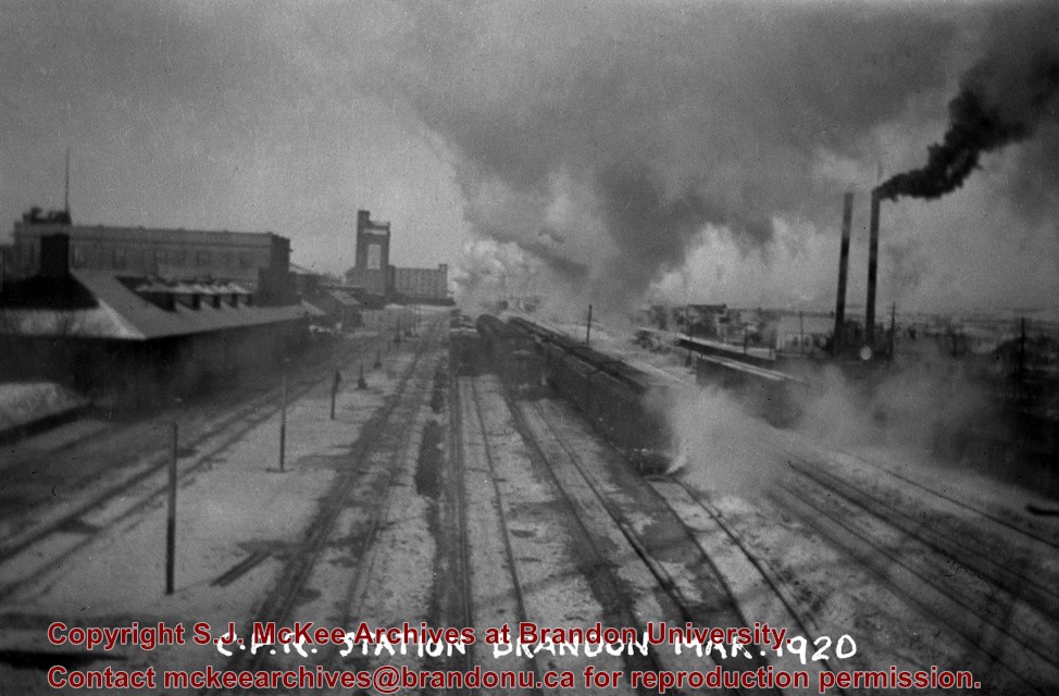
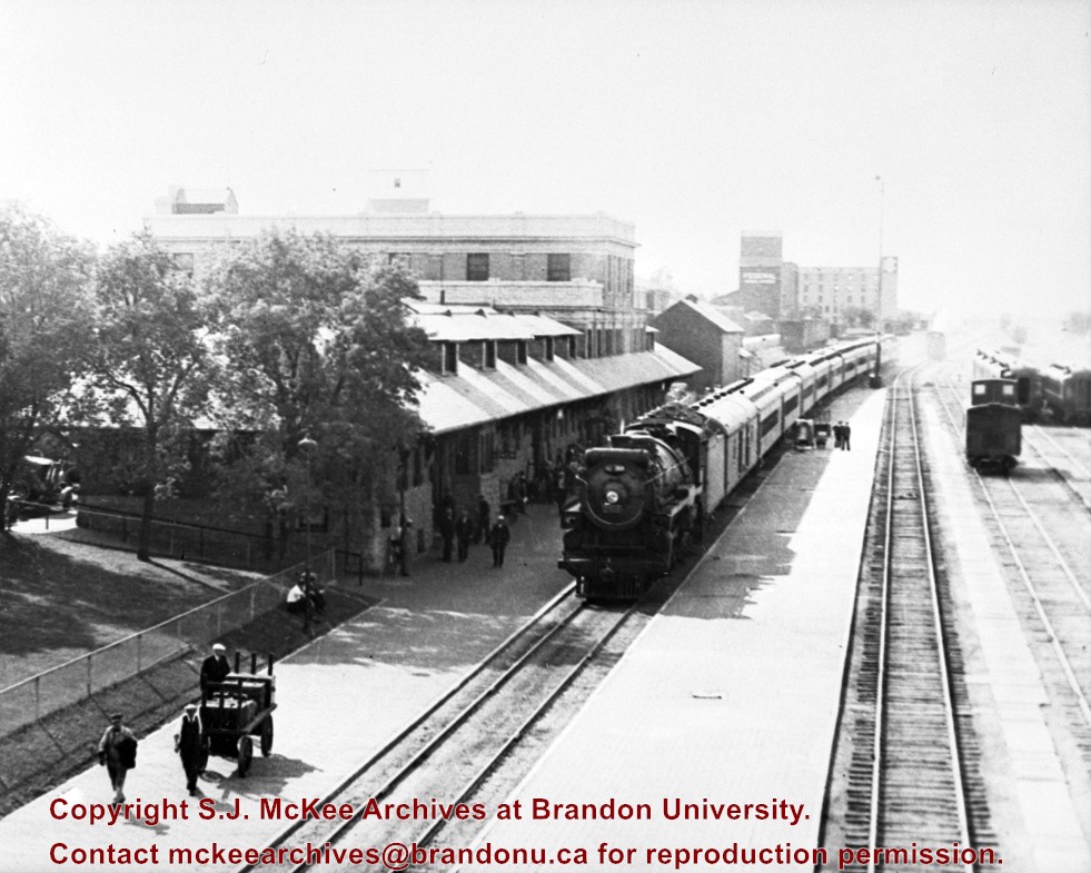
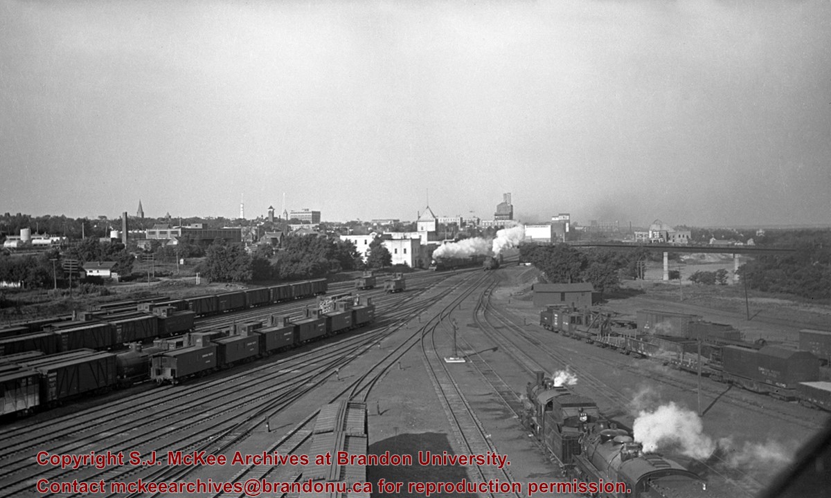
Scope and Content
[East side of Prince Edward Hotel railway station; facing Ninth Street]
Notes
[Mr. Stuckey put six negatives (3 combined negatives) in one envelope. We have separated them and numbered them DC6f(1) through DC6f(6). From a combined negative.]
For custodial history see the collection level description of the Lawrence Stuckey collection.
Scope and Content
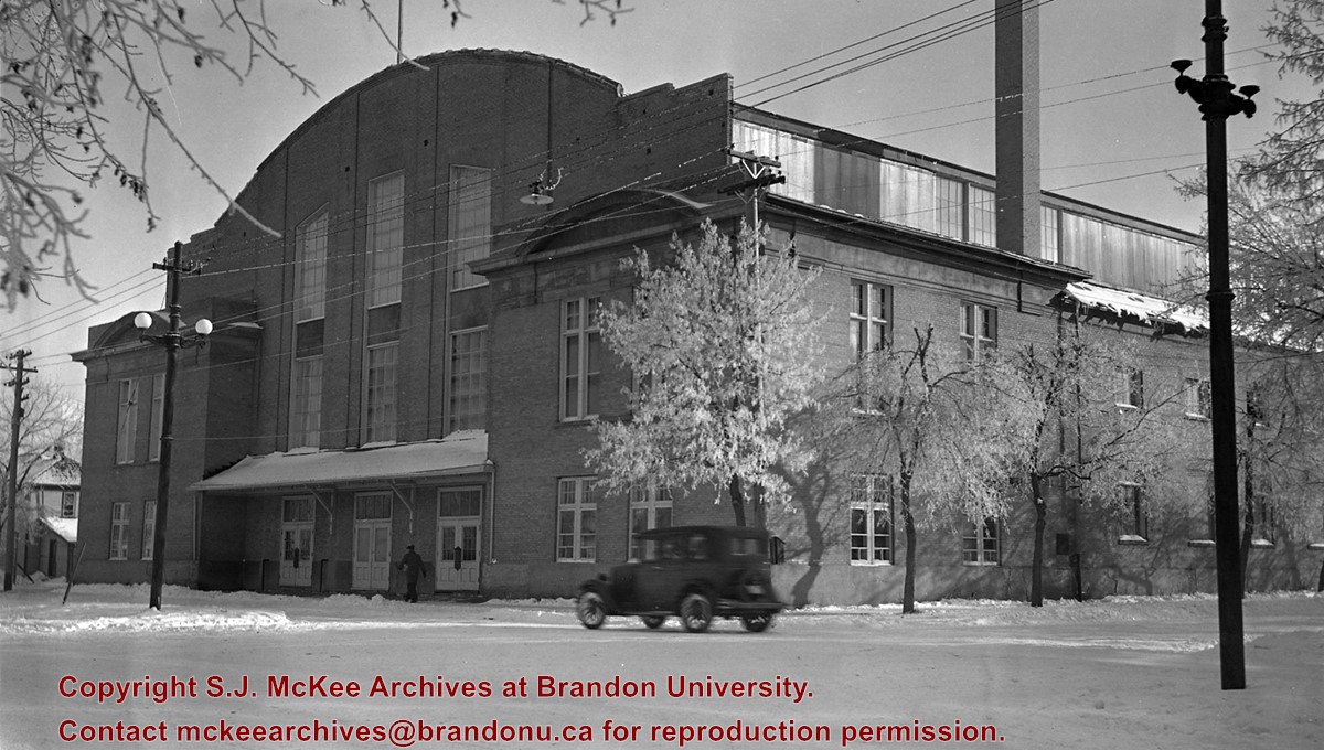
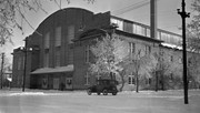
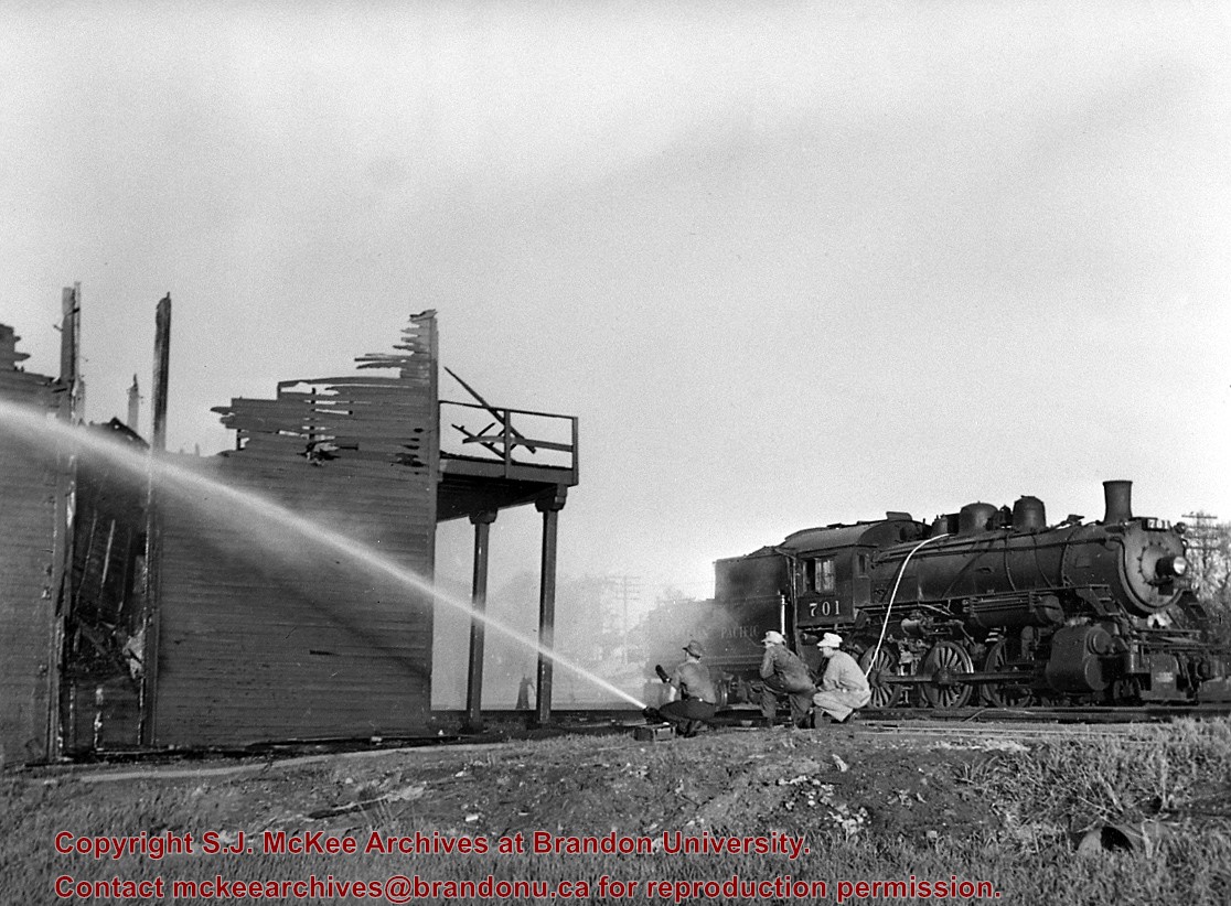
CPR Ice House Fire with engine 701
Notes
This large ice house, located between the CPR tracks and Assiniboine Avenue at 3rd Street, was filled with blocks of ice from the Assiniboine River each winter. It had a long high platform for [loading ice blocks into] refrigerator cars, and also handled charcoal braziers for heating these same cars in winter. The new ice house structure that was built after this fire was much smaller, as it had an artificial ice plant.
With mechanically temperature-controlled cars replacing ice-cooled refrigerators, it was demolished in the 1970's.
This photograph shows how steam switch engines were used as fire engines. A hose carried in a box under the tender was fitted into a branch of the boiler feed pipe (discharge pipe). When the injector was turned on it gave a nozzle pressure of over 200 psi.
Due to the increasing volume of long-distance auto traffic in the 1920's, the city designated the block between Hill & Queen's Avenues and 9th & 10th streets as a "Tourist Camp" with a few basic facilities. After the demise of the Brandon Municipal Railway, several of the old car bodies were placed in the Tourist Camp to be used as cooking & eating shelters. Some may have had sleeping accommodations. Later (ca. 1938?) several were placed in a row along the south side of Victoria Avenue, approximately 28th or 29th St, and were used as the city's first drive-in hamburger place, "The Train Drive-in". This, I believe, only lasted one or two summer seasons. LAS.
Custodial History
For custodial history see the collection level description of the Lawrence Stuckey collection.
This wedge-shaped tract of woodland was located west of 34th Street on the south side of the Canadian Pacific Railway. It was formerly owned by the Great Northern Railway, and was acquired by the CPR when the GN line was abandoned in 1936. In 1978 Marathon Realty (CPR) sold this 7 acre property to a developer who planned to build condominiums. However this residential development was objected to for two reasons: [The proposed location] was home to many species of flora & fauna, and it was too close to the CPR mainline. Local residents took out a petition against the development. [Mr. Stuckey] wrote a letter to the editor of the Brandon Sun, [expressing the] attitudes of CPR officials, and read a statement to the Provincial Planning Board suggesting development be refused and the area become an undeveloped park. These efforts would prove successful - see file on same.
Custodial History
For custodial history see the collection level description of the Lawrence Stuckey collection.
Scope and Content
John Indian's Bush (also known as Bang's Bush)
Notes
Additional historical information provided by the Fred McGuinness collection (20-2009). Stuckey's letter to the editor appears in the July 22, 1978 issue of The Brandon Sun.
This wedge-shaped tract of woodland was located west of 34th Street on the south side of the Canadian Pacific Railway. It was formerly owned by the Great Northern Railway, and was acquired by the CPR when the GN line was abandoned in 1936. In 1978 Marathon Realty (CPR) sold this 7 acre property to a developer who planned to build condominiums. However this residential development was objected to for two reasons: [The proposed location] was home to many species of flora & fauna, and it was too close to the CPR mainline. Local residents took out a petition against the development. [Mr. Stuckey] wrote a letter to the editor of the Brandon Sun, [expressed the] attitudes of CPR officials, and read a statement to the provincial planning board suggesting development be refused and the area become an undeveloped park. These efforts would prove successful - see file on same.
Custodial History
For custodial history see the collection level description of the Lawrence Stuckey collection.
Scope and Content
John Indian's Bush (also known as Bang's Bush).
Notes
Additional historical information provided by the Fred McGuinness collection (20-2009). Stuckey's letter to the editor appears in the July 22, 1978 issue of The Brandon Sun.
This bridge was condemned in the late 1930s but cyclists continued to use it until it was torn down (approximately 1940)
Until the early 1920s the Canadian Pacific Railway maintained a well and pumping station near the southeast corner of this bridge, which pumped water through a pipeline to a locomotive watering tank at Kemnay.
Custodial History
For custodial history see the collection level description of the Lawrence Stuckey collection.
Scope and Content
Assiniboine River Bridge North of Kemnay
Notes
[Mr. Stuckey put a negative and print in the same envelope. We have separated them, numbering the negative OB5(1) and the print OB5(1a).]


.jpg?width=1200&404=no-img.jpg&watermark=wmk)
.jpg?width=180&404=no-img.jpg)


.jpg?width=1200&404=no-img.jpg&watermark=wmk)
.jpg?width=180&404=no-img.jpg)
.jpg?width=1200&404=no-img.jpg&watermark=wmk)
.jpg?width=180&404=no-img.jpg)
.jpg?width=1200&404=no-img.jpg&watermark=wmk)
.jpg?width=180&404=no-img.jpg)
.jpg?width=1200&404=no-img.jpg&watermark=wmk)
.jpg?width=180&404=no-img.jpg)
.jpg%3fmaxheight%3d1000%26maxwidth%3d1000%26watermark%3dwmk&description=Prince+Edward+Hotel+-+Railway+Station)
.jpg%3fmaxheight%3d1000%26maxwidth%3d1000%26watermark%3dwmk&description=John+Indian%27s+Bush)
.jpg%3fmaxheight%3d1000%26maxwidth%3d1000%26watermark%3dwmk&description=John+Indian%27s+Bush)
.jpg%3fmaxheight%3d1000%26maxwidth%3d1000%26watermark%3dwmk&description=Assiniboine+River+Bridge+North+of+Kemnay)
.jpg%3fmaxheight%3d1000%26maxwidth%3d1000%26watermark%3dwmk&description=Assiniboine+River+Bridge+North+of+Kemnay)