Skip header and navigation

Revise Search

5 records – page 1 of 1.

Front lawn and Clark Hall

http://archives.brandonu.ca/en/permalink/descriptions815
Part Of
Aerial views and campus photographs
Description Level
Item
GMD
graphic
Date Range
c. 1980s
Part Of
Aerial views and campus photographs
Description Level
Item
Series Number
2.1
Item Number
2.1.50
GMD
graphic
Date Range
c. 1980s
Physical Description
8" x 10" (b/w)
Scope and Content
Photograph shows a woman reading in the seating area on the front lawn in front of Clark Hall.
Images
Show Less

Park Street School

http://archives.brandonu.ca/en/permalink/descriptions14316
Part Of
Brandon and Area Photograph Collection
Description Level
Item
GMD
graphic
Date Range
[after 1905]
Part Of
Brandon and Area Photograph Collection
Description Level
Item
Series Number
2
Item Number
BAPC 2.42
GMD
graphic
Date Range
[after 1905]
Physical Description
5.5" x 3.5" (color)
Material Details
Postcard
History / Biographical
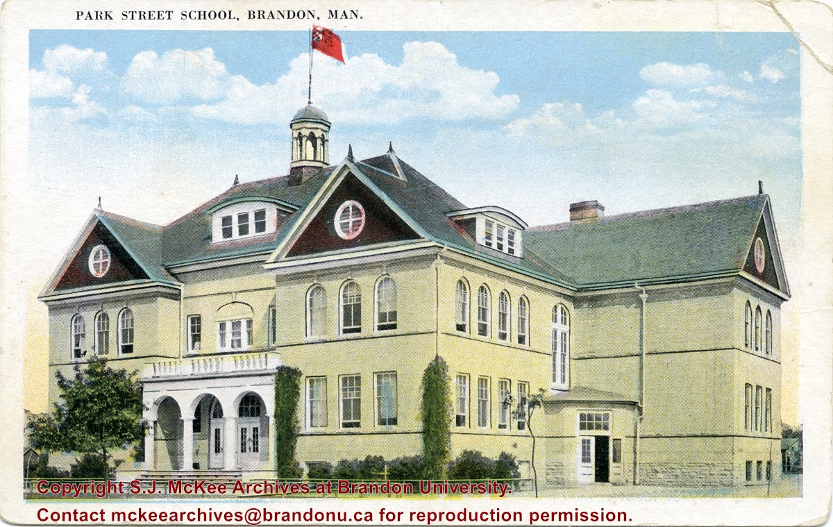
Located south of Stanley Park along the 1400 block of Lorne Avenue, Park School was constructed in 1904. Designed by W.A. Elliot and built by the Brandon Construction Company the structure measured 71 x 107 feet and cost approximately $38,000. The school featured a principal’s office, reception room, staff rooms, an assembly hall for eight hundred, and ten class rooms. The interior walls were lined with mahogany while the floors were made of western pine. The interior of the basement was constructed from Tyndall stone, while Crookston brick trimmed with Bedford stone made up the exterior. The building was razed in September 1978. Hobbes Manor was built on the location.
Scope and Content
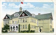
Item is a postcard showing Park School in Brandon, MB.
Name Access
Park School
Subject Access
schools
Education
Storage Location
BAPC photograph drawer
Images
Show Less

Aerial view: Flora Cowan, Gymnasium, Darrach Hall

http://archives.brandonu.ca/en/permalink/descriptions614
Part Of
Aerial views and campus photographs
Description Level
Item
GMD
graphic
Date Range
c. 1970
Part Of
Aerial views and campus photographs
Description Level
Item
Series Number
2.1
Item Number
2.1.18
GMD
graphic
Date Range
c. 1970
Physical Description
8" x 10" (b/w)
Scope and Content
View is southwest from the John R. Brodie Science Centre. Photograph shows: Flora Cowan Hall, the Brandon University Gymnasium, Darrach Hall, the Quill trailer and the Jeff Umphrey Centre.
Images
Show Less

Citizens' Science Building, Brandon College Building and Clark Hall

http://archives.brandonu.ca/en/permalink/descriptions816
Part Of
Aerial views and campus photographs
Description Level
Item
GMD
graphic
Date Range
October 1981
Part Of
Aerial views and campus photographs
Description Level
Item
Series Number
2.1
Item Number
2.1.142
GMD
graphic
Date Range
October 1981
Physical Description
8" x 10" (b/w)
Scope and Content
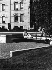
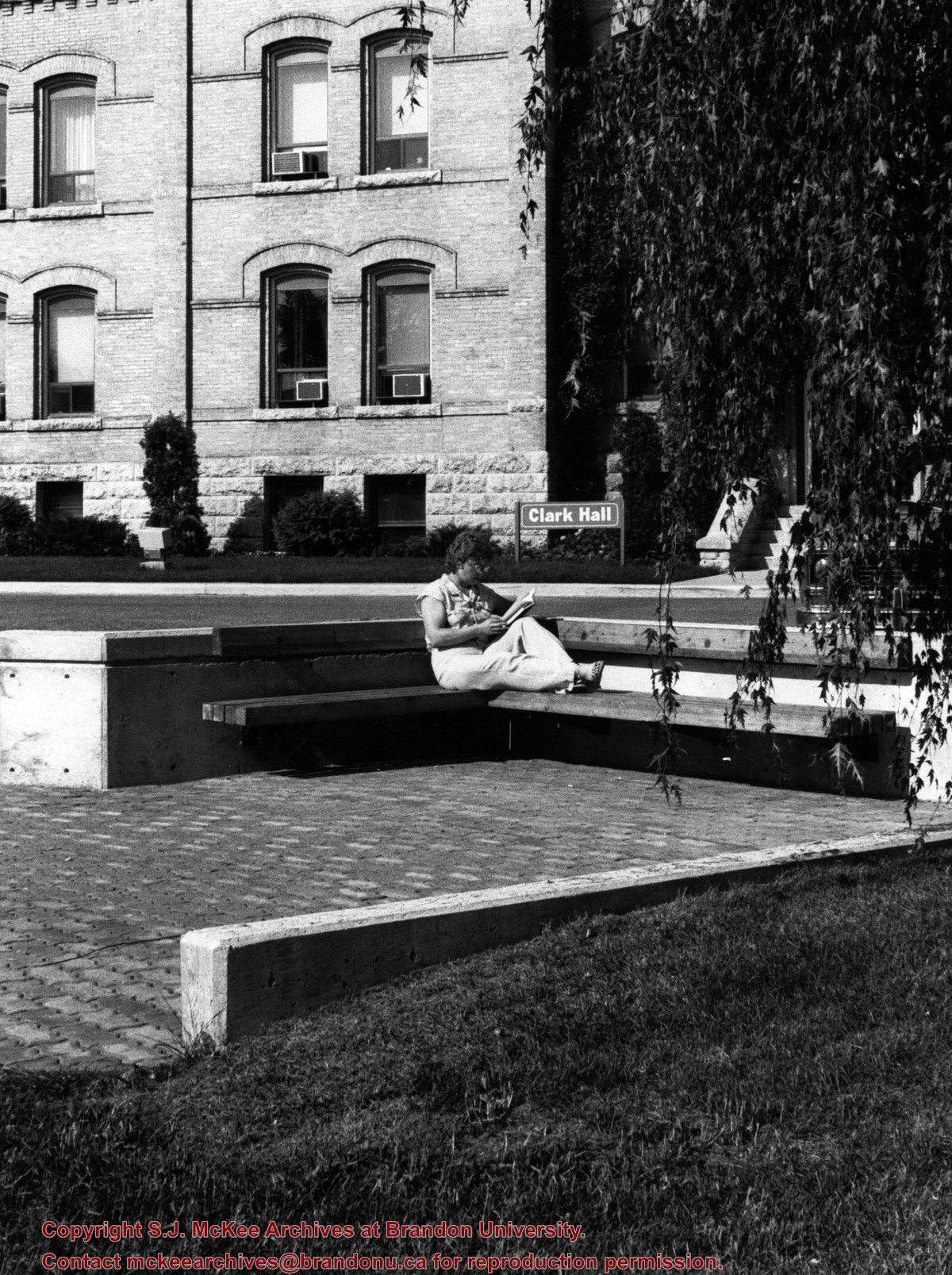
Photograph is looking northwest probably from the John R. Brodie Science Centre and shows the Citzens' Science Building, the Brandon College Building, Clark Hall and a portion of the driveway and grounds in front of the buildings.
Images
Show Less

Aerial view: Clark Hall, Education Building, Student Union Building

http://archives.brandonu.ca/en/permalink/descriptions612
Part Of
Aerial views and campus photographs
Description Level
Item
GMD
graphic
Date Range
c. 1960s
Part Of
Aerial views and campus photographs
Description Level
Item
Series Number
2.1
Item Number
2.1.17
GMD
graphic
Date Range
c. 1960s
Physical Description
10" x 8" (b/w)
Scope and Content
View is northeast, taken from the John R. Brodie Science Centre. Photograph shows: the Brandon College Building, the Student Services H-Hut, the Education Building, and the Student Union Building (Citizens' Science Building), as well as 18th Street and some houses. The trailer to the south of the Education Building was a Canada Manpower office in the 1960s. It was latter moved over by the Gymnasium, where it became the Quill office.
Images
Show Less