Skip header and navigation

Revise Search

2 records – page 1 of 1.

Part Of
Aerial views and campus photographs
Description Level
Item
GMD
graphic
Date Range
c. 1967-1969
Part Of
Aerial views and campus photographs
Description Level
Item
Series Number
2.1
Item Number
2.1.29
GMD
graphic
Date Range
c. 1967-1969
Physical Description
4.5" x 3.5" (b/w)
Physical Condition
Photograph is slightly overexposed.
Scope and Content
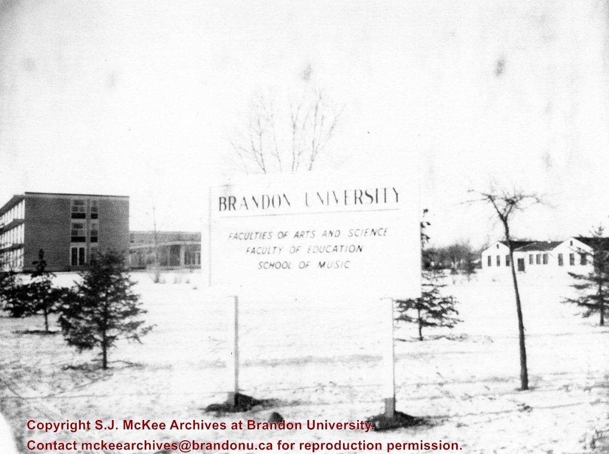
View is northwest from approximatley the corner of 18th Street and Louise Avenue. Photograph shows a Brandon University sign post listing the faculties and schools on campus. In the background is Flora Cowan Hall, the Dining Hall, Darrach Hall and the H-Huts.
Images
Show Less

Aerial view: Clark Hall, Education Building, Student Union Building

http://archives.brandonu.ca/en/permalink/descriptions612
Part Of
Aerial views and campus photographs
Description Level
Item
GMD
graphic
Date Range
c. 1960s
Part Of
Aerial views and campus photographs
Description Level
Item
Series Number
2.1
Item Number
2.1.17
GMD
graphic
Date Range
c. 1960s
Physical Description
10" x 8" (b/w)
Scope and Content
View is northeast, taken from the John R. Brodie Science Centre. Photograph shows: the Brandon College Building, the Student Services H-Hut, the Education Building, and the Student Union Building (Citizens' Science Building), as well as 18th Street and some houses. The trailer to the south of the Education Building was a Canada Manpower office in the 1960s. It was latter moved over by the Gymnasium, where it became the Quill office.
Images
Show Less