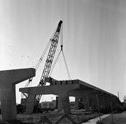
Stuckey's notes: Contract for concrete approach from north end to replace east and west timber approaches along Assiniboine Ave. awarded to A.E. Jones and E. Fulcher for $30,590. Oct. 11, 1934. (Brandon Sun). As part of this project a Z-shaped ramp on the west side to Assiniboine Ave for pedestrians replaced wooden stairs to north end. G. Crighton Collection.
Scope and Content
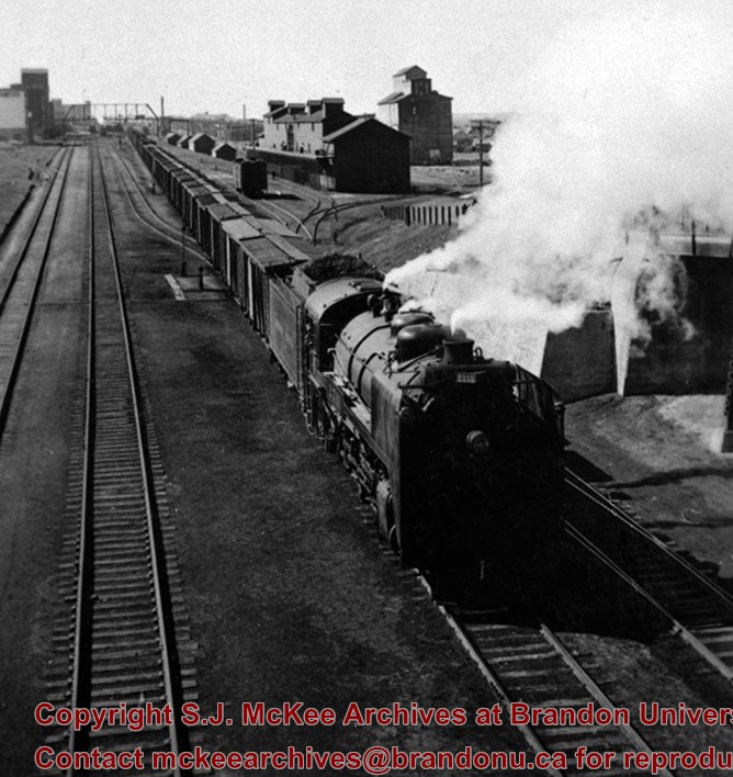
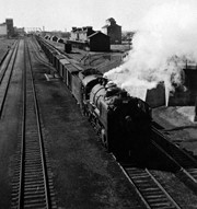
Photograph was taken from the east side of Pacific Avenue and shows the pedestrian stairway to the North end and a CPR early 2800 being serviced in Train No. 4.
Notes
Corresponds with negative 1-2002.3.9.BF2.
Repro Restriction
The McKee Archives is the copyright holder for the Stuckey materials.
For custodial history see the collection level description of the Lawrence Stuckey collection.
Scope and Content
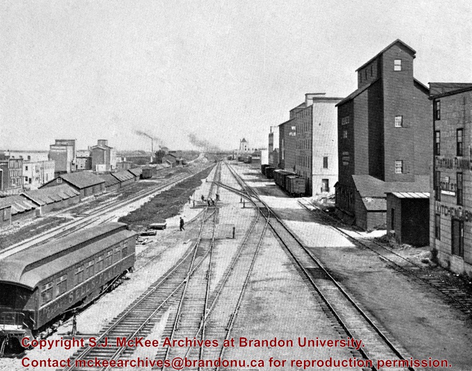
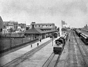
View of Canadian Pacific Railway, east from overhead [Eighth Street] bridge
Notes
Publicity coach of Sells-Floto Circus (foreground)
On left, a long row of domestic fuel coal sheds (many of which were later burned), Hanbury's Mill, elevators & Maple Leaf flour mill
On right, grain elevator & Hanbury Hardware (in 1985 used by Christie School Supply)
[For original plate, please see the Alf Fowler collection of the S.J. McKee Archives 6-1999.16. P.E.]
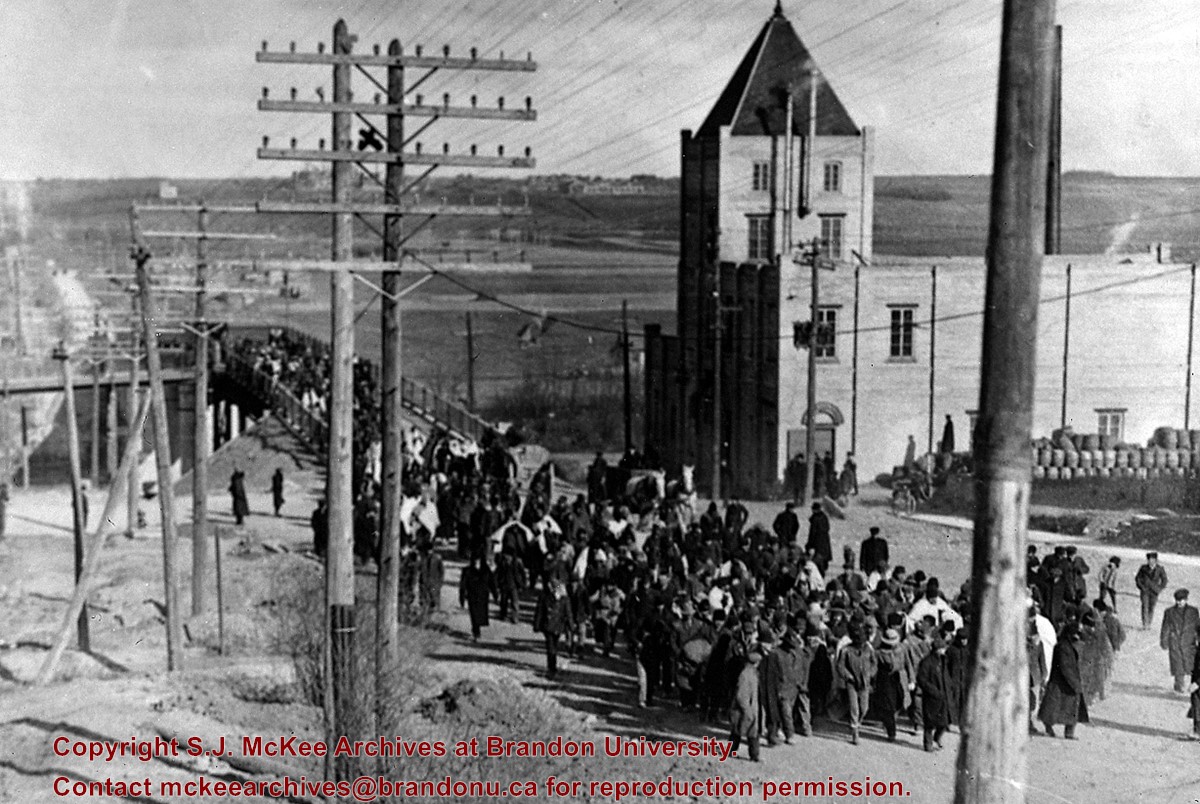
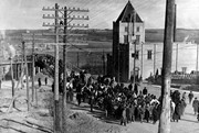
Seeking temporary housing, a parade of patients walked from the Brandon Asylum to the Winter Fair Building (located on the 500 block of 10th Street) the day after fire completely destroyed the asylum.
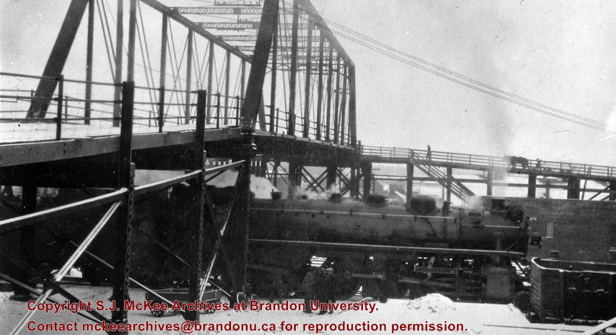
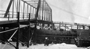
This photo shows the First Street Bridge as built and opened in 1909.
Note the pile of kegs next to the Empire Brewery. [The building was then] owned by Dave Weiss of Brandon Scrap Iron & Metals Recycling Co.
Custodial History
For custodial history see the collection level description of the Lawrence Stuckey collection.
Scope and Content
Brandon asylum patients crossing the First Street Bridge
Trembley was a point along the Algoma Central Railway line that connected the Helen Mine to the Michipicoten Harbour. It is located southwest of Wawa, Ontario.
Scope and Content
Photograph shows railroad tracks. A line of ore cars stretch along one track. Writing on the side of one of the cars (#3017) reads: Algoma Central Railway Co.
Notes
Writing beneath the photograph in the album reads: Trembley - Ore Cars
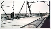
Stuckey's notes: Built 1909, pedestrian sidewalk added 1929. a. Junction Assiniboine Ave. ramp & CPR Yard Office. b. Section over river (north end). c. CPR employees stairway. d. south approach & Empire Brewery. e. distant view from Pacific Ave.
Scope and Content
Photograph is looking north northeast and shows the south approach and the former Empire Brewery building (sign on the building in the photo says Lindenburg B?) at 1st Street and Pacific Avenue.
Notes
Corresponds with negative 1-2002.3.9.BA2(d).
Repro Restriction
The McKee Archives is the copyright holder for the Stuckey materials.
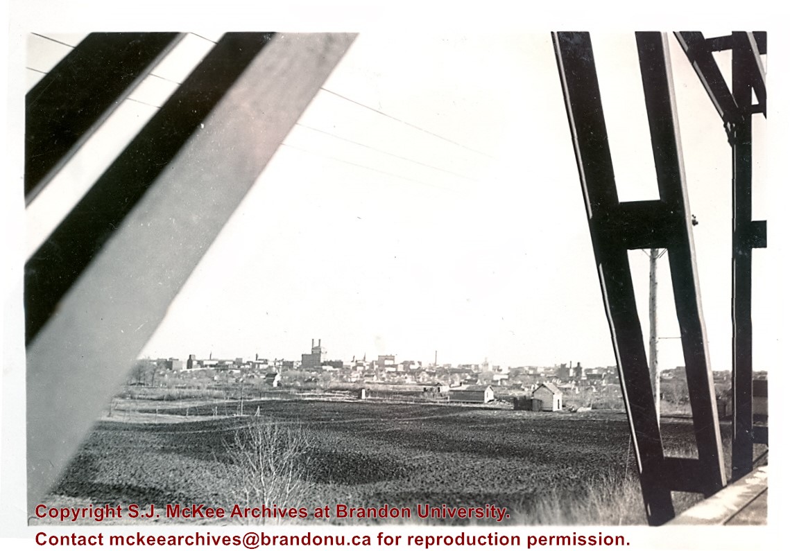
Stuckey's notes: Built 1909, pedestrian sidewalk added 1929. a. Junction Assiniboine Ave. ramp & CPR Yard Office. b. Section over river (north end). c. CPR employees stairway. d. south approach & Empire Brewery. e. distant view from Pacific Ave.
Scope and Content
Photograph is looking east northeast and shows the bridge in the distance from Pacific Avenue.
Notes
Corresponds with negative 1-2002.3.9.BA2(e).
Repro Restriction
The McKee Archives is the copyright holder for the Stuckey materials.
See MG 1 Brandon College Teaching and Administration, 1.11 Martin Johns fonds for custodial history.
Scope and Content
Photograph is looking south southeast from the Assiniboine bridge on 18th Street and shows the Brandon cityscape in the background.
Notes
Writing on the back of the photo reads: "Brandon from the Assiniboine bridge. The 2 girls were just local coloring. Don't ask me who they were or are? The College is just off the street on the right away in the background."
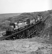
Mr. Stuckey's notes: On bridge mile 87.2, Bredenbury Sub[division]. Has permanent 10 MPH slow order [on] account [of] footings in shale.
Custodial History
For custodial history see the collection level description of the Lawrence Stuckey collection.
Scope and Content
Image of CP XW 6015-5701-5929-5747-QNS&L 215-6037, Harrowby, Manitoba. Image was taken along the CPR Minnedosa & Bredenbury subdivision (ex. Manitoba & N.W. Railway).
The Snye was a former channel (oxbow lake) of the Assiniboine River. It was located south of the Assiniboine between about 14th and 24th Streets, and during high water in the spring it carried overflow. For many years it was used as a log storage area for Hanbury's Mill. I remember there being bridges over it at 18th & 22nd Streets. It was dammed with a one way flipper valve at 14th Street that allowed water to flow out to the river, but prevented river water backing into it. Water within the Snye became stagnant in summer and formed a breeding area for mosquitoes. It was deemed a health hazard and the river was gradually filled in. LAS.
Custodial History
For custodial history see the collection level description of the Lawrence Stuckey collection.
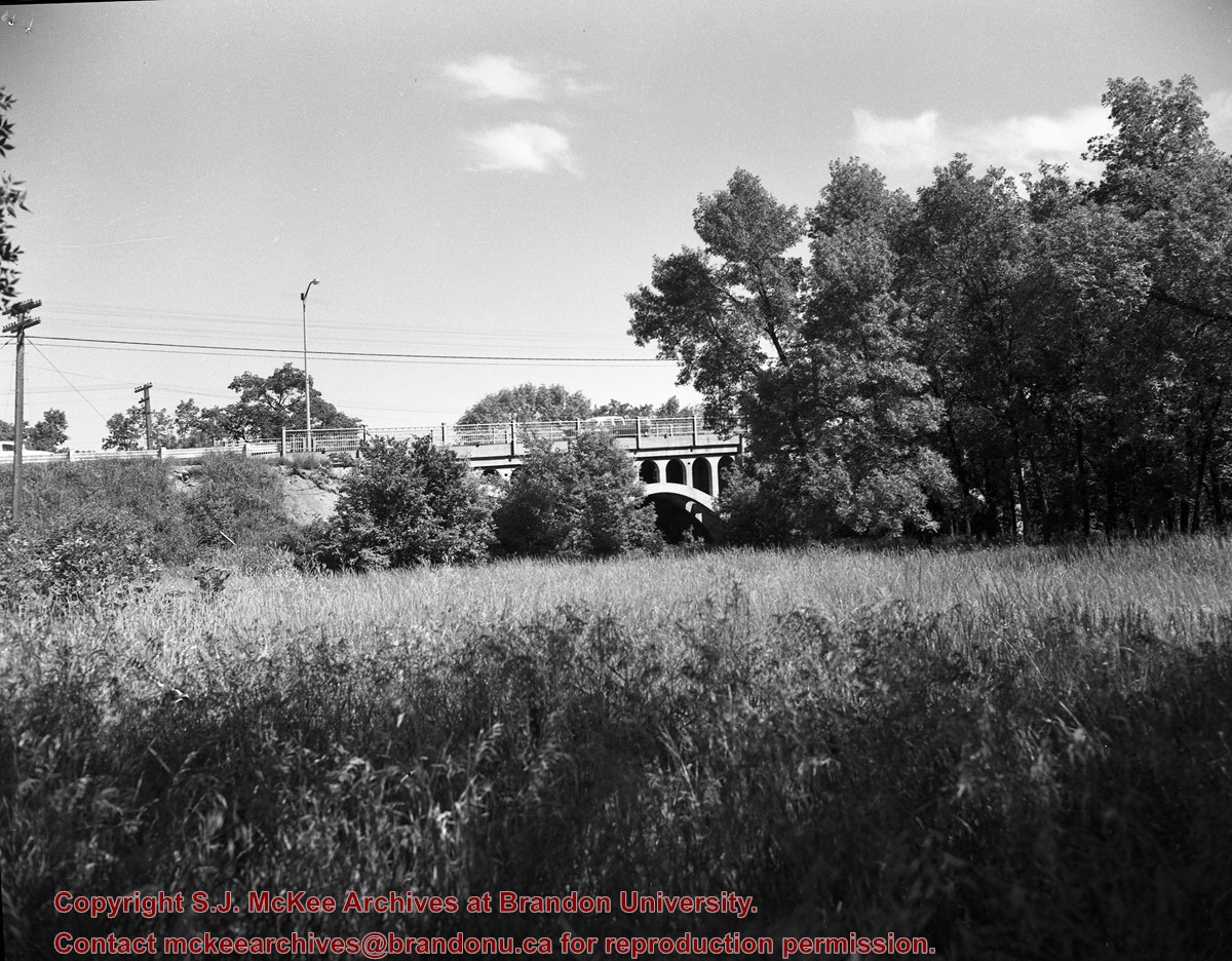
Scope and Content
Snye River
Notes
[This negative was produced using a previous published image. P.E. 22/07/09]
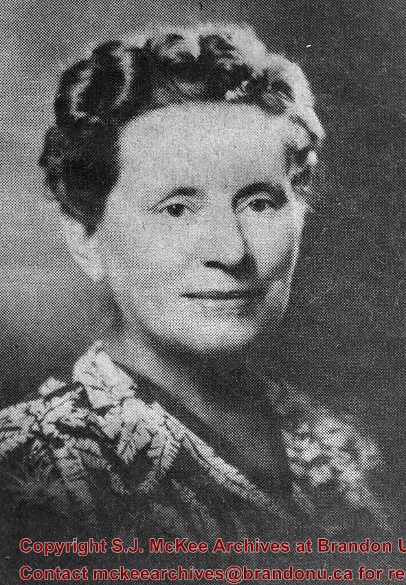
Additional historical information provided by the Fred McGuinness collection (20-2009).
[For additional information see "Beatrice Brigden and Radicalism in the Methodist Church" by Tom Mitchell, Manitoba History, Number 19, Spring 1990 (P.E. 26/05/09).]
Custodial History
For custodial history see the collection level description of the Lawrence Stuckey collection.
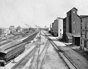
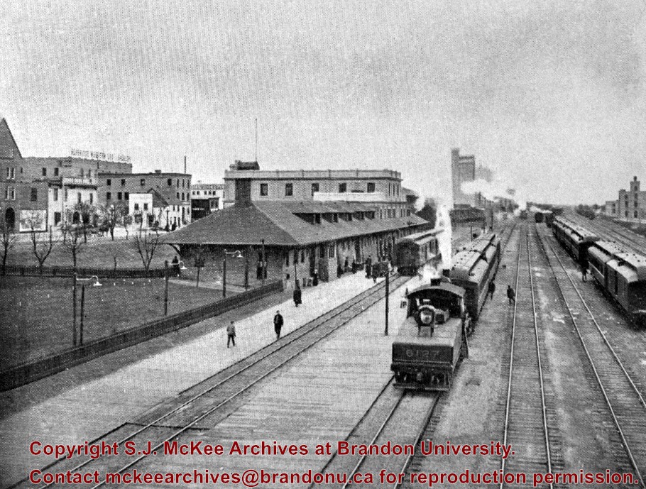
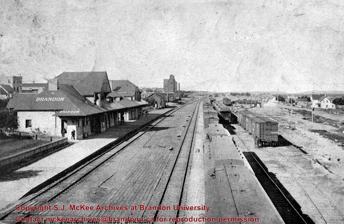
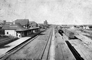
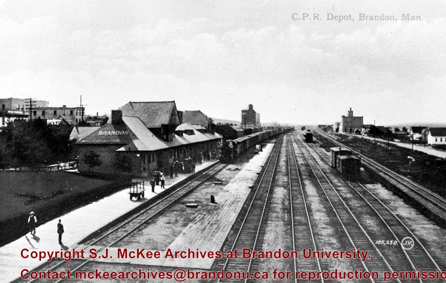
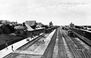
Stuckey's notes: Including Fraser Building, Brandon Brewery, EBD. through freight on mainline. Brandon Brewery (L. background) built 1905, razed 1939. Copy from postcard.
Scope and Content
Photograph is looking west along the CPR tracks.
Notes
Corresponds with negative 1-2002.3.9.P7.
Repro Restriction
The McKee Archives is the copyright holder for the Stuckey materials.

/17-2011_9.jpg?width=1200&404=no-img.jpg&watermark=wmk)
/17-2011_9.jpg?width=180&404=no-img.jpg)


.jpg?width=1200&404=no-img.jpg&watermark=wmk)
.jpg?width=180&404=no-img.jpg)
.jpg?width=1200&404=no-img.jpg&watermark=wmk)
.jpg?width=180&404=no-img.jpg)


%2f17-2011_9.jpg%3fmaxheight%3d1000%26maxwidth%3d1000%26watermark%3dwmk&description=Ironing)
.jpg%3fmaxheight%3d1000%26maxwidth%3d1000%26watermark%3dwmk&description=Second+1st+street+bridge)
.jpg%3fmaxheight%3d1000%26maxwidth%3d1000%26watermark%3dwmk&description=Second+1st+street+bridge)