The International Peace Garden is situated on the international border between Manitoba and North Dakota, adjacent to the Canadian Border Services Boissevain port of entry and the U.S. Customs and Border Protection Agency's Dunseith port of entry. The dedication for the International Peace Garden was held on July 14, 1932. It was estimated that 50,000 people were in attendance on opening day. The park is 9.5-square kilometers or 3.54-square miles.
Custodial History
Pictures were sent to Fred McGuinness in 1970 from E.M. Bergson of Brandon.
Scope and Content
Photograph shows large crowds surrounding a stone cairn draped in American and Union Jack flags. According to the International Peace Garden website, the pictured cairn was built from stones gathered from Manitoba and North Dakota. The crowds gathered for the 1932 dedication of the International Peace Garden.
Notes
The back of the photograph is stamped: Enameloid Velox Print by the Jul 27 1932, Chicago Postal Photo Supplies, Regina, Sask.
The International Peace Garden is situated on the international border between Manitoba and North Dakota, adjacent to the Canadian Border Services Boissevain port of entry and the U.S. Customs and Border Protection Agency's Dunseith port of entry. The dedication for the International Peace Garden was held on July 14, 1932. It was estimated that 50,000 people were in attendance on opening day. The park is 9.5-square kilometers or 3.54-square miles.
Custodial History
Pictures were sent to Fred McGuinness in 1970 from E.M. Bergson of Brandon.
Scope and Content
Photograph shows the crowded parking lot at the International Peace Garden's 1932 dedication ceremony. People mill amongst the automobiles and tents can be seen in the background.
Notes
The back of the photograph is stamped: Enameloid Velox Print by the Jul 27 1932, Chicago Postal Photo Supplies, Regina, Sask.
Photograph given to Fred McGuinness by Helen Turner
Scope and Content
Photograph shows a man - George Porterfield - dressed in a three-piece and hat sitting at the reins of a horse drawn buggy. The buggy appears to be parked on Lorne Avenue beside the bandstand at Stanely Park.
Notes
Note attached to the back of the photograph reads: This George Porterfield, who lived on a farm 4.9.19. Delivered eggs, cream & milk in Brandon by this method in the early 1920. Maybe he was out courting Mary, he looks pretty dressed up.
As a boy my father pointed out this pile of bricks, and pit beside it, and told me a small brick plant had been established here in the early days. The product was of poor quality and the business never became established. LAS.
Custodial History
For custodial history see the collection level description of the Lawrence Stuckey collection.
Scope and Content
Spring Park brick pile near the CPR grade
Notes
Located just south of the CPR mainline at Mile 3 [three miles west of Brandon. P.E.]
[Mr. Stuckey put three negatives in same envelope. We have separated them and numbered them H13(1), H13(2) and H13(3).]
As a boy my father pointed out an old pile of bricks, and pit beside it, and told me a small brick plant had been established here in the early days. The product was of poor quality and the business never became established. LAS.
Custodial History
For custodial history see the collection level description of the Lawrence Stuckey collection.
Scope and Content
Area nearby the Spring Park brick pile
Notes
Located just south of the CPR mainline at Mile 3 [three miles west of Brandon. P.E.]
[Mr. Stuckey put three negatives in same envelope. We have separated them and numbered them H13(1), H13(2) and H13(3).]
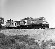
Due to the increasing volume of long-distance auto traffic in the 1920's, the city designated the block between Hill & Queen's Avenues and 9th & 10th streets as a "Tourist Camp" with a few basic facilities. After the demise of the Brandon Municipal Railway, several of the old car bodies were placed in the Tourist Camp to be used as cooking & eating shelters. Some may have had sleeping accommodations. Later (ca. 1938?) several were placed in a row along the south side of Victoria Avenue, approximately 28th or 29th St, and were used as the city's first drive-in hamburger place, "The Train Drive-in". This, I believe, only lasted one or two summer seasons. LAS.
Custodial History
For custodial history see the collection level description of the Lawrence Stuckey collection.
For history/bio information see the collection level description of the Lawrence Stuckey collection.
Custodial History
For custodial history see the collection level description of the Lawrence Stuckey collection.
Scope and Content
Series consists of slides created from photographs taken by Lawrence Stuckey during his travels throughout Manitoba, other parts of Canada and the United States. Although Lawrence and his wife Mavis travelled for pleasure, their destinations were often chosen deliberately to enable Lawrence to explore and photograph specific landscapes, flora and fauna.
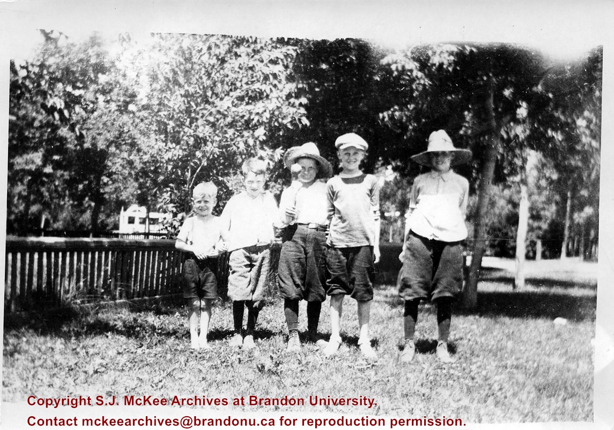
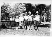
Photograph shows a group of five young boys standing shoulder-to-shoulder as they pose for the picture. Don McPherson has been identified as the boy in the middle. The boys appear to be standing in a residential backyard on a summer's day. The children are wearing shorts and some are wearing straw hats.
Notes
Writing on the back of the photograph reads: 300 block 14th St., ? Clement, ? Hill, Don McPherson, ?- , ?-, 1922
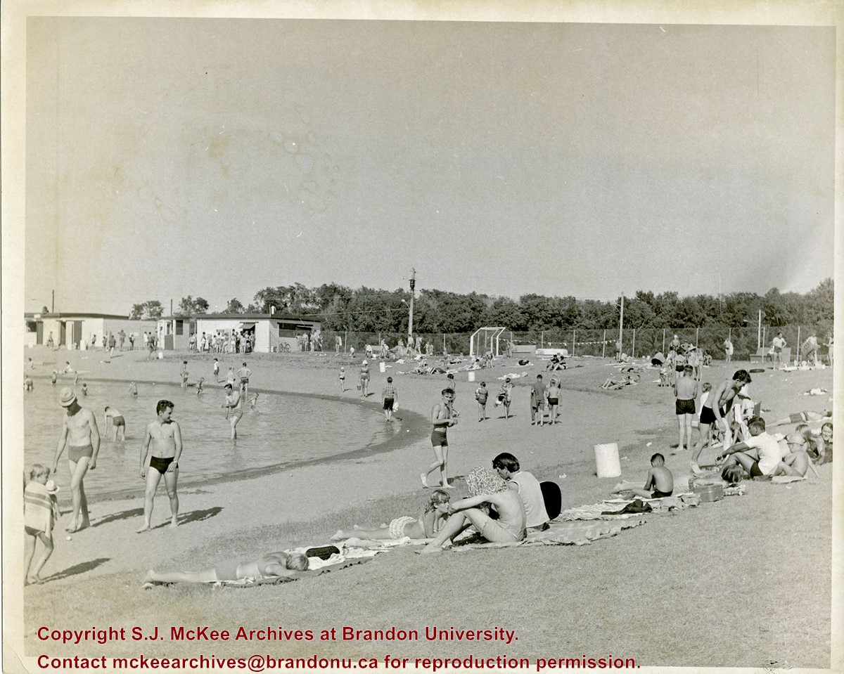
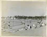
Curran Park is located at 4100 Grand Valley Rd, Brandon, MB. Originally called Suburban Park, it underwent a formal name change in 1934, in honour of J.P. Curran, a lawyer, civil servant and judge, who died in 1928.
The City of Brandon first set aside $6000 for the acquisition of a new park in 1911, but the acquisition of appropriate land stalled for a number of years. Finally in 1919, the city was able to acquire a parcel of Crown land the Brandon Industrial School was located on, to establish the park; the land was acquired through a 99-year lease. Suburban Park officialy opened in 1921.
The development of the park was gradual. Some of the work was completed as part of the Brandon Parks Board's unemployment relief planning; from 1931-1936, relief workers cleared underbrush, thinned trees, constructed a road and built latrines. In 1933 a refreshment stand was approved and a large cook stove was donated.
The City of Brandon and the Department of Agriculture (in right of the Crown) agreed to terminate the original park lease in March 1965, with the city purchasing the land outright. Curran Park was sold to Gretna businessman Gerald Voth in 2001, and renamed Turtle Crossing.
Scope and Content
Item is a photograph of the pool at Curran Park, Brandon, MB.
Notes
History/Bio information was taken from A Cup of Cold Water: Alfred Kirkness and the Brandon Residential School Cemeteries by Anne Lindsay, Clare Cook, and David Cuthbert (Manitoba History journal, Number 78, Summer 2015).


.jpg?width=1200&404=no-img.jpg&watermark=wmk)
.jpg?width=180&404=no-img.jpg)
.jpg?width=1200&404=no-img.jpg&watermark=wmk)
.jpg?width=180&404=no-img.jpg)

.jpg?width=1200&404=no-img.jpg&watermark=wmk)
.jpg?width=180&404=no-img.jpg)
.jpg?width=1200&404=no-img.jpg&watermark=wmk)
.jpg?width=180&404=no-img.jpg)
.jpg?width=1200&404=no-img.jpg&watermark=wmk)
.jpg?width=180&404=no-img.jpg)


.jpg%3fmaxheight%3d1000%26maxwidth%3d1000%26watermark%3dwmk&description=Park+School)
.jpg%3fmaxheight%3d1000%26maxwidth%3d1000%26watermark%3dwmk&description=Park+School)
.jpg%3fmaxheight%3d1000%26maxwidth%3d1000%26watermark%3dwmk&description=Spring+Park+Brick+Pile)
.jpg%3fmaxheight%3d1000%26maxwidth%3d1000%26watermark%3dwmk&description=Spring+Park+Brick+Pile)
.jpg%3fmaxheight%3d1000%26maxwidth%3d1000%26watermark%3dwmk&description=Spring+Park+Brick+Pile)