Situated in the R.M. of Whitehead on the Little Saskatchewan River, the 10 Mile Dam was a 14 kilometer transmission line that supplied the city of Brandon with power. The Brandon Electric Light Company built the dam in 1900 and it is considered Manitoba's first hydroelectic power generating station. The dam spanned approximately 80 meters and was constructed from timber and reinforced with clay and stone. The station was decommissioned in 1924.
Scope and Content
Photograph shows 10 Mile Dam, also known as the Brandon Dam or Minnedosa River Hydro Plant.
Notes
Writing on the back of the photograph reads: "10 mile dam". Biographical information obtained from Manitoba Historical Society.
Situated in the R.M. of Whitehead on the Little Saskatchewan River, the 10 Mile Dam was a 14 kilometer transmission line that supplied the city of Brandon with power. The Brandon Electric Light Company built the dam in 1900 and it is considered Manitoba's first hydroelectic power generating station. The dam spanned approximately 80 meters and was constructed from timber and reinforced with clay and stone. The station was decommissioned in 1924.
Scope and Content
Photograph shows 10 Mile Dam, also known as the Brandon Dam or Minnedosa River Hydro Plant. The dam's timber construction is quite evident in the picture.
Notes
Writing on the back of the photograph reads: McGuinness (Manitoba Hydro), on Little Saskatchewan.
Erected by the village of Wawanesa, the memorial is dedicated to the local citizens who died as a result of the First and Second World Wars. It was unveiled on November 11, 1921.
Scope and Content
Photograph shows the dedication of a war memorial in the village of Wawanesa, MB. The memorial is located near the bank of the Souris River. The photograph was taken from Wawanesa Mutual. The street on the left is 4th Street.
Notes
History/Bio information taken from the Canadian National Defense website.
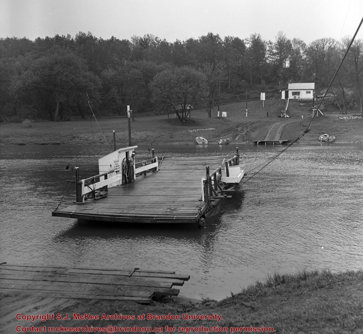
Bunclody, MB was located near Souris, MB. The bridge in question crossed the Souris River.
Custodial History
Photograph was donated by a "Mrs. Wilson" in 1989.
Scope and Content
Photograph shows a portion of the Great Northern Railway track with the Bunclody bridge in the background. Also visible are a couple of houses, railway cars, lumber and part of the Souris River. The photograph was taken in early winter or early spring.
John C. Cousins was the son of Thomas Cousins (b. August 17, 1882 in Truro, Nova Scotia - d. March 5, 1914) and Mary Margaret Craig (b. April 14, 1824 - d. April 25, 1903). He married Eunice Eliza Nixon from London Township, County of Middlesex, Ontario. Together they had three children: Eunice M., Eric O. and Kathleen. J.C. Cousins was Reeve of the Rural Municipality of Daly from 1905 to 1910 and Assessor for the Town of Rivers from 1931-1938.
Custodial History
Record was accessioned in 2007 by the McKee Archives. Prior custodial history unknown.
Scope and Content
This document is a rambling memoir of John C. Cousins' recollections of life in the Rural Municipality of Daly from the settlement era in the early 1880s, through to the 1940s. He touches on various themes, including: his family history; the activities of the R.M. of Daly and his role as Reeve; the history of school districts in the municipality (lists names of first teachers and early students); the history of churches in the municipality; tragedies in the municipality; lists members of the Council of the municipality for the years 1885-1946; and the devastating impact of the Spanish Influenza on Aboriginal people in the municipality.
In addition, the memoir includes documentary records, such as minutes and copies of letters. There are also many photographs of both events and individuals (virtually all of the photographs are labelled and names are provided). The memoir goes beyond a simple recounting of facts. Cousins is discursive and thoughtful, often making references to developments happening in other parts of North America and Canada. There is also a link to the Maritimes, from which his family originated.


