See RG 6 Brandon University fonds, Series 7 Faculties and Schools, Sub-series 7.1 Faculty of Arts, Sub sub series 7.1.1 Dean of Arts for biographical information for Michael Blanar.
Custodial History
Collection was in the possession of Dr. Michael Blanar until he donated the records to the S.J. McKee Archives in May 2002.
Scope and Content
Collection consists of textual records and five microfilm reels related to Dr. Blanar’s post-graduate research. It is assumed that the records were collected during the course of Blanar’s research for his dissertation entitled “Early British Travellers in French Canada (1960).”
Textual records include three Dominion of Canada notebooks containing handwritten Saulteaux verbs, and animate nouns. Included is a dark red booklet titled “Ojibwe.” The book contains Ojibwa translations of English words. The book comes from St. Peter Clavers Industrial School in Spanish, Ontario, and may have acted as an instructional book as it also contains French and English. Collection also contains a transcript of an Ojibwa dictionary and three file folders titled “Manuscripts,’ “John Long Research,” and “Maps” which contain additional research material. Contents of “Manuscript” folder are original typed manuscripts. “John Long” and “Maps” file folders contain copies of materials held at Library and Archives Canada, as well as hand drawn documents and hand written documents detailing contents of folders.
In addition to the textual records there are five microfilm reels. Three microfilm cases are labeled “The British Reference Division,” one case labeled “Public Archives Canada, central microfilm operations,” and the last case is from an unidentified source labeled “Longs voyages and travels”. Four of the five microfilm cases are also numbered. The British Reference Division microfilm case numbered “1346 i 43” contains a copy of a book titled “The Cacique of Ontario.” British Reference Division microfilm case numbered “104706640” contains a copy of a book titled “The Four Kings of Canada.” British Reference Division microfilm case numbered “9073279” contains a copy of a book titled “The Indians.” The Public Archives Canada microfilm case numbered “c-3006” contains copies of original documents in French and English. Documents include letters, diary pages, maps, and business ledgers. Microfilm case labeled “Longs voyages and travels” contains a copy of a book written by John Long titled “Voyages and Travels of Indian Interpreter and Trader.”
Notes
Description by Aaron McKay (October 2013). The Ojibwa language dictionary and notebook make references to Fredric Baraga (1797-1868), a missionary priest from Slovenia who recorded the Lake Superior Ojibwa language dialect. Baraga’s findings were published into an Ojibwa language dictionary.
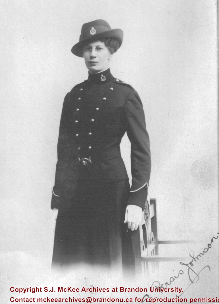
For biographical information on Sarah Persis Darrach see RG 1 Brandon College fonds, Series 9: Clark Hall women's residence.
Custodial History
See collection level description of the Maureen Johnson collection (10-2009) for custodial history.
Scope and Content
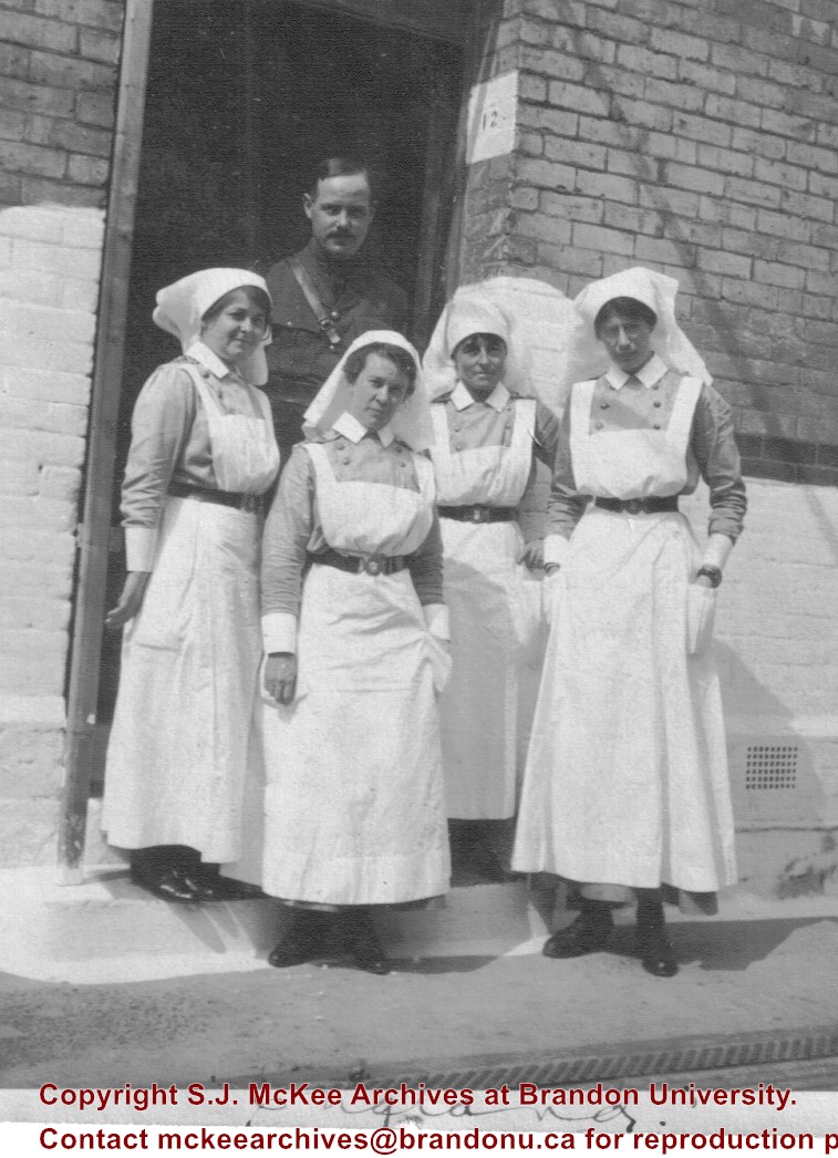
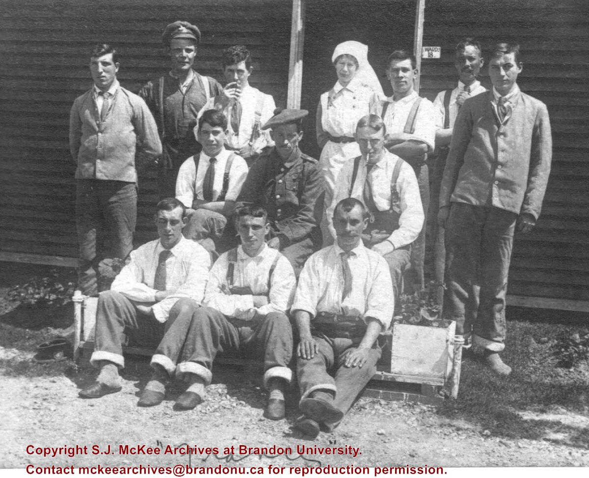
Group photograph of four nurses and one male military officer standing in front of a brick building in England where Sarah Persis Johnson was stationed. Johnson is standing on the far right.
For biographical information on Sarah Persis Darrach see RG 1 Brandon College fonds, Series 9: Clark Hall women's residence.
Custodial History
See collection level description of the Maureen Johnson collection (10-2009) for custodial history.
Scope and Content
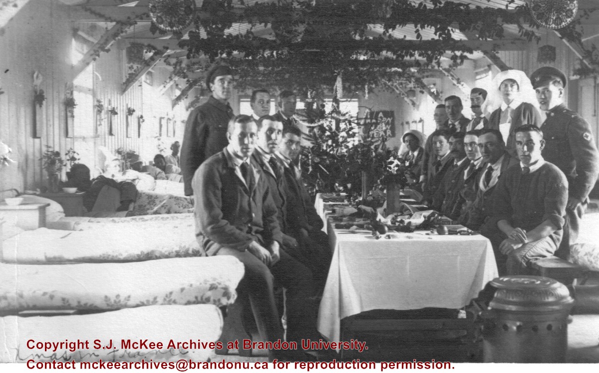
Photograph shows staff and possibly patients gathered around a dining table at Christmas. The table is located in the hospital building. Other patients are visible in their beds. Sarah Persis Johnson is standing second from the front on the right side of the table.
Photograph shows the removal of one of the houses formerly located on 20th Street between Louise and Princess Avenues. The houses on those blocks were removed to create parking lots for the University. A Fed Zavislak Ltd. Well Drilling & Trucking pickup truck is visible at the curb.
Photograph shows the removal of one of the houses formerly located on 20th Street between Louise and Princess Avenues. The houses on those blocks were removed to create parking lots for the University.
Aerial photographs of the campus were generally commissioned by the College/University to record important milestones, such as centennials, changes in status, and building projects. The general campus photographs were placed in this sub-series because the composition of the images made it difficult to place them with individual buildings.
Scope and Content
Sub-series consists of photographs of the Brandon College and Brandon University campus.
View is northeast from the Brandon College Building. Photograph shows the inside of the Brandon College Building after it had been gutted and then partially rebuilt. The exterior fascade of the west side of the building can be clearly seen in this photograph. A number of houses on the east side of 200 block of 18th Street are also visible, as is the stone fence on Princess Avenue and the flag pole on the front lawn.
View is southwest from approximatley 16th Street between Princess and Rosser Avenues. Photograph shows the Brandon University campus, as well as surrounding residential blocks, including Flemming, J.R. Reid and Vincent Massey schools.
View is west southwest from approximatley 16th Street between Princess and Lorne Avenues. Photograph shows the Brandon University campus, as well as surrounding residential blocks between 16th and 23rd Streets, Princess and Louise Avenues..
View is west from approximatley 17th Street between Lorne and Louise Avenues. Photograph shows a portion of the Brandon University campus (excluding the Education Building and anything north of it), as well as surrounding residential blocks from approximatley 17th Street to 22nd Street.
View is west northwest from approximatley 16th Street and Louise Avenue. Photograph shows the Brandon University campus, prior to the Library Extension, and a large portion of the city to the west of the campus.
View is northwest from approximatley 16th Street and Louise Avenue. Photograph shows the Brandon University campus, prior to the Library Extension, and a large portion of the city to the west of the campus.
View is northeast probably from the roof of McMaster Hall. Photograph shows the construction of the new roof on Clark Hall and the Brandon College Building. A portion of the east side of the 000 and 100 blocks of 18th Street, as well as the corner of 18th Street and Rosser Avenue are visible in the upper left hand corner. This includes the "Downtown Brandon" sign.
View is north northeast probably from the roof of McMaster Hall. Photograph shows the construction of the new roof on Clark Hall and the Brandon College Building, as well as the construction of the extension to Clark Hall and the skywalk. Portions of the city as far north as the Assiniboine River are also visible.
View is north northeast from the roof of McMaster Hall. Photograph shows the campus under construction during the renovation of the Brandon College Building and Clark Hall. The photograph was taken in late fall after the roof had been removed from the buildings but before the construction of the extension of Clark Hall. Construction materials litter the courtyard and driveway. The view looking north extends to The North Hill - a number of residential blocks, particularly to the northeast of 18th Street are visible. Buildings include the International Harvester Building and Kin Village.
View is north northeast probably from the roof of McMaster Hall. Photograph shows the construction of the new roof on Clark Hall and the Brandon College Building, as well as the construction of the extension to Clark Hall and the skywalk. The view looking north extends to The North Hill - a number of residential blocks, particularly to the northeast of 18th Street are visible. Buildings include the International Harvester Building and Kin Village.
Brandon College looking south from 19th Street. Photograph was taken after Flora Cowan Hall was built but before construction of the Education Building.
Image shows the Brandon College campus from 17th Street looking southwest. The photo was taken after the completion of the original Music Building in 1963, but construction of the Education Building. Also visible are a number of properties on the 200 block of 18th Street and the 200 block of 20th Street.


