Photograph shows the west side of the 200-block on 10th Street. Visible businesses include: Chamber of Commerce Tourist Information, Dominion Tire & Radio Co., Steve's Grill, Wally's Taxi, and the garage entrances to Western Motors Ltd. A Santa Claus Christmas ornament is displayed from a light standard.
Photograph has been glued to a backing board that has warped over time
History / Biographical
On 16 November 1906, Manitoba was hit by a severe winter storm that began that Thursday evening and extended through the weekend. The Brandon Daily Sun ("Storm Extends Over a Large Territory," 17 Nov. 1906, 1) reported that rail and telegraph services had been disrupted, country roads were impassable, and business in town was at a stand still. Following the weekend, the daily reported the blizzard was one of the greatest in recent memory. CPR trains had been caught in drifts by Carberry and an express car had caught fire and was destroyed ("Worst Storm in Many Years," Brandon Daily Sun, 19 Nov. 1906, 1).
Scope and Content
Photograph shows street view of intersection of the 000 block of 8th Street and Rosser Avenue in the winter. Businesses on the east side of 8th Street from Pacific to Rosser Avenues are clearly visible and include: a Lunch Room (likely Aagaard's Lunch Counter), the Hotel Imperial Annex, Liverpool House (a boarding house), R.S. Thompson and Company Real Estate Office (Land Office), a barber shop (likely J. Coulter's), Frank Gowen photography studio. Fleming's Drug Store on the corner of 8th Street and Rosser Avenue has been replaced by the Bank of Hamilton. The Imperial Hotel is visible on the west side of 8th Street. The 8th Street Bridge is visible in the background. Men in winter coats and hats are crossing the street at the intersection. A horse-drawn sleigh is parked on 8th Street.
Notes
Writing on the front of the photograph matting reads: 340, after the storm November 1906. Page appears to be from a photo album. The photograph appears to be taken from the interior of a builing on the southwest corner of 8th Street and Rosser Avenue.
For custodial history see the collection level description of the Lawrence Stuckey collection.
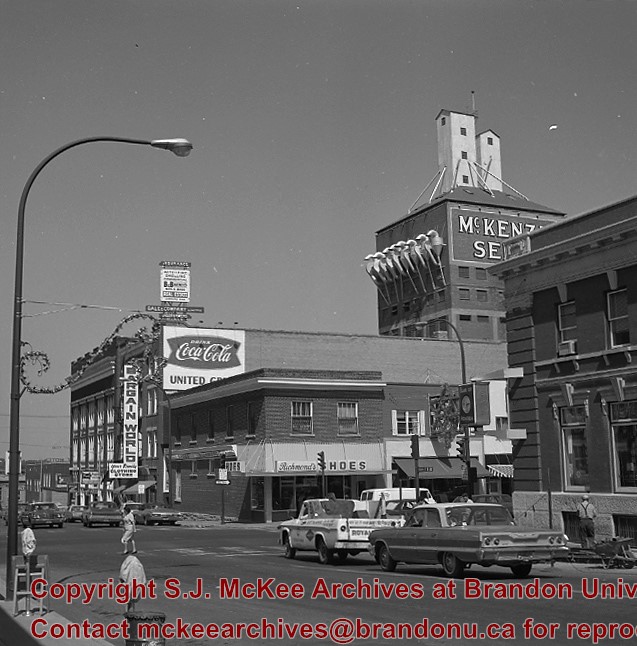
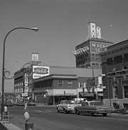
Scope and Content
Northwest corner of Tenth Street and Rosser Avenue
Notes
Showing (left to right): Fraser Building 1890, John E. Smith Block 1907, The Canadian Bank of Commerce 1907, Cecil Hotel 1910, Brandon Sun Building 1905; Can be dated by Cecil Hotel (built 1910) and because the streets were paved and streetcar tracks laid in 1912.
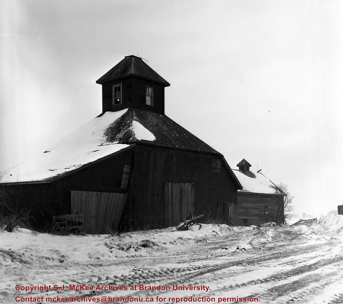
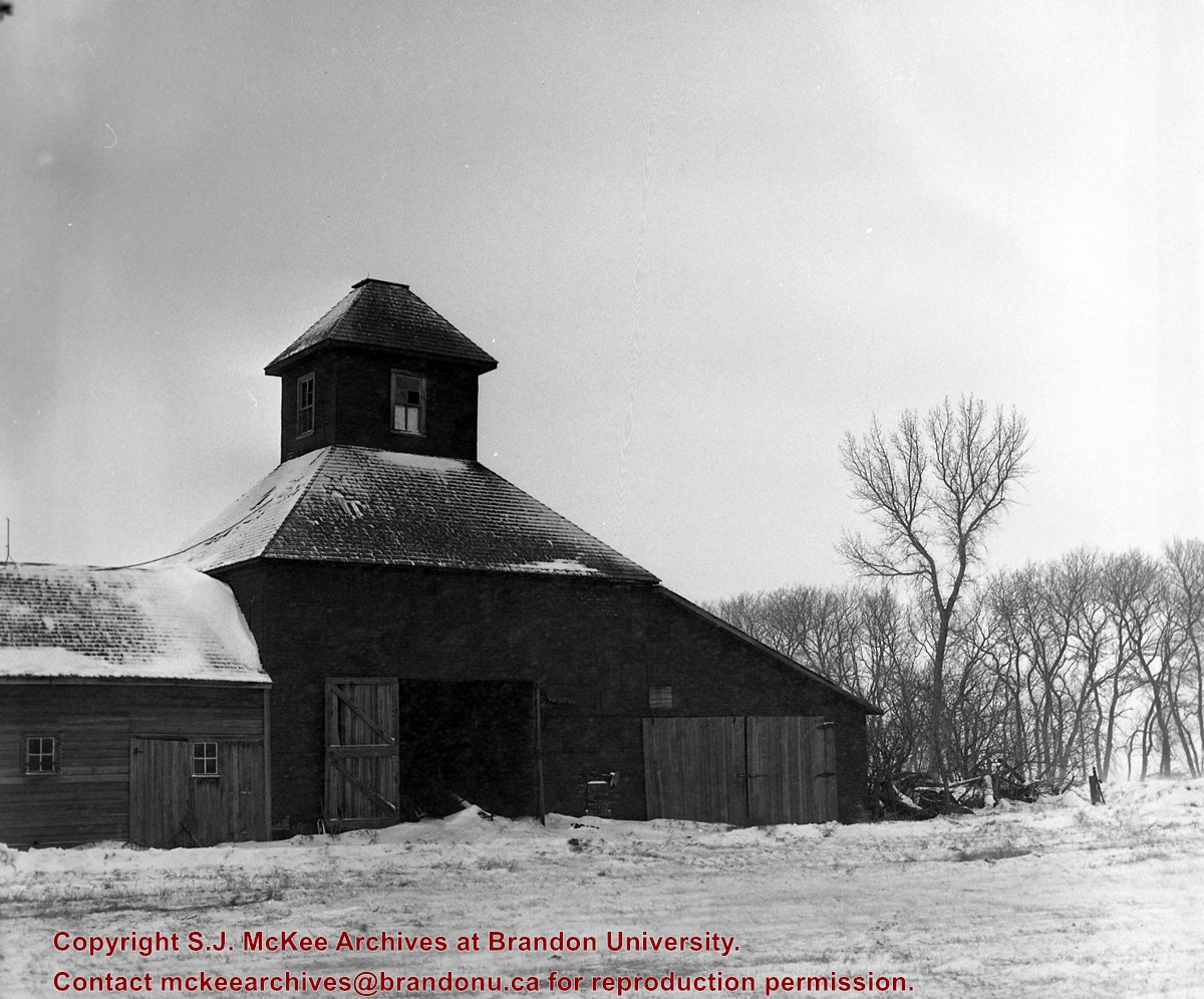
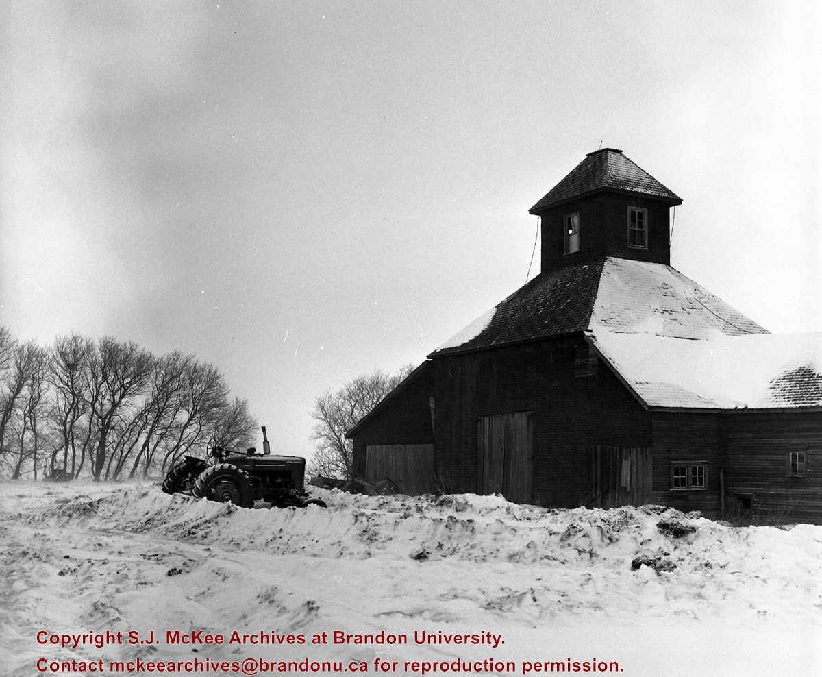
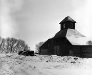
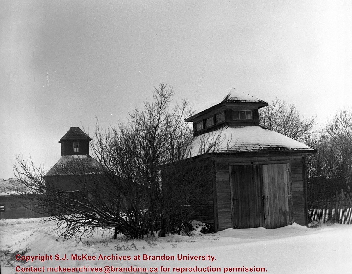
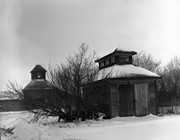
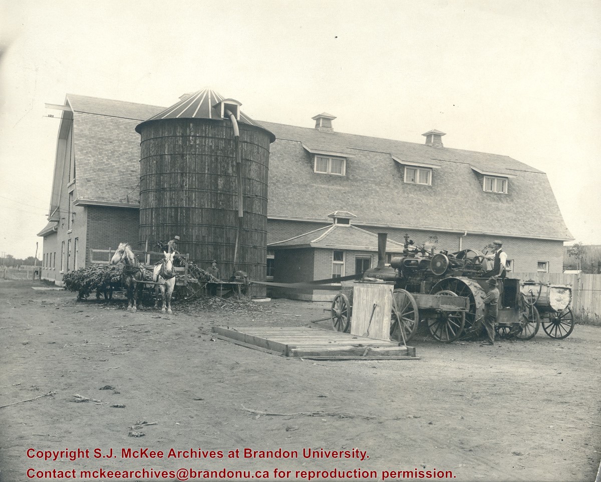
Photograph shows the Manitoba Agricultural College located at Treesbank, MB. Photograph shows a large barn-like structure comprised of brick and a wooden silo in the side yard. A steam engine is processing a field crop (corn perhaps) that is then being funneled into the silo.
View is northeast probably from the roof of McMaster Hall. Photograph shows the construction of the new roof on Clark Hall and the Brandon College Building. A portion of the east side of the 000 and 100 blocks of 18th Street, as well as the corner of 18th Street and Rosser Avenue are visible in the upper left hand corner. This includes the "Downtown Brandon" sign.
View is north northeast probably from the roof of McMaster Hall. Photograph shows the construction of the new roof on Clark Hall and the Brandon College Building, as well as the construction of the extension to Clark Hall and the skywalk. Portions of the city as far north as the Assiniboine River are also visible.
View is north northeast from the roof of McMaster Hall. Photograph shows the campus under construction during the renovation of the Brandon College Building and Clark Hall. The photograph was taken in late fall after the roof had been removed from the buildings but before the construction of the extension of Clark Hall. Construction materials litter the courtyard and driveway. The view looking north extends to The North Hill - a number of residential blocks, particularly to the northeast of 18th Street are visible. Buildings include the International Harvester Building and Kin Village.
View is north northeast probably from the roof of McMaster Hall. Photograph shows the construction of the new roof on Clark Hall and the Brandon College Building, as well as the construction of the extension to Clark Hall and the skywalk. The view looking north extends to The North Hill - a number of residential blocks, particularly to the northeast of 18th Street are visible. Buildings include the International Harvester Building and Kin Village.
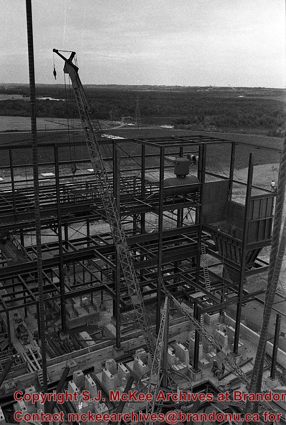
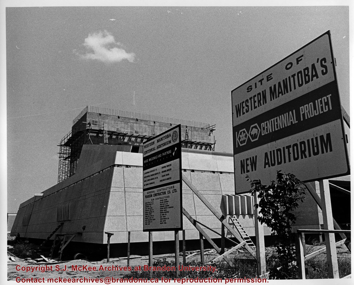
View is looking east southeast. Photograph shows the Western Manitoba Centennial Auditorium (WMCA) under construction. There are two signs in the foreground. One lists the names of the architectural firm, the engineers, contractiors and subcontractors involved with the project. The other reads: Site of Western Manitoba's 100 Centennial Project New Auditorium


.jpg?width=1200&404=no-img.jpg&watermark=wmk)
.jpg?width=180&404=no-img.jpg)


.jpg%3fmaxheight%3d1000%26maxwidth%3d1000%26watermark%3dwmk&description=600+block+of+Tenth+Street)