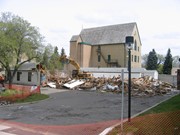
Located at the centre of the Brandon University campus, the Physical Plant H-Hut was destroyed following the opening of the new $3.9M, 13,600 square-foot physical plant on 07 April 2010.
Custodial History
Photograph was taken by McKee Archives project archivist Jill Sutherland.
Scope and Content
Photograph shows the demolition of the Physical Plant H-Hut. The photograph is looking northeast from the steps of Harvest Hall. The Citizens' Science Centre (BUSU Building) is visible in the background.
Located at the centre of the Brandon University campus, the Physical Plant H-Hut was destroyed following the opening of the new $3.9M, 13,600 square-foot physical plant on 07 April 2010.
Custodial History
Photograph was taken by McKee Archives project archivist Jill Sutherland.
Scope and Content
Photograph shows the demolition of the Physical Plant H-Hut. The photograph is looking northeast.
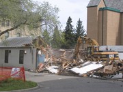
Located at the centre of the Brandon University campus, the Physical Plant H-Hut was destroyed following the opening of the new $3.9M, 13,600 square-foot physical plant on 07 April 2010.
Custodial History
Photograph was taken by McKee Archives project archivist Jill Sutherland.
Scope and Content
Photograph shows the demolition of the Physical Plant H-Hut. The photograph is looking south/southeast.
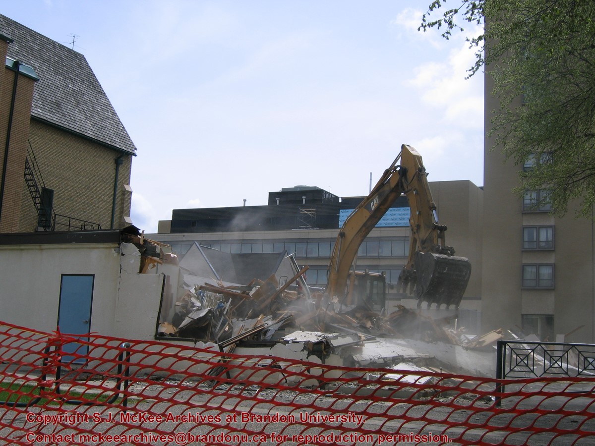
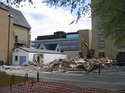
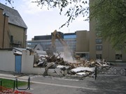
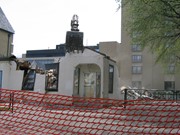
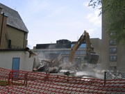
Located at the centre of the Brandon University campus, the Physical Plant H-Hut was destroyed following the opening of the new $3.9M, 13,600 square-foot physical plant on 07 April 2010.
Custodial History
Photograph was taken by McKee Archives project archivist Jill Sutherland.
Scope and Content
Photograph shows the demolition of the Physical Plant H-Hut. The photograph is looking southeast. The John R. Brodie Science Centre, the Geology H-Hut, and portions of the Citizens' Science Building (BUSU Building), Knowles-Douglas expansion (KDC) and McMaster Hall are visible in the background.
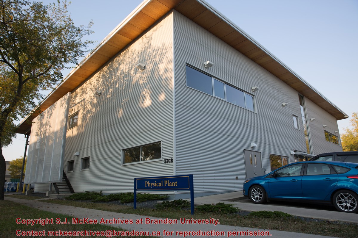
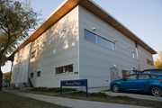
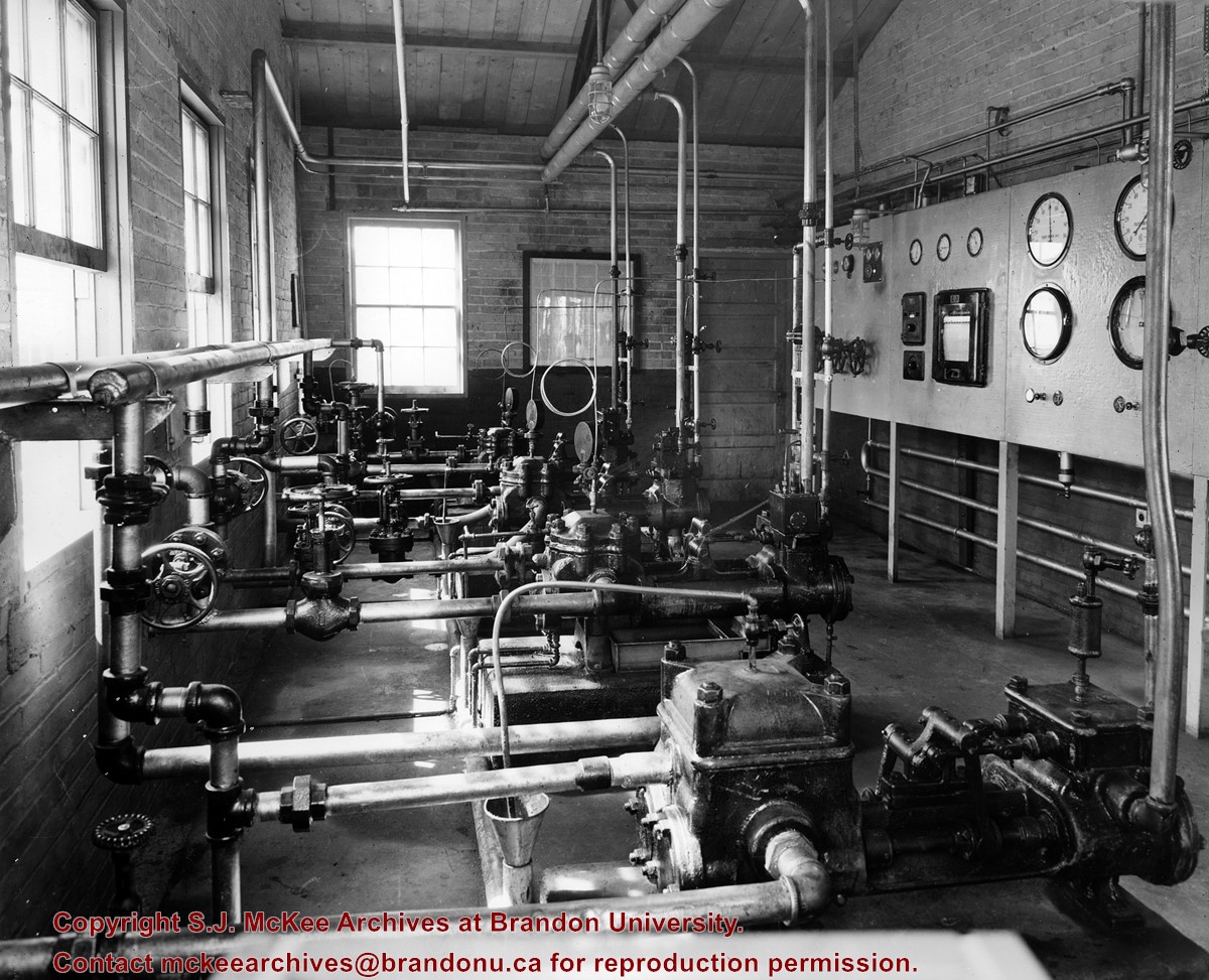
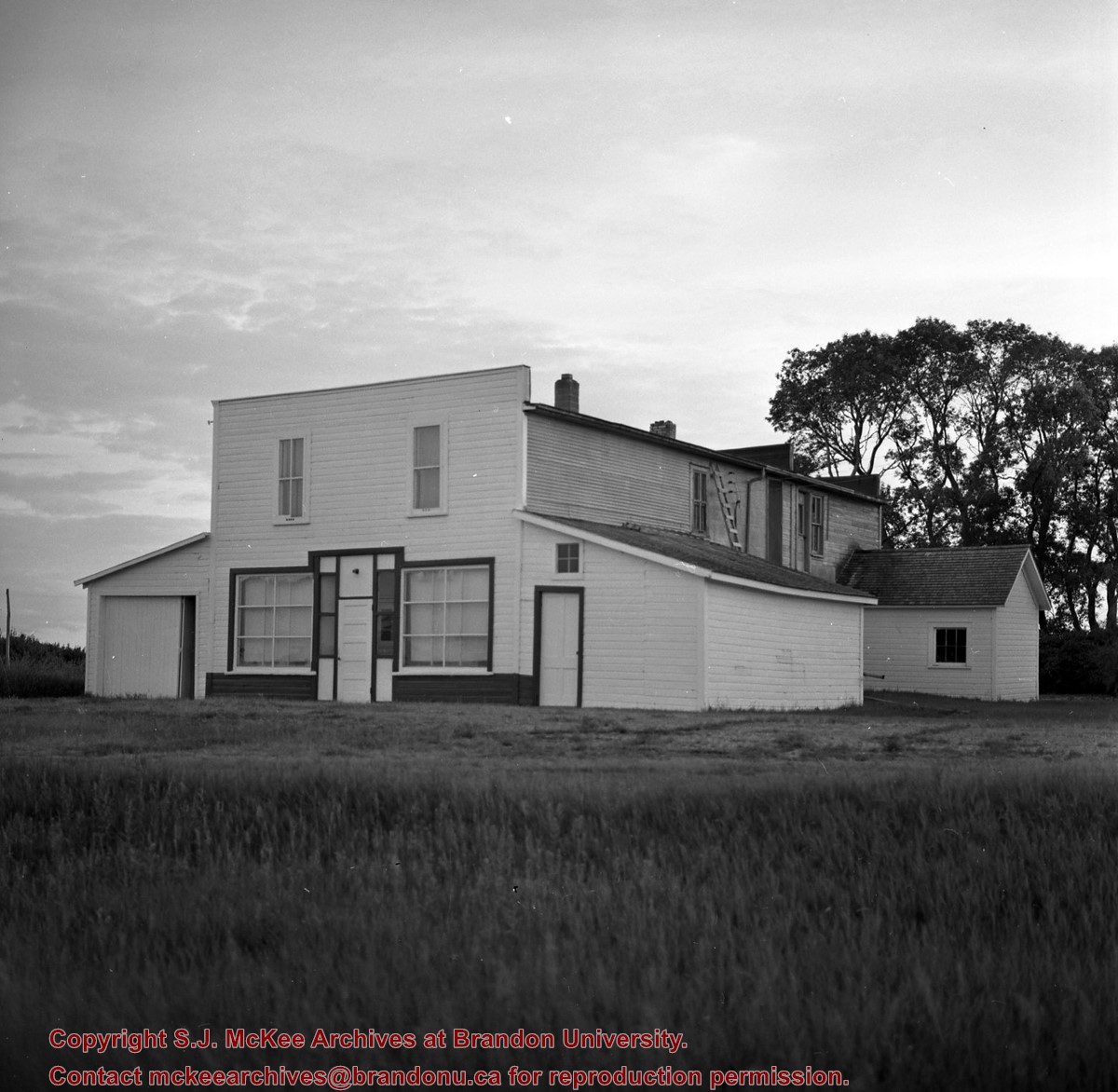
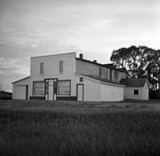
A $3.9M, 13,600 square-foot physical plant was opened on 07 April 2010. Located south of the steam plant on 20th Street by Darrach Hall, the building replaced the old Physical Plant occupying the World War II H-Huts. The new building serves as the hub for many campus operations, providing services from security and technical support, to building maintenance, deliveries, grounds keeping, cleaning, and capital project management.
Custodial History
Photograph is part of a series of campus images commissioned by the McKee Archives and Communications in the lead up to Brandon University's 50th Anniversary celebration.
Scope and Content
Photograph shows the new Physical Plant building located on the west side of 20th Street, just north of Louise Avenue. The photograph is looking southwest and shows the exterior of the building, as well as part of the parking lot.
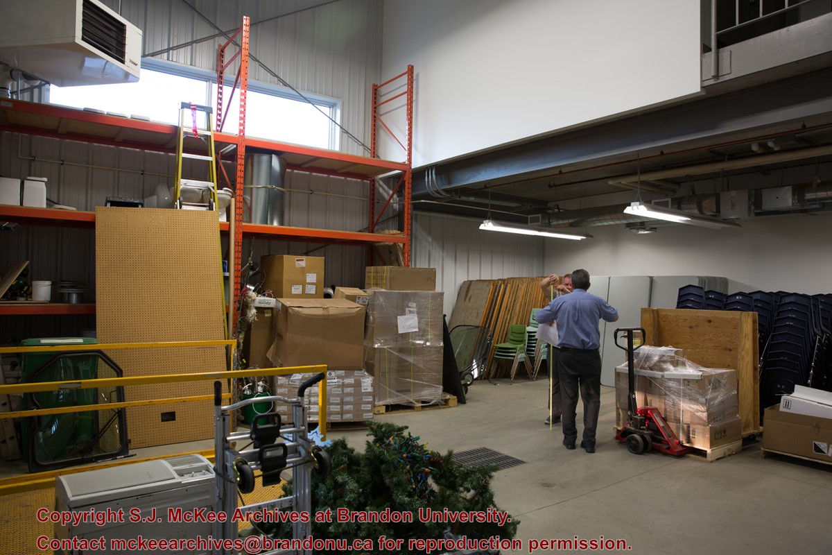
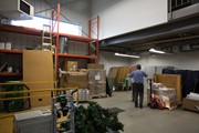
A $3.9M, 13,600 square-foot physical plant was opened on 07 April 2010. Located south of the steam plant on 20th Street by Darrach Hall, the building replaced the old Physical Plant occupying the World War II H-Huts. The new building serves as the hub for many campus operations, providing services from security and technical support, to building maintenance, deliveries, grounds keeping, cleaning, and capital project management.
Custodial History
Photograph is part of a series of campus images commissioned by the McKee Archives and Communications in the lead up to Brandon University's 50th Anniversary celebration.
Scope and Content
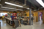
Photograph shows a storage/work space inside the new Physical Plant building located on the west side of 20th Street, just north of Louise Avenue. The man with his back to the camera is Al Puhach, Maintenacne Supervisor. The man facing the camera is Gord Neal, Director of Physical Plant.
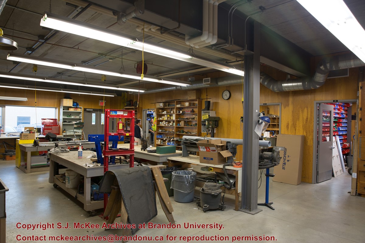
A $3.9M, 13,600 square-foot physical plant was opened on 07 April 2010. Located south of the steam plant on 20th Street by Darrach Hall, the building replaced the old Physical Plant occupying the World War II H-Huts. The new building serves as the hub for many campus operations, providing services from security and technical support, to building maintenance, deliveries, grounds keeping, cleaning, and capital project management.
Custodial History
Photograph is part of a series of campus images commissioned by the McKee Archives and Communications in the lead up to Brandon University's 50th Anniversary celebration.
Scope and Content
Photograph shows a work space inside the new Physical Plant building located on the west side of 20th Street, just north of Louise Avenue. The woman in the background is Stacey Harper, Physical Plant Office Assistant. The man in the background is Brent Cuvelier, Carpenter.
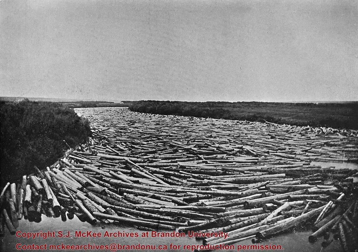
Probably the peak of the sawmilling industry in Brandon was "The Big Drive" in 1910, when 125 drivers brought 5 million board feet of timber down the Assiniboine to Hanbury's Mill.
Most of these logs were cut in the Riding Mountains in winter and floated down the Little Saskatchewan and Birdtail Rivers to the Assiniboine.
Custodial History
For custodial history see the collection level description of the Lawrence Stuckey collection.
Scope and Content
Logs, destined for Hanbury Manufacturing Co., in the Assiniboine River
Notes
Looking north from 3rd Street.
[This negative was produced using a previously published image (P.E.).]
After demise of the streetcars, a transit system was started by MacArthur Transportation Co. with three routes, an east end loop, a south end loop, and a west end loop, with terminal at 8th St. & Rosser Ave. The E & W was operated as a continuous route with two locally built coach bodies on new Maple Leaf trucks. A secondhand, larger, Leland coach was acquired for the S. end, which was replaced by a large GMC about 1938.
Custodial History
For custodial history see the collection level description of the Lawrence Stuckey collection.
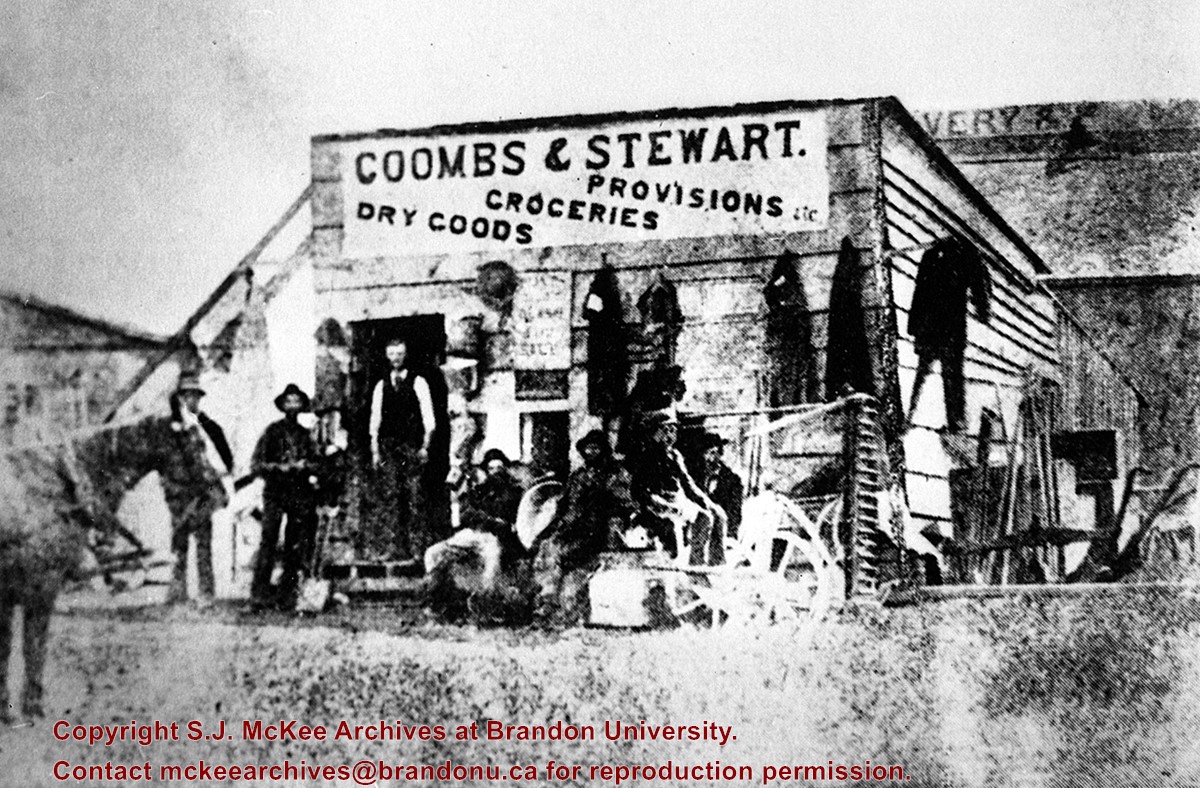
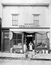
This store, the first established in Brandon (June 12, 1881), was erected on the southeast corner of 6th St. & Pacific Avenue, facing Pacific.
Coombs and Steward later opened a store on the northeast corner of 9th St. & Rosser Ave.
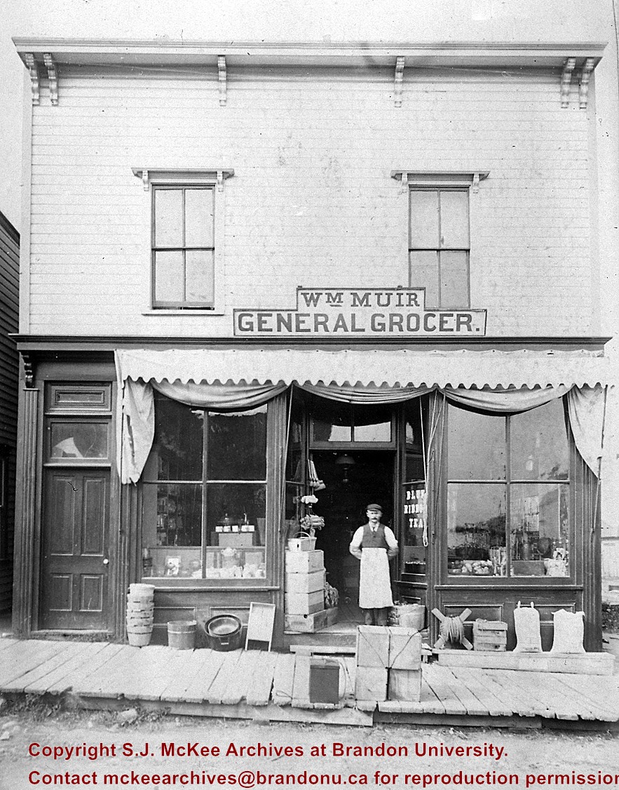
Billy Muir was Coombs & Stewart's first clerk. He later opened a store of his own on the west side of the 100 block of 6th St., which he operated for nearly 50 years. (I was often a customer as a kid - LAS). Billy Muir closed his 6th Street store June 1945 (Brandon Sun). [See E18]
Custodial History
For custodial history see the collection level description of the Lawrence Stuckey collection.
Muir started as a clerk for Coombs & Stewart in 1882, went into business for himself 1888 and was still operating in 1938. He closed his 6th Street store in June of 1945 (Brandon Sun).
Muir was a good friend of my pioneer grandfather, Sam Gilmour, who lived a block up the street, and as a small boy I spent many nickels in this store (LAS).
Custodial History
For custodial history see the collection level description of the Lawrence Stuckey collection.
Scope and Content
Wm. "Billy" Muir & grocery store
Notes
Located on the west side of the 100 block of 6th St.
This photo presented by Wm. Muir to Martin Kavanagh and donated to collection of Assiniboine Historical Society.
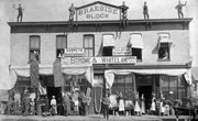
July 12 Orange Lodge parade in progress; Shows that there was a building in what was for many years, a small vacant lot behind the Bank of Montreal; Campbell & Campbell building and Security Block. Davidson (photography) Studio on awning - became Henfries studio and, in 1923, Jerrets' Studio.
Custodial History
For custodial history see the collection level description of the Lawrence Stuckey collection.
Scope and Content
100 Block of Tenth Street
Notes
Probably taken from Strathcona Block
Creator provided by Fred McGuinness collection (20-2009).


.jpg?width=1200&404=no-img.jpg&watermark=wmk)
.jpg?width=180&404=no-img.jpg)
)
.jpg%3fmaxheight%3d1000%26maxwidth%3d1000%26watermark%3dwmk&description=Simplot+Canada+Ltd.)